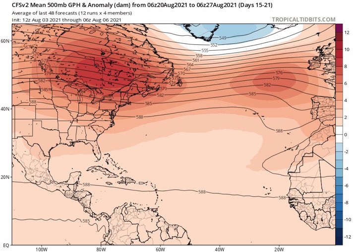
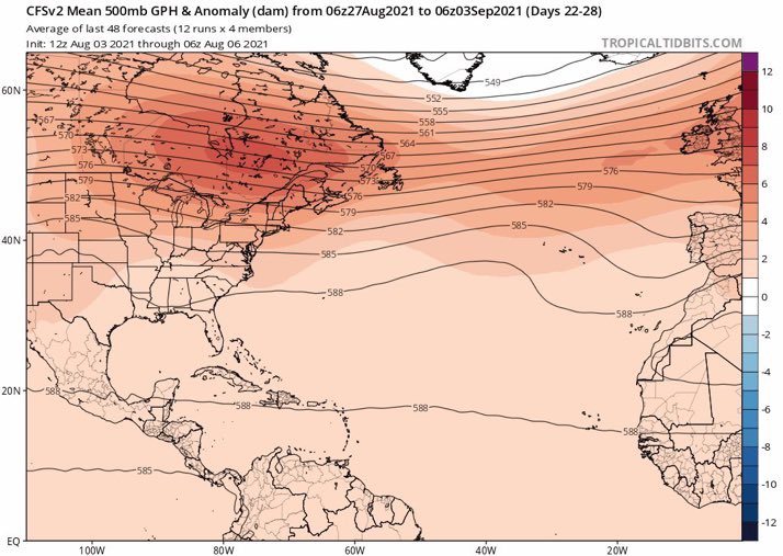
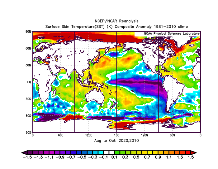
AlphaToOmega wrote:Shell Mound wrote:The very warm subtropics likely mean that ridging, while strong, will be displaced northward during the peak of the season, allowing troughs to form underneath.SFLcane wrote:Overnight long range guidance is still meh… interesting the ECMWF seasonal backed off to average. Just to dry and stable right now. It's competing factors Right now La Niña and WAM vs stability plus cooler MDR (relative to the rest).
We will see when it flips.
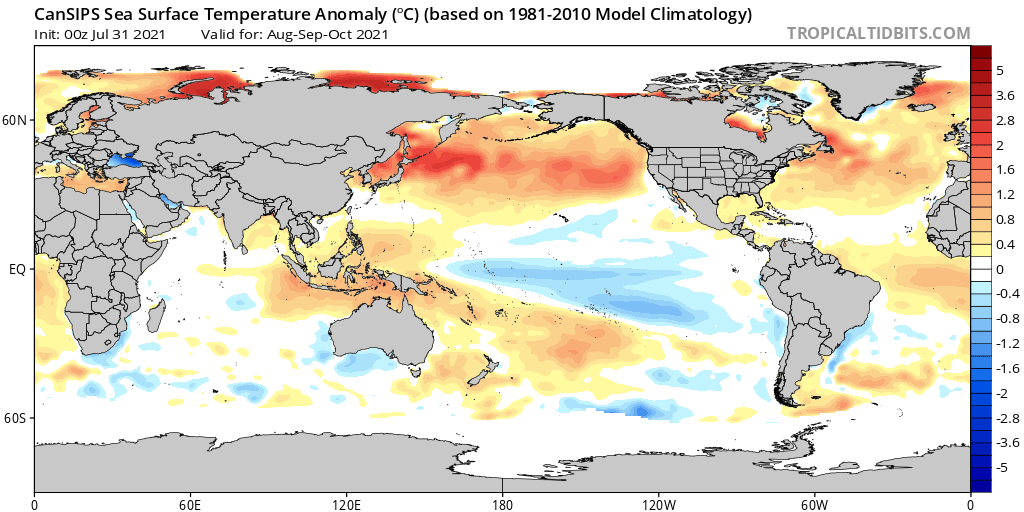
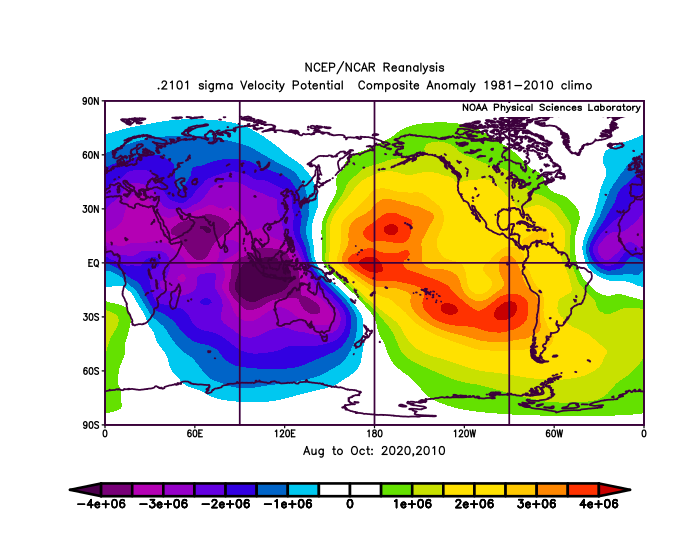
Some people thought that the Niña and ASW alone would overcome the -AMM/-AMO and EPAC -VP. So far that is not the case. Wxman57's bearish outlook on the MDR will end up being correct for ASO. This goes to show that much more is needed than La Niña and a strong Africa monsoon for an above-average MDR. The fact is that the tropical Atlantic is cooler than the subtropics, so sinking air alone will be sufficient to reduce the prospects of long-trackers in the MDR. A drier Atlantic also means smaller and generally less destructive storms.
How do you know the AMO was negative for July?

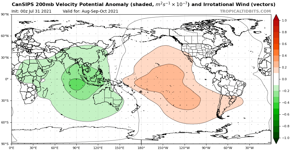
Note that the rising air will be concentrated over the regions highlighted, while other areas will serve as net sinks, per SST analysis.
Please see jconsor’s explanation(s).