KQ wrote:So, if I am getting the gist of what I am reading here.... It is unlikely to survive the DR track and what is left is going to head up the west coast of Florida? Those of us on the east coast will get wet, but that is about it?
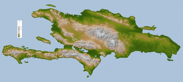
As I said, I think it will "survive", pretty much as it is now after crossing the DR. There's very little for the DR to disrupt with respect to a circulation. The main question is whether it will regenerate its circulation when it reaches the eastern Gulf Sunday night. Regardless, it will be a rain threat to Florida rather than a wind threat. Of course, there could be some squalls with gusty winds across the FL Peninsula. Such squalls could cause scattered power outages.