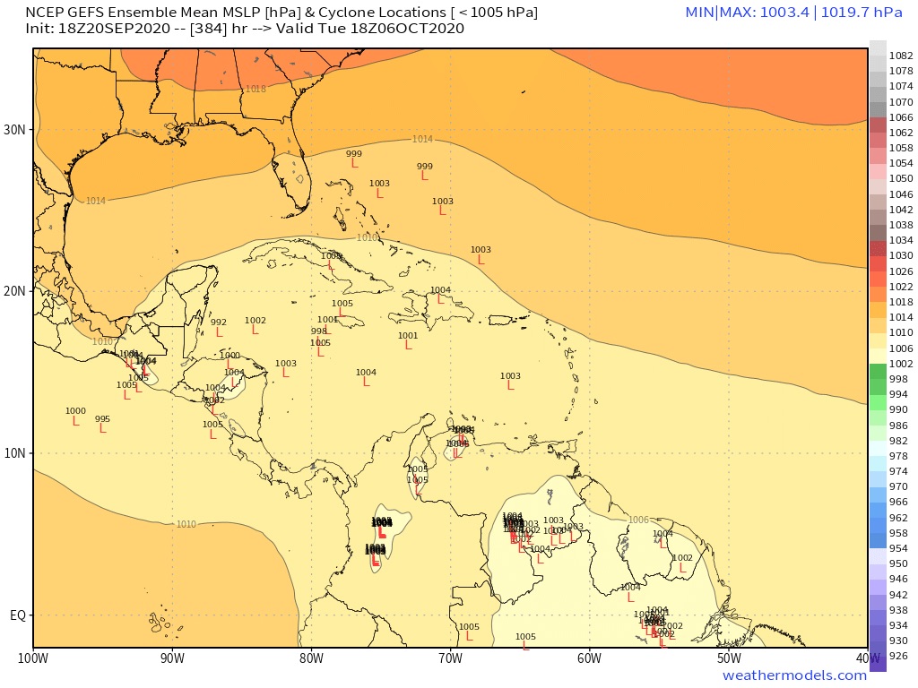
Back on Tue evening when I first was analyzing ENSO based analogs for potential Oct CONUS trouble, there had not yet been any GFS runs showing a TC in the W Caribbean. Part of the reason was that the runs ended before the most prime timeframe for genesis per analogs. However, since then as we’ve gotten further out in time in the forecast well into early Oct, a respectable 8 of 20 GFS (and 4 of 18 Para GFS) runs have shown it. When I say that, I mean they showed a full fledged TC/strong low. Additional runs like the 18Z GFS just run have had weaker lows. Plus, most GEFS and para GEFS runs this weekend, including the 18Z runs just out, have been anywhere from somewhat to quite active late in their runs in the W Caribbean and nearby. So, being that I had already become concerned based merely on analogs, I’m naturally even more concerned than I was when I last posted on this Friday afternoon as decent model support seems to now be there. I have yet to see much on the EPS for then, but it hasn’t exactly been stellar on picking up on geneses that far out in time. I’ll be looking to see if the EPS starts to get more active late in their upcoming runs.
I’m fully aware of the history of the GFS to have fake W Caribbean TCs as I’ve often criticized it for that, myself. But I think this time it may be into something since it is backing the ENSO based analogs (current weak to moderate La Niña following a weak to moderate El Niño). Early to mid Oct certainly bears watching and even more than in most seasons.