2024 Global Model Runs Discussion (Out thru day 16)

This is the general tropical discussion area. Anyone can take their shot at predicting a storms path.

Moderator: S2k Moderators

Forum rules

The posts in this forum are NOT official forecasts and should not be used as such. They are just the opinion of the poster and may or may not be backed by sound meteorological data. They are NOT endorsed by any professional institution or STORM2K. For official information, please refer to products from the National Hurricane Center and National Weather Service.

Help Support Storm2K
Message
Author
User avatar
WaveBreaking
Category 2
Category 2
Posts: 561
Joined: Sun Jun 30, 2024 11:33 am
Location: US

Re: 2024 Global Model Runs Discussion (Out thru day 16)

#2521 Postby WaveBreaking » Fri Nov 15, 2024 9:47 pm

18z GEFS and 12z EPS have a weak signal for even more Caribbean development in early December

Image
Image
2 likes   
I am NOT a professional meteorologist, so take all of my posts with a grain of salt. My opinions are mine and mine alone.

User avatar
WaveBreaking
Category 2
Category 2
Posts: 561
Joined: Sun Jun 30, 2024 11:33 am
Location: US

Re: 2024 Global Model Runs Discussion (Out thru day 16)

#2522 Postby WaveBreaking » Sun Nov 17, 2024 1:27 am

WaveBreaking wrote:18z GEFS and 12z EPS have a weak signal for even more Caribbean development in early December

https://i.imgur.com/1uXJ6HB.png
https://i.imgur.com/OMDlRJP.png


Signal's still there on both ensembles, and the 18z gfs develops a storm in the WCAR in fantasyland range.
1 likes   

I am NOT a professional meteorologist, so take all of my posts with a grain of salt. My opinions are mine and mine alone.

WeatherBoy2000
Category 1
Category 1
Posts: 279
Joined: Mon Apr 10, 2023 9:29 am

Re: 2024 Global Model Runs Discussion (Out thru day 16)

#2523 Postby WeatherBoy2000 » Sun Nov 17, 2024 11:50 am

WaveBreaking wrote:
WaveBreaking wrote:18z GEFS and 12z EPS have a weak signal for even more Caribbean development in early December

https://i.imgur.com/1uXJ6HB.png
https://i.imgur.com/OMDlRJP.png


Signal's still there on both ensembles, and the 18z gfs develops a storm in the WCAR in fantasyland range.


It would be very unusual to have a storm develop in the Caribbean in the month of December, the last time it happened was back in 2003. However, this has been an unusual season, so why not?
1 likes   

User avatar
kevin
Category 5
Category 5
Posts: 2554
Age: 26
Joined: Wed Aug 28, 2019 4:35 am

Re: 2024 Global Model Runs Discussion (Out thru day 16)

#2524 Postby kevin » Tue Nov 19, 2024 7:46 am

06z GFS with another TS which eventually landfalls in CA.

Image
0 likes   

User avatar
kevin
Category 5
Category 5
Posts: 2554
Age: 26
Joined: Wed Aug 28, 2019 4:35 am

Re: 2024 Global Model Runs Discussion (Out thru day 16)

#2525 Postby kevin » Thu Nov 21, 2024 7:10 am

There is now weak model support for a TC forming in the SWCar about 7 - 10 days from now near the end of November or the first week of December. Usually I'd attribute it to GEFS CAG bias, but the Euro also has some support. Perhaps we'll get a 0/10 lemon if the signal remains for another 2 - 3 days. Note that, depending on your exact definition, only 5 - 6 TCs have formed in the WCar in December (since 1851). So if this happens it would be a very rare occurrence.

GEFS
*13 out of 31 members (40%) develop a 30+ kt system with many more members showing a disturbance in the 20 - 30 kt range. One member reaches 60 - 70 kt for a short period of time.
Image

Euro
*8 out of 51 members (16%) develop a 30+ kt system, 2 members (4%) show hurricane intensity.
Image

00z ICON also shows a developing low near the end of the run.

Image
5 likes   

User avatar
blp
Category 5
Category 5
Posts: 2840
Age: 46
Joined: Thu Sep 09, 2004 7:51 pm
Location: Miami, FL
Contact:

Re: 2024 Global Model Runs Discussion (Out thru day 16)

#2526 Postby blp » Thu Nov 21, 2024 7:29 am

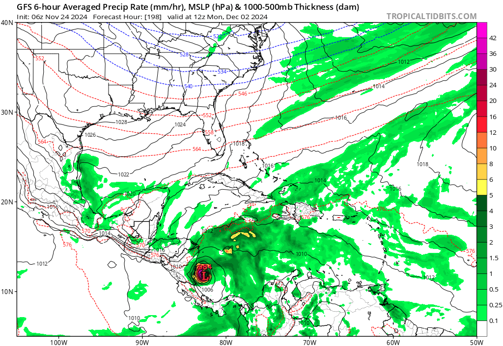
kevin wrote:There is now weak model support for a TC forming in the SWCar about 7 - 10 days from now near the end of November or the first week of December. Usually I'd attribute it to GEFS CAG bias, but the Euro also has some support. Perhaps we'll get a 0/10 lemon if the signal remains for another 2 - 3 days. Note that, depending on your exact definition, only 5 - 6 TCs have formed in the WCar in December (since 1851). So if this happens it would be a very rare occurrence.

GEFS
*13 out of 31 members (40%) develop a 30+ kt system with many more members showing a disturbance in the 20 - 30 kt range. One member reaches 60 - 70 kt for a short period of time.
https://i.imgur.com/AsArWHJ.png

Euro
*8 out of 51 members (16%) develop a 30+ kt system, 2 members (4%) show hurricane intensity.
https://i.imgur.com/eJJUXbh.png

00z ICON also shows a developing low near the end of the run.

https://i.imgur.com/qOkxiSs.png


The fact the ICON shows something is worth a look. It has been stellar this year. Let's see if the 12z keeps it going.
5 likes   
The following post is NOT an official forecast and should not be used as such. It is just the opinion of the poster and may or may not be backed by sound meteorological data. It is NOT endorsed by any professional institution including storm2k.org For Official Information please refer to the NHC and NWS products.

emeraldislenc
Category 2
Category 2
Posts: 558
Joined: Fri Aug 24, 2012 4:49 pm
Location: Emerald Isle NC

Re: 2024 Global Model Runs Discussion (Out thru day 16)

#2527 Postby emeraldislenc » Thu Nov 21, 2024 3:25 pm

I am in curaçao today and it is 91. So still warm in this part of the Caribbean. Heard it was approaching record heat for this date.
3 likes   

User avatar
Emmett_Brown
Category 5
Category 5
Posts: 1432
Joined: Wed Aug 24, 2005 9:10 pm
Location: Sarasota FL

Re: 2024 Global Model Runs Discussion (Out thru day 16)

#2528 Postby Emmett_Brown » Fri Nov 22, 2024 1:05 pm

Theres an uptick in activity on the 12Z GEFS ensemble, showing multiple 'canes in the NW Caribbean next week. Would you like that hurricane with stuffing?
6 likes   

WeatherBoy2000
Category 1
Category 1
Posts: 279
Joined: Mon Apr 10, 2023 9:29 am

Re: 2024 Global Model Runs Discussion (Out thru day 16)

#2529 Postby WeatherBoy2000 » Sun Nov 24, 2024 10:29 am

Emmett_Brown wrote:Theres an uptick in activity on the 12Z GEFS ensemble, showing multiple 'canes in the NW Caribbean next week. Would you like that hurricane with stuffing?


It's probably just a ghost, but there is a very weak signal for something on the geps/eps as well.
0 likes   

User avatar
Teban54
Category 5
Category 5
Posts: 3168
Joined: Sat May 19, 2018 1:19 pm

Re: 2024 Global Model Runs Discussion (Out thru day 16)

#2530 Postby Teban54 » Sun Nov 24, 2024 12:24 pm

Today's 6z and 12z GFS continue to show a TS/Cat 1 in SW Caribbean: (12z is weaker)

Image
4 likes   

User avatar
REDHurricane
Category 1
Category 1
Posts: 394
Age: 27
Joined: Sun Jul 03, 2022 2:36 pm
Location: Northeast Pacific Ocean

Re: 2024 Global Model Runs Discussion (Out thru day 16)

#2531 Postby REDHurricane » Sat Dec 07, 2024 4:31 am

Surprised no one has posted about this yet, but GFS has been hinting at a subtropical storm forming over the central Atlantic around December 15-17th for the last day or two -- tonight's 00z run shows it strengthening below 990mb and hanging out in the ocean for a while:

Image

Image

There actually hasn't been a named Atlantic storm in December since... you guessed it, Zeta in 2005! Let's see if the 2024 season can add this to its list of "accomplishments" that we hadn't seen since then because why not at this point?
3 likes   

OtakuForecaster
Tropical Low
Tropical Low
Posts: 11
Joined: Mon Dec 02, 2024 9:44 am

Re: 2024 Global Model Runs Discussion (Out thru day 16)

#2532 Postby OtakuForecaster » Sat Dec 07, 2024 9:29 pm

REDHurricane wrote:Surprised no one has posted about this yet, but GFS has been hinting at a subtropical storm forming over the central Atlantic around December 15-17th for the last day or two -- tonight's 00z run shows it strengthening below 990mb and hanging out in the ocean for a while:

https://i.ibb.co/RS5VDvk/gfs-mslp-wind-eatl-56.png

https://i.ibb.co/yBMNdYG/gfs-z850-vort-eatl-56.png

There actually hasn't been a named Atlantic storm in December since... you guessed it, Zeta in 2005! Let's see if the 2024 season can add this to its list of "accomplishments" that we hadn't seen since then because why not at this point?


Small correction; the last December storm was actually the unnamed subtropical storm of 2013 that the NHC operationally didn't name! Would be Nestor.

That's interesting though. Hadn't noticed that. I had kinda taken my eye off the Atlantic after Sara dissipated.
0 likes   

User avatar
Category5Kaiju
Category 5
Category 5
Posts: 4051
Joined: Thu Dec 24, 2020 12:45 pm
Location: Seattle

Re: 2024 Global Model Runs Discussion (Out thru day 16)

#2533 Postby Category5Kaiju » Sun Dec 08, 2024 12:37 am

REDHurricane wrote:Surprised no one has posted about this yet, but GFS has been hinting at a subtropical storm forming over the central Atlantic around December 15-17th for the last day or two -- tonight's 00z run shows it strengthening below 990mb and hanging out in the ocean for a while:

https://i.ibb.co/RS5VDvk/gfs-mslp-wind-eatl-56.png

https://i.ibb.co/yBMNdYG/gfs-z850-vort-eatl-56.png

There actually hasn't been a named Atlantic storm in December since... you guessed it, Zeta in 2005! Let's see if the 2024 season can add this to its list of "accomplishments" that we hadn't seen since then because why not at this point?


Are we sure that that is indeed a subtropical or tropical entity? I feel like there were numerous times in the recent past when the models consistently showed some well-bundled feature like that in the Atlantic during the off-season, only for such to not end up as a subtropical/tropical storm (and instead be an extra tropical system or some other storm).
0 likes   
Unless explicitly stated, all info in my posts is based on my own opinions and observations. Tropical storms and hurricanes can be extremely dangerous. Do not think you can beat Mother Nature. Refer to an accredited weather research agency or meteorologist if you need to make serious decisions regarding an approaching storm.

WeatherBoy2000
Category 1
Category 1
Posts: 279
Joined: Mon Apr 10, 2023 9:29 am

Re: 2024 Global Model Runs Discussion (Out thru day 16)

#2534 Postby WeatherBoy2000 » Sun Dec 08, 2024 7:49 am

Category5Kaiju wrote:
REDHurricane wrote:Surprised no one has posted about this yet, but GFS has been hinting at a subtropical storm forming over the central Atlantic around December 15-17th for the last day or two -- tonight's 00z run shows it strengthening below 990mb and hanging out in the ocean for a while:

https://i.ibb.co/RS5VDvk/gfs-mslp-wind-eatl-56.png

https://i.ibb.co/yBMNdYG/gfs-z850-vort-eatl-56.png

There actually hasn't been a named Atlantic storm in December since... you guessed it, Zeta in 2005! Let's see if the 2024 season can add this to its list of "accomplishments" that we hadn't seen since then because why not at this point?


Are we sure that that is indeed a subtropical or tropical entity? I feel like there were numerous times in the recent past when the models consistently showed some well-bundled feature like that in the Atlantic during the off-season, only for such to not end up as a subtropical/tropical storm (and instead be an extra tropical system or some other storm).


Yeah I've noticed this as well. In any case whatever the gfs was showing a few runs back is gone.
1 likes   

User avatar
REDHurricane
Category 1
Category 1
Posts: 394
Age: 27
Joined: Sun Jul 03, 2022 2:36 pm
Location: Northeast Pacific Ocean

Re: 2024 Global Model Runs Discussion (Out thru day 16)

#2535 Postby REDHurricane » Sun Dec 08, 2024 4:25 pm

OtakuForecaster wrote:
REDHurricane wrote:Surprised no one has posted about this yet, but GFS has been hinting at a subtropical storm forming over the central Atlantic around December 15-17th for the last day or two -- tonight's 00z run shows it strengthening below 990mb and hanging out in the ocean for a while:

https://i.ibb.co/RS5VDvk/gfs-mslp-wind-eatl-56.png

https://i.ibb.co/yBMNdYG/gfs-z850-vort-eatl-56.png

There actually hasn't been a named Atlantic storm in December since... you guessed it, Zeta in 2005! Let's see if the 2024 season can add this to its list of "accomplishments" that we hadn't seen since then because why not at this point?


Small correction; the last December storm was actually the unnamed subtropical storm of 2013 that the NHC operationally didn't name! Would be Nestor.

That's interesting though. Hadn't noticed that. I had kinda taken my eye off the Atlantic after Sara dissipated.


That's why I said last named storm ;)
1 likes   

OtakuForecaster
Tropical Low
Tropical Low
Posts: 11
Joined: Mon Dec 02, 2024 9:44 am

Re: 2024 Global Model Runs Discussion (Out thru day 16)

#2536 Postby OtakuForecaster » Mon Dec 09, 2024 9:26 am

REDHurricane wrote:
OtakuForecaster wrote:
REDHurricane wrote:Surprised no one has posted about this yet, but GFS has been hinting at a subtropical storm forming over the central Atlantic around December 15-17th for the last day or two -- tonight's 00z run shows it strengthening below 990mb and hanging out in the ocean for a while:

https://i.ibb.co/RS5VDvk/gfs-mslp-wind-eatl-56.png

https://i.ibb.co/yBMNdYG/gfs-z850-vort-eatl-56.png

There actually hasn't been a named Atlantic storm in December since... you guessed it, Zeta in 2005! Let's see if the 2024 season can add this to its list of "accomplishments" that we hadn't seen since then because why not at this point?


Small correction; the last December storm was actually the unnamed subtropical storm of 2013 that the NHC operationally didn't name! Would be Nestor.

That's interesting though. Hadn't noticed that. I had kinda taken my eye off the Atlantic after Sara dissipated.


That's why I said last named storm ;)


hehe, fair enough. I've gotten too used to using Phil's definition of named storm. :P
1 likes   

User avatar
Hurricane2022
Category 5
Category 5
Posts: 1496
Joined: Tue Aug 23, 2022 11:38 pm
Location: Araçatuba, Brazil

Re: 2024 Global Model Runs Discussion (Out thru day 16)

#2537 Postby Hurricane2022 » Wed Dec 18, 2024 11:27 pm

The latest GFS runs shows that a possible subtropical system should occur between December 20 - 22 north of the MDR. Euro also shows this system, but a bit weaker. Icon also shows a decent vortex in this same region. I'm surprised (but not too much) that the NHC hasn't given this the attention it deserves yet.
0 likes   
Sorry for the bad English sometimes...!
For reliable and detailed information for any meteorological phenomenon, please consult the National Hurricane Center, Joint Typhoon Warning Center , or your local Meteo Center.

--------

Una cvm Christo, pro Christo, et in Christo. Sit nomen Domini benedictvm.

User avatar
StormWeather
Tropical Depression
Tropical Depression
Posts: 65
Joined: Wed Jun 05, 2024 2:34 pm

Re: 2024 Global Model Runs Discussion (Out thru day 16)

#2538 Postby StormWeather » Thu Dec 19, 2024 9:47 pm

Hurricane2022 wrote:The latest GFS runs shows that a possible subtropical system should occur between December 20 - 22 north of the MDR. Euro also shows this system, but a bit weaker. Icon also shows a decent vortex in this same region. I'm surprised (but not too much) that the NHC hasn't given this the attention it deserves yet.

That low is coming together decently right now, but the convection isn’t the greatest. Whether it will become a subtropical system or not if up for grabs.
0 likes   
Just your average cyclone tracker

Cyclones experienced;

Debby 24’


Return to “Talkin' Tropics”

Who is online

Users browsing this forum: AnnularCane, Kingarabian, Teban54 and 69 guests