

HurricaneBelle wrote:Evil Jeremy wrote:Jevo wrote:The one thing Ive learned over the years is that if your a direct hit at the end of the forecast period.. Hold off putting the shutters up.. I saw my house here in Fort Laud in the position this morning.. and if models hold true.. my theory is still going to hold true
Oh and just so I dont get flamed.. If you're anywhere in the cone always be alert and pay attention to local and state authorities. Make sure your hurricane plan is ready to go and dont sink your patio furniture in the pool.. and all that other good advice
VVVV Disclaimer below VVVV
While you don't need to put your shutters up yet, SFL is no longer at the end of the forecast cone. Were within 4 days. If when you wake up in the morning, and SFL is still in the cone, thats about 3 1/2 days away, and time to seriously start getting ready.
Problem is, ever since Ike missed us, many people I know are more hesistant to prepare for big threats, not wanting to go through the entire preparation process again when the system might miss.
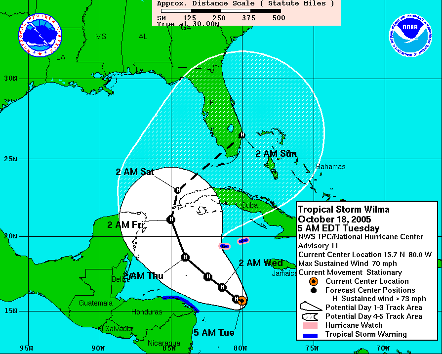
You'd think people in SFL would be respectful of the 5-day track since Wilma went there just as predicted (albeit a day later due to getting hung up near Cozumel):
http://www.nhc.noaa.gov/archive/2005/gr ... 2405W5.GIF
Yeah and notice Wilma ended up On the Yucatan, it got further west than the models thought even with a big trough digging.


