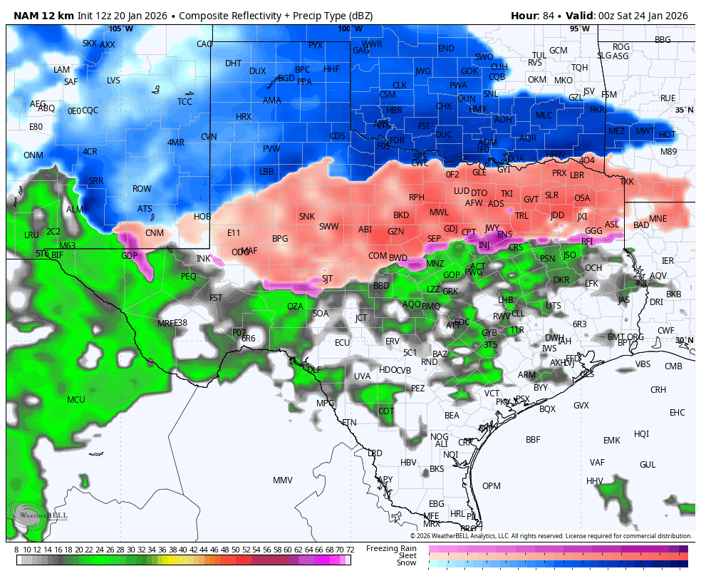
Wthrfan wrote:Brent wrote:Ntxw wrote:Time to buy bread and milk if you are in central, north, northeast, northwest Texas. This is THAT storm. Oklahoma too but for you guys what is some inches of snow?

.
If we get a foot I dunno about that

I dunno I wasn't even here the last time Tulsa had a foot haha(February 2011). That storm was apparently horrible here but it was also a full blown blizzard
Anyway someone is getting a foot for sure around here
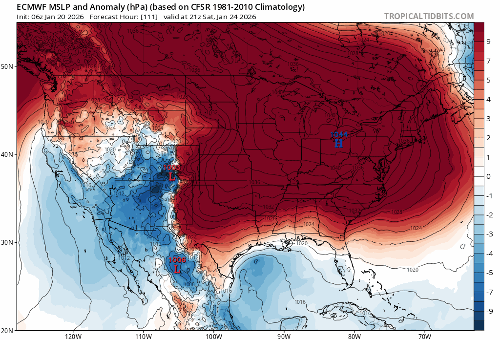
I hope that big arctic high doesn't shift the majority of the precip too far south of us.
Yeah I know it's not exactly my favorite setup ever based off that but the other side.....the precip may linger into Sunday now
it's not like it's gonna be some 2 hour window and then it's over I guess
Honestly I'm seeing people east of here scared it's gonna shift back north anyway. Not sure how but we'll see. I think they are worried it cuts into the northeast or something
Yeah he's worried about too much phasing and it goes inland basically
 The posts in this forum are NOT official forecast and should not be used as such. They are just the opinion of the poster and may or may not be backed by sound meteorological data. They are NOT endorsed by any professional institution or


