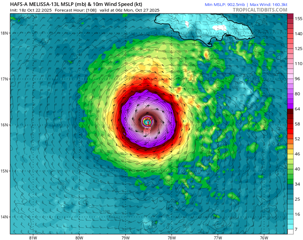
SouthFLTropics wrote:18z HAFS-B has so far backed off significantly from the earlier insane 12z run.
18z HAFS-A, however, is actually slightly stronger.
Moderator: S2k Moderators


SouthFLTropics wrote:18z HAFS-B has so far backed off significantly from the earlier insane 12z run.
AutoPenalti wrote:18z Euro shifts east at 144.
Nuno wrote:AutoPenalti wrote:18z Euro shifts east at 144.
Everything is shifting eastward for 18z after several cycles of west shifts. The wipers are wiping...
Hypercane_Kyle wrote:SouthFLTropics wrote:18z HAFS-B has so far backed off significantly from the earlier insane 12z run.
18z HAFS-A, however, is actually slightly stronger.


SouthFLTropics wrote:00z CMC, WHAT ARE YOU DOING??? That’s a little too close to South Florida!!!
Sent from my iPhone using Tapatalk
CrazyC83 wrote:How does the upper level environment compare to the reanalyzed environment from the 1932 hurricane? Since that seems to be the primary analog right now.


aspen wrote:Oh my god the 00z HMON is a catastrophic scenario for Jamaica. Just stalls over the island as a Cat 3/4. Not good that the hurricane models have shifted closer to Jamaica during the 00z cycle.
HAFS-A/B both have a sub-900 monster much closer to Jamaica than in previous runs, too.


Users browsing this forum: No registered users and 162 guests


