ATL: LAURA - Post-Tropical - Discussion
Moderator: S2k Moderators
-
Do_For_Love
- Category 1

- Posts: 271
- Age: 35
- Joined: Sat May 09, 2015 7:47 am
- Location: Delaware
Re: ATL: LAURA - Tropical Storm - Discussion
Looks like Cuba did what Hispaniola couldn't, and weakened Laura a bit. She looks messy this morning. Still has strong convection to the south though, and maybe some trying to build over the center. With the NHC still calling for a Cat 2 in the gulf, and some models even stronger, I would bet she will be back and then some before too long.
3 likes
Irene '11, Sandy '12, Fay '20, Isaias '20, Ida '21
-
Aric Dunn
- Category 5

- Posts: 21238
- Age: 43
- Joined: Sun Sep 19, 2004 9:58 pm
- Location: Ready for the Chase.
- Contact:
Re: ATL: LAURA - Tropical Storm - Discussion
SoupBone wrote:Aric Dunn wrote:SoupBone wrote:
I'm not following, what are you suggesting? A more pronounced radical turn to what direction?
If marco was not there. then a gradual turn is fine given the tilt to the ridge. .. but the weakness is there.
so a sharper NW turn before bending back WNW>
That would put Central and SELA back in play.
You can see Laura's Circulation being stretched to the NW.. a key indicator that the two circs are already beginning to interact. and that the weakness/steering behind Marco is in place.
( I am not an artist lol)

4 likes
Note: If I make a post that is brief. Please refer back to previous posts for the analysis or reasoning. I do not re-write/qoute what my initial post said each time.
If there is nothing before... then just ask
Space & Atmospheric Physicist, Embry-Riddle Aeronautical University,
I believe the sky is falling...
If there is nothing before... then just ask
Space & Atmospheric Physicist, Embry-Riddle Aeronautical University,
I believe the sky is falling...

Re: ATL: LAURA - Tropical Storm - Discussion
A Rossby Wave is forecast to be pretty close to Laura on approach to the coast.
Strong UL winds could put a lid on her then.
But then again, there's the possibility of entraining high TPW air from the EPAC and also running thru a high CAPE pool off the coast from the high OHC eaddy in the W GoM.
Things to watch for.

Strong UL winds could put a lid on her then.
But then again, there's the possibility of entraining high TPW air from the EPAC and also running thru a high CAPE pool off the coast from the high OHC eaddy in the W GoM.
Things to watch for.
3 likes
-
hurricaneCW
- Category 5
- Posts: 1799
- Joined: Wed Mar 03, 2010 6:20 am
- Location: Toms River, NJ
Re: ATL: LAURA - Tropical Storm - Discussion
Laura about to see a large burst near the center. Should be much better organized by this afternoon and evening.
4 likes

Re: ATL: LAURA - Tropical Storm - Discussion
Thanks Aric. I think some of the more eastern models yesterday were showing Marco hanging around longer and Laura following that weakness.
0 likes
Personal Forecast Disclaimer:
The posts in this forum are NOT official forecast and should not be used as such. They are just the opinion of the poster and may or may not be backed by sound meteorological data. They are NOT endorsed by any professional institution or storm2k.org. For official information, please refer to the NHC and NWS products.
The posts in this forum are NOT official forecast and should not be used as such. They are just the opinion of the poster and may or may not be backed by sound meteorological data. They are NOT endorsed by any professional institution or storm2k.org. For official information, please refer to the NHC and NWS products.

Re: ATL: LAURA - Tropical Storm - Discussion
Aric Dunn wrote:SoupBone wrote:Aric Dunn wrote:
If marco was not there. then a gradual turn is fine given the tilt to the ridge. .. but the weakness is there.
so a sharper NW turn before bending back WNW>
That would put Central and SELA back in play.
You can see Laura's Circulation being stretched to the NW.. a key indicator that the two circs are already beginning to interact. and that the weakness/steering behind Marco is in place.
( I am not an artist lol)
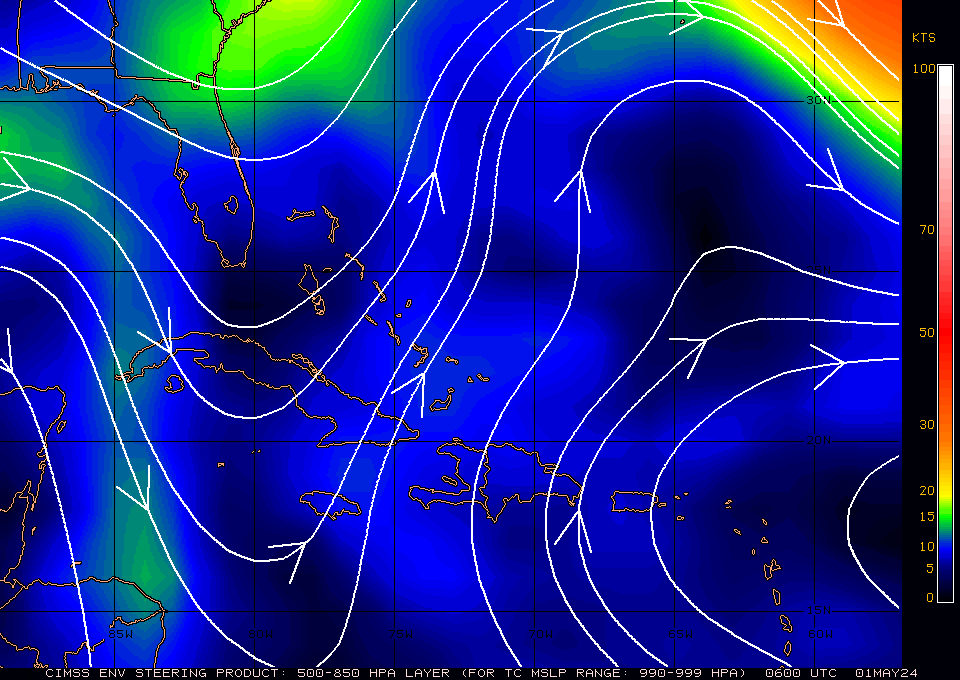
https://i.ibb.co/zSCJRsp/Capture.png
http://tropic.ssec.wisc.edu/real-time/atlantic/winds/wg8dlm2Z.GIF
Not a fan of where those arrows are pointing...but 10/10 would visit your gala.
0 likes
-
supercane4867
- Category 5
- Posts: 4966
- Joined: Wed Nov 14, 2012 10:43 am
Re: ATL: LAURA - Tropical Storm - Discussion
Low level structure is solid. Just needs sometime for the convection to rebuild itself. Should be able to start serious intensification as soon as it clears Cuba.
0 likes

Re: ATL: LAURA - Tropical Storm - Discussion
hurricaneCW wrote:Laura about to see a large burst near the center. Should be much better organized by this afternoon and evening.
Yeah convection is developing around the center at the moment, this probably won't really take off till past Cuba but don't be fooled by its current lopsided nature once convection develops over the center it will look alot better.
Something like Frederic but further west landfall.
0 likes
Personal Forecast Disclaimer:
The posts in this forum are NOT official forecast and should not be used as such. They are just the opinion of the poster and may or may not be backed by sound meteorological data. They are NOT endorsed by any professional institution or storm2k.org. For official information, please refer to the NHC and NWS products
The posts in this forum are NOT official forecast and should not be used as such. They are just the opinion of the poster and may or may not be backed by sound meteorological data. They are NOT endorsed by any professional institution or storm2k.org. For official information, please refer to the NHC and NWS products
-
jconsor
- Professional-Met

- Posts: 580
- Joined: Mon Jun 30, 2008 9:31 pm
- Location: Jerusalem, Israel
- Contact:
Re: ATL: LAURA - Tropical Storm - Discussion
I personally think Marco's impact on weakening the 500 mb ridge is minimal if any... Marco is too small and has weakened too quickly to have much impact. It likely has weakened the lower-level ridge (850 mb).
Models are presently underestimating the western extent/strength of the SE US ridge at 500 mb:
https://twitter.com/yconsor/status/1297841859847364609
Models are presently underestimating the western extent/strength of the SE US ridge at 500 mb:
https://twitter.com/yconsor/status/1297841859847364609
NDG wrote:Aric Dunn wrote:Marco is still well intact.. I see this turning more nw suddenly later today as it gets caught in the wake of Marco. sheared but intact
then when marco dies ridge will build back some and we see a more wnw track.
this gradual turn stuff is not realistic in this scenario. the weakness behind marco and southerly flow is coming up quickly around central and western cuba and can easily be seen.
I agree, Marco's mid level vorticty has made it further north & east, thus weakening the western extension of the Bermuda ridge into the eastern GOM.
5 likes
-
USTropics
- Professional-Met
- Posts: 2738
- Joined: Sun Aug 12, 2007 3:45 am
- Location: Florida State University
Re: ATL: LAURA - Tropical Storm - Discussion
hurricaneCW wrote:NDG wrote:Recon finds no signs of a LLC reforming further south as many were thinking about late last night on Twitter.
https://i.imgur.com/qgRhXGj.png
The LLC was well intact, there was zero indication it was going to reform. People were -removed-.
Basically the southerly flow through Jamaica's topography creates lee waves, and this interaction with Laura created a turbulent vortex (the NHC is calling this a leeside vortex). Essentially orographic lift creates vertical displacement , and this creates periodic changes in speed and direction of air (this happens on the lee side of terrain, hence the name leeside vortex). Radar was showing this vortex last night.
1 likes
-
tolakram
- Admin

- Posts: 20184
- Age: 62
- Joined: Sun Aug 27, 2006 8:23 pm
- Location: Florence, KY (name is Mark)
Re: ATL: LAURA - Tropical Storm - Discussion
Laura visible loop: https://whirlwind.aos.wisc.edu/~wxp/goe ... o1_30.html
0 likes
M a r k
- - - - -
Join us in chat: Storm2K Chatroom Invite. Android and IOS apps also available.
The posts in this forum are NOT official forecasts and should not be used as such. Posts are NOT endorsed by any professional institution or STORM2K.org. For official information and forecasts, please refer to NHC and NWS products.

Re: ATL: LAURA - Tropical Storm - Discussion
tolakram wrote:Laura visible loop: https://whirlwind.aos.wisc.edu/~wxp/goe ... o1_30.html
Sucking in dry air from the north. She needs a lot of help. Cannot clearly see a LLC ATM. Looks to be reorganizing her LLC with the MLC? IDK and cannot tell. A mess.
0 likes
Re: ATL: LAURA - Tropical Storm - Discussion
tolakram wrote:Laura visible loop: https://whirlwind.aos.wisc.edu/~wxp/goe ... o1_30.html
Great video, looks like Laura is indeed refiring convection over the center. Quite small size wise but once past Cuba it's going to be expanding its northern section. The waters it's in is plenty enough to develop an inner core.
2 likes
Personal Forecast Disclaimer:
The posts in this forum are NOT official forecast and should not be used as such. They are just the opinion of the poster and may or may not be backed by sound meteorological data. They are NOT endorsed by any professional institution or storm2k.org. For official information, please refer to the NHC and NWS products
The posts in this forum are NOT official forecast and should not be used as such. They are just the opinion of the poster and may or may not be backed by sound meteorological data. They are NOT endorsed by any professional institution or storm2k.org. For official information, please refer to the NHC and NWS products
-
HoustonFrog
- Tropical Depression

- Posts: 98
- Joined: Thu Jun 04, 2020 1:49 pm
Re: ATL: LAURA - Tropical Storm - Discussion
So when will they start evacuation orders for Galveston? Time is running thin
0 likes
-
tolakram
- Admin
- Posts: 20184
- Age: 62
- Joined: Sun Aug 27, 2006 8:23 pm
- Location: Florence, KY (name is Mark)
Re: ATL: LAURA - Tropical Storm - Discussion
3090 wrote:tolakram wrote:Laura visible loop: https://whirlwind.aos.wisc.edu/~wxp/goe ... o1_30.html
Sucking in dry air from the north. She needs a lot of help. Cannot clearly see a LLC ATM. Looks to be reorganizing her LLC with the MLC? IDK and cannot tell. A mess.
The right side of that LLC is where the convection is firing south of Cuba. While not pretty I think it's fairly well organized. Recon found a fairly strong circulation and a lot of west winds. The fact that an LLC exists for Laura is a pretty big deal, given it's history.

8 likes
M a r k
- - - - -
Join us in chat: Storm2K Chatroom Invite. Android and IOS apps also available.
The posts in this forum are NOT official forecasts and should not be used as such. Posts are NOT endorsed by any professional institution or STORM2K.org. For official information and forecasts, please refer to NHC and NWS products.
- - - - -
Join us in chat: Storm2K Chatroom Invite. Android and IOS apps also available.
The posts in this forum are NOT official forecasts and should not be used as such. Posts are NOT endorsed by any professional institution or STORM2K.org. For official information and forecasts, please refer to NHC and NWS products.

Re: ATL: LAURA - Tropical Storm - Discussion
jconsor wrote:I personally think Marco's impact on weakening the 500 mb ridge is minimal if any... Marco is too small and has weakened too quickly to have much impact. It likely has weakened the lower-level ridge (850 mb).
Models are presently underestimating the western extent/strength of the SE US ridge at 500 mb:
https://twitter.com/yconsor/status/1297841859847364609NDG wrote:Aric Dunn wrote:Marco is still well intact.. I see this turning more nw suddenly later today as it gets caught in the wake of Marco. sheared but intact
then when marco dies ridge will build back some and we see a more wnw track.
this gradual turn stuff is not realistic in this scenario. the weakness behind marco and southerly flow is coming up quickly around central and western cuba and can easily be seen.
I agree, Marco's mid level vorticty has made it further north & east, thus weakening the western extension of the Bermuda ridge into the eastern GOM.
A couple of dm difference will not make such a difference, I have seen this plenty of times before where I think it will make a difference but it does not. If Marco's dying mid level vorticity hangs around longer in the NE GOM is what needs to be watched, but it is dying quicker than what models were showing yesterday.
0 likes
-
hurricaneCW
- Category 5
- Posts: 1799
- Joined: Wed Mar 03, 2010 6:20 am
- Location: Toms River, NJ
Re: ATL: LAURA - Tropical Storm - Discussion
Not much to stop this from intensifying into a Cat 4/5 once in the gulf except time maybe.
Look out gulf coast and be prepared please.
Look out gulf coast and be prepared please.
4 likes
-
Nederlander
- S2K Supporter

- Posts: 1259
- Joined: Sat Jul 19, 2008 4:28 pm
- Location: Conroe, TX
Re: ATL: LAURA - Tropical Storm - Discussion
HoustonFrog wrote:So when will they start evacuation orders for Galveston? Time is running thin
They will probably at least clear Bolivar today and wait for future advisories to see if there are any further west shifts before clearing Galveston.
They can contraflow I45 and clear Galveston relatively swiftly. Bolivar is prone to storm surge flooding near high island, thereby creating an island. Many were trapped during Ike for waiting too long to leave.
Last edited by Nederlander on Mon Aug 24, 2020 7:19 am, edited 1 time in total.
2 likes
-
tolakram
- Admin
- Posts: 20184
- Age: 62
- Joined: Sun Aug 27, 2006 8:23 pm
- Location: Florence, KY (name is Mark)
Re: ATL: LAURA - Tropical Storm - Discussion
saved loop

6 likes
M a r k
- - - - -
Join us in chat: Storm2K Chatroom Invite. Android and IOS apps also available.
The posts in this forum are NOT official forecasts and should not be used as such. Posts are NOT endorsed by any professional institution or STORM2K.org. For official information and forecasts, please refer to NHC and NWS products.
- - - - -
Join us in chat: Storm2K Chatroom Invite. Android and IOS apps also available.
The posts in this forum are NOT official forecasts and should not be used as such. Posts are NOT endorsed by any professional institution or STORM2K.org. For official information and forecasts, please refer to NHC and NWS products.

Re: ATL: LAURA - Tropical Storm - Discussion
Last edited by tolakram on Mon Aug 24, 2020 7:26 am, edited 1 time in total.
Reason: removed mobile, removed space in front of URL
Reason: removed mobile, removed space in front of URL
3 likes
Irene '11 Sandy '12 Hermine '16 5/15/2018 Derecho Fay '20 Isaias '20 Elsa '21 Henri '21 Ida '21
I am only a meteorology enthusiast who knows a decent amount about tropical cyclones. Look to the professional mets, the NHC, or your local weather office for the best information.
I am only a meteorology enthusiast who knows a decent amount about tropical cyclones. Look to the professional mets, the NHC, or your local weather office for the best information.
Who is online
Users browsing this forum: No registered users and 40 guests