ATL: HERMINE - Post-Tropical - Discussion

Moderator: S2k Moderators

Message
Author
User avatar
centuryv58
Tropical Storm
Tropical Storm
Posts: 233
Age: 67
Joined: Sat Jul 30, 2016 1:24 pm
Location: Southeast Florida

Re: ATL: INVEST 99L - Discussion

#3181 Postby centuryv58 » Sat Aug 27, 2016 9:01 am

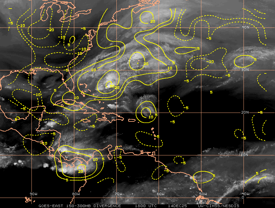
srainhoutx wrote:Two atmospheric features that have been missing are a somewhat more favorable MJO and a CCKW. Both of those atmospheric features are moving E into the Caribbean Sea from the EPAC this morning and we are seeing general rising air with instability begin to increase across the Western Atlantic Basin.

http://i228.photobucket.com/albums/ee29 ... _vp200.png

http://i228.photobucket.com/albums/ee29 ... _vp200.png


I read that elsewhere too. Well maybe the MJO will do its mojo next week.
Last edited by Ntxw on Sat Aug 27, 2016 9:20 am, edited 1 time in total.
Reason: Removed img tags
0 likes   

tolakram
Admin
Admin
Posts: 20020
Age: 62
Joined: Sun Aug 27, 2006 8:23 pm
Location: Florence, KY (name is Mark)

Re: ATL: INVEST 99L - Discussion

#3182 Postby tolakram » Sat Aug 27, 2016 9:01 am

A couple more saved GIFS. These are much too large to embed, here are the links.

http://i.imgur.com/Jcn0mMZ.gifv

http://i.imgur.com/m7MC1Fq.gifv
1 likes   
M a r k
- - - - -
Join us in chat: Storm2K Chatroom Invite. Android and IOS apps also available.

The posts in this forum are NOT official forecasts and should not be used as such. Posts are NOT endorsed by any professional institution or STORM2K.org. For official information and forecasts, please refer to NHC and NWS products.

User avatar
JaxGator
Category 2
Category 2
Posts: 780
Joined: Sun Jun 12, 2016 3:33 pm
Location: Jacksonville Florida

Re: ATL: INVEST 99L - Discussion

#3183 Postby JaxGator » Sat Aug 27, 2016 9:02 am

Well, looks like we have both lower convergence (1) and upper divergence (2).

http://tropic.ssec.wisc.edu/real-time/a ... g8conv.GIF

http://tropic.ssec.wisc.edu/real-time/a ... wg8dvg.GIF
1 likes   
The posts or stuff said are NOT an official forecast. Please look to the NHC and NWS for official forecasts and products.

Floyd-1999, Frances-2004, Jeanne-2004, Fay-2008, Beryl-2012, Debby-2012, Colin-2016, Hermine-2016, Julia-2016, Matthew-2016, Irma-2017, Elsa-2021, Idalia-2023, Debby-2024, Helene-2024.


Go Gators! Go Jags!

User avatar
NDG
S2K Supporter
S2K Supporter
Posts: 15457
Joined: Sun Jul 09, 2006 10:14 pm
Location: Orlando, FL

Re: ATL: INVEST 99L - Discussion

#3184 Postby NDG » Sat Aug 27, 2016 9:07 am

Cayo Coco, Cuba, is now reporting WNW winds telling me that the circulation might be getting better defined and closer to the deep convection now.
0 likes   

HurriGuy
S2K Supporter
S2K Supporter
Posts: 734
Joined: Thu Aug 15, 2013 8:43 pm
Location: Prairieville, LA

Re: ATL: INVEST 99L - Discussion

#3185 Postby HurriGuy » Sat Aug 27, 2016 9:09 am

We are getting an ASCAT scan in about 40 minutes. Please be a good one...
1 likes   
The posts in this forum are NOT official forecast and should not be used as such. They are just the opinion of the poster and may or may not be backed by sound meteorological data. They are NOT endorsed by any professional institution or storm2k.org. For official information, please refer to the NHC and NWS products.

JabNOLA
Tropical Low
Tropical Low
Posts: 36
Joined: Mon Aug 09, 2004 11:00 am
Location: New Orleans, Louisiana

Re: ATL: INVEST 99L - Discussion

#3186 Postby JabNOLA » Sat Aug 27, 2016 9:10 am

Check out the Miami long range. I believe the center is just coming into range and appears closed. It's a long way out so looks can be deceiving but notice how the showers never cross into the center. Someone please post a legal link.
0 likes   

tolakram
Admin
Admin
Posts: 20020
Age: 62
Joined: Sun Aug 27, 2006 8:23 pm
Location: Florence, KY (name is Mark)

Re: ATL: INVEST 99L - Discussion

#3187 Postby tolakram » Sat Aug 27, 2016 9:12 am

JabNOLA wrote:Check out the Miami long range. I believe the center is just coming into range and appears closed. It's a long way out so looks can be deceiving but notice how the showers never cross into the center. Someone please post a legal link.


Remember from a distance you are seeing the MLC, not the LLC.

 https://twitter.com/EricBlake12/status/769533291615715328


2 likes   
M a r k
- - - - -
Join us in chat: Storm2K Chatroom Invite. Android and IOS apps also available.

The posts in this forum are NOT official forecasts and should not be used as such. Posts are NOT endorsed by any professional institution or STORM2K.org. For official information and forecasts, please refer to NHC and NWS products.

User avatar
ronjon
Category 5
Category 5
Posts: 4832
Joined: Fri Aug 19, 2005 5:17 pm
Location: Hernando Beach, FL

Re: ATL: INVEST 99L - Discussion

#3188 Postby ronjon » Sat Aug 27, 2016 9:12 am

HurriGuy wrote:We are getting an ASCAT scan in about 40 minutes. Please be a good one...


Yeah this hopefully will give us a good idea of the geometry and location of the center.
0 likes   

Dean4Storms
S2K Supporter
S2K Supporter
Posts: 6358
Age: 62
Joined: Sun Aug 31, 2003 1:01 pm
Location: Miramar Bch. FL

Re: ATL: INVEST 99L - Discussion

#3189 Postby Dean4Storms » Sat Aug 27, 2016 9:15 am

This convection is still to the SE of the Wave Axis and highest Vorticity, we need convection further to the NW within the top area of that wave. Still a good deal of organization needed here.
0 likes   

HurriGuy
S2K Supporter
S2K Supporter
Posts: 734
Joined: Thu Aug 15, 2013 8:43 pm
Location: Prairieville, LA

Re: ATL: INVEST 99L - Discussion

#3190 Postby HurriGuy » Sat Aug 27, 2016 9:15 am

Those storms are still racing in trying to cover the entire circulation
1 likes   
The posts in this forum are NOT official forecast and should not be used as such. They are just the opinion of the poster and may or may not be backed by sound meteorological data. They are NOT endorsed by any professional institution or storm2k.org. For official information, please refer to the NHC and NWS products.

User avatar
NDG
S2K Supporter
S2K Supporter
Posts: 15457
Joined: Sun Jul 09, 2006 10:14 pm
Location: Orlando, FL

Re: ATL: INVEST 99L - Discussion

#3191 Postby NDG » Sat Aug 27, 2016 9:18 am

JaxGator wrote:Well, looks like we have both lower convergence (1) and upper divergence (2).

http://tropic.ssec.wisc.edu/real-time/a ... g8conv.GIF

http://tropic.ssec.wisc.edu/real-time/a ... wg8dvg.GIF


Yeah, one thing that has a lot more of compared to yesterday morning is UL divergence, is really helping in convection keep firing up.
Northerly Mid level shear has also significantly decreased.
1 likes   

HurriGuy
S2K Supporter
S2K Supporter
Posts: 734
Joined: Thu Aug 15, 2013 8:43 pm
Location: Prairieville, LA

Re: ATL: INVEST 99L - Discussion

#3192 Postby HurriGuy » Sat Aug 27, 2016 9:18 am

Although the HWRF is not good for genesis, I just want to say that the past several runs have been absolutely spot on in the placement of the convection in the area the circulation is now. It never really had it over the center either
1 likes   
The posts in this forum are NOT official forecast and should not be used as such. They are just the opinion of the poster and may or may not be backed by sound meteorological data. They are NOT endorsed by any professional institution or storm2k.org. For official information, please refer to the NHC and NWS products.

User avatar
NDG
S2K Supporter
S2K Supporter
Posts: 15457
Joined: Sun Jul 09, 2006 10:14 pm
Location: Orlando, FL

Re: ATL: INVEST 99L - Discussion

#3193 Postby NDG » Sat Aug 27, 2016 9:19 am

Dean4Storms wrote:This convection is still to the SE of the Wave Axis and highest Vorticity, we need convection further to the NW within the top area of that wave. Still a good deal of organization needed here.


Is not a wave axis, even the NHC's TWOs state that it is a low pressure center.
1 likes   

User avatar
NDG
S2K Supporter
S2K Supporter
Posts: 15457
Joined: Sun Jul 09, 2006 10:14 pm
Location: Orlando, FL

Re: ATL: INVEST 99L - Discussion

#3194 Postby NDG » Sat Aug 27, 2016 9:21 am

HurriGuy wrote:Although the HWRF is not good for genesis, I just want to say that the past several runs have been absolutely spot on in the placement of the convection in the area the circulation is now. It never really had it over the center either


Yeah, I saw that earlier this morning, I went back to the previous runs they were pretty spot on on convection firing up this morning near the low pressure center.
0 likes   

User avatar
NDG
S2K Supporter
S2K Supporter
Posts: 15457
Joined: Sun Jul 09, 2006 10:14 pm
Location: Orlando, FL

Re: ATL: INVEST 99L - Discussion

#3195 Postby NDG » Sat Aug 27, 2016 9:22 am

More evidence of a closed surface low south of Andros Island.

Image
0 likes   

User avatar
ScottNAtlanta
Category 5
Category 5
Posts: 2413
Joined: Sat May 25, 2013 3:11 pm
Location: Atlanta, GA

Re: ATL: INVEST 99L - Discussion

#3196 Postby ScottNAtlanta » Sat Aug 27, 2016 9:23 am

Before anyone gets complacent or thinks this is done...in 2005 there was tropical depression 10 that died off obituaries written only later to become tropical depression 12 as it got closer to FL...and we all know how that played out...it aint over till its over
1 likes   
The posts in this forum are NOT official forecast and should not be used as such. They are just the opinion of the poster and may or may not be backed by sound meteorological data. They are NOT endorsed by any professional institution or storm2k.org. For official information, please refer to the NHC and NWS products.

SapphireSea
Category 1
Category 1
Posts: 430
Joined: Wed Aug 24, 2005 12:13 pm
Location: Miami, FL

Re: ATL: INVEST 99L - Discussion

#3197 Postby SapphireSea » Sat Aug 27, 2016 9:25 am

NDG wrote:
Dean4Storms wrote:This convection is still to the SE of the Wave Axis and highest Vorticity, we need convection further to the NW within the top area of that wave. Still a good deal of organization needed here.


Is not a wave axis, even the NHC's TWOs state that it is a low pressure center.


I believe it's an elongated trough with an axis or embedded area of lowest pressure. If it was a closed center at the surface it would meet the TD criteria. So maybe at mid levels one can track a center, but at surface it would still be an axis.
1 likes   
Forecast Disclaimer:

Don't be stupid. Make your own informed decisions.

Dean4Storms
S2K Supporter
S2K Supporter
Posts: 6358
Age: 62
Joined: Sun Aug 31, 2003 1:01 pm
Location: Miramar Bch. FL

Re: ATL: INVEST 99L - Discussion

#3198 Postby Dean4Storms » Sat Aug 27, 2016 9:27 am

NDG wrote:
Dean4Storms wrote:This convection is still to the SE of the Wave Axis and highest Vorticity, we need convection further to the NW within the top area of that wave. Still a good deal of organization needed here.


Is not a wave axis, even the NHC's TWOs state that it is a low pressure center.


OK, Trough Axis.
0 likes   

Tuffy
Tropical Low
Tropical Low
Posts: 11
Joined: Sat Sep 10, 2005 12:59 pm
Location: South Carolina

Re: ATL: INVEST 99L - Discussion

#3199 Postby Tuffy » Sat Aug 27, 2016 9:28 am

It strikes me that the HWRF picked up on something that is visible now. There are actually TWO possible LLC areas: Our focus just N of Cuba and an area SE of Nassau. The model bounced these a time or two and, then ignored the east one. I agree with that, but can wonder what we would "see" if the more southerly circulation really had no life left. Why would we not wonder about development of the second area? ONLY the lack of model recognition? Think I'd see it differently if I lived in Nassau. Sure looks like tight circulation there to me. Just MLC and ULC? Lots of convection there now.
1 likes   

User avatar
NDG
S2K Supporter
S2K Supporter
Posts: 15457
Joined: Sun Jul 09, 2006 10:14 pm
Location: Orlando, FL

Re: ATL: INVEST 99L - Discussion

#3200 Postby NDG » Sat Aug 27, 2016 9:30 am

This is where I now see the low pressure center to be, which makes sense because Cayo Coco just to the south of it is now reporting WNW winds.

Image
1 likes   


Return to “2016”

Who is online

Users browsing this forum: No registered users and 2 guests