AREA FORECAST DISCUSSION
NATIONAL WEATHER SERVICE NORMAN OK
308 PM CST SAT DEC 6 2008
.DISCUSSION...
IN THE NEAR TERM...FIRE WEATHER WILL BE AN ISSUE TOMORROW
AFTERNOON AS STRONG SOUTHERLY WINDS WILL COMBINE WITH WARM
TEMPERATURES AND LOW RH VALUES. WE WILL ISSUE A FIRE WEATHER WATCH
FOR FAR WESTERN OKLAHOMA AND WESTERN NORTH TEXAS FOR THE AFTERNOON
HOURS TOMORROW.
MODEL DISAGREEMENTS CONTINUE BETWEEN GFS AND ECMWF/NAM. FORECAST
PREPARATION WAS PRIMARILY GEARED TOWARD THE LATTER...WITH THE GFS
BEING THE OUTLIER. THIS WILL MEAN A FASTER LEAD WAVE...RESULTING
IN POPS BY MONDAY AFTERNOON...ALTHOUGH MOISTURE WILL BE MARGINAL
AT BEST. THE ECMWF/NAM ARE ALSO FASTER WITH SURGE OF COLD AIR
MONDAY NIGHT AND EARLY TUESDAY. THIS WILL ALLOW US TO SPEED UP
SOUTHWARD PROGRESSION OF RAIN/SNOW LINE MONDAY NIGHT AND TUESDAY.
HOWEVER...WITH POSITIVE TILT TO SYSTEM IN FAVORED MODELS...DEEP
LAYER FLOW REMAINS VEERED - RESULTING IN GREATEST MOISTURE AND
FORCING EAST OF OUR FORECAST AREA. GFS DOES FAVOR ELEVATED
BAROCLINIC ZONE ACROSS NORTHERN AND WESTERN OKLAHOMA ON TUESDAY
FOR MODERATE/HEAVY SNOW BANDS...THIS PRIMARILY DUE TO CLOSED NATURE
OF MID-LEVEL SYSTEM AND ENHANCED FG-FORCING IN 750-650MB LAYER.
FAVORED ECMWF/NAM FLOW REGIME POINT MORE TOWARD WEAKER FORCING AND
GREATER INFLUENCE FROM DRY-SLOT. ALTHOUGH LIGHT ACCUMS MAY OCCUR OVER
NORTHERN/CENTRAL PORTIONS OF OKLAHOMA...BIGGEST IMPACTS CURRENTLY
EXPECTED TO BE STRONG NORTHERLY WINDS MONDAY NIGHT AND TUESDAY
RESULTING IN LOW WIND CHILL VALUES AND PERHAPS REDUCED
VISIBILITIES DUE TO BLOWING SNOW.
SLOW WARMING TREND FOR LATE WEEK AHEAD OF NEXT STORM SYSTEM. NEXT
WEEKEND INTO THE FOLLOWING WEEK ARE APPEARING FAIRLY ACTIVE
WITH COLD AIR BUILDING TO OUR NORTH AND SOUTHWEST FLOW / WESTERN
U.S. TROUGH/ PROGD TO DEVELOP.
Southern Plains winter wx thread (2008-2009)
Moderator: S2k Moderators
Forum rules
 The posts in this forum are NOT official forecast and should not be used as such. They are just the opinion of the poster and may or may not be backed by sound meteorological data. They are NOT endorsed by any professional institution or STORM2K.
 The posts in this forum are NOT official forecast and should not be used as such. They are just the opinion of the poster and may or may not be backed by sound meteorological data. They are NOT endorsed by any professional institution or STORM2K.
- Extremeweatherguy
- Category 5

- Posts: 11095
- Joined: Mon Oct 10, 2005 8:13 pm
- Location: Florida
Re: Cold pattern on the way?
Afternoon Norman, OK AFD...
0 likes
Re: Cold pattern on the way?
Third day in a row that the CPC Outlook shifts the trough further west...this could be a major cold weather event for Southern California...if this pans out
AREA FORECAST DISCUSSION
NATIONAL WEATHER SERVICE SAN DIEGO CA
200 PM PST SAT DEC 6 2008
.LONG TERM...AFTER THURSDAY A BIG COOL DOWN AND
MOISTENING TREND BEGINS. MODELS CONTINUE TO SHOW LONG WAVE TROUGH
DEVELOPING ALONG THE WEST COAST WITH WINTER STORM MOVING INTO
PACIFIC NORTHWEST REGION NEXT SATURDAY. AFTER THIS THE GFS AND ECMWF
MODELS DIVERGE ON TIMING AND TRACK...THE GFS MODEL IS FAVORED BASED
ON CLIMATOLOGY AND ENSEMBLE FORECASTS. THIS WOULD HAVE THE PARENT
LOW DROPPING DOWN THE COAST WITH THE STRONG AND WET COLD FRONT
SWEEPS THROUGH SOUTHERN CALIFORNIA LATE MONDAY DECEMBER 15TH. STAY
TUNED.
&&
SOUTHWEST CALIFORNIA AREA FORECAST DISCUSSION
NATIONAL WEATHER SERVICE LOS ANGELES/OXNARD CA
200 PM PST SAT DEC 6 2008
FRI AND SAT ARE STILL SOMEWHAT UNCERTAIN. MODELS CONTINUE TO SHOW A
RATHER LARGE AND SLIGHTLY NEGATIVELY TILTED TROUGH DIPPING DOWN THE
WEST COAST. MODELS CONTINUE TO SLOW THE SYSTEM DOWN...NOW BRINGING
IT TO NRN CA ON SAT. ENSEMBLES ARE ALL OVER THE PLACE AS TO THE
EXACT POSITION OF THE SYSTEM...AND RATHER THAN GET TO
PRECISE...TRENDED TEMPS DOWN AND KEPT PTCLDY
CONDITIONS GOING TO START THE WEEKEND. MORE WILL BE LEARNED AS WE
GET INTO NEXT WEEK.
&&

0 likes
-
JonathanBelles
- Professional-Met

- Posts: 11430
- Age: 35
- Joined: Sat Dec 24, 2005 9:00 pm
- Location: School: Florida State University (Tallahassee, FL) Home: St. Petersburg, Florida
- Contact:
- Extremeweatherguy
- Category 5

- Posts: 11095
- Joined: Mon Oct 10, 2005 8:13 pm
- Location: Florida
The 00z GFS run looks like it finally may be starting to catch on. It is showing a nice blast of arctic air trying to make it south by early next week. It still looks to hang up the cold air a little too much, not letting it get as far south as it probably will, but this definitely looks better than previous runs. Things could certainly get interesting (and COLD) in about 8-10 days...
180 hrs: http://www.nco.ncep.noaa.gov/pmb/nwprod ... n_180l.gif
192 hrs: http://www.nco.ncep.noaa.gov/pmb/nwprod ... n_192l.gif
204 hrs: http://www.nco.ncep.noaa.gov/pmb/nwprod ... n_204l.gif
216 hrs: http://www.nco.ncep.noaa.gov/pmb/nwprod ... n_216l.gif
228 hrs: http://www.nco.ncep.noaa.gov/pmb/nwprod ... n_228l.gif
0 likes
-
Ed Mahmoud
Re:
Extremeweatherguy wrote:The 00z GFS run looks like it finally may be starting to catch on. It is showing a nice blast of arctic air trying to make it south by early next week. It still looks to hang up the cold air a little too much, not letting it get as far south as it probably will, but this definitely looks better than previous runs. Things could certainly get interesting (and COLD) in about 8-10 days...
180 hrs: http://www.nco.ncep.noaa.gov/pmb/nwprod ... n_180l.gif
192 hrs: http://www.nco.ncep.noaa.gov/pmb/nwprod ... n_192l.gif
204 hrs: http://www.nco.ncep.noaa.gov/pmb/nwprod ... n_204l.gif
216 hrs: http://www.nco.ncep.noaa.gov/pmb/nwprod ... n_216l.gif
228 hrs: http://www.nco.ncep.noaa.gov/pmb/nwprod ... n_228l.gif
That could be a joyous and happy occasion, with 500 mb pattern suggesting a good push of cold air down toward the Canadian border (and hopefully cold, dense air and high pressure does the rest) with SW flow at 500 mb over Texas and precip.
500 mb forecast in 8 days from GFS
I can't remember which pro-met (might be JB, not sure, might be WxMan57 at KHOU forum) who has mentioned the GFS error pattern with shallow cold air producing 500 mb progs that aren't bad but surface features in bad places. Perhaps hour 216 surface map above's cold front in East Texas with 850 mb freeze line Northwest of Dallas and surface freeze line near Dallas is off by a hundred or three hundred miles, and Dallas is into the snow, and the surface freezing line might be approaching Houston with warm air still just above the surface, producing a school and work cancelling ice storm. The kids and I bundled up, slipping around on our icy lawn.
Eternal optimist in me, I guess.
0 likes
- Extremeweatherguy
- Category 5

- Posts: 11095
- Joined: Mon Oct 10, 2005 8:13 pm
- Location: Florida
The 12z GFS looks to still be having problems in handling the shallow cold airmass for next week. It tries to have the cold air stall somewhere along the OK/KS border, not making it too much further south than Oklahoma City from time to time. This is not very realistic though. With such cold, dense air to work with, this airmass will much more likely slip south all the way to central and south Texas by mid next week.
What concerns me most about this scenario is the fact that we will have a SW flow aloft. This is the kind of setup you like to see when looking for wintry precipitation in the southern plains. I would not at all be surprised to see a decent winter storm take shape for parts of Texas and Oklahoma sometime next week. This upcoming scenario is actually a bit reminiscent of the setup we had back in January 2007, when the southern plains was coated in ice and snow for several days.
What concerns me most about this scenario is the fact that we will have a SW flow aloft. This is the kind of setup you like to see when looking for wintry precipitation in the southern plains. I would not at all be surprised to see a decent winter storm take shape for parts of Texas and Oklahoma sometime next week. This upcoming scenario is actually a bit reminiscent of the setup we had back in January 2007, when the southern plains was coated in ice and snow for several days.
0 likes
- cheezyWXguy
- Category 5

- Posts: 6280
- Joined: Mon Feb 13, 2006 12:29 am
- Location: Dallas, TX
Re:
Extremeweatherguy wrote:The 12z GFS looks to still be having problems in handling the shallow cold airmass for next week. It tries to have the cold air stall somewhere along the OK/KS border, not making it too much further south than Oklahoma City from time to time. This is not very realistic though. With such cold, dense air to work with, this airmass will much more likely slip south all the way to central and south Texas by mid next week.
What concerns me most about this scenario is the fact that we will have a SW flow aloft. This is the kind of setup you like to see when looking for wintry precipitation in the southern plains. I would not at all be surprised to see a decent winter storm take shape for parts of Texas and Oklahoma sometime next week. This upcoming scenario is actually a bit reminiscent of the setup we had back in January 2007, when the southern plains was coated in ice and snow for several days.
haha we got jipped on that one though. If the temperature were maybe 2 or 3 degrees colder, we wouldve gone from 2 slushy inches to 7 or 8 powdery inches of snow and a day off of school. Lets hope this one ends up better...
0 likes
Re:
I've started reading the daily discussion the CPC posts when they issue their 6-10 day and 8-14 day temp and precip outlooks...they are actually very informative. They discuss the models, address inconsistent runs, show which models (and %) go into their outlooks, and even give a rating on a scale of 1-5 on how confident they are on the day's outlook.
I find the confidence rating they give very useful...that is one thing we do not see with individual model run outputs like the ones posted here. Sometimes the runs are probably more of 'a sure thing' based on straightforward atmosphere dynamics expected. Other times, the models may really struggle to derive a forecast...those are the runs where we probably see huge flip flops every 6 hours because the variables are still unknown and the dynamics too complex. "Margin of error" is never mentioned with runs for winter weather...but just as we see cones of uncertainty with hurricanes.,...often hundreds of miles only 5 days out, there has to be a range for model runs as far as where highs, lows, etc will be 1 or 2 weeks out.
Like I said, I only used to look at the graphics they put out during the week....but the discussions really do show that their is significant analysis going on and that the outlooks aren't just the result of throwing darts. Folks may not like or agree with the outlooks, but there is a wealth of information in the back-up discussion. These are forecasts, so of course things can change during "week 1" to effect the exact foecast put out today for "week 2"....but the overall accuracy of individual model runs...if you look to see if the exact outcome predicted in 240 hours today verifies....is lower than most people think.
The CPC Outlooks are based on probabilities of an area being above or below normal in temp and precip. Important to remember that. Also, the outlook for temps being above normal for days 8-14 doesn't mean every one of those days will be above normal...they are referring to what the 'overall' average will be.
This was Friday's full discussion (discussions issued monday-friday):
PROGNOSTIC DISCUSSION FOR 6 TO 10 AND 8 TO 14 DAY OUTLOOKS
NWS CLIMATE PREDICTION CENTER CAMP SPRINGS, MD
300 PM EST FRI DEC 05 2008
6-10 DAY OUTLOOK FOR DEC 11 - 15 2008
THE MODEL SOLUTIONS ARE IN FAIR AGREEMENT ON THE EXPECTED 500-HPA HEIGHT
PATTERN DEPICTING A POTENTIAL LONGWAVE PATTERN CHANGE. FOR THE SECOND
CONSECUTIVE DAY, MODEL GUIDANCE INDICATES THAT A SIGNIFICANT INCREASE IN
500-HPA HEIGHTS OVER THE ALEUTIANS SHOULD RESULT IN THE AMPLIFICATION OF A
TROUGH DOWNSTREAM ACROSS THE WESTERN THIRD OF THE CONUS. MEANWHILE, THE RIDGE
OVER THE NORTH ATLANTIC WILL FAVOR THE PERSISTENCE OF A WEAK TO MODERATE TROUGH
ACROSS THE EASTERN CONUS. THE TIMING OF THIS POTENTIAL LONGWAVE PATTERN CHANGE
IS CRITICAL TO THE TEMPERATURE OUTLOOK. AT THE BEGINNING OF THE PERIOD, BELOW
NORMAL TEMPERATURES SHOULD PREVAIL ACROSS THE SOUTHEAST. HOWEVER, A MODERATING
TEMPERATURE TREND LATER IN THE PERIOD SHOULD RESULT IN NEAR NORMAL TEMPERATURES
FOR THE 5-DAY PERIOD. FOR THE REMAINDER OF THE CONUS, BELOW NORMAL TEMPERATURES
SHOULD DOMINATE. BELOW NORMAL TEMPERATURES ARE FORECAST FOR THE ALASKAN
PANHANDLE AND SOUTHEAST ALASKA WITH NEAR OR ABOVE NORMAL TEMPERATURES ACROSS
THE REMAINDER OF THE STATE. REGARDING THE PRECIPITATION OUTLOOK ACROSS THE
CONUS, MODEL GUIDANCE REMAINS CONSISTENT IN SHOWING A LOW PRESSURE SYSTEM
DEPARTING THE EAST COAST AT THE BEGINNING OF THE PERIOD. AS THE LONGWAVE TROUGH
RETROGRADES, THE STORM TRACK SHOULD SHIFT WEST. ABOVE NORMAL PRECIPITATION IS
FORECAST FROM THE MIDDLE MISSISSIPPI VALLEY AND OHIO VALLEY INTO THE
MID-ATLANTIC, NORTHEAST, AND NEW ENGLAND WITH BELOW NORMAL PRECIPITATION
EXPECTED ACROSS FLORIDA. WITH A DEEPENING TROUGH ACROSS THE WESTERN CONUS,
ABOVE NORMAL PRECIPITATION CAN BE EXPECTED ACROSS THE ROCKIES AND SOUTHWEST.
DOWNSTREAM OF THE RIDGE AXIS CENTERED OVER THE ALEUTIANS, BELOW NORMAL
PRECIPITATION IS FORECAST IN SOUTHEAST ALASKA, THE ALASKAN PANHANDLE, PACIFIC
NORTHWEST, AND NORTHERN CALIFORNIA.
TODAYS OFFICIAL 500-HPA BLEND CONSISTS OF 20 PERCENT OF TODAY'S OPERATIONAL
ECMWF CENTERED ON DAY 7...20 PERCENT OF TODAY'S 0Z GFS ENSEMBLE MEAN CENTERED
ON DAY 8...20 PERCENT OF TODAY'S 6Z GFS ENSEMBLE MEAN CENTERED ON DAY 8...AND
40 PERCENT OF TODAY'S GFS SUPERENSEMBLE MEAN CENTERED ON DAY 8.
MODEL OF THE DAY: GFS SUPERENSEMBLE MEAN.
FORECAST CONFIDENCE FOR THE 6-10 DAY PERIOD: AVERAGE, 3 ON A SCALE OF 1 TO 5,
DUE TO FAIR AGREEMENT AMONG THE MODEL SOLUTIONS AND UNCERTAINTY IN THE TIMING
OF A POTENTIAL LONGWAVE PATTERN CHANGE.
THE 6-10 DAY TEMPERATURE PROG IS BASED ON THE CPC AUTOMATED TEMPERATURE
FORECAST, KLEIN AND ANALOG TEMPERATURE SPECIFICATIONS FROM THE BLENDED HEIGHT
FIELD, KLEIN AND ANALOG TEMPERATURE SPECIFICATIONS FROM THE GFS ENSEMBLE MEANS,
AND TELECONNECTIONS ON A POSITIVE 500-HPA HEIGHT ANOMALY CENTER AT 60N 165W.
THE 6-10 DAY PRECIPITATION PROG IS BASED ON THE CPC AUTOMATED PRECIPITATION
FORECAST, ANALOG PRECIPITATION SPECIFICATIONS FROM THE BLENDED HEIGHT FIELD,
THE NAEFS PRECIPITATION FORECAST, CALIBRATED PRECIPITATION AMOUNTS FROM THE
GFS-BASED MODELS, TELECONNECTIONS ON A POSITIVE 500-HPA HEIGHT ANOMALY CENTER
AT 60N 165W, AND INSPECTION OF DAILY PRECIPITATION FORECASTS FROM THE VARIOUS
MODELS.
8-14 DAY OUTLOOK FOR DEC 13 - 19 2008
FOR THE WEEK 2 PERIOD MODEL SOLUTIONS ARE IN BETTER AGREEMENT COMPARED TO THE
DAY 6-10 PERIOD AFTER THE EXPECTED LONGWAVE PATTERN CHANGE OCCURS. A LONGWAVE
TROUGH BECOMES ESTABLISHED ACROSS THE WESTERN CONUS, WHILE A WEAK RIDGE
DEVELOPS ACROSS THE SOUTHEASTERN CONUS. THE DEVELOPMENT OF A LONGWAVE TROUGH
ACROSS THE WESTERN CONUS RESULTS FROM A STRENGTHENING RIDGE OVER THE ALEUTIANS.
TELECONNECTIONS ON A LARGE POSITIVE 500-HPA HEIGHT ANOMALY CENTER OVER THE
ALEUTIANS SUPPORT THE AFOREMENTIONED TROUGH/RIDGE PATTERN. THE OFFICIAL BLENDED
HEIGHT CHART SHOWS A POSITIVELY TILTED TROUGH EXTENDING FROM HUDSON BAY
SOUTHWEST INTO THE DESERT SOUTHWEST, A RIDGE OVER THE ALEUTIANS, AND A RIDGE IN
THE NORTH ATLANTIC. THIS EXPECTED LONGWAVE PATTERN YIELDS BELOW NORMAL
TEMPERATURES ACROSS MUCH OF THE WESTERN AND CENTRAL CONUS WITH ABOVE NORMAL
TEMPERATURES ACROSS THE SOUTHEASTERN CONUS. THE PRESENCE OF THE RIDGE IN THE
NORTH ATLANTIC MAY SLOW THE MODERATION OF TEMPERATURES ACROSS THE NORTHEAST AND
NEW ENGLAND. AS THE WESTERN CONUS TROUGH BECOMES DEEPER, A TREND TOWARDS WETTER
CONDITIONS IS EXPECTED IN CALIFORNIA WHILE ABOVE NORMAL PRECIPITATION SHOULD
CONTINUE ACROSS THE ROCKIES AND SOUTHWEST. DOWNSTREAM OF THE WESTERN CONUS
TROUGH, ABOVE NORMAL PRECIPITATION IS FORECAST FROM THE OHIO VALLEY INTO THE
NORTHEAST AND NEW ENGLAND. A WEAK RIDGE SHOULD RESULT IN BELOW NORMAL
PRECIPITATION ALONG THE GULF COAST AND FLORIDA. ACROSS MUCH OF ALASKA, BELOW
NORMAL TEMPERATURES AND PRECIPITATION CAN BE EXPECTED.
THE OFFICIAL 8-14 DAY HEIGHT PROG CONSISTS OF 10 PERCENT OF TODAY'S OPERATIONAL
0Z GFS CENTERED ON DAY 11...10 PERCENT OF TODAY'S OPERATIONAL 6Z GFS CENTERED
ON DAY 11...30 PERCENT OF TODAY'S 0Z GFS ENSEMBLE MEAN CENTERED ON DAY 11...20
PERCENT OF TODAY'S 6Z GFS ENSEMBLE MEAN CENTERED ON DAY 11...AND 30 PERCENT OF
TODAY'S GFS SUPERENSEMBLE MEAN CENTERED ON DAY 11.
FORECAST CONFIDENCE FOR THE 8-14 DAY PERIOD IS: ABOVE AVERAGE, 4 ON A SCALE OF
1 TO 5, DUE TO GOOD AGREEMENT AMONG THE GFS ENSEMBLE MEAN SOLUTIONS,
TEMPERATURE TOOLS, AND PRECIPITATION TOOLS.
THE 8-14 DAY TEMPERATURE PROG IS BASED ON: CPC AUTOMATED TEMPERATURE FORECAST,
KLEIN AND ANALOG SPECIFICATIONS FROM THE BLENDED HEIGHT FIELD, KLEIN AND ANALOG
SPECIFICATIONS FROM THE GFS ENSEMBLE MEANS, AND TELECONNECTIONS ON A POSITIVE
500-HPA HEIGHT ANOMALY CENTER AT 60N 170W.
THE 8-14 DAY PRECIPITATION PROG IS BASED ON: CPC AUTOMATED PRECIPITATION
FORECAST, ANALOG PRECIPITATION SPECIFICATIONS FROM THE BLENDED HEIGHT FIELD,
THE NAEFS PRECIPITATION FORECAST, CALIBRATED PRECIPITATION AMOUNTS FROM THE GFS
ENSEMBLE MEANS, AND TELECONNECTIONS ON A POSITIVE 500-HPA HEIGHT ANOMALY CENTER
AT 60N 170W.
fact789 wrote:I dont look at the CPC very much. What they predict in the short term is usually the opposite of what happens usually.
0 likes
Re: Cold pattern on the way?
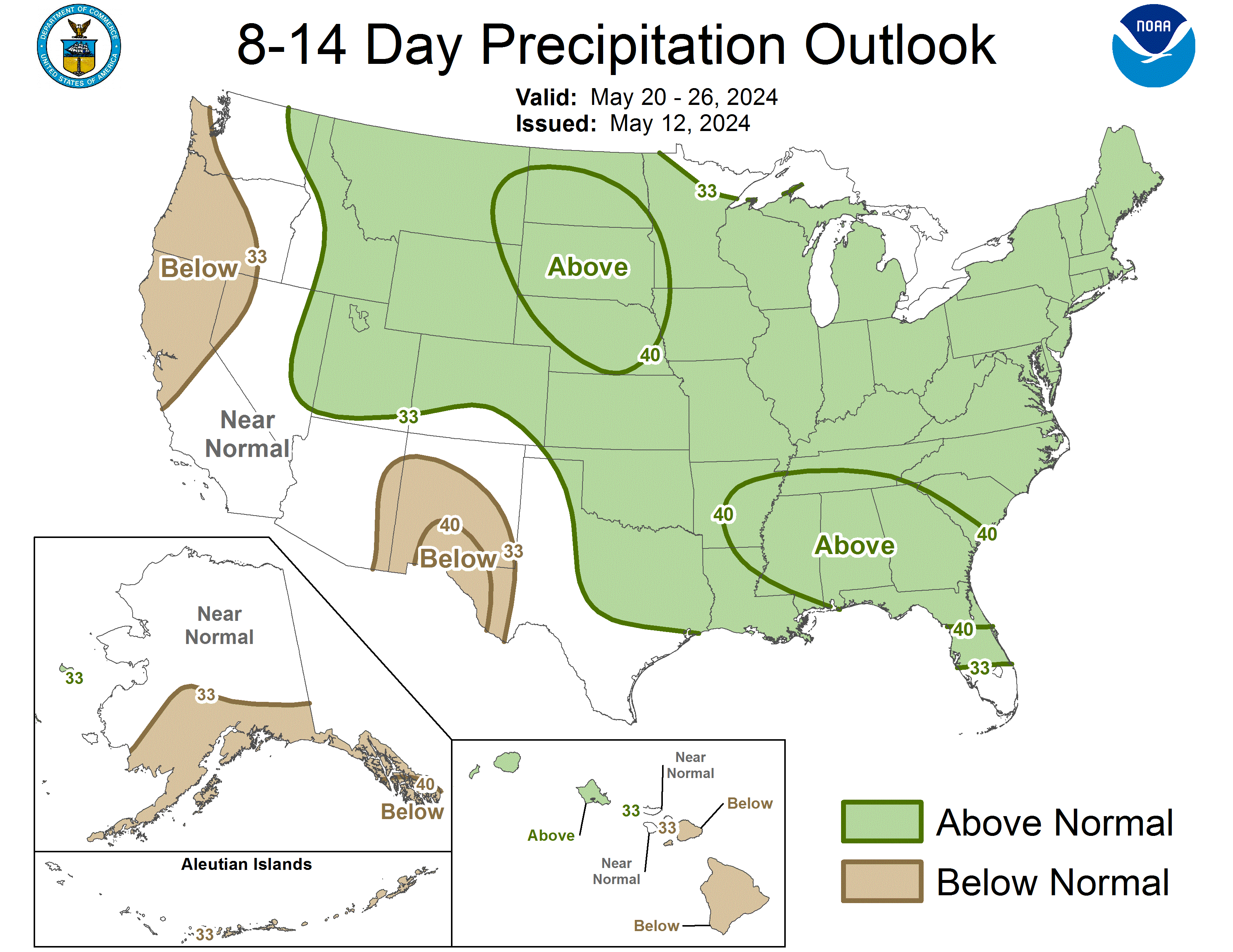
CPC 8-14 Day Outlook (12/15 - 12/21) issued this afternoon...pushes below normal temps (presumably trough) further west (trend of the last 4 days) and builds above normal temps (ridge) across the atlantic seaboard and gulf coast.

Precip outlook....wet west and north, dryer than normal from west texas points east along the gulf coast.

Precip outlook....wet west and north, dryer than normal from west texas points east along the gulf coast.

0 likes
Re: Cold pattern on the way?
I remember December of 1989 was really cold because of Arctic fronts kept coming and coming until it hit single digits.
0 likes
- Extremeweatherguy
- Category 5

- Posts: 11095
- Joined: Mon Oct 10, 2005 8:13 pm
- Location: Florida
Re:
Don't worry, its coming. The models (especially the GFS) are having major problems beyond hour 180, but I expect that to change once we get into the <120 hour range. Hopefully by the end of this week the models will have a better handle on what to expect for next week. My current guess is that they will shift to a colder and wetter pattern with a potential icy/snowy setup for Oklahoma and perhaps Texas. We shall see.iorange55 wrote:I stayed away for as long as I could. Which was about a day or two. So a question to someone who is smarter than me, which is basically anyone over the age of five.
Do you think there is a good chance of this arctic front not even coming at all or do you think it's just a matter of timing?
0 likes
- gboudx
- S2K Supporter

- Posts: 4090
- Joined: Thu Sep 04, 2003 1:39 pm
- Location: Rockwall, Tx but from Harvey, La
Re:
iorange55 wrote:I stayed away for as long as I could. Which was about a day or two. So a question to someone who is smarter than me, which is basically anyone over the age of five.
Do you think there is a good chance of this arctic front not even coming at all or do you think it's just a matter of timing?
Well, I'm not smarter than you on this weather stuff for sure. But when you get pro's like wxman57 and jeff providing opinions with a tone that is consistent and suggestive of something big possibly happening, you have to consider this a good possibility of happening. I'd like to hear what AirForceMet has to say on this since he's always good with his analysis and experience.
0 likes
- Portastorm
- Storm2k Moderator

- Posts: 9954
- Age: 63
- Joined: Fri Jul 11, 2003 9:16 am
- Location: Round Rock, TX
- Contact:
Re: Cold pattern on the way?
0 likes
- Extremeweatherguy
- Category 5

- Posts: 11095
- Joined: Mon Oct 10, 2005 8:13 pm
- Location: Florida
- southerngale
- Retired Staff

- Posts: 27418
- Joined: Thu Oct 10, 2002 1:27 am
- Location: Southeast Texas (Beaumont area)
So the Euro (and other models, I believe) and respected mets like wxman57 and Jeff are talking about the potential of record-breaking cold and/or possibly some wintry precip thrown in, but the CPC 8-14 day outlook says above normal temps and drier than normal for most of Texas and points east. I know it's an average and a few days of really cold and wet weather could still average out to be warmer and drier, but that doesn't make it sound very promising.
Does "it" still look as likely as it did a few days ago? More likely? Less likely? Just tell me exactly how it's going to play out and I'll be very appreciative.
Does "it" still look as likely as it did a few days ago? More likely? Less likely? Just tell me exactly how it's going to play out and I'll be very appreciative.

0 likes
- jasons2k
- Storm2k Executive

- Posts: 8290
- Age: 52
- Joined: Wed Jul 06, 2005 12:32 pm
- Location: The Woodlands, TX
Re: Cold pattern on the way?
Hi Southerngale, At this point I'd say it is looking more likely simply because the Euro model has been so consistent.
Also, the placement of the high is such that the cold air would plow straight down the plains/lee side of the rockies as opposed to the last few years where the coldest air got shunted east.
I'm starting to get concerned because this is the kind of cold that could potentially cause problems for gardenders and agricultural interests. But it's still too early to say it's a sure thing.
0 likes
-
Ed Mahmoud
Re: Cold pattern on the way?
boca wrote:Will Florida get into the cold air action too?
A citrus freeze for Texas and Florida? That'd be bad. But it seems like the ridge over Florida will mean no direct shots of the coldest air.
0 likes
-
Brent
- S2K Supporter

- Posts: 38714
- Age: 37
- Joined: Sun May 16, 2004 10:30 pm
- Location: Tulsa Oklahoma
- Contact:
Re: Cold pattern on the way?
boca wrote:Will Florida get into the cold air action too?
What do you consider cold?
As far as an arctic outbreak, I really have no clue, but we've been way below normal here for much of the last month(failed to get out of the 40's again today), already had lows in the teens last month which is incredibly rare this early so it's already been really cold over here. I do think we're going to warm up a bit between now and Christmas, beyond that, who knows. I'm not yet convinced of some historic cold outbreak though on the scale of 1983, 1985, or 1989.
0 likes
Who is online
Users browsing this forum: No registered users and 43 guests


