Forecast raised about 10 deg for tonight in south florida…lows ‘around or just above 60’ now forecast…normal to a degree or 2 above normal.
Better shot at low 50’s later in the week or the weekend…. …although NWS Miami not as bullish on Glades and Hendry counties seeing possible frost and overall models trending warmer for Friday night now too. If I had to forecast, Miami will probably bottom out at 52 or 53 deg during this cool snap.
AREA FORECAST DISCUSSION
NATIONAL WEATHER SERVICE MIAMI FL
822 AM EST THU JAN 15 2009
FOR TODAY AND TONIGHT... BIG IMPLICATIONS TO THE TEMPERATURE FCST
IN THE FORM OF THICK UPSTREAM CIRRUS BUILDING OVER THE SOUTHERN
GULF OF MEXICO. THIS CIRRUS HAS BEEN VERY WELL FCST BY MODELS THE
PAST FEW DAYS TO MOVE ACROSS OUR AREA... WILL HELP KEEP TEMPS
UP SOME TONIGHT AND MOST PLACES MAY ACTUALLY BE A DEGREE OR TWO
WARMER THAN LAST NIGHT. MAV MOS HAS CLOSED THE GAP ON THE MET
SIGNIFICANTLY...AND GIVEN OVERNIGHT TRENDS WITH CIRRUS OVER THE SE
MAY EVEN KEEP TEMPS AROUND OR JUST ABOVE 60 ALONG THE SE
COAST...AND COULD HOLD TEMPS CLOSER TO 40 ACROSS GLADES/HENDRY
COUNTIES...AND THIS WOULD INHIBIT FROST FORMATION. WIND
CHILLS WILL NOT BE MUCH OF A CONCERN IN THE EASTERN METRO AREAS
WITH LOW TEMPS HOVERING CLOSE TO 60.
CIRRUS LINGERS INTO FRIDAY BEFORE CLEARING DURING THE AFTERNOON AS
STRONGEST COLD PUSH MOVES ACROSS THE REGION...MODEL
GUIDANCE HAS BEEN TRENDING SLIGHTLY WARMER WITH LOW TEMPS FRIDAY
NIGHT. LAST NIGHTS GFS ENSEMBLE MOS AVERAGE LOW TEMP AT PGD FOR SAT
MORNING WAS 12 DEGREES WARMER THAN THE OPERATIONAL MEX MOS...AND THE
TREND OVER THE PAST WEEK SHOWS THE OPERATIONAL MEX HAS BEEN AT LEAST
4 DEGREES COOLER THAN THE ENSEMBLE AVERAGE EACH NIGHT.
WITH THIS IN MIND IT WOULD BE VERY HARD FOR ME TO DROP TEMPS TO FREEZING IN
GLADES/HENDRY COUNTIES AT THIS POINT...AND WILL WAIT FOR SUCCESSIVE
MODEL RUNS. HOWEVER IT WILL BE CLEAR WITH WINDS DECOUPLING SOME. IF
NOT A FREEZE THEN FROST COULD POTENTIALLY BE A CONCERN THERE ONCE
AGAIN...AND WILL BE BORDERLINE FOR WIND CHILL ADVISORY BASED ON WIND
SPEEDS...BUT WIND CHILLS CLOSE TO 30 MAY BE POSSIBLE DEPENDING ON
HOW COLD IT GETS. LOWS WILL LIKELY BE A FEW DEGREES COOLER ELSEWHERE
ACROSS THE CWA WITH MID 40S AT NAPLES...AND PERHAPS LOWER 50S ACROSS
THE EASTERN METRO AREAS. WIND CHILLS CLOSE TO 40 DEGREES ARE
POSSIBLE IN THE NAPLES AREA THE NEXT FEW NIGHTS.
Florida Weather
Moderator: S2k Moderators
Forum rules

The posts in this forum are NOT official forecast and should not be used as such. They are just the opinion of the poster and may or may not be backed by sound meteorological data. They are NOT endorsed by any professional institution or STORM2K.
-
feederband

- S2K Supporter

- Posts: 3423
- Joined: Wed Oct 01, 2003 6:21 pm
- Location: Lakeland Fl
-
Scorpion
Re: Florida Weather Thread: cooler pattern
So much for "arctic air". Seems like a few degrees below normal for South Florida.
0 likes
Re: Florida Weather Thread: cooler pattern
NWS Melbourne may drop freeze watch for tonight
SO WHILE TEMPS WILL BE
COOL TO COLD TODAY/TONIGHT ...THIS MAKES A WDSPRD FREEZE ACROSS THE
FAR NORTH SEEM MUCH LESS LKLY THAN IT DID EARLIER THIS WEEK. MIN
TEMP GUIDANCE HAS COME UP ABOUT A FULL CAT ACROSS THE AREA...AND THE
GRIDS/ZFP WILL FOLLOW SUIT. AM HESITANT TO PULL THE FREEZE WATCH
JUST YET...BUT BASED ON CURRENT SAT IMAGERY...WILL NOT BE SURPRISED
TO SEE IT PULLED LATER THIS AFTN.
0 likes
-
JonathanBelles
- Professional-Met

- Posts: 11430
- Age: 35
- Joined: Sat Dec 24, 2005 9:00 pm
- Location: School: Florida State University (Tallahassee, FL) Home: St. Petersburg, Florida
- Contact:
-
gatorcane

- S2K Supporter
- Posts: 23708
- Age: 48
- Joined: Sun Mar 13, 2005 3:54 pm
- Location: Boca Raton, FL
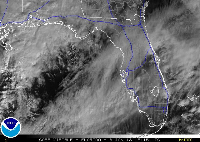
As long as these clouds hang around, lows just simply won't drop that much across Southern Florida. This cold snap is just another example of how difficult it is to not only forecast the actual lows but how conditions much be "just right" across Southern Florida to allow temperatures to nose-dive. Conditions for chilly lows are just not there despite the huge trough along the Eastern CONUS.
NWS mentions these clouds. The low at West Palm Beach last night dropped to 52, several degrees above the guidance and just a few degrees lower than normal.
THICK BLANKET OF MID/HIGH CLOUDS MOVING NE ACROSS THE GULF AND OVER
D FLA KEPT TEMPERATURES A LITTLE COZIER THAN EXPECTED. FROST ADVISORY
FOR THE NW INTERIOR FOR THIS MORNING WAS CANCELED. NOW WHAT WILL IT
DO TO EXPECTED HIGHS FOR TODAY. FORECAST CURRENTLY INDICATES MAX
TEMPERATURES THIS AFTERNOON 2 TO 5 DEGREES BELOW GUIDANCE (DEPENDS
ON LOCALE) WHICH...WITH ADJUSTED GRIDS...LOOKS PRETTY GOOD
0 likes
-
gatorcane
- S2K Supporter
- Posts: 23708
- Age: 48
- Joined: Sun Mar 13, 2005 3:54 pm
- Location: Boca Raton, FL
New South Florida forecasts from NWS rolling out....looks like nearly all of the CWA from Palm Beach County down to Miami-Dade will stay above 50 except for western interior and NW where some upper 40s may pop up but isolated areas to say the least.....notice also the NWS is keeping clouds in the forecast now nearly ever night which will keep the lows higher.
As Scropion stated below, forget the artic air here in South Florida, not happening this time, granted though it will "feel" much cooler than the 80s we have been enjoying for the past month or so.
Forecast for Miami:
http://forecast.weather.gov/MapClick.ph ... &map.y=138
As Scropion stated below, forget the artic air here in South Florida, not happening this time, granted though it will "feel" much cooler than the 80s we have been enjoying for the past month or so.
Forecast for Miami:
http://forecast.weather.gov/MapClick.ph ... &map.y=138
0 likes
Re: Florida Weather Thread: cooler pattern
Yep, the Gulf decided to put a blanket over the peninsula

0 likes

Re: Florida Weather Thread: cooler pattern
So far this winter(only by the calendar) I dropped to 50.2°F and that was November.I can't recall going thru winter and not seeing temps at least get into the 40's.The one bright spot is I'm giving the ac a rest. On another board by late next week the SE ridge will be back with temps around 80 again.This time of year weather wise for Florida is boring.
0 likes
Re: Florida Weather Thread: cooler pattern
So far the cold snap in October has been colder in Miami...
On 10/28/08, Miami had a low of 57 deg (and a high of 71 deg).
On 1/15/09, Miami had a low of 59 deg. Normal low for the date is 60 deg.
On 10/28/08, Miami had a low of 57 deg (and a high of 71 deg).
On 1/15/09, Miami had a low of 59 deg. Normal low for the date is 60 deg.
0 likes
Re: Florida Weather Thread: cooler pattern
Below are the coldest temps seen in Miami (at the airport) during the fall/winter season (oct-nov-dec-jan-feb-mar) of the following years:
From that, we can gather that we can pretty much can expect at least one temp reading each season in the 30s's to low and mid-40's
for an 'official' low in Miami.
2008/09 = 51 deg (as of 1/15/09)
2007/08 = 39 deg
2006/07 = 42 deg
2005/06 = 44 deg
2004/05 = 43 deg
2003/04 = 46 deg
2002/03 = 37 deg
2001/02 = 42 deg
2000/01 = 39 deg
In Miami, annual average temperatures reach their lowest for the entire year this week….with
an average high of 76 and an average low of 59 through January 19. On January 20, the average goes to 77/60 and continues a
a slow, but progressively steadier, increase through February. At the same time, the days are growing longer, gaining 25 minutes
of daylight just from January 1 - January 31. By January 31, the sun sets in Miami at 6:03 P.M.
Not to say that arctic outbreaks can't and won't still occur….and I don't think there is any reason Miami won't drop below 50 deg
at least once this winter given the history, but the last time Miami dropped below 30 deg in February was in 1917.
0 likes
-
Tampa Bay Hurricane

- Category 5

- Posts: 5597
- Age: 38
- Joined: Fri Jul 22, 2005 7:54 pm
- Location: St. Petersburg, FL
Re: Florida Weather Thread: cooler pattern
Low at the house was 52*F, Currently 54*F
Some Arctic Blast...LOL
Some Arctic Blast...LOL
0 likes
Re: Florida Weather Thread: cooler pattern
Around 6pm yesterday dewpoints in the tampa area were in the mid to even high 40's in some cases....i would expect much lower dewpts if frost or freezing temps are going to ever take place (if for no other reason than the temp can't go below the dewpt). Do you know if those dropped during the night? If they did, it wasn't as much as forecast.
The next shot of cold air may finally bring in those lower dewpoints and allow for the radiational cooling that didn't happen last night. But from some NWS Discussions I have been reading, although the coldest temps across the state may still have yet to happen this week into the weekend, even those have been bumped up a bit.
Still wouldn't rule out a frost/freeze threat up in your area and north of there....but the citrus farmers can be a bit more relaxed today.
Tampa Bay Hurricane wrote:Low at the house was 52*F, Currently 54*F
Some Arctic Blast...LOL
0 likes
-
gatorcane
- S2K Supporter
- Posts: 23708
- Age: 48
- Joined: Sun Mar 13, 2005 3:54 pm
- Location: Boca Raton, FL
Re: Florida Weather Thread: cooler pattern
jinftl wrote:Below are the coldest temps seen in Miami (at the airport) during the fall/winter season (oct-nov-dec-jan-feb-mar) of the following years:
From that, we can gather that we can pretty much can expect at least one temp reading each season in the 30s's to low and mid-40's
for an 'official' low in Miami.
2008/09 = 51 deg (as of 1/15/09)
2007/08 = 39 deg
2006/07 = 42 deg
2005/06 = 44 deg
2004/05 = 43 deg
2003/04 = 46 deg
2002/03 = 37 deg
2001/02 = 42 deg
2000/01 = 39 deg
In Miami, annual average temperatures reach their lowest for the entire year this week….with
an average high of 76 and an average low of 59 through January 19. On January 20, the average goes to 77/60 and continues a
a slow, but progressively steadier, increase through February. At the same time, the days are growing longer, gaining 25 minutes
of daylight just from January 1 - January 31. By January 31, the sun sets in Miami at 6:03 P.M.
Not to say that arctic outbreaks can't and won't still occur….and I don't think there is any reason Miami won't drop below 50 deg
at least once this winter given the history, but the last time Miami dropped below 30 deg in February was in 1917.
Thanks for the great info. Based on the last 100 years of historical data, here are the latest dates of expected possible freeze across metro SE Florida:
West Palm Beach (Feb. 24th -- 32F 1989)
Ft. Lauderdale (Feb. 6th -- 28F 1947)
Miami (Feb. 6th -- 32F, 1947)
So it looks like Southern Florida's chance to freeze has about 4 weeks left.
Source: http://www.srh.noaa.gov/mfl/localdata.php
0 likes
Re: Florida Weather Thread: cooler pattern
Temps at noon are cool in the panhandle with plenty of sun. Temps across most of the peninsula are being kept down due to cloudcover (what also insulated areas last night from getting as cold as forecast). Where the cloudcover thins some over se fl, temps have responded and are around 70.
FLORIDA REGIONAL WEATHER ROUNDUP
1200 PM EST THU JAN 15 2009
PENSACOLA 50
PANAMA CITY 55
APALACHICOLA 59
TALLAHASSEE 55
GAINESVILLE 57
JACKSONVILLE 54
ORLANDO INTL 57
DAYTONA BEACH 57
MELBOURNE 57
FT PIERCE 59
TAMPA 55
FT MYERS 53
KEY WEST NAS 67
W PALM BEACH 65
FT LAUDERDALE 71
MIAMI 68
FLORIDA REGIONAL WEATHER ROUNDUP
1200 PM EST THU JAN 15 2009
PENSACOLA 50
PANAMA CITY 55
APALACHICOLA 59
TALLAHASSEE 55
GAINESVILLE 57
JACKSONVILLE 54
ORLANDO INTL 57
DAYTONA BEACH 57
MELBOURNE 57
FT PIERCE 59
TAMPA 55
FT MYERS 53
KEY WEST NAS 67
W PALM BEACH 65
FT LAUDERDALE 71
MIAMI 68
0 likes
-
gatorcane
- S2K Supporter
- Posts: 23708
- Age: 48
- Joined: Sun Mar 13, 2005 3:54 pm
- Location: Boca Raton, FL
Latest radar shows a decent band of showers moving into Southern Florida. But looking at the latest forecast for shows 0% chance of rain for the South Florida CWA....? Huh?
NWS and models having a difficult time with the upper-air pattern and lingering moisture/rainfall. I'm not sure why NWS would not mention the rain showing up on the radar in their 1:00PM EST discussion?
http://radar.weather.gov/radar.php?rid= ... 11&loop=no
Latest Disco:
weather.gov
National Weather Service
Area Forecast Discussion
Local weather forecast by "City, St" or zip code
Current Version
Previous Version: 01 02 03 04 05 06 07 08 09 10 11 12 13 14 15 16 17 18 19 20 21 22 23 24 25 26 27 28 29 30
31 32 33 34 35 36 37 38 39 40 41 42 43 44 45 46 47 48 49 50 51 52 53 54 55 56
[Printable]
Links in the discussion text will open a (small) new browser window with more information inside.
A more complete Weather Glossary is Available Here
000
FXUS62 KMFL 151801
AFDMFL
AREA FORECAST DISCUSSION
NATIONAL WEATHER SERVICE MIAMI FL
101 PM EST THU JAN 15 2009
.AVIATION...DOES NOT LOOK LIKE WE WILL BE ABLE TO GET RID OF THE
MID OR HIGH LEVEL CLOUDS BUT STILL VFR. SOME EAST TERMINALS WILL
HAVE BKN045 BUT BY THIS EVENING LOW CLOUDS SCT OUT. WINDS NNW WILL
BECOME NNE THIS AFTN EAST TERMINALS AND THEN GO NNW AT SLIGHTLY
LOWER SPEEDS BTWN 7 AND 10 KNOTS. KAPF WILL STAY NNE AT 8 TO 9
KNOTS. WINDS WILL BECOME NE AOB 12 KNOTS WITH GUSTS TO AT LEAST
20 KNOTS AND SLIGHTLY LESS KAPF.
0 likes
-
Extremeweatherguy

- Category 5
- Posts: 11095
- Joined: Mon Oct 10, 2005 8:13 pm
- Location: Florida
Re: Florida Weather Thread: cooler pattern
Dew points have fallen into the middle 20s across the Orlando metro area this afternoon:
Orlando Executive Airport - 24F dew point
Orlando International Airport - 26F dew point
Orlando/Sanford Airport - 25F dewpoint
These dew point temperatures are running about 4-7 degrees lower than forecast.
Orlando Executive Airport - 24F dew point
Orlando International Airport - 26F dew point
Orlando/Sanford Airport - 25F dewpoint
These dew point temperatures are running about 4-7 degrees lower than forecast.
0 likes
Re: Florida Weather Thread: cooler pattern
Well...there goes Miami getting below 50 deg this week or weekend....updated NWS Miami forecast has raised nighttime temps across the board....days will be cool for sure, but winds with more of an easterly component will shut off arctic air intrusion....a cool, breezy time ahead....not a 'real south florida arctic airmass' though (i.e., temps 35-45 even on the coast)
NWS Forecast for: Miami FL
Issued by: National Weather Service Miami - South Florida
Last Update: 1:52 pm EST Jan 15, 2009
--------------------------------------------------------------------------------
Tonight: Mostly cloudy, with a low around 58.
Friday: A 10 percent chance of showers. Mostly cloudy, with a high near 70.
Friday Night: A 10 percent chance of showers. Partly cloudy, with a low around 55.
Saturday: A 10 percent chance of showers. Partly cloudy, with a high near 70.
Saturday Night: Partly cloudy, with a low around 59. Breezy, with a east wind between 13 and 17 mph.
Sunday: Mostly sunny, with a high near 70. East wind between 9 and 13 mph.
Sunday Night: Partly cloudy, with a low around 55. East wind 7 to 11 mph becoming northwest.
M.L.King Day: A 10 percent chance of showers. Partly cloudy, with a high near 70. West wind around 11 mph.
Monday Night: Partly cloudy and breezy, with a low around 55.
0 likes
-
Extremeweatherguy
- Category 5
- Posts: 11095
- Joined: Mon Oct 10, 2005 8:13 pm
- Location: Florida
The Melbourne afternoon AFD puts Orlando (MCO) at 38F tonight and 38F tomorrow night. The biggest question though will be the clouds and the winds. With such low dewpoints, a clearer sky or calmer winds could make a big difference in the forecast. It will be interesting to watch how everything plays out...
CURRENT...A STRONG ARCTIC FRONT CONTINUES TO DROP ACROSS THE
SOUTHEAST U.S. AND EVENTUALLY OVER THE FLORIDA PENINSULA THIS
EVENING & OVERNIGHT. THIS BOUNDARY WILL REINFORCE COLDER AND DRIER
CONDITIONS ACROSS EAST CENTRAL FLORIDA. A LARGE AREA OF STRONG HIGH
PRESSURE IS LOCATED OVER THE NORTHERN PLAINS AND UPPER MIDWEST EARLY
THIS AFTERNOON. VAST AREA OF HIGH CLOUDS FROM THE SOUTHERN HALF OF
THE PENINSULA SOUTHWESTWARD INTO THE GULF INDICATIVE OF STRONG UPPER
DIVERGENCE. INTERESTING ENOUGH IS THAT THE 12Z GFS HAS COME IN A
COUPLE-FEW DEGREES COOLER OVERNIGHT THAN PREVIOUS RUNS. FORECASTING
CHALLENGE WILL BE HOW HIGH CLOUDINESS AFFECTS OVERNIGHT LOWS.
Last edited by Extremeweatherguy on Thu Jan 15, 2009 3:47 pm, edited 1 time in total.
0 likes
Re: Florida Weather Thread: cooler pattern
From NWS Melbourne:
TONIGHT...NOT EXPECTING FROST ISSUES OVERNIGHT AS NORTH-NORTHWEST
WINDS UP UNTIL AROUND MIDNIGHT WILL RANGE FROM 5 TO 10 MPH WITH
WINDS INCREASING MOST LOCATIONS 10 TO 15 KTS AFTER MIDNIGHT BEHIND
THE STRONG ARCTIC FRONT. HOWEVER...WIND CHILL READINGS BETWEEN
08Z-14Z WILL BE PROBLEMATIC WHEN COMBINED WITH THE TEMPERATURES.
ADDITIONAL RH AND INCREASED UPPER DIVERGENCE IN THE H40-H20 LAYER
LIKELY TO KEEP OVERNIGHT LOWS FROM BOTTOMING OUT...AND AS SUCH WILL
CANCEL THE FREEZE WATCH. WILL INITIATE A WIND CHILL ADVISORY
BEGINNING AT 08Z OVERNIGHT FOR LAKE...VOLUSIA...ORANGE...SEMINOLE
AND NORTHWEST OSCEOLA COUNTIES IN EAST CENTRAL FLORIDA THROUGH 14Z
FRI MORNING.
FRIDAY NIGHT-SUNDAY...ANOTHER COLD NIGHT FRIDAY AND HAVE RAISED
FREEZE WATCH FOR LAKE AND INTERIOR VOLUSIA COUNTIES FOR AT LEAST A
COUPLE HOURS OF TEMPS AT OR JUST BELOW FREEZING. MAY NEED ANOTHER
WIND CHILL ADVISORY ACROSS THE NORTH AS WINDS MAY STAY UP AROUND
10 MPH. WINDS VEER TO THE NE SAT AND TEMPS MODERATE SOME BUT STILL
REMAIN MUCH BELOW NORMAL...RANGING FROM UPPER 50S FAR NORTH TO
UPPER 60S FAR SOUTH (OKEECHOBEE COUNTY). HIGH PRESSURE SETTLES
ACROSS THE AREA SUNDAY PRODUCING LIGHT WINDS AND ALLOWS MAX TEMPS
TO GET BACK CLOSE TO NORMAL...REACHING THE UPPER 60S. WOULD NOT BE
SURPRISED TO SEE SOME 70 DEGREE TEMPS SUNDAY.
From NWS Tampa Bay:
AREA FORECAST DISCUSSION...
NATIONAL WEATHER SERVICE TAMPA BAY RUSKIN FL
219 PM EST THU JAN 15 2009
.SHORT TERM (TONIGHT-SATURDAY)... LOOKS LIKE
FREEZING TEMPERATURES WILL BE CONFINED TO THE NATURE COAST FROM
PASCO COUNTY NORTH AND WILL THEREFORE NOT ISSUE A FREEZE WARNING
FOR HILLSBOROUGH AND POLK COUNTIES. WILL ALSO NOT INCLUDE PASCO
COUNTY AS TEMPERATURES AT OR BELOW 32 WILL NOT REACH THE NECESSARY
THREE HOURS NEEDED FOR A FREEZE WARNING.
ON FRIDAY THE CLOUDS ARE EXPECTED TO CONTINUE ACROSS THE CENTRAL AND
SOUTH...BUT SHOULD GRADUALLY THIN OUT AND MOVE SOUTH DURING THE
DAY. COLD ADVECTION WILL CONTINUE WITH TEMPERATURES ONLY EXPECTED
TO CLIMB INTO THE LOWER 50S FAR NORTH TO THE MID 60S SOUTH.
CLOUDS SHOULD FINALLY MOVE OUT OF THE AREA FRIDAY NIGHT...BUT
GUIDANCE CONTINUING TO INDICATE THAT WINDS REMAIN UP AROUND 5 MPH
NORTH TO 10 TO 15 MPH SOUTH. THIS SHOULD HELP KEEP TEMPERATURES UP
SOME...ESPECIALLY ACROSS THE CENTRAL AND SOUTHERN ZONES...AND
PRESENT FREEZE WATCH AREA LOOKS GOOD. HOWEVER...MAY NEED TO UPGRADE
LEVY COUNTY TO A HARD FREEZE AS GUIDANCE CONTINUES TO INDICATE LOWS
IN THE LOWER TO MID 20S.
SATURDAY LOOKS TO BE MOSTLY SUNNY AND SLIGHTLY WARMER AS HIGH
PRESSURE MOVES OFF THE SOUTHEAST U.S. COAST. TEMPERATURES SHOULD
CLIMB INTO THE UPPER 50S FAR NORTH TO AROUND 70 FAR SOUTH.
LONG TERM...(SATURDAY NIGHT - THURSDAY)...U/L TROUGH WILL LINGER OVER
THE EASTERN STATES DURING MUCH OF THE LONG TERM WITH SEVERAL WEAK
FRONTAL BOUNDARIES REACHING FLORIDA. MEANWHILE SURFACE HIGH PRESSURE
WILL REMAIN ACROSS THE STATE THROUGH SUNDAY EVENING WHEN THE FIRST
FROPA COULD BRING SOME BRIEF SHOWERS. LOW END 20 POPS REMAIN IN THE
FORECAST UNTIL MONDAY MORNING. HIGH PRESSURE WILL FOLLOW THE FRONT
AND SHOULD REMAIN IN PLACE THROUGH TUESDAY. A WEAKER AND DRIER FRONT
IS SHOWN IN MODEL GUIDANCE FOR WEDNESDAY AFTERNOON WITH NO
SIGNIFICANT IMPACTS WEATHERWISE.
0 likes
Return to “USA & Caribbean Weather”
Who is online
Users browsing this forum: rwfromkansas and 53 guests