Invest 91L,E Caribbean,Comments,Sat Pics,Models Thread #3

This is the general tropical discussion area. Anyone can take their shot at predicting a storms path.

Moderator: S2k Moderators

Forum rules

The posts in this forum are NOT official forecasts and should not be used as such. They are just the opinion of the poster and may or may not be backed by sound meteorological data. They are NOT endorsed by any professional institution or STORM2K. For official information, please refer to products from the National Hurricane Center and National Weather Service.

Help Support Storm2K
Message
Author
User avatar
brunota2003
S2K Supporter
S2K Supporter
Posts: 9476
Age: 34
Joined: Sat Jul 30, 2005 9:56 pm
Location: Stanton, KY...formerly Havelock, NC
Contact:

#341 Postby brunota2003 » Wed Aug 09, 2006 1:46 pm

Lowpressure wrote:Waiting for someone to say they think they see an eye.
I think I see an eye...ahhh...run for the hills...:lol: j/k :craz: look at those spirl bands and the big sun filled eye in the center: :sun: its got to be the most developed thing I've ever seen!!! This moment of humor brought to you by Storm2K Icons :D :lol:
0 likes   

User avatar
Damar91
Category 2
Category 2
Posts: 551
Joined: Wed Aug 24, 2005 1:06 pm
Location: Coral Springs, FL

#342 Postby Damar91 » Wed Aug 09, 2006 1:46 pm

Go ahead, give it your best shot! :lol: By the way, I think I see an eye! :wink:
0 likes   

Sanibel
Category 5
Category 5
Posts: 10375
Joined: Mon Aug 30, 2004 11:06 pm
Location: Offshore SW Florida

#343 Postby Sanibel » Wed Aug 09, 2006 1:47 pm

The central vortex is the obvious sign of a strongly drawing LLC.


I'm not trying to start any arguments or violate site rules but people who see this certain sign and say "there is no circulation" are to me people who refuse to learn. I'd also like those people to explain how a storm showing good dvorak curvature drops pressure and raises windspeed without an LLC?
Last edited by Sanibel on Wed Aug 09, 2006 1:49 pm, edited 1 time in total.
0 likes   

User avatar
HurricaneMaster_PR
Category 2
Category 2
Posts: 795
Joined: Tue Jul 22, 2003 6:23 pm
Location: San Juan, Puerto Rico

#344 Postby HurricaneMaster_PR » Wed Aug 09, 2006 1:48 pm

DATE/TIME LAT LON CLASSIFICATION STORM
09/1745 UTC 13.2N 57.5W T1.5/1.5 91L -- Atlantic Ocean
09/1145 UTC 12.5N 54.9W T1.0/1.0 91L
0 likes   

User avatar
skysummit
S2K Supporter
S2K Supporter
Posts: 5305
Age: 49
Joined: Tue Aug 31, 2004 11:09 pm
Location: Ponchatoula, LA
Contact:

#345 Postby skysummit » Wed Aug 09, 2006 1:49 pm

Sanibel wrote:The central vortex is the obvious sign of a strongly drawing LLC.


I'm not trying to start any arguments or violate site rules but people who see this certain sign and say "there is no circulation" are to me people who refuse to learn.


I don't think anyone is saying "there is no circulation"...there's obviously a circulation that's clearly visible on sat imagery. What they are saying is there is no closed low level circulation. Recon has not found anything to verify otherwise. Comments saying "this is a depression" is just inaccurate.
0 likes   

User avatar
Lowpressure
S2K Supporter
S2K Supporter
Posts: 2032
Age: 58
Joined: Sun Sep 14, 2003 9:17 am
Location: Charlotte, North Carolina

#346 Postby Lowpressure » Wed Aug 09, 2006 1:49 pm

Sanibel wrote:The central vortex is the obvious sign of a strongly drawing LLC.


I'm not trying to start any arguments or violate site rules but people who see this certain sign and say "there is no circulation" are to me people who refuse to learn.


I think the bigger issue here that we have learned that visible sat can be deceiving. Waiting for recon confirmation here. I see what you are referring to and tend to agree, but with a bird right there- recon takes precedence.
Last edited by Lowpressure on Wed Aug 09, 2006 1:50 pm, edited 1 time in total.
0 likes   

Matt-hurricanewatcher

#347 Postby Matt-hurricanewatcher » Wed Aug 09, 2006 1:50 pm

I see the convection falling apart near the center which makes for a very strong MLC. But I also see some inflow on the eastern and southwestern side. Which the low clouds are moving counterclockwise. Which would be a strong sign of a LLC. But the recon still has not found it at the surface.
0 likes   

User avatar
ALhurricane
Professional-Met
Professional-Met
Posts: 452
Joined: Wed Jan 08, 2003 12:46 pm
Location: Daphne, AL

#348 Postby ALhurricane » Wed Aug 09, 2006 1:50 pm

Sanibel wrote:The central vortex is the obvious sign of a strongly drawing LLC.


I'm not trying to start any arguments or violate site rules but people who see this certain sign and say "there is no circulation" are to me people who refuse to learn.


Well the bottom line is that recon has not yet found any evidence of a LLC. That is what counts at this point.
0 likes   

User avatar
brunota2003
S2K Supporter
S2K Supporter
Posts: 9476
Age: 34
Joined: Sat Jul 30, 2005 9:56 pm
Location: Stanton, KY...formerly Havelock, NC
Contact:

#349 Postby brunota2003 » Wed Aug 09, 2006 1:51 pm

Sanibel wrote:The central vortex is the obvious sign of a strongly drawing LLC.


I'm not trying to start any arguments or violate site rules but people who see this certain sign and say "there is no circulation" are to me people who refuse to learn.
I'm going to disagree, the people who are saying there is no LLC are going by what recon is finding...so no it isnt people refusing to learn, its them going by what is actually out there, not what other people are seeing on Sat images...guess what...right now, there is NO LLC...
0 likes   

User avatar
docjoe
S2K Supporter
S2K Supporter
Posts: 262
Joined: Thu Sep 09, 2004 10:42 pm
Location: SE Alabama..formerly the land of ivan and dennis

#350 Postby docjoe » Wed Aug 09, 2006 1:53 pm

I think I detect a wobble back to the east :jk:

docjoe
0 likes   

Sanibel
Category 5
Category 5
Posts: 10375
Joined: Mon Aug 30, 2004 11:06 pm
Location: Offshore SW Florida

#351 Postby Sanibel » Wed Aug 09, 2006 1:54 pm

I also go by no one yet explaining a pressure drop and windspeed increase without an LLC.

Especially with such a promising dvorak.
0 likes   

User avatar
ConvergenceZone
Category 5
Category 5
Posts: 5201
Joined: Fri Jul 29, 2005 1:40 am
Location: Northern California

#352 Postby ConvergenceZone » Wed Aug 09, 2006 1:54 pm

Well, at least since the convection is there, once they find a low level circulation, it should blow up fairly quickly and perhaps even bypass tropical depressio status. Alot of the time there will be a LLC but no convection. We already have the convection in place, so once they classify it, they might bypass the depression stage alltogether.
0 likes   

User avatar
Thunder44
Category 5
Category 5
Posts: 5922
Age: 44
Joined: Mon Jun 09, 2003 7:53 pm
Location: New York City

#353 Postby Thunder44 » Wed Aug 09, 2006 1:55 pm

355
WHXX01 KWBC 091852
CHGHUR

DISCLAIMER...NUMERICAL MODELS ARE SUBJECT TO LARGE ERRORS.
PLEASE REFER TO TPC/NHC OFFICIAL FORECASTS FOR TROPICAL CYCLONES.

NATIONAL HURRICANE CENTER NORTH ATLANTIC OBJECTIVE AIDS FOR

DISTURBANCE INVEST (AL912006) ON 20060809 1800 UTC

...00 HRS... ...12 HRS... ...24 HRS... ...36 HRS...
060809 1800 060810 0600 060810 1800 060811 0600

LAT LON LAT LON LAT LON LAT LON
BAMD 13.6N 59.7W 14.1N 62.6W 14.7N 65.1W 15.4N 67.7W
BAMM 13.6N 59.7W 13.8N 63.2W 14.3N 66.5W 14.8N 69.6W
A98E 13.6N 59.7W 14.0N 64.8W 14.2N 69.2W 14.2N 72.8W
LBAR 13.6N 59.7W 14.1N 63.9W 15.1N 67.9W 16.1N 71.7W
SHIP 30KTS 36KTS 42KTS 49KTS
DSHP 30KTS 36KTS 42KTS 49KTS

...48 HRS... ...72 HRS... ...96 HRS... ..120 HRS...
060811 1800 060812 1800 060813 1800 060814 1800

LAT LON LAT LON LAT LON LAT LON
BAMD 16.4N 70.3W 18.3N 75.2W 20.6N 80.0W 22.0N 83.8W
BAMM 15.4N 72.5W 16.2N 78.0W 17.2N 83.7W 18.2N 89.4W
A98E 14.0N 75.4W 14.3N 79.5W 14.9N 83.5W 16.1N 88.4W
LBAR 17.3N 74.9W 20.0N 79.9W 19.3N 84.3W .0N .0W
SHIP 54KTS 68KTS 75KTS 82KTS
DSHP 54KTS 68KTS 75KTS 54KTS

...INITIAL CONDITIONS...
LATCUR = 13.6N LONCUR = 59.7W DIRCUR = 275DEG SPDCUR = 27KT
LATM12 = 13.2N LONM12 = 54.3W DIRM12 = 276DEG SPDM12 = 27KT
LATM24 = 12.7N LONM24 = 49.0W
WNDCUR = 30KT RMAXWD = 50NM WNDM12 = 25KT
CENPRS = 1010MB OUTPRS = 1012MB OUTRAD = 100NM SDEPTH = M
RD34NE = 0NM RD34SE = 0NM RD34SW = 0NM RD34NW = 0NM

$$


18z models. They are still calling it a "Disturbance"
0 likes   

User avatar
ALhurricane
Professional-Met
Professional-Met
Posts: 452
Joined: Wed Jan 08, 2003 12:46 pm
Location: Daphne, AL

#354 Postby ALhurricane » Wed Aug 09, 2006 1:56 pm

Sanibel wrote:I also go by no one yet explaining a pressure drop and windspeed increase without an LLC.

Especially with such a promising dvorak.


You get pressure drops and wind increases with a sfc trough (wave axis) especially if there is convection present. It does not mean there has to be a LLC.
0 likes   

User avatar
jasons2k
Storm2k Executive
Storm2k Executive
Posts: 8247
Age: 51
Joined: Wed Jul 06, 2005 12:32 pm
Location: The Woodlands, TX

#355 Postby jasons2k » Wed Aug 09, 2006 1:56 pm

I'll just remind you that Chris had some very promising Dvorak numbers too but in the grand scheme didn't mean too much.
0 likes   

User avatar
skysummit
S2K Supporter
S2K Supporter
Posts: 5305
Age: 49
Joined: Tue Aug 31, 2004 11:09 pm
Location: Ponchatoula, LA
Contact:

#356 Postby skysummit » Wed Aug 09, 2006 1:57 pm

Wow....SHIPS up to 82kts now.
0 likes   

User avatar
cycloneye
Admin
Admin
Posts: 146186
Age: 69
Joined: Thu Oct 10, 2002 10:54 am
Location: San Juan, Puerto Rico

#357 Postby cycloneye » Wed Aug 09, 2006 1:57 pm

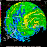
Image
0 likes   
Visit the Caribbean-Central America Weather Thread where you can find at first post web cams,radars
and observations from Caribbean basin members Click Here

Derek Ortt

#358 Postby Derek Ortt » Wed Aug 09, 2006 1:58 pm

something to get the kids excited

SHIFOR makes this a major hurricane in 5 days
0 likes   

User avatar
WindRunner
Category 5
Category 5
Posts: 5806
Age: 34
Joined: Fri Jul 29, 2005 8:07 pm
Location: Warrenton, VA, but Albany, NY for school
Contact:

#359 Postby WindRunner » Wed Aug 09, 2006 1:58 pm

Maybe still a disturbance . . . but now a 30kt one, FWIW.
0 likes   

User avatar
HURAKAN
Professional-Met
Professional-Met
Posts: 46086
Age: 38
Joined: Thu May 20, 2004 4:34 pm
Location: Key West, FL
Contact:

#360 Postby HURAKAN » Wed Aug 09, 2006 1:58 pm

Moving at 31 mph, that's fast!!!
0 likes   


Return to “Talkin' Tropics”

Who is online

Users browsing this forum: cycloneye, Google Adsense [Bot], jgh, O Town, ouragans and 54 guests