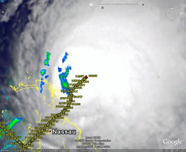
cpdaman wrote:981 BOOM
Ahhh the beauty of ET processes at work.
Moderator: S2k Moderators

cpdaman wrote:981 BOOM
Air Force Met wrote:cpdaman wrote:981 BOOM
Ahhh the beauty of ET processes at work.

RL3AO wrote:Air Force Met wrote:cpdaman wrote:981 BOOM
Ahhh the beauty of ET processes at work.
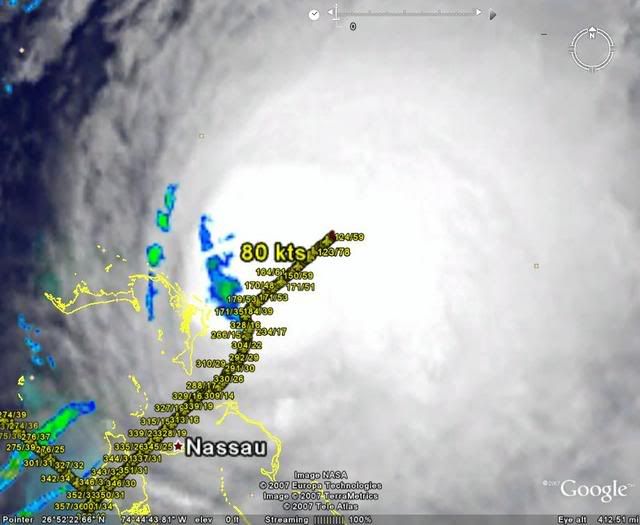
Yep. Don't worry guys, the pressure is going to drop quickly and could be near 960 in 36 hours.

deltadog03 wrote:AFM, if they do find a cane..do they upgrade it briefly before ET is fully in effect?
CrazyC83 wrote:deltadog03 wrote:AFM, if they do find a cane..do they upgrade it briefly before ET is fully in effect?
Yes they would.
Air Force Met wrote:CrazyC83 wrote:deltadog03 wrote:AFM, if they do find a cane..do they upgrade it briefly before ET is fully in effect?
Yes they would.
You are correct....and I stand corrected. I expected the ET transition to start spinning up very soon but didn't know that it had already done its dirty work. I thought the hurricane winds would be there right after transition or close enough the NHC would not pull the trigger...but they won't have a choice here. I suspect it will be ET by sometime tomorrow morning...so we'll have a cane for about 12 hours or so.
Users browsing this forum: No registered users and 53 guests