
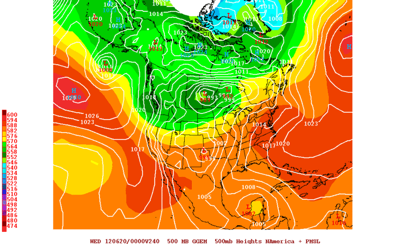
18Z GFS shows the low like the NOGAPS at the Yuc channel but again it opens up to a wave.....
http://mag.ncep.noaa.gov/NCOMAGWEB/appc ... mageSize=M
Global model runs discussion
Moderator: S2k Moderators
Re: Global Model Runs Discussion
0 likes
-
Rgv20

- S2K Supporter

- Posts: 2466
- Age: 39
- Joined: Wed Jan 05, 2011 5:42 pm
- Location: Edinburg/McAllen Tx
0z CMC Has it in the BOC by day 10..
0 likes
The following post is NOT an official forecast and should not be used as such. It is just the opinion of the poster and may or may not be backed by sound meteorological data. It is NOT endorsed by any professional institution including storm2k.org For Official Information please refer to the NHC and NWS products.
-
somethingfunny

- ChatStaff

- Posts: 3926
- Age: 37
- Joined: Thu May 31, 2007 10:30 pm
- Location: McKinney, Texas
Re: Global Model Runs Discussion
00z Euro does NOT have it.

00z GFS run brewed it up more quickly, at 180hr, and had it crossing Florida by 216 (as a weak TS) and sent it out to sea to die by 264. The ensembles tell a different story, stretching it out and losing it after 228hr, indicating quite a bit of disagreement among the GFS ensembles. The individual ensemble members are, of course, too numerous to bother describing right now.
00z GFS run brewed it up more quickly, at 180hr, and had it crossing Florida by 216 (as a weak TS) and sent it out to sea to die by 264. The ensembles tell a different story, stretching it out and losing it after 228hr, indicating quite a bit of disagreement among the GFS ensembles. The individual ensemble members are, of course, too numerous to bother describing right now.
0 likes
I am not a meteorologist, and any posts made by me are not official forecasts or to be interpreted as being intelligent. These posts are just my opinions and are probably silly opinions.
-
cycloneye

- Admin

- Posts: 149495
- Age: 69
- Joined: Thu Oct 10, 2002 10:54 am
- Location: San Juan, Puerto Rico
Re: Global Model Runs Discussion
Here is this mornings discussion by HPC about futrure TC development in NW Caribbean/GOM:
RIDGING EXPECTED ACROSS NORTHWEST MEXICO FAVORS TROPICAL
CYCLOGENESIS SOUTH OF MEXICO...AND THE GLOBAL ENSEMBLE GUIDANCE
CONTINUES TO INDICATE TWO POSSIBLE SYSTEMS DEVELOPING ACROSS THAT
REGION DURING THE NEXT WEEK. SEE THE LATEST TROPICAL WEATHER
OUTLOOKS FROM THE NATIONAL HURRICANE CENTER /NHC/ REGARDING THE
FIRST OF THE TWO POSSIBILITIES LOCATED SEVERAL HUNDRED MILES SOUTH
OF MANZANILLO MEXICO EARLY THIS MORNING. ACROSS THE NORTHWEST
CARIBBEAN NEXT SUNDAY...THERE IS LIMITED AND MAINLY GEFS-BASED
ENSEMBLE GUIDANCE WHICH FAVORS A SOLUTION SOUTH OF THE 00Z GFS
REGARDING A POTENTIAL WARM CORE CYCLONE IN THE AREA. FOR
NOW...PLACED A WEAK LOW IN THAT AREA. THE 17Z CONFERENCE CALL
WITH NHC WILL LIKELY DISCUSS THIS FEATURE EARLY THIS AFTERNOON
ROTH
http://www.hpc.ncep.noaa.gov/discussion ... isc=pmdepd
0 likes
Visit the Caribbean-Central America Weather Thread where you can find at first post web cams,radars
and observations from Caribbean basin members Click Here
and observations from Caribbean basin members Click Here
-
JonathanBelles
- Professional-Met

- Posts: 11430
- Age: 35
- Joined: Sat Dec 24, 2005 9:00 pm
- Location: School: Florida State University (Tallahassee, FL) Home: St. Petersburg, Florida
- Contact:
-
cycloneye
- Admin
- Posts: 149495
- Age: 69
- Joined: Thu Oct 10, 2002 10:54 am
- Location: San Juan, Puerto Rico
Re:
JonathanBelles wrote:Is the HPC running 10-day graphics in house? The last graphic run (the 7-day graphic) is next Saturday, which currently does not have a low.
Here is the HPC on day 7 made this morning. Has a 1008 mb isobar but without the L.

0 likes
Visit the Caribbean-Central America Weather Thread where you can find at first post web cams,radars
and observations from Caribbean basin members Click Here
and observations from Caribbean basin members Click Here
-
Aric Dunn
- Category 5

- Posts: 21238
- Age: 43
- Joined: Sun Sep 19, 2004 9:58 pm
- Location: Ready for the Chase.
- Contact:
actually the euro does have a system only problem is it keep its over the entirety of central America so never has a chance to develop. you will see an area in far sw carrib move NW emerge briefly east of belize then back over land at 216 hours with a 1006 closed isobar at the NW tip of the Yucatan.
http://www.meteo.psu.edu/~gadomski/ECMW ... ml#picture
http://www.meteo.psu.edu/~gadomski/ECMW ... ml#picture
0 likes
Note: If I make a post that is brief. Please refer back to previous posts for the analysis or reasoning. I do not re-write/qoute what my initial post said each time.
If there is nothing before... then just ask
Space & Atmospheric Physicist, Embry-Riddle Aeronautical University,
I believe the sky is falling...
If there is nothing before... then just ask
Space & Atmospheric Physicist, Embry-Riddle Aeronautical University,
I believe the sky is falling...
-
Aric Dunn
- Category 5
- Posts: 21238
- Age: 43
- Joined: Sun Sep 19, 2004 9:58 pm
- Location: Ready for the Chase.
- Contact:
also looks like the beginning of the east pac system getting going. se corner/.
http://www.ssd.noaa.gov/goes/east/tatl/loop-rgb.html
http://www.ssd.noaa.gov/goes/east/tatl/loop-rgb.html
0 likes
Note: If I make a post that is brief. Please refer back to previous posts for the analysis or reasoning. I do not re-write/qoute what my initial post said each time.
If there is nothing before... then just ask
Space & Atmospheric Physicist, Embry-Riddle Aeronautical University,
I believe the sky is falling...
If there is nothing before... then just ask
Space & Atmospheric Physicist, Embry-Riddle Aeronautical University,
I believe the sky is falling...
-
cycloneye
- Admin
- Posts: 149495
- Age: 69
- Joined: Thu Oct 10, 2002 10:54 am
- Location: San Juan, Puerto Rico
Re: Global Model Runs Discussion
12z GFS has at 168 hours a weak low in the NW Caribbean.

0 likes
Visit the Caribbean-Central America Weather Thread where you can find at first post web cams,radars
and observations from Caribbean basin members Click Here
and observations from Caribbean basin members Click Here
Re: Global Model Runs Discussion
The GFS shows a weak low on Day 8 - of course that could easily disappear by the next run...
Still the model does show the current Bermuda high breaking down and moving NE again, which hopefully means more rainfall (and cooler temps with the cloud cover) for us...
Today it's sunny but hot, even with the easterly seebreeeze...
Still the model does show the current Bermuda high breaking down and moving NE again, which hopefully means more rainfall (and cooler temps with the cloud cover) for us...
Today it's sunny but hot, even with the easterly seebreeeze...
0 likes
-
cycloneye
- Admin
- Posts: 149495
- Age: 69
- Joined: Thu Oct 10, 2002 10:54 am
- Location: San Juan, Puerto Rico
Re: Global Model Runs Discussion
The 12z ECMWF has nothing in the Atlantic side but has a hurricane in the Eastern Pacific. (Not 93E) In other words,the models in general so far are not consistent on developing something in the NW Caribbean/GOM. Let's see if the next runs by the GFS/ECMWF provide more consensus or not.

0 likes
Visit the Caribbean-Central America Weather Thread where you can find at first post web cams,radars
and observations from Caribbean basin members Click Here
and observations from Caribbean basin members Click Here
-
floridasun78
- Category 5
- Posts: 3755
- Joined: Sun May 17, 2009 10:16 pm
- Location: miami fl
Re: Global Model Runs Discussion
like i say Long-range models can be tricky to watch their change alot time
0 likes
Re: Global Model Runs Discussion
18Z NOGAPS has a hurricane at 180hr about to destroy the Yucatan. But its the NOGAPS.... 
https://www.fnmoc.navy.mil/wxmap_cgi/cg ... t=Tropical
https://www.fnmoc.navy.mil/wxmap_cgi/cg ... t=Tropical
0 likes
-
floridasun78
- Category 5
- Posts: 3755
- Joined: Sun May 17, 2009 10:16 pm
- Location: miami fl
Re: Global Model Runs Discussion
ok that look like model gone wild it unlikely that will happen specifically the way it form
0 likes


Re: Global Model Runs Discussion
Frank2 wrote:The GFS shows a weak low on Day 8 - of course that could easily disappear by the next run...
Still the model does show the current Bermuda high breaking down and moving NE again, which hopefully means more rainfall (and cooler temps with the cloud cover) for us...
Today it's sunny but hot, even with the easterly seebreeeze...
You can have all the rain you want down your way. North Florida is so drenched a spilled cup of water can cause a flash flood.
My concern is that with some models showing the Bermuda high moving away, more of the SE is open for any landfalling stuff.
0 likes
-
USTropics
- Professional-Met
- Posts: 2738
- Joined: Sun Aug 12, 2007 3:45 am
- Location: Florida State University
0z GFS running. Showing a very impressive system in the Pacific in the 80-100 hour range. In the 140-180 range low pressures are located in the Caribbean and the BOC. Nothing of real significance, a closed low does meander in the Caribbean through from 160-260 hours before crossing Yucatan and entering the BOC, but doesn't look particularly potent.
0 likes
-
USTropics
- Professional-Met
- Posts: 2738
- Joined: Sun Aug 12, 2007 3:45 am
- Location: Florida State University
The 0z ECMWF not picking up on any development in the Caribbean. It does have a frontal boundary pushing through Florida and into the GOM/Caribbean around the time that the GFS tries to develop something though. Both the GFS and the ECMWF are hinting at a possible system trying to form off of the east coast in the next 3-5 days, most likely subtropical in nature if anything does get going.
GFS Ensembles is also showing a weak system hanging around in the Caribbean before burying itself inland over the Yucatan Peninsula.
CMC is showing a system pushing off of the East Coast in the same time frame as the GFS/ECMWF but no tropical development in the GOM/BOC/Caribbean within the 144 hour time frame.
the experimental FIM model hints at a possible East Coast system, but nothing within the 144 hour time frame in the GOM/BOC/Caribbean.
All in all, the more likely area to look for in regards to immediate tropical development would be the east coast this coming week.
0 likes

The way the reliable models have turned I doubt there will be any tropical development in the NW Caribbean/Southern GOM this week.
Yet another positive tilted trough will dig in the SE US as ridging across the Great Lakes and Ohio valley builds, this in turn will make most of the GOM and parts of NW Caribbean too hostile for development.
I don't know what kind of dope the NOGAPS is on when not even the CMC is now showing development, lol.
GFS & Euro still show lowering pressures but keep things broad with no real organization in the next 7-10 days.
May have to wait till next week for that area, if things don't change.
However, there might be something that might get going off of the Carolinas later this week as a piece of energy rotates off of the NE US and dives SW across the gulf stream, very similar set up like when Alberto formed.
The posts in this forum are NOT official forecast and should not be used as such. They are just the opinion of the poster and may or may not be backed by sound meteorological data. They are NOT endorsed by any professional institution or storm2k.org. For official information, please refer to the NHC and NWS products
0 likes

Re: Global Model Runs Discussion
Ok -grasping at straws here but the 06z NOGAPS shows a tropical cyclone in the central GOM at 180 hrs.
https://www.fnmoc.navy.mil/wxmap_cgi/cgi-bin/wxmap_loop.cgi?area=ngp_troplant&dtg=2012061106&prod=prp&tau=000&set=Tropical
https://www.fnmoc.navy.mil/wxmap_cgi/cgi-bin/wxmap_loop.cgi?area=ngp_troplant&dtg=2012061106&prod=prp&tau=000&set=Tropical
0 likes
-
cycloneye
- Admin
- Posts: 149495
- Age: 69
- Joined: Thu Oct 10, 2002 10:54 am
- Location: San Juan, Puerto Rico
Re: Global Model Runs Discussion
More grasping with this 06z GFS. Take this with caution because is the first run that has something this strong in the GOM,is the 06z run and is long range. Let's wait for the 12z run and see if it shows the same.

0 likes
Visit the Caribbean-Central America Weather Thread where you can find at first post web cams,radars
and observations from Caribbean basin members Click Here
and observations from Caribbean basin members Click Here
Who is online
Users browsing this forum: No registered users and 45 guests