more likely the date...
the blue dots matches perfectly with each other and now up to +0.3 currently...
ENSO Updates (2007 thru 2023)
Moderator: S2k Moderators
Forum rules

The posts in this forum are NOT official forecasts and should not be used as such. They are just the opinion of the poster and may or may not be backed by sound meteorological data. They are NOT endorsed by any professional institution or STORM2K. For official information, please refer to products from the National Hurricane Center and National Weather Service.


Re: ENSO Updates
stephen23 wrote:Ok. I understand now Ntxw. Now one more question. Why is there a difference on the Tropical Tidbit site and the site that Wxman had above for the the sst values on March 19th . Tropical Tidbit site had March 19th at -.082. The site that Wxman has above for March 19th has .1. Am I missing something that is calculated in here. Just trying to learn and figure this stuff out. This is my past time when I'm not out doing catastrophe work.
Certainly, it looks like the link wxman57 posted is a weekly average centered midweek Weds the 19th. The actual date may not have been that high but warming later in the week bumped up the weekly average centered there. As for tropicaltidbits I'm uncertain how it is calculated but by guess is he uses real time daily data.
0 likes
The above post and any post by Ntxw is NOT an official forecast and should not be used as such. It is just the opinion of the poster and may or may not be backed by sound meteorological data. It is NOT endorsed by any professional institution including Storm2k. For official information, please refer to NWS products.
Help support Storm2K!

Re: ENSO Updates
Ntxw wrote:stephen23 wrote:Ok. I understand now Ntxw. Now one more question. Why is there a difference on the Tropical Tidbit site and the site that Wxman had above for the the sst values on March 19th . Tropical Tidbit site had March 19th at -.082. The site that Wxman has above for March 19th has .1. Am I missing something that is calculated in here. Just trying to learn and figure this stuff out. This is my past time when I'm not out doing catastrophe work.
Certainly, it looks like the link wxman57 posted is a weekly average centered midweek Weds the 19th. The actual date may not have been that high but warming later in the week bumped up the weekly average centered there. As for tropicaltidbits I'm uncertain how it is calculated but by guess is he uses real time daily data.
Ok. Thank you Ntxw and waxman 57 That makes since and clears up some confusion for me. A lot to learn on all this stuff
0 likes
Personal Forecast Disclaimer:
The posts in this forum are NOT official forecast and should not be used as such. They are just the opinion of the poster and may or may not be backed by sound meteorological data. They are NOT endorsed by any professional institution or storm2k.org. For official information, please refer to the NHC and NWS products.
The posts in this forum are NOT official forecast and should not be used as such. They are just the opinion of the poster and may or may not be backed by sound meteorological data. They are NOT endorsed by any professional institution or storm2k.org. For official information, please refer to the NHC and NWS products.
-
xtyphooncyclonex

- Category 5

- Posts: 3891
- Age: 24
- Joined: Sat Dec 08, 2012 9:07 am
- Location: Cebu City
- Contact:
I now see that Niño 3 is already +0.1°C as the subsurface warm pool expands and moves eastwards, which may be signs of a traditional El Niño.
0 likes
REMINDER: My opinions that I, or any other NON Pro-Met in this forum, are unofficial. Please do not take my opinions as an official forecast and warning. I am NOT a meteorologist. Following my forecasts blindly may lead to false alarm, danger and risk if official forecasts from agencies are ignored.
Re:
xtyphooncyclonex wrote:I now see that Niño 3 is already +0.1°C as the subsurface warm pool expands and moves eastwards, which may be signs of a traditional El Niño.
I think now that many are agreeing it's going to be more than a weak El Nino it's intensity is more valuable than if it's a traditional or modoki. With moderate to strong it's going to effect everyone across the globe and all basins whether it's EP or CP. Weak Nino's are the ones have a bigger role in modoki. If it's a strong moderate or greater all regions of ENSO will have significant basin wide warmth just a matter of where is it warmest.
Low level jet is going to be prominent the stronger it is ripping from the EPAC to the Atlantic. The bigger the nino the more intense the ripping shear will be. CPAC and EPAC have better favorability due to strong MJO presence.
0 likes
The above post and any post by Ntxw is NOT an official forecast and should not be used as such. It is just the opinion of the poster and may or may not be backed by sound meteorological data. It is NOT endorsed by any professional institution including Storm2k. For official information, please refer to NWS products.
Help support Storm2K!
Help support Storm2K!
-
Kingarabian

- S2K Supporter

- Posts: 16364
- Joined: Sat Aug 08, 2009 3:06 am
- Location: Honolulu, Hawaii
Re: Re:
Ntxw wrote:xtyphooncyclonex wrote:I now see that Niño 3 is already +0.1°C as the subsurface warm pool expands and moves eastwards, which may be signs of a traditional El Niño.
I think now that many are agreeing it's going to be more than a weak El Nino it's intensity is more valuable than if it's a traditional or modoki. With moderate to strong it's going to effect everyone across the globe and all basins whether it's EP or CP. Weak Nino's are the ones have a bigger role in modoki. If it's a strong moderate or greater all regions of ENSO will have significant basin wide warmth just a matter of where is it warmest.
Low level jet is going to be prominent the stronger it is ripping from the EPAC to the Atlantic. The bigger the nino the more intense the ripping shear will be. CPAC and EPAC have better favorability due to strong MJO presence.
And the EPAC is no slouch when it comes to Hurricanes. I believe we can have some beautiful monster fish Hurricanes if we do get a nice El-Nino.
0 likes
RIP Kobe Bryant
-
TeamPlayersBlue

- Category 5
- Posts: 3530
- Joined: Tue Feb 02, 2010 1:44 am
- Location: Denver/Applewood, CO
Ok, deep question for our mets. This year i was taught that the warm pool near Alaska caused a high pressure around the 500MB layer to form creating the NW flow for us all winter. Now, i know that El nino will create much more moisture and rising air, but what effects will it have on the 500 MB flow near the equator which will effect us, or basically the world? I thought the warm pool near Alaska this year really opened my eyes to how a single SST anamoly can effect our weather so much, so your help would be greatly appreciated.
I notice form looking at 500 MB maps that the lower in latitude you go, there isnt really much going on at the 500MB layer, thats why im curious. Thanks for all you guys do!
I notice form looking at 500 MB maps that the lower in latitude you go, there isnt really much going on at the 500MB layer, thats why im curious. Thanks for all you guys do!
0 likes
Personal Forecast Disclaimer:
The posts in this forum are NOT official forecast and should not be used as such. They are just the opinion of the poster and may or may not be backed by sound meteorological data. They are NOT endorsed by any professional institution or storm2k.org. For official information, please refer to the NHC and NWS products.
The posts in this forum are NOT official forecast and should not be used as such. They are just the opinion of the poster and may or may not be backed by sound meteorological data. They are NOT endorsed by any professional institution or storm2k.org. For official information, please refer to the NHC and NWS products.

Re: ENSO Updates
wxman57 wrote:Very interesting if you go back to March of 1997 and check the March 12th and March 9th Nino 3.4 values and compare to the current month:
http://www.cpc.ncep.noaa.gov/data/indices/wksst8110.for
Here are the readings from 1997:
March 12th: -0.4C
March 19th: +0.1C
And from 2014:
March 12th: -0.4C
March 19th: +0.1C
Notice any similarities?
There's a huge mass of warm sub-surface water about to make its appearance. Anomalies may top +1.0C by June.
Eerily similar.
0 likes
-
cycloneye

- Admin

- Posts: 149460
- Age: 69
- Joined: Thu Oct 10, 2002 10:54 am
- Location: San Juan, Puerto Rico
Re: ENSO Updates
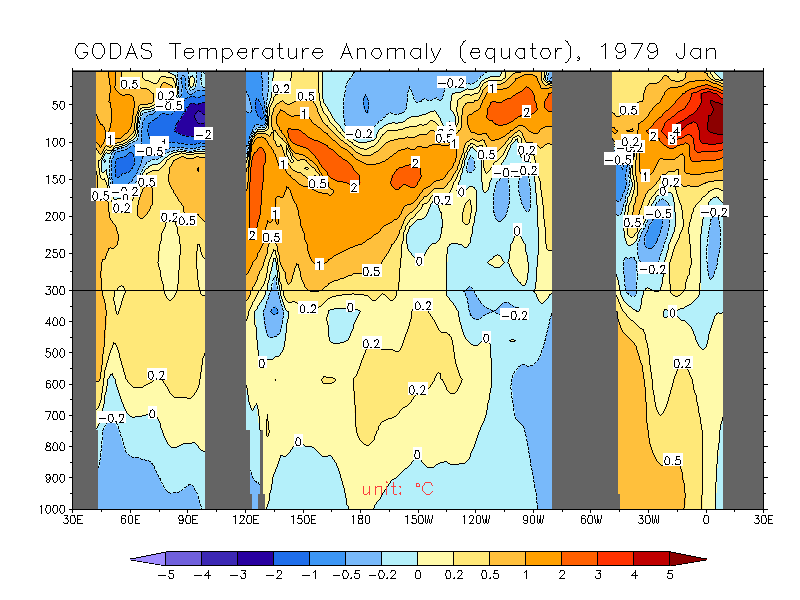
Interesting animation of sub-surface but goes from 1979 to 2012.
0 likes
Visit the Caribbean-Central America Weather Thread where you can find at first post web cams,radars
and observations from Caribbean basin members Click Here
and observations from Caribbean basin members Click Here
-
euro6208
Re: Re:
Kingarabian wrote:Ntxw wrote:xtyphooncyclonex wrote:I now see that Niño 3 is already +0.1°C as the subsurface warm pool expands and moves eastwards, which may be signs of a traditional El Niño.
I think now that many are agreeing it's going to be more than a weak El Nino it's intensity is more valuable than if it's a traditional or modoki. With moderate to strong it's going to effect everyone across the globe and all basins whether it's EP or CP. Weak Nino's are the ones have a bigger role in modoki. If it's a strong moderate or greater all regions of ENSO will have significant basin wide warmth just a matter of where is it warmest.
Low level jet is going to be prominent the stronger it is ripping from the EPAC to the Atlantic. The bigger the nino the more intense the ripping shear will be. CPAC and EPAC have better favorability due to strong MJO presence.
And the EPAC is no slouch when it comes to Hurricanes. I believe we can have some beautiful monster fish Hurricanes if we do get a nice El-Nino.
The WPAC which gets affected the most from el ninos will be insane!
Here's hoping for some fish typhoons
0 likes
-
euro6208
Re: ENSO Updates
CPC now has possible development in the WPAC during week 1 or 2 next month...
Could we see Isa part 2?
145 knots


Could we see Isa part 2?
145 knots
0 likes
Re: ENSO Updates
Should there be any concerns with how fast the sst's are warming up in the GOM or is this normal this time of year?

Uploaded with ImageShack.us

Uploaded with ImageShack.us
0 likes
Personal Forecast Disclaimer:
The posts in this forum are NOT official forecast and should not be used as such. They are just the opinion of the poster and may or may not be backed by sound meteorological data. They are NOT endorsed by any professional institution or storm2k.org. For official information, please refer to the NHC and NWS products.
The posts in this forum are NOT official forecast and should not be used as such. They are just the opinion of the poster and may or may not be backed by sound meteorological data. They are NOT endorsed by any professional institution or storm2k.org. For official information, please refer to the NHC and NWS products.
-
wxman57

- Moderator-Pro Met

- Posts: 23174
- Age: 68
- Joined: Sat Jun 21, 2003 8:06 pm
- Location: Houston, TX (southwest)
Re: ENSO Updates
The northern Gulf is well below normal temperature-wise, as a result of a quite cold winter in the Southern Plains. Draw a line from Tampico, MX to Tampa, FL and temps are below normal to the north and above normal across the southeast Gulf.
0 likes

Re: ENSO Updates
wxman57 wrote:The northern Gulf is well below normal temperature-wise, as a result of a quite cold winter in the Southern Plains. Draw a line from Tampico, MX to Tampa, FL and temps are below normal to the north and above normal across the southeast Gulf.
That's not going to help the 2200 hour GFS with it's cat 5 in the gulf.
0 likes
The above post and any post by dhweather is NOT an official forecast and should not be used as such. It is just the opinion of the poster and may or may not be backed by sound meteorological data. It is NOT endorsed by any professional institution including storm2k.org. For official information, please refer to NWS products.
-
xtyphooncyclonex
- Category 5
- Posts: 3891
- Age: 24
- Joined: Sat Dec 08, 2012 9:07 am
- Location: Cebu City
- Contact:
Niño 1+2 is warming rapidly. Warm anomalies at subsurface are starting to reach the surface.
0 likes
REMINDER: My opinions that I, or any other NON Pro-Met in this forum, are unofficial. Please do not take my opinions as an official forecast and warning. I am NOT a meteorologist. Following my forecasts blindly may lead to false alarm, danger and risk if official forecasts from agencies are ignored.
-
cycloneye
- Admin
- Posts: 149460
- Age: 69
- Joined: Thu Oct 10, 2002 10:54 am
- Location: San Juan, Puerto Rico
Re: ENSO Updates
Is starting. Now we watch how much it will warm with the help of possible tropical systems in WPAC.

0 likes
Visit the Caribbean-Central America Weather Thread where you can find at first post web cams,radars
and observations from Caribbean basin members Click Here
and observations from Caribbean basin members Click Here
-
Hurricane Jed

- Category 2

- Posts: 546
- Age: 38
- Joined: Mon Jan 24, 2011 3:36 pm
- Location: Cen Tex
Re: ENSO Updates
euro6208 wrote:CPC now has possible development in the WPAC during week 1 or 2 next month...
Could we see Isa part 2?
145 knots
http://i.imgur.com/FEH7y6U.jpg
http://i.imgur.com/372xbr9.gif
The MJO is going to be in place very similar to 1997. Both 2014 and 1997 will have a similar starting area from the IO to begin the month as per the EC will behave quite similarly weakening through the Martime Continent and try for the Pacific. We'll have to watch for MJO enhanced tropical activity in the wpac.


0 likes
The above post and any post by Ntxw is NOT an official forecast and should not be used as such. It is just the opinion of the poster and may or may not be backed by sound meteorological data. It is NOT endorsed by any professional institution including Storm2k. For official information, please refer to NWS products.
Help support Storm2K!
Help support Storm2K!
According to this chart, there may actually be a +7C anomaly down there at least through 155meters

0 likes
The above post and any post by Ntxw is NOT an official forecast and should not be used as such. It is just the opinion of the poster and may or may not be backed by sound meteorological data. It is NOT endorsed by any professional institution including Storm2k. For official information, please refer to NWS products.
Help support Storm2K!
Help support Storm2K!
-
TropicalAnalystwx13

- Category 5
- Posts: 2109
- Age: 28
- Joined: Tue Jul 19, 2011 8:20 pm
- Location: Wilmington, NC
- Contact:

Who is online
Users browsing this forum: Hurricane2022, islandgirl45 and 132 guests