
wxwatcher1999 wrote:So is it safe to say the upper Texas coast and sw Louisiana is in the clear?
Until it gets north of you ,never turn ur back .
Moderator: S2k Moderators

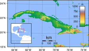
psyclone wrote:it really looks like hispaniola has done a number to isaac. even though the center may have cleared land, it's very lopsided and the low level circ may be impacted by the nearby higher elevations for some time to come. look at the lack of convection north and west of the center. perhaps downsloping winds are contributing. with the way Isaac has behaved, my inclination is to bet against strengthening until there's compelling evidence to the contrary.
The posts in this forum are NOT official forecast and should not be used as such. They are just the opinion of the poster and may or may not be backed by sound meteorological data. They are NOT endorsed by any professional institution or storm2k.org. For official information, please refer to the NHC and NWS products.
otowntiger wrote:psyclone wrote:it really looks like hispaniola has done a number to isaac. even though the center may have cleared land, it's very lopsided and the low level circ may be impacted by the nearby higher elevations for some time to come. look at the lack of convection north and west of the center. perhaps downsloping winds are contributing. with the way Isaac has behaved, my inclination is to bet against strengthening until there's compelling evidence to the contrary.
The posts in this forum are NOT official forecast and should not be used as such. They are just the opinion of the poster and may or may not be backed by sound meteorological data. They are NOT endorsed by any professional institution or storm2k.org. For official information, please refer to the NHC and NWS products.
Most everybody expected this. I'm not sure what you expected but I didn't see anyone say they thought this thing would do anything but weaken while crossing a MOUNTAINOUS region, lol. Nor is anyone expecting it to intensify while interacting with the mountainous terrain nearby. The forecast and general consensus is that it will gradually strengthen once it is far enough away from land.
meriland23 wrote:Not too happy about the fact HWRF takes this all the way down to 940 mb on the western panhandle, lowest I have seen Isaac forecasted (in strength)


otowntiger wrote:psyclone wrote:it really looks like hispaniola has done a number to isaac. even though the center may have cleared land, it's very lopsided and the low level circ may be impacted by the nearby higher elevations for some time to come. look at the lack of convection north and west of the center. perhaps downsloping winds are contributing. with the way Isaac has behaved, my inclination is to bet against strengthening until there's compelling evidence to the contrary.
The posts in this forum are NOT official forecast and should not be used as such. They are just the opinion of the poster and may or may not be backed by sound meteorological data. They are NOT endorsed by any professional institution or storm2k.org. For official information, please refer to the NHC and NWS products.
Most everybody expected this. I'm not sure what you expected but I didn't see anyone say they thought this thing would do anything but weaken while crossing a MOUNTAINOUS region, lol. Nor is anyone expecting it to intensify while interacting with the mountainous terrain nearby. The forecast and general consensus is that it will gradually strengthen once it is far enough away from land.
Weatherboy1 wrote:Well whatever that trough area is in the vicinity of the Keys, it is soaking us here in South FL. Been pouring in Jupiter on and off all morning ... and Isaac isn't even supposed to be in our neighborhood for another 24-36 hours. I do still wonder if this more northerly component is going to continue a bit longer than anticipated. Seems like Isaac is consistently missing model and forecast points to the north and east - not by a lot, but a little. And each miss increases the risk further up the coast of FL. All in my amateur opinion, of course.

smw1981 wrote:meriland23 wrote:Not too happy about the fact HWRF takes this all the way down to 940 mb on the western panhandle, lowest I have seen Isaac forecasted (in strength)
Good morning Meriland! HWRF is not too good with forecasting strength, so I wouldn't put too weight on it.
 good morning
 cpdaman wrote:tailgater doesn't look like it's gonna be spending 5-6 hours over E cuba to me...unless it starts wobblin WNW in next frame..(which it could) ....the gitmo radar is not a good way to track the center if that is what anyone is doing
http://www.ssd.noaa.gov/PS/TROP/floater ... -long.html (latest frame seems to show clouds /surrounding LLC to thicken and this could go to town again by this afternoon *if it is not pull'd WNW shortly into NE cuban coastline* next few hours crucial
tailgater wrote:cpdaman wrote:tailgater doesn't look like it's gonna be spending 5-6 hours over E cuba to me...unless it starts wobblin WNW in next frame..(which it could) ....the gitmo radar is not a good way to track the center if that is what anyone is doing
http://www.ssd.noaa.gov/PS/TROP/floater ... -long.html (latest frame seems to show clouds /surrounding LLC to thicken and this could go to town again by this afternoon *if it is not pull'd WNW shortly into NE cuban coastline* next few hours crucial
The hi- res vis loop I'm looking at is currently showing a good deal more westward track than earlier.
http://weather.msfc.nasa.gov/GOES/goeseastconus.html

still moving nw not west
tailgater wrote:cpdaman wrote:tailgater doesn't look like it's gonna be spending 5-6 hours over E cuba to me...unless it starts wobblin WNW in next frame..(which it could) ....the gitmo radar is not a good way to track the center if that is what anyone is doing
http://www.ssd.noaa.gov/PS/TROP/floater ... -long.html (latest frame seems to show clouds /surrounding LLC to thicken and this could go to town again by this afternoon *if it is not pull'd WNW shortly into NE cuban coastline* next few hours crucial
The hi- res vis loop I'm looking at is currently showing a good deal more westward track than earlier.
http://weather.msfc.nasa.gov/GOES/goeseastconus.html
meriland23 wrote:tailgater wrote:cpdaman wrote:tailgater doesn't look like it's gonna be spending 5-6 hours over E cuba to me...unless it starts wobblin WNW in next frame..(which it could) ....the gitmo radar is not a good way to track the center if that is what anyone is doing
http://www.ssd.noaa.gov/PS/TROP/floater ... -long.html (latest frame seems to show clouds /surrounding LLC to thicken and this could go to town again by this afternoon *if it is not pull'd WNW shortly into NE cuban coastline* next few hours crucial
The hi- res vis loop I'm looking at is currently showing a good deal more westward track than earlier.
http://weather.msfc.nasa.gov/GOES/goeseastconus.html
very short run, hard to tell..
Frank2 wrote:still moving nw not west
Over the years I've noticied that systems that move NW or NNW from the same general area (Windward Passage) often continue moving northward through the Bahamas and miss the US completely - we'll see what happens...


Users browsing this forum: No registered users and 14 guests
