NATL: MELISSA - Aftermath - Discussion
Moderator: S2k Moderators


Re: NATL: MELISSA - Tropical Storm - Discussion
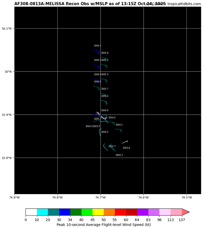
Looks like recon didn't want to get close to that hot tower.
0 likes
Re: NATL: MELISSA - Tropical Storm - Discussion
Holy crap, I just saw they measured near 80mm/hr rain rate near that tower.
About the strongest I have ever seen.
Rapid core heating is underway.
Shear reduction is having a big effect.
https://www.tropicaltidbits.com/recon/r ... series.png
About the strongest I have ever seen.
Rapid core heating is underway.
Shear reduction is having a big effect.
https://www.tropicaltidbits.com/recon/r ... series.png
2 likes
-
Hypercane_Kyle

- Category 5

- Posts: 3465
- Joined: Sat Mar 07, 2015 7:58 pm
- Location: Cape Canaveral, FL
Re: NATL: MELISSA - Tropical Storm - Discussion
Rooting for a LLC re-location south personally. The more this thing gets away from Jamacia the better.
0 likes
My posts are my own personal opinion, defer to the National Hurricane Center (NHC) and other NOAA products for decision making during hurricane season.
Re: NATL: MELISSA - Tropical Storm - Discussion
14.95N 74.45W looking real good.
Top-end rain rate.
Persistent cirrus outflow with stacking and radial fingers.
Top-end rain rate.
Persistent cirrus outflow with stacking and radial fingers.
0 likes
-
AutoPenalti
- Category 5
- Posts: 4091
- Age: 29
- Joined: Mon Aug 17, 2015 4:16 pm
- Location: Ft. Lauderdale, Florida
Re: NATL: MELISSA - Tropical Storm - Discussion
GCANE wrote:14.95N 74.45W looking real good.
Top-end rain rate.
Persistent cirrus outflow with stacking and radial fingers.
Isn't this where they tagged the center?
0 likes
The posts in this forum are NOT official forecasts and should not be used as such. They are just the opinion of the poster and may or may not be backed by sound meteorological data. They are NOT endorsed by any professional institution or STORM2K. For official information, please refer to products from the NHC and NWS.
Model Runs Cheat Sheet:
GFS (5:30 AM/PM, 11:30 AM/PM)
HWRF, GFDL, UKMET, NAVGEM (6:30-8:00 AM/PM, 12:30-2:00 AM/PM)
ECMWF (1:45 AM/PM)
TCVN is a weighted averaged

Re: NATL: MELISSA - Tropical Storm - Discussion
Has anyone been keeping track of how many reformations Melissa had?
1 likes
TC naming lists: retirements and intensity
Most aggressive Advisory #1's in North Atlantic (cr. kevin for starting the list)
Most aggressive Advisory #1's in North Atlantic (cr. kevin for starting the list)
Re: NATL: MELISSA - Tropical Storm - Discussion
Feeder band forming from just north of Panama into the system.
Getting a lot of juice from the EPAC.
Can see more of that moist air being blocked by the Costa Rica mountains and moving south towards Panama.
Will likely move across Panama late today or tomorrow and then into Melissa late this weekend.
Highly likely Melissa will RI after that.
https://www.tropicaltidbits.com/sat/sat ... uct=wv_mid
1 likes
Re: NATL: MELISSA - Tropical Storm - Discussion
AutoPenalti wrote:GCANE wrote:14.95N 74.45W looking real good.
Top-end rain rate.
Persistent cirrus outflow with stacking and radial fingers.
Isn't this where they tagged the center?
They tagged it very close to 16N 75W.
But it looks like it is walking its way down to the hot tower.
0 likes

Re: NATL: MELISSA - Tropical Storm - Discussion
Hypercane_Kyle wrote:Rooting for a LLC re-location south personally. The more this thing gets away from Jamacia the better.
That jog to the east on recon might unfortunately raise the odds of a Jamaica landfall.
0 likes
Irene '11 Sandy '12 Hermine '16 5/15/2018 Derecho Fay '20 Isaias '20 Elsa '21 Henri '21 Ida '21
I am only a meteorology enthusiast who knows a decent amount about tropical cyclones. Look to the professional mets, the NHC, or your local weather office for the best information.
I am only a meteorology enthusiast who knows a decent amount about tropical cyclones. Look to the professional mets, the NHC, or your local weather office for the best information.
Re: NATL: MELISSA - Tropical Storm - Discussion
Starting to see a warm-core signature on IR at 14.95N 74.45W
https://www.tropicaltidbits.com/sat/sat ... product=ir
https://www.tropicaltidbits.com/sat/sat ... product=ir
0 likes
-
ScottNAtlanta

- Category 5
- Posts: 2535
- Joined: Sat May 25, 2013 3:11 pm
- Location: Atlanta, GA
Re: NATL: MELISSA - Tropical Storm - Discussion
It's getting hard to see what is movement and what is caused by shear
3 likes
The posts in this forum are NOT official forecast and should not be used as such. They are just the opinion of the poster and may or may not be backed by sound meteorological data. They are NOT endorsed by any professional institution or storm2k.org. For official information, please refer to the NHC and NWS products.
-
WeatherBoy2000
- Category 1

- Posts: 463
- Joined: Mon Apr 10, 2023 9:29 am
Re: NATL: MELISSA - Tropical Storm - Discussion
ScottNAtlanta wrote:It's getting hard to see what is movement and what is caused by shear
I think the NHC summed up Melissa's movement pretty well in the latest advisory:
For all intents and purposes, Melissa is nearly stationary over the
north-central Caribbean Sea.
1 likes
-
cheezyWXguy

- Category 5
- Posts: 6282
- Joined: Mon Feb 13, 2006 12:29 am
- Location: Dallas, TX
Re: NATL: MELISSA - Tropical Storm - Discussion
Clearly a lot of reorganization going on this morning. Center relocations are making things confusing, but overall the system looks much healthier than yesterday and the whole envelope is rotating pretty aggressively on satellite. Convection starting to appear on the western side of the envelope too. Conditions are becoming more favorable, everything still seems to be on track for this to become a major.
6 likes
Re: NATL: MELISSA - Tropical Storm - Discussion
Visible Satellite showing rapid convergence at the mid-levels.
This will work down to the surface before sunset.
https://www.tropicaltidbits.com/sat/sat ... roduct=vis
This will work down to the surface before sunset.
https://www.tropicaltidbits.com/sat/sat ... roduct=vis
3 likes

Re: NATL: MELISSA - Tropical Storm - Discussion
Melissa's raw T# on the UW-CIMSS page jumped from 2.2 to 3.6 with the identification of the new center, as it's now back under the CDO. Let's see if it can stay there this time.
1 likes
-
cheezyWXguy
- Category 5
- Posts: 6282
- Joined: Mon Feb 13, 2006 12:29 am
- Location: Dallas, TX
Re: NATL: MELISSA - Tropical Storm - Discussion
GCANE wrote:Visible Satellite showing rapid convergence at the mid-levels.
This will work down to the surface before sunset.
https://www.tropicaltidbits.com/sat/sat ... roduct=vis
I wouldn’t be surprised if this drill down process were attempting to take place right now, that mlc looks vigorous, especially with upper level outflow beginning to increase radially from the center of that main burst. The current llc centered on the nw side of this burst seems to be losing influence. I wonder how long it will be before recon starts seeing evidence of this process.
2 likes
Re: NATL: MELISSA - Tropical Storm - Discussion
11am cone now shows a 130 kt landfall in Jamaica.
3 likes
Irene '11 Sandy '12 Hermine '16 5/15/2018 Derecho Fay '20 Isaias '20 Elsa '21 Henri '21 Ida '21
I am only a meteorology enthusiast who knows a decent amount about tropical cyclones. Look to the professional mets, the NHC, or your local weather office for the best information.
I am only a meteorology enthusiast who knows a decent amount about tropical cyclones. Look to the professional mets, the NHC, or your local weather office for the best information.
Who is online
Users browsing this forum: No registered users and 73 guests