ATL : TROPICAL DEPRESSION ERIKA (06L)

Moderator: S2k Moderators

Message
Author
User avatar
lrak
S2K Supporter
S2K Supporter
Posts: 1770
Age: 58
Joined: Thu Jun 21, 2007 2:48 pm
Location: Corpus Christi, TX

Re: Re:

#4081 Postby lrak » Thu Sep 03, 2009 12:45 pm

Evil Jeremy wrote:
Shewtinstar wrote:Does anyone know how to play taps?


Uh, what are "taps"?


Image

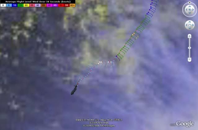
http://flhurricane.com/imageanimator.php?69

still looks like something is happening besides dying.
0 likes   

User avatar
HURAKAN
Professional-Met
Professional-Met
Posts: 46086
Age: 38
Joined: Thu May 20, 2004 4:34 pm
Location: Key West, FL
Contact:

#4082 Postby HURAKAN » Thu Sep 03, 2009 12:45 pm

It seems El Niño also affects computer model performances!!!
0 likes   

Derek Ortt

#4083 Postby Derek Ortt » Thu Sep 03, 2009 12:46 pm

a reminder, el nino shear is at the upper levels. This is mid level shear that has done in Erika. Cannot blame this on el nino
0 likes   

User avatar
cycloneye
Admin
Admin
Posts: 145303
Age: 68
Joined: Thu Oct 10, 2002 10:54 am
Location: San Juan, Puerto Rico

Re: ATL : TROPICAL STORM ERIKA - Computer Models

#4084 Postby cycloneye » Thu Sep 03, 2009 12:47 pm

GFS is not alone as 12z CMC develops too.

http://moe.met.fsu.edu/cgi-bin/cmctc2.c ... =Animation
0 likes   

Derek Ortt

#4085 Postby Derek Ortt » Thu Sep 03, 2009 12:49 pm

cmc develops something from a broad area of low-pressure. Not sure if it is Erika or something new
0 likes   

User avatar
wxman57
Moderator-Pro Met
Moderator-Pro Met
Posts: 22978
Age: 67
Joined: Sat Jun 21, 2003 8:06 pm
Location: Houston, TX (southwest)

Re: ATL : TROPICAL STORM ERIKA (06L)

#4086 Postby wxman57 » Thu Sep 03, 2009 12:49 pm

Latest surface analysis/satellite combo shows a weak swirl of low clouds marking what's left of Erika. Definitely not a TS now. Absolutely no support in any of the dozens of obs around the "storm". Max winds I could find were 25 kts. Would never qualify as an upgrade to a TD/TS based on its current appearance and lack of a solid center. No convergence in toward the center. Winds are blowing away from the center.

As to the question of whether it'll survive the interaction with PR/DR, of course it will. It's just an area of storms now. The mountains won't kill the vorticity, and there's no LLC left to kill. The vorticity area will continue to generate storms after passing the DR. But thunderstorms alone do not a TC make. It would take a favorable environment for redevelopment. That's not indicated, presently. So redevelopment looks unlikely. Since it won't likely redevelop, the models projecting a recurve in the Bahamas may be too far east. Might have to wait until it reaches S. FL before it turns north (as just an area of thunderstorms).

Image
0 likes   

User avatar
ConvergenceZone
Category 5
Category 5
Posts: 5194
Joined: Fri Jul 29, 2005 1:40 am
Location: Northern California

#4087 Postby ConvergenceZone » Thu Sep 03, 2009 12:52 pm

Good post wxman57
Put a fork in Erika, she's done!....
Next?

Bring on 2010!!!
Last edited by ConvergenceZone on Thu Sep 03, 2009 1:01 pm, edited 1 time in total.
0 likes   

HenkL
S2K Supporter
S2K Supporter
Posts: 2401
Joined: Fri Sep 10, 2004 5:33 pm
Location: Groningen, The Netherlands
Contact:

#4088 Postby HenkL » Thu Sep 03, 2009 12:52 pm

URNT15 KNHC 031747
AF304 0506A ERIKA HDOB 09 20090903
173700 1635N 06438W 9761 00281 0081 +240 +111 201003 004 011 000 00
173730 1635N 06439W 9762 00279 0079 +243 +114 202005 006 008 001 00
173800 1635N 06441W 9766 00276 0079 +243 +117 210006 006 012 000 00
173830 1635N 06443W 9761 00281 0080 +245 +118 250002 003 006 001 03
173900 1635N 06444W 9759 00281 0079 +245 +120 286002 003 005 002 03
173930 1634N 06445W 9766 00276 0079 +244 +122 281004 005 015 000 00
174000 1633N 06446W 9763 00280 0080 +245 +123 285007 007 013 000 00
174030 1632N 06447W 9762 00281 0080 +243 +122 301008 009 011 001 00
174100 1631N 06449W 9764 00279 0080 +245 +122 297008 008 011 001 00
174130 1630N 06450W 9764 00280 0080 +245 +122 301008 008 009 001 00
174200 1628N 06451W 9762 00281 0080 +245 +122 317007 008 014 000 00
174230 1627N 06452W 9764 00280 0080 +245 +123 330007 008 014 000 00
174300 1626N 06453W 9763 00280 0081 +245 +123 332007 008 013 000 03
174330 1625N 06454W 9764 00279 0080 +245 +123 336007 008 999 999 03
174400 1624N 06455W 9766 00278 0080 +245 +124 342008 008 999 999 03
174430 1623N 06457W 9762 00283 0081 +242 +124 330008 008 999 999 03
174500 1622N 06458W 9759 00284 0081 +240 +123 334009 010 016 000 03
174530 1621N 06459W 9765 00280 0082 +245 +121 340008 009 012 000 00
174600 1619N 06500W 9764 00281 0082 +245 +120 336007 008 017 000 00
174630 1618N 06501W 9764 00281 0083 +245 +120 337006 006 012 000 00

That's a quick one:
extrapolated 1008 mb around 1635N 6440W
0 likes   

User avatar
cycloneye
Admin
Admin
Posts: 145303
Age: 68
Joined: Thu Oct 10, 2002 10:54 am
Location: San Juan, Puerto Rico

Re: ATL: TROPICAL STORM ERIKA Advisories Thread

#4089 Postby cycloneye » Thu Sep 03, 2009 12:53 pm

WTNT31 KNHC 031751
TCPAT1
BULLETIN
TROPICAL STORM ERIKA INTERMEDIATE ADVISORY NUMBER 8A
NWS TPC/NATIONAL HURRICANE CENTER MIAMI FL AL062009
200 PM AST THU SEP 03 2009

...AIRCRAFT RECONNAISSANCE FINDS CENTER OF POORLY-ORGANIZED ERIKA
FARTHER SOUTHWEST...

AT 2 PM AST...1800 UTC...THE TROPICAL STORM WARNING FOR DOMINICA
AND GUADELOUPE HAVE BEEN DISCONTINUED.

A TROPICAL STORM WARNING REMAINS IN EFFECT FOR PUERTO RICO...THE
U.S. AND BRITISH VIRGIN ISLANDS...ST. MARTIN...ST. BARTHELEMY...
ANTIGUA...BARBUDA...MONTSERRAT...ST.KITTS...NEVIS...ANGUILLA...
ST. MAARTEN...SABA...AND ST. EUSTATIUS. A TROPICAL STORM WARNING
MEANS THAT TROPICAL STORM CONDITIONS ARE EXPECTED SOMEWHERE WITHIN
THE WARNING AREA WITHIN 24 HOURS.

INTERESTS IN THE DOMINICAN REPUBLIC AND HAITI SHOULD MONITOR THE
PROGRESS OF ERIKA.

FOR STORM INFORMATION SPECIFIC TO YOUR AREA IN THE UNITED
STATES...INCLUDING POSSIBLE INLAND WATCHES AND WARNINGS...PLEASE
MONITOR PRODUCTS ISSUED BY YOUR LOCAL NATIONAL WEATHER SERVICE
FORECAST OFFICE. FOR STORM INFORMATION SPECIFIC TO YOUR AREA
OUTSIDE OF THE UNITED STATES...PLEASE MONITOR PRODUCTS ISSUED
BY YOUR NATIONAL METEOROLOGICAL SERVICE.

AT 200 PM AST...1800 UTC...THE CENTER OF POORLY-ORGANIZED TROPICAL
STORM ERIKA WAS LOCATED BY AN AIR FORCE RESERVE HURRICANE HUNTER
AIRCRAFT NEAR LATITUDE 16.6 NORTH...LONGITUDE 64.7 WEST OR ABOUT
80 MILES...130 KM...SOUTH OF ST. CROIX AND ABOUT 155 MILES...
245 KM...SOUTHEAST OF SAN JUAN PUERTO RICO.

ERIKA IS MOVING TOWARD THE WEST NEAR 9 MPH...15 KM/HR...AND THIS
MOTION IS EXPECTED TO CONTINUE FOR THE NEXT COUPLE OF DAYS WITH A
GRADUAL INCREASE IN FORWARD SPEED. ON THE FORECAST TRACK...THE
WEATHER ASSOCIATED WITH ERIKA WILL CONTINUE TO MOVE THROUGH THE
LEEWARD ISLANDS TODAY AND APPROACH THE U.S. AND BRITISH VIRGIN
ISLANDS AND PUERTO RICO LATER TODAY AND TONIGHT.

MAXIMUM SUSTAINED WINDS ARE NEAR 40 MPH...65 KM/HR...WITH HIGHER
GUSTS. GRADUAL WEAKENING IS LIKELY DURING THE NEXT COUPLE OF
DAYS...AND ERIKA COULD BECOME A TROPICAL DEPRESSION LATER TODAY OR
TONIGHT. IT IS ALSO POSSIBLE THAT ERIKA COULD DEGENERATE INTO A
REMNANT LOW OR TROPICAL WAVE.

TROPICAL STORM FORCE WINDS EXTEND OUTWARD UP TO 175 MILES...280
KM...PRIMARILY TO THE EAST OF THE CENTER.

THE LATEST MINIMUM CENTRAL PRESSURE MEASURED BY THE AIR FORCE
RECONNAISSANCE HURRICANE HUNTER AIRCRAFT WAS 1008 MB...29.77
INCHES.

ERIKA IS EXPECTED TO PRODUCE TOTAL RAINFALL ACCUMULATIONS OF 3 TO 5
INCHES OVER THE CENTRAL AND NORTHERN LESSER ANTILLES...PUERTO
RICO...AND THE U.S. AND BRITISH VIRGIN ISLANDS...WITH ISOLATED
MAXIMUM AMOUNTS OF 8 INCHES POSSIBLE.

...SUMMARY OF 200 PM AST INFORMATION...
LOCATION...16.6N 64.7W
MAXIMUM SUSTAINED WINDS...40 MPH
PRESENT MOVEMENT...WEST OR 270 DEGREES AT 9 MPH
MINIMUM CENTRAL PRESSURE...1008 MB

THE NEXT ADVISORY WILL BE ISSUED BY THE NATIONAL HURRICANE CENTER AT
500 PM AST.

$$
FORECASTER BRENNAN

0 likes   

User avatar
jasons2k
Storm2k Executive
Storm2k Executive
Posts: 8245
Age: 51
Joined: Wed Jul 06, 2005 12:32 pm
Location: The Woodlands, TX

Re: ATL : TROPICAL STORM ERIKA (06L)

#4090 Postby jasons2k » Thu Sep 03, 2009 12:54 pm

wxman57 wrote:As to the question of whether it'll survive the interaction with PR/DR, of course it will. It's just an area of storms now. The mountains won't kill the vorticity, and there's no LLC left to kill. The vorticity area will continue to generate storms after passing the DR.


Thank you for posting this reminder :-) Developed cyclones, especially hurricanes, are much more fragile and therefore much more susceptible to self-destrucing when it crosses the G.A.

When there is nothing but an open wave or blob moving across, it tends to just stay that way...
0 likes   

User avatar
HURAKAN
Professional-Met
Professional-Met
Posts: 46086
Age: 38
Joined: Thu May 20, 2004 4:34 pm
Location: Key West, FL
Contact:

#4091 Postby HURAKAN » Thu Sep 03, 2009 12:54 pm

Image
0 likes   

User avatar
wxman57
Moderator-Pro Met
Moderator-Pro Met
Posts: 22978
Age: 67
Joined: Sat Jun 21, 2003 8:06 pm
Location: Houston, TX (southwest)

Re: ATL : TROPICAL STORM ERIKA (06L)

#4092 Postby wxman57 » Thu Sep 03, 2009 12:55 pm

18Z intermediate just out has 16.6N/64.7W as the center. That's the naked swirl on my map above. Didn't take recon to find it. Now they can downgrade it to a remnant low.
Last edited by wxman57 on Thu Sep 03, 2009 1:07 pm, edited 1 time in total.
0 likes   

SapphireSea
Category 1
Category 1
Posts: 430
Joined: Wed Aug 24, 2005 12:13 pm
Location: Miami, FL

Re: ATL : TROPICAL STORM ERIKA (06L)

#4093 Postby SapphireSea » Thu Sep 03, 2009 12:55 pm

I cannot wait. Sorry for everyone else down here, but I need more rain for my stuff. :P

NOTE: I don't mean I want a hurricane or whatnot, i'm talking about this convective mass of rain.

I love standing in the rain (and not almost getting struck by lightning), helps me cool off.

I still and will keep saying that this is just the convective instability out in this area. Although I agree with the models. We have been in a SW wind regime down here in miami more than normal this summer, I don't see a high and Erly wind regime lasting too long after this lifts out. This will be sweeped out to sea.
0 likes   

User avatar
expat2carib
S2K Supporter
S2K Supporter
Posts: 458
Joined: Tue Jul 22, 2008 1:44 pm
Location: Sint Maarten

Re: ATL : TROPICAL STORM ERIKA - Computer Models

#4094 Postby expat2carib » Thu Sep 03, 2009 12:56 pm

All this with models makes me think. Lots of people here on the board act/react schizophrenic. On one hand people use it as an authority behind their arguments and on the other hand they kick them an extra time when they are laying down and are knock out.

What's the use of them in this context? That's what I ask myself.

Is it like my Maserati is better than your Ferrari?
0 likes   

User avatar
micktooth
S2K Supporter
S2K Supporter
Posts: 391
Joined: Mon Jul 11, 2005 3:47 pm
Location: PreK:New Orleans,PostK:Colorado

Re: ATL : TROPICAL STORM ERIKA (06L)

#4095 Postby micktooth » Thu Sep 03, 2009 1:01 pm

Image
0 likes   

Stormcenter
S2K Supporter
S2K Supporter
Posts: 6684
Joined: Wed Sep 03, 2003 11:27 am
Location: Houston, TX

#4096 Postby Stormcenter » Thu Sep 03, 2009 1:02 pm

IMO If I read the NHC discussion correctly the future issue (lack of re-development)with Erika has only a little to do with land interaction and more to do with very poor atmospheric conditions (shear,etc.) which don't show any signs of improving but instead probably worsening as she moves in a westward direction.
0 likes   

tolakram
Admin
Admin
Posts: 20009
Age: 62
Joined: Sun Aug 27, 2006 8:23 pm
Location: Florence, KY (name is Mark)

Re: ATL : TROPICAL STORM ERIKA - Computer Models

#4097 Postby tolakram » Thu Sep 03, 2009 1:02 pm

GFS is Danny all over again. Sharp right turn and rapid deepening. That must be a bad area for the model.
0 likes   

Aric Dunn
Category 5
Category 5
Posts: 21238
Age: 42
Joined: Sun Sep 19, 2004 9:58 pm
Location: Ready for the Chase.
Contact:

#4098 Postby Aric Dunn » Thu Sep 03, 2009 1:03 pm

URNT12 KNHC 031759 CCA
VORTEX DATA MESSAGE AL062009
A. 03/17:38:20Z
B. 16 deg 35 min N
064 deg 42 min W
C. NA
D. 25 kt
E. 026 deg 70 nm
F. 123 deg 21 kt
G. 049 deg 27 nm
H. EXTRAP 1008 mb
I. 25 C / 310 m
J. 25 C / 312 m
K. 12 C / NA
L. NA
M. NA
N. 134 / 1
O. 0.02 / 10 nm
P. AF304 0506A ERIKA OB 02 CCA
MAX FL WIND 21 KT NE QUAD 17:28:50Z
SLP EXTRAP FROM BELOW 1500 FT
MAX FL TEMP 25 C 050 / 26 NM FROM FL CNTR


Thats just funny.. lol
0 likes   

HenkL
S2K Supporter
S2K Supporter
Posts: 2401
Joined: Fri Sep 10, 2004 5:33 pm
Location: Groningen, The Netherlands
Contact:

#4099 Postby HenkL » Thu Sep 03, 2009 1:04 pm

URNT15 KNHC 031757
AF304 0506A ERIKA HDOB 10 20090903
174700 1617N 06502W 9763 00281 0082 +245 +120 336007 007 011 001 00
174730 1616N 06503W 9765 00279 0081 +245 +120 343007 007 010 000 00
174800 1615N 06505W 9764 00280 0081 +244 +120 344006 007 015 000 00
174830 1614N 06506W 9764 00279 0080 +245 +121 347006 007 013 000 00
174900 1613N 06507W 9764 00279 0080 +245 +121 347006 006 017 000 00
174930 1611N 06508W 9763 00281 0081 +245 +121 341006 007 016 000 00
175000 1610N 06509W 9761 00283 0081 +245 +121 349006 007 011 000 00
175030 1609N 06510W 9762 00283 0081 +245 +121 353006 006 016 000 00
175100 1608N 06511W 9762 00281 0082 +242 +122 340005 005 020 001 00
175130 1607N 06513W 9764 00280 0082 +245 +121 334005 005 010 001 00
175200 1606N 06514W 9762 00284 0083 +245 +120 334005 005 016 000 00
175230 1605N 06515W 9761 00284 0083 +245 +120 329005 005 014 000 00
175300 1604N 06516W 9764 00281 0083 +245 +121 315005 006 014 000 00
175330 1602N 06517W 9765 00279 0082 +245 +121 312004 004 015 000 00
175400 1601N 06518W 9760 00284 0081 +245 +121 332004 005 011 000 00
175430 1600N 06519W 9766 00278 0081 +245 +122 320004 005 012 000 03
175500 1559N 06520W 9758 00284 0081 +245 +122 315005 006 011 000 03
175530 1557N 06521W 9764 00280 0081 +245 +124 319005 005 012 000 00
175600 1556N 06521W 9762 00283 0082 +246 +125 315005 006 006 001 03
175630 1555N 06522W 9756 00287 0082 +245 +125 323005 006 009 000 03
0 likes   

User avatar
jasons2k
Storm2k Executive
Storm2k Executive
Posts: 8245
Age: 51
Joined: Wed Jul 06, 2005 12:32 pm
Location: The Woodlands, TX

Re: ATL : TROPICAL STORM ERIKA (06L)

#4100 Postby jasons2k » Thu Sep 03, 2009 1:04 pm

wxman57 wrote:18Z itermediate just out has 16.6N/64.7W as the center. That's the naked swirl on my map above. Didn't take recon to find it. Now they can downgrade it to a remnant low.


Yes, but recon shows that it is still closed off.
0 likes   


Return to “2009”

Who is online

Users browsing this forum: No registered users and 11 guests