Portastorm wrote:Interesting little convergence zone forming this Friday afternoon across the Austin metro area. Hope these showers build into something which provides me and weatherdude1108 with some generous rainfall!
I saw that!

Moderator: S2k Moderators


Portastorm wrote:Interesting little convergence zone forming this Friday afternoon across the Austin metro area. Hope these showers build into something which provides me and weatherdude1108 with some generous rainfall!

THE BIG WEATHER STORY IS THE FORECAST FOR FRIDAY AND BEYOND. A
MAJOR PATTERN CHANGE WILL OCCUR OVER THE CONTINENT LATE IN THE
WEEK AS THE POLAR VORTEX CURRENTLY LOCATED NEAR THE NORTH POLE
DROPS SOUTH INTO THE HUDSON BAY AREA. THIS DISLODGES A DECENT
CHUNK OF COLD AIR ASSOCIATED WITH A 1025MB HIGH THAT SPILLS SOUTH
INTO THE PLAINS AND MIDWEST BY THURSDAY. THE EXTENDED MODELS HAVE
BEEN HINTING AT THIS POSSIBILITY FOR 3+ DAYS NOW...AND THE LATEST
12Z GUIDANCE REMAINS IN FAIRLY GOOD AGREEMENT. MOST OF THE COOL
AIR SHOULD REMAIN TO THE NORTH AND EAST OF THE REGION...BUT THE
FRONT SHOULD STILL MAKE IT INTO NORTH TEXAS BY FRIDAY NIGHT. THE
GFS IS THE WEAKEST WITH THE FRONT...AND SINCE IT IS STILL
AUGUST...IT WOULD MAKE SENSE TO BE AS CONSERVATIVE AS POSSIBLE
WITH THIS FRONT IN THE EXTENDED FORECAST. HOWEVER...IF THE
ECMWF/UKMET/CANADIAN MODELS ARE CORRECT...THE FRONT WILL ARRIVE
EARLIER /ON THURSDAY NIGHT/ AND BE MUCH STRONGER. FOR THIS REASON
WILL SHOW TEMPS COOLING INTO THE MID AND UPPER 90S ON FRIDAY...BUT
THIS IS REALLY A HEDGE ROOTED IN TIMING UNCERTAINTIES. EITHER
WAY...BY NEXT SATURDAY HIGHS SHOULD BE NEAR OR SLIGHTLY BELOW
NORMAL...MOST LIKELY IN THE LOW 90S FOR HIGHS. IN ADDITION THE
GFS/ECMWF SHOW GOOD CHANCES OF RAIN ALONG AND BEHIND THE FRONT. IF
THE FRONT IS WEAKER...PER THE GFS...IT WILL BE STATIONARY OVER THE
REGION LONGER AND WOULD BODE WELL FOR RAIN CHANCES FOR SEVERAL
DAYS. HOWEVER A STRONGER FRONT LIKE THE ECMWF FORECAST WOULD MEAN
MORE LIMITED RAIN CHANCES MAINLY OCCURRING FRIDAY AND SATURDAY.


vbhoutex wrote:So are we talking a repeat this coming week? Or is this what came through today?


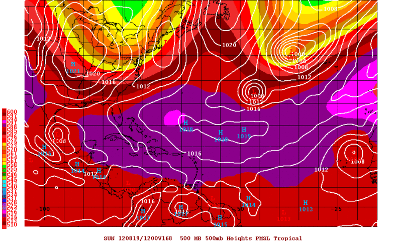
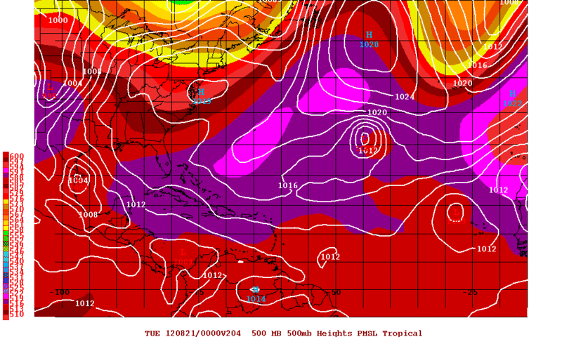
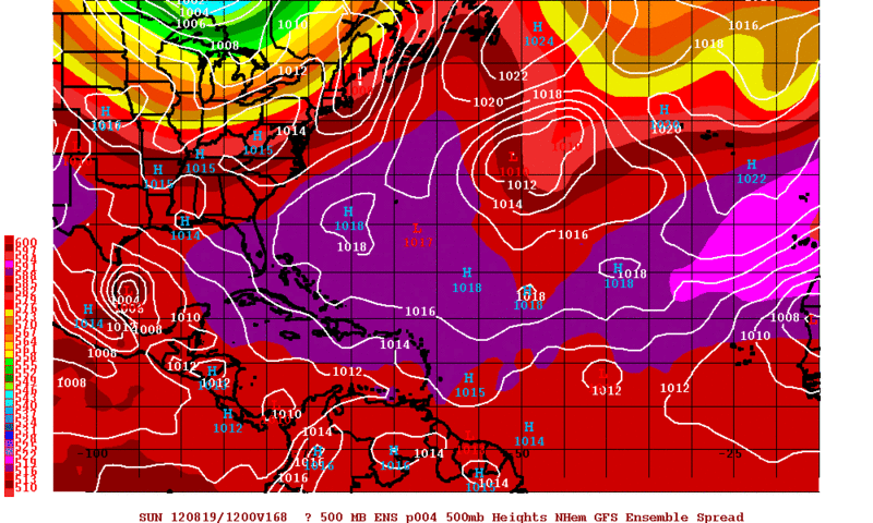

Portastorm wrote:Hey Ntxw, thanks for posting that. Encouraging although I got the sense from the locals (NWS) that whatever convective activity sprung up that it would stay north of us tonight. Meanwhile, the GFS continues showing a weak but closed tropical circulation in the western Gulf by late next week. Several runs in a row. I wonder if that's the remnants of TD #7 or something else.
Ntxw wrote:MCS-ish storms could string from Dallas to Austin this evening, fingers crossed for slow moving rain filled storms!
Perhaps 0.50-1+ in some locales according to some short range models.
Portastorm wrote::uarrow:
Thank you, friend. So this ought be an interesting week for us Texans. Here's hoping for rain!


Return to “USA & Caribbean Weather”
Users browsing this forum: WeatherNewbie and 98 guests

