The EWX AFD mentions "A SEE-SAW OF WIND SHIFTS AND A RAIN CHANCES WITH EACH PASSING SHORTWAVE TROUGH."
000
FXUS64 KEWX 102042
AFDEWX
AREA FORECAST DISCUSSION
NATIONAL WEATHER SERVICE AUSTIN/SAN ANTONIO TX
242 PM CST TUE FEB 10 2015
.SHORT TERM (TONIGHT THROUGH WEDNESDAY NIGHT)...
MOIST GULF RETURN FLOW IS EVIDENT AS DEW POINTS ACROSS SOUTH TEXAS
ARE REMAINING STEADY OR SLIGHTLY INCREASING...IN WHAT SHOULD BE
THE DIURNAL MINIMUM DUE TO MIXING. ALL MODELS AND CIRA-WRF
SIMULATED FOG/LOW CLOUD IMAGERY AGREE ON PATCHY FOG ALONG AND EAST
OF I-35 FROM 06-15Z. MOST VISIBILITY SHOULD BE 3-5 MILES...BUT A
FEW SPOTS COULD GET DOWN TO ONE MILE. THE FOG WILL BURN OFF BY
MID-MORNING WEDNESDAY...ALLOWING MOSTLY SUNNY SKIES AND HIGH TEMPERATURES
1-3 DEGREES LOWER THAN TODAY.
&&
.LONG TERM (THURSDAY THROUGH TUESDAY)...
A COLD FRONT WILL SWEEP ACROSS THE AREA OVERNIGHT WEDNESDAY INTO
EARLY THURSDAY...USHERING IN GUSTY NORTH WINDS AND COLDER
CONDITIONS...WITH HIGHS ONLY IN THE MID-50S TO LOWER 60S. SOME
MODELS TRY TO SQUEEZE OUT SOME LIGHT RAIN WITH THE FRONT...BUT WE
OPTED TO LEAVE THE FORECAST DRY AT THIS TIME AS THE RETURN GULF
FLOW WILL BE SHALLOW AND THE INVADING AIR DRY. THIS FIRST FRONT
WILL BE THE START OF A PERIOD OF UNSETTLED CONDITIONS...AS THE
LONGWAVE PATTERN DEVELOPS A DEEP TROUGH OVER THE EASTERN STATES
AND A WEAK RIDGE OVER THE WESTERN STATES.
A CUTOFF LOW RETROGRADING INTO BAJA CALIFORNIA WILL EVENTUALLY
PHASE WITH THE MAJOR LONGWAVE TROUGH AND SWEEP ACROSS THE AREA NEXT
MONDAY NIGHT THROUGH WEDNESDAY. THE BEST CHANCE FOR RAIN WILL BE
NEXT TUESDAY INTO EARLY WEDNESDAY...BUT OVERALL AMOUNTS APPEAR TO
BE LIGHT. AFTER WEDNESDAY...THE LONGWAVE PATTERN WILL TREND
TOWARD ZONAL...BRINGING THE PROSPECTS OF NEAR NORMAL TEMPERATURES AND A
SEE-SAW OF WIND SHIFTS AND A RAIN CHANCES WITH EACH PASSING
SHORTWAVE TROUGH.
Texas Winter 2014-2015
Moderator: S2k Moderators
Forum rules
 The posts in this forum are NOT official forecast and should not be used as such. They are just the opinion of the poster and may or may not be backed by sound meteorological data. They are NOT endorsed by any professional institution or STORM2K.

The posts in this forum are NOT official forecast and should not be used as such. They are just the opinion of the poster and may or may not be backed by sound meteorological data. They are NOT endorsed by any professional institution or STORM2K.
-
weatherdude1108
- Category 5

- Posts: 4228
- Joined: Tue Dec 13, 2011 1:04 pm
- Location: Northwest Austin/Cedar Park, TX
0 likes
The preceding post is NOT an official forecast, and should not be used as such. It is only the opinion of the poster and may or may not be backed by sound meteorological data. It is NOT endorsed by any professional institution including storm2k.org. For Official Information please refer to the NHC and NWS products.

Re:
TeamPlayersBlue wrote:According to models, it looks like the Typhoon will have zero effect on the ULL pattern. If anything, i believe it could strengthen the Low in GOA.
I wouldn't fully agree with this. Aside from enhancing the passing trough above it (which it may or may not do) tropical systems as this brings heat ahead and above. It may enhance the ridging along the west coast poleward as the flux of heat is being pumped up. Tropical systems themselves are quite small in the grand scheme but they are enhancers or perhaps a manifestation of a change in paradigm/regime.
For example, Higos is likely spawned by westerly wind burst in Nino regions 4 and 3.4. This is usually because of a favorable MJO, which creates the tropical forcing to enhance ridging above all the tropical convection. The typhoon when formed enhances the westerlies and you have a runaway effect keeping the MJO in those favorable phases.
Courtesy WSI Energy twitter if you prefer it in visual form

0 likes
The above post and any post by Ntxw is NOT an official forecast and should not be used as such. It is just the opinion of the poster and may or may not be backed by sound meteorological data. It is NOT endorsed by any professional institution including Storm2k. For official information, please refer to NWS products.
Help support Storm2K!
-
Ralph's Weather
- S2K Supporter

- Posts: 3371
- Age: 38
- Joined: Fri Dec 13, 2013 11:55 am
- Location: Lindale, TX
- Contact:
-
Texas Snowman

- Storm2k Moderator

- Posts: 6197
- Joined: Fri Jan 25, 2008 11:29 am
- Location: Denison, Texas
Re: Re:
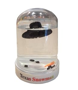
wxman57 wrote:I have a new avatar for you, Texas Snowman. Looks just like you after this week's warmth:
http://ecx.images-amazon.com/images/I/4 ... SY300_.jpg
Hey, I like that! I need to get one of those and put it in my study. Will remind me of my old Storm2K pals like Wxman 57, Portastorm, Ntxw and others.
0 likes
The above post and any post by Texas Snowman is NOT an official forecast and should not be used as such. It is just the opinion of the poster and may or may not be backed by sound meteorological data. It is NOT endorsed by any professional institution including storm2k.org. For official information, please refer to NWS products.


Euro falling in line. Pacific ridge is the real deal that begins this weekend. Bears watch. Wxman57's aggressive warm postings may be muted a bit.
0 likes
The above post and any post by Ntxw is NOT an official forecast and should not be used as such. It is just the opinion of the poster and may or may not be backed by sound meteorological data. It is NOT endorsed by any professional institution including Storm2k. For official information, please refer to NWS products.
Help support Storm2K!
Help support Storm2K!
Re:
Ntxw wrote:Euro falling in line. Pacific ridge is the real deal that begins this weekend. Bears watch. Wxman57's aggressive warm postings may be muted a bit.
Maybe our last chace so I am getting interested. A warm start to the day today. Yesterday was absolutly fantastic, but winter needs to return.
0 likes
-
Portastorm

- Storm2k Moderator
- Posts: 9954
- Age: 63
- Joined: Fri Jul 11, 2003 9:16 am
- Location: Round Rock, TX
- Contact:
Wow, the 6z GFS has quite the winter storm for Texas next Wednesday! This one ain't two weeks out. 
And how about those CMC and Euro runs from the overnight 0z cycle?! They say "I've got a meteogram for ya, wxman57."
And how about those CMC and Euro runs from the overnight 0z cycle?! They say "I've got a meteogram for ya, wxman57."
0 likes
Any forecasts under my name are to be taken with a grain of salt. Get your best forecasts from the National Weather Service and National Hurricane Center.

-
gboudx

- S2K Supporter
- Posts: 4090
- Joined: Thu Sep 04, 2003 1:39 pm
- Location: Rockwall, Tx but from Harvey, La
From Steve McCauley:
Data still indicate a more substantial cold snap heading our way next week with gusty north winds and some cold rain As usual, the only thing left to figure out is whether our rain will stop before it has a chance to snow (how many times have we seen, right?). I am in hopes of finishing up grading these last few exams and labs to run the SM on next week's system !
0 likes
Re: Texas Winter 2014-2015
ENS are pretty much in agreement. The first cold snap (weekend and early week) will be aimed at the east. But following its heels will be aimed down the Plains and keeps coming. #AlaskanRidge, #TyphoonHigos
0 likes
The above post and any post by Ntxw is NOT an official forecast and should not be used as such. It is just the opinion of the poster and may or may not be backed by sound meteorological data. It is NOT endorsed by any professional institution including Storm2k. For official information, please refer to NWS products.
Help support Storm2K!
Help support Storm2K!
-
orangeblood
- S2K Supporter
- Posts: 3895
- Joined: Tue Dec 15, 2009 6:14 pm
- Location: Fort Worth, TX
Re: Texas Winter 2014-2015
Ntxw wrote:ENS are pretty much in agreement. The first cold snap (weekend and early week) will be aimed at the east. But following its heels will be aimed down the Plains and keeps coming. #AlaskanRidge, #TyphoonHigos
Yep, there are some insanely colds members mixed in there for late next week....a few single digit lows and low 20's for highs in DFW
Snowfall Accumulation for 06Z GFS...

0 likes
-
wxman57

- Moderator-Pro Met

- Posts: 23169
- Age: 68
- Joined: Sat Jun 21, 2003 8:06 pm
- Location: Houston, TX (southwest)
Re: Texas Winter 2014-2015
There is definitely some cold air involved with next week's front. The big question is how much takes a detour south to Texas. I'm not liking the 6Z GFS at all. High of 24 in Dallas next Wednesday with snow? An inch of snow in Houston? For now, I'd put my money on a model shift back to warmer over the next few days.
00Z Euro has some light snow in the Panhandle next week. That's it. Highs in the upper 30s for Dallas area Wed with a Thursday low around 27. Low of 35 in Houston next week. Quite a difference between the two.


00Z Euro has some light snow in the Panhandle next week. That's it. Highs in the upper 30s for Dallas area Wed with a Thursday low around 27. Low of 35 in Houston next week. Quite a difference between the two.
0 likes
-
TeamPlayersBlue

- Category 5
- Posts: 3523
- Joined: Tue Feb 02, 2010 1:44 am
- Location: Denver/Applewood, CO
Well i think the cold is coming, going to be all bout timing. 06z has the precip slowing slowing down compared to the 00z. At least theres hope!
0 likes
Personal Forecast Disclaimer:
The posts in this forum are NOT official forecast and should not be used as such. They are just the opinion of the poster and may or may not be backed by sound meteorological data. They are NOT endorsed by any professional institution or storm2k.org. For official information, please refer to the NHC and NWS products.
The posts in this forum are NOT official forecast and should not be used as such. They are just the opinion of the poster and may or may not be backed by sound meteorological data. They are NOT endorsed by any professional institution or storm2k.org. For official information, please refer to the NHC and NWS products.
-
wxman57
- Moderator-Pro Met
- Posts: 23169
- Age: 68
- Joined: Sat Jun 21, 2003 8:06 pm
- Location: Houston, TX (southwest)
Re: Texas Winter 2014-2015
Note that those 6Z GFS operational temperatures are colder than almost all of its ensemble members for Dallas and colder than all members for Houston. That would not be very likely. For example, on the coldest day (Thu), the ensembles have a range of 21 to 46 for Houston's low. Operational has 19.
0 likes
Re: Texas Winter 2014-2015
wxman57 wrote:Note that those 6Z GFS operational temperatures are colder than almost all of its ensemble members for Dallas and colder than all members for Houston. That would not be very likely. For example, on the coldest day (Thu), the ensembles have a range of 21 to 46 for Houston's low. Operational has 19.
In that case let us take a look at western Canada. How cold is there? How cold will it be when height rises poleward in similar location as to mid November? All good questions!
0 likes
The above post and any post by Ntxw is NOT an official forecast and should not be used as such. It is just the opinion of the poster and may or may not be backed by sound meteorological data. It is NOT endorsed by any professional institution including Storm2k. For official information, please refer to NWS products.
Help support Storm2K!
Help support Storm2K!
-
CYCLONE MIKE
- Category 5
- Posts: 2183
- Joined: Tue Aug 31, 2004 6:04 pm
- Location: Gonzales, LA
Re: Texas Winter 2014-2015
For now, I'd put my money on a model shift back to warmer over the next few days.
Agree 100% And as I mentioned in the deep south thread it was only a few short days ago that the nws offices were talking coldest record breaking temps so far this winter for this weekend. Now we have one minor freeze forecast Thurs night then temps bouncing back into the 50 the 60's for the weekend, sounds awfully familiar.
Guess one bit of good news is that it is the first time the gfs has shown a winter storm for the south inside of 12- 14 days
Last edited by CYCLONE MIKE on Wed Feb 11, 2015 10:14 am, edited 1 time in total.
0 likes
-
TeamPlayersBlue
- Category 5
- Posts: 3523
- Joined: Tue Feb 02, 2010 1:44 am
- Location: Denver/Applewood, CO
Re: Texas Winter 2014-2015
Ntxw wrote:wxman57 wrote:Note that those 6Z GFS operational temperatures are colder than almost all of its ensemble members for Dallas and colder than all members for Houston. That would not be very likely. For example, on the coldest day (Thu), the ensembles have a range of 21 to 46 for Houston's low. Operational has 19.
In that case let us take a look at western Canada. How cold is there? How cold will it be when height rises poleward in similar location as to mid November? All good questions!
Folks here in SE will take 25 degrees, no biggie
0 likes
Personal Forecast Disclaimer:
The posts in this forum are NOT official forecast and should not be used as such. They are just the opinion of the poster and may or may not be backed by sound meteorological data. They are NOT endorsed by any professional institution or storm2k.org. For official information, please refer to the NHC and NWS products.
The posts in this forum are NOT official forecast and should not be used as such. They are just the opinion of the poster and may or may not be backed by sound meteorological data. They are NOT endorsed by any professional institution or storm2k.org. For official information, please refer to the NHC and NWS products.
-
Ralph's Weather
- S2K Supporter
- Posts: 3371
- Age: 38
- Joined: Fri Dec 13, 2013 11:55 am
- Location: Lindale, TX
- Contact:
Things are definitely getting interesting. I have been holding off on getting back into winter forecasting mode, but this storm looks like it at least has a decent shot at happening so guess I will.
0 likes
Follow on Facebook at Ralph's Weather.
-
TheProfessor

- Professional-Met

- Posts: 3506
- Age: 29
- Joined: Tue Dec 03, 2013 10:56 am
- Location: Wichita, Kansas
Who is online
Users browsing this forum: Brent, Ralph's Weather and 110 guests