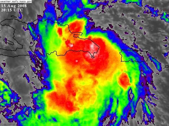
Looking at the visible it appears Fay just realized she is running into the DR, burst of convection over the estimated center (18.6N/68.6W) and a NW wobble.
http://www.ssd.noaa.gov/goes/flt/t1/loop-vis.html
ATL: Tropical Depression Fay
Moderator: S2k Moderators
-
Blown Away

- S2K Supporter

- Posts: 10253
- Joined: Wed May 26, 2004 6:17 am
Re: ATL: Invest 92L in Western Atlantic
Air Force Met wrote:Category 5 wrote:Hello Fay
AL, 06, 2008081518, , BEST, 0, 185N, 686W, 35, 1009, TS, 34, NEQ, 75, 0, 0, 75, 1013,
Yep...and it sure as heck isn't sitting on the north coast...or off the north coast of the DR.
Where's Aric?
well done Air force met, now do you think this may skip around to the north or the south when land interaction with the mountains (on the west side of island) get's closer?
0 likes
-
gatorcane

- S2K Supporter
- Posts: 23708
- Age: 48
- Joined: Sun Mar 13, 2005 3:54 pm
- Location: Boca Raton, FL
Re: ATL: Invest 92L=Breaking News=Best Track intensity=35 kts
jinftl wrote:As a wave, this feature has generated news here in south florida....if we have a named system and south florida is in the 'cone' at 5pm, this is really going to take off as a news item down here.....the onslaught will begin in less than an hour
Well South Florida should be in the cone, as of this AM the line would have aimed right at SE Florida -- now I see the line more in the Eastern GOM somewhere. As usual people will concentrate on the line here in SE Florida and say its going west and missing the area. Just yesterday I was hearing "its going east of us"
0 likes
-
Aric Dunn
- Category 5

- Posts: 21238
- Age: 43
- Joined: Sun Sep 19, 2004 9:58 pm
- Location: Ready for the Chase.
- Contact:
Re: ATL: Invest 92L in Western Atlantic
Air Force Met wrote:Category 5 wrote:Hello Fay
AL, 06, 2008081518, , BEST, 0, 185N, 686W, 35, 1009, TS, 34, NEQ, 75, 0, 0, 75, 1013,
Yep...and it sure as heck isn't sitting on the north coast...or off the north coast of the DR.
Where's Aric?
im here ... nice... i was taking a nap just got off work..
cool so still waiting on the Nhc Offical but its was a tough call either way
nice job....
they did check north of the island though
i figured about an hour or so ago it was just a vorticy that i was tracking as it started to acclerate.
0 likes
-
dolebot_Broward_NW
- Category 2

- Posts: 529
- Joined: Fri Sep 10, 2004 6:38 am
Re: ATL: Invest 92L=Breaking News=Best Track intensity=35 kts
Is this just a forecast or evidence this thing is getting upgraded?
Usually when you see a vortex data message from recon, then shortly afterwards - the Navy NRL site changes it to "06.NONAME" or 06L.FAY (as in this case) its a fairly safe bet that it'll be upgraded. Being that 35kt winds were in the best track - and that its currently listed as 06l.fay - I'm going to say that unofficially we have TS Fay on our hands! YAY! FINALLY!
Last edited by dolebot_Broward_NW on Fri Aug 15, 2008 3:25 pm, edited 2 times in total.
0 likes

Re: ATL: Invest 92L=Breaking News=Best Track intensity=35 kts
I would not want to be the NHC forecaster who has to come up with an intensity forecast with this advisory. I guess it will just be based on the forecast track.
0 likes
-
Cookiely

- S2K Supporter
- Posts: 3211
- Age: 75
- Joined: Fri Aug 13, 2004 7:31 am
- Location: Tampa, Florida
Re: ATL: Invest 92L=Breaking News=Best Track intensity=35 kts
Not sure if this was posted or not. I love the sense of humor.
FXUS62 KTBW 151745
AFDTBW
AREA FORECAST DISCUSSION
NATIONAL WEATHER SERVICE TAMPA BAY RUSKIN FL
145 PM EDT FRI AUG 15 2008
...UNCERTAINTY IN TROPICAL SITUATION MEANS LITTLE CHANGE IN
FORECAST UNTIL/WHEN/IF/WHERE A STORM ACTUALLY DEVELOPS...
COORDINATED WITH SURROUNDING OFFICES AND FAVOR THE DGEX MODEL FOR
NOW.
.SHORT TERM (TONIGHT - SUNDAY)...MOISTURE ALONG STALLED NORTH GULF
BOUNDARY CONTINUES THROUGH SATURDAY NIGHT. THIS WILL KEEP WESTERLY
LOW LEVEL FLOW AND PRECIP IN FORECAST ONE MORE DAY...MOST
WIDESPREAD FROM TAMPA AND NORTH. EXPECT LOW LEVEL EASTERLY FLOW TO
TAKE OVER SUNDAY SO BEST CHANCE OF RAIN ALONG SEA BREEZE FRONT
ALONG GULF COAST.
.LONG TERM (SUNDAY NIGHT - FRIDAY)...MUCH DEPENDS UPON THE WAVE
CURRENTLY OVER PR AND USVI. THE DGEX AND ECMWF AND TO A LESS EXTENT
THE GFS TRACK THE SYSTEM NORTHWARD OFF THE FL EAST COAST THROUGH
MUCH OF THE PERIOD. HOWEVER...THE GFS HAS HAD SOME DIFFERENCES RUN
TO RUN W/R/T THE TRACK. WILL THEREFORE CONTINUE TO FAVOR THE DGEX
FOR WIND FIELDS. POPS IN THE SCATTERED RANGE WITH MOSTLY DIURNAL
TIMING ALTHOUGH WILL TREND POPS UP SOME ABOUT MID-WEEK. WILL KEEP
TEMPS CLOSE TO NORMAL FOR NOW.
0 likes
-
CrazyC83
- Professional-Met

- Posts: 34315
- Joined: Tue Mar 07, 2006 11:57 pm
- Location: Deep South, for the first time!
Re: ATL: Invest 92L=Breaking News=Best Track intensity=35 kts
BigA wrote:I would not want to be the NHC forecaster who has to come up with an intensity forecast with this advisory. I guess it will just be based on the forecast track.
The posts in this forum are NOT official forecast and should not be used as such. They are just the opinion of the poster and may or may not be backed by sound meteorological data. They are NOT endorsed by any professional institution or storm2k.org. For official information, please refer to the NHC and NWS products.
These are just my guesses, and follows the median in the models, hugging the northern shores into the Florida Straits:
Current - 45 kt
12 hr - 35 kt - Inland
24 hr - 35 kt - Over water
48 hr - 50 kt
72 hr - 65 kt
96 hr - 85 kt
120 hr - 100 kt
0 likes

-
OuterBanker
- S2K Supporter
- Posts: 1761
- Joined: Wed Feb 26, 2003 10:53 am
- Location: Nags Head, NC
- Contact:
Re: ATL: Invest 92L=Breaking News=Best Track intensity=35 kts
what's the deal with the steering flow over east CUBA appears to be a temporary lessening of the "turning mechanism" which would lift fay NW. appears the trough is being more zonal in only my amateur opinion. anyone know if there is any support for this idea? (at least concerning a delayed turn to the north)
0 likes

Re:
yep...we could see a system either dissipate over land or blow up into a major....and 100 miles or so in track might make the difference.
Cyclenall wrote:This is going to be one of the most intresting NHC first forecasts we might see in years. I have no idea what track or strength they will forecast.
0 likes
-
Canelaw99

- S2K Supporter
- Posts: 2128
- Age: 49
- Joined: Tue Aug 31, 2004 8:27 am
- Location: Homestead, FL
Re: ATL: Invest 92L=Breaking News=Best Track intensity=35 kts
jinftl wrote:As a wave, this feature has generated news here in south florida....if we have a named system and south florida is in the 'cone' at 5pm, this is really going to take off as a news item down here.....the onslaught will begin in less than an hour
LOL and The Weather Channel just showed their "It Could Happen Tomorrow" this afternoon - with a cat 5 hitting Miami.
0 likes
-
Matt-hurricanewatcher
Re: ATL: Invest 92L=Breaking News=Best Track intensity=35 kts
Personal Forecast Disclaimer:
The posts in this forum are NOT official forecast and should not be used as such. They are just the opinion of the poster and may or may not be backed by sound meteorological data. They are NOT endorsed by any professional institution or storm2k.org. For official information, please refer to the NHC and NWS products.[/quote]
I would say
Now 45 knots
6 hours 35 knots
12 hours 30 knots
24 hours 30 knots possibly trying to get back over water.
36 hours 30 knots over Cuba
48 hours 40 knots south or north of Cuba. Who knows
72 hours possibly where ever 50 knots.
0 likes

Re: ATL: 92L
our local weather guy just said it's official either td or ts. this was channel 25 mike lyons palm beach.
0 likes
-
Blown Away
- S2K Supporter
- Posts: 10253
- Joined: Wed May 26, 2004 6:17 am
Re: ATL: 92L
NNW wobble on the visible, feeling the land and deciding either N or S. I'll say N IMO.
http://www.ssd.noaa.gov/goes/flt/t1/loop-vis.html
http://www.ssd.noaa.gov/goes/flt/t1/loop-vis.html
0 likes
-
Air Force Met
- Military Met

- Posts: 4372
- Age: 57
- Joined: Tue Jul 08, 2003 9:30 am
- Location: Roan Mountain, TN
Re: ATL: Invest 92L in Western Atlantic
cpdaman wrote:Air Force Met wrote:Category 5 wrote:Hello Fay
AL, 06, 2008081518, , BEST, 0, 185N, 686W, 35, 1009, TS, 34, NEQ, 75, 0, 0, 75, 1013,
Yep...and it sure as heck isn't sitting on the north coast...or off the north coast of the DR.
Where's Aric?
well done Air force met, now do you think this may skip around to the north or the south when land interaction with the mountains (on the west side of island) get's closer?
Right now...and I know this is a cop out...but I think its 50/50. With the convection firing on the south end...that may serve to pull it south. Steering is going to try and move it WNW. It could also just as easily move right over the spine of the island and get its act together once on the eastern end of Cuba.
It is a real wait and see ball game right now. If I had to bet...I would say it will track over the center of the island or the south side of it. Either way...I think it stays inland and re-emerges on the west coast of Haiti sometime tomorrow. Then I suspect...as I said earlier...a landfall somewhere along the west coast of FL. Not sure where...Panhandle down to the Keys.
JUST A GUESS!!!!
0 likes
-
CrazyC83
- Professional-Met
- Posts: 34315
- Joined: Tue Mar 07, 2006 11:57 pm
- Location: Deep South, for the first time!
Re: ATL: 92L
mel38 wrote:our local weather guy just said it's official either td or ts. this was channel 25 mike lyons palm beach.
It's a TS. Not sure what intensity they will set it at though, although 45 kt (50 mph) seems best based on data from the Recon.
0 likes
Who is online
Users browsing this forum: No registered users and 17 guests