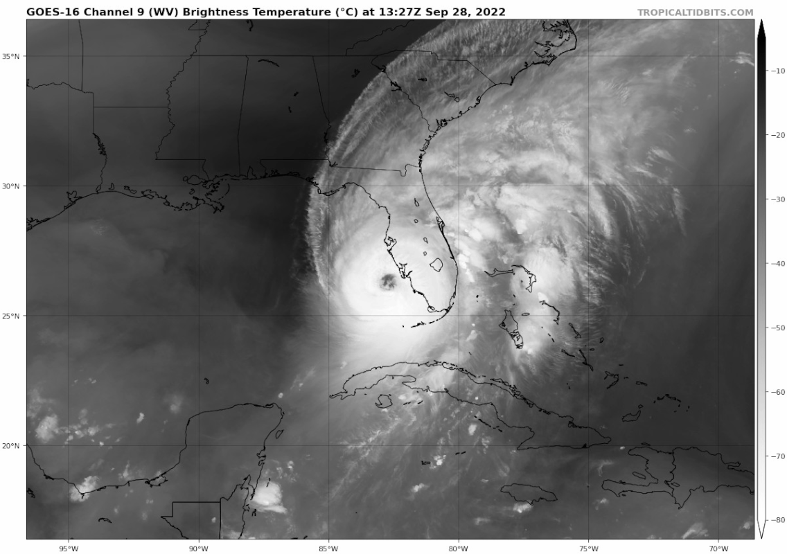
jdjaguar wrote:wxman57 wrote:jdjaguar wrote:is that a pinhole eye?
NO! Eye is 30nm across.
Good, thanks. Visually it appeared to be, my mistake for not looking at the data before posting.
Storm is bad enough.
Just look at radar.. Large eye
Moderator: S2k Moderators

jdjaguar wrote:wxman57 wrote:jdjaguar wrote:is that a pinhole eye?
NO! Eye is 30nm across.
Good, thanks. Visually it appeared to be, my mistake for not looking at the data before posting.
Storm is bad enough.


ObsessedMiami wrote:underthwx wrote:How far from the center are Tropical Storm strength winds, and Hurricane force winds being experienced?
Clearly getting TS gusts in West Miami Dade if that tells you anything
underthwx wrote:How far from the center are Tropical Storm strength winds, and Hurricane force winds being experienced?
Cyclenall wrote:GCANE wrote:Just looked at 200mb vort at CIMSS.
Ian is pushing back the PV streamers to its west, making room for longer term intensification.
This was from a few nights ago, but I was wondering what causes those PV streamers out there in the GOM like that? Great to see you back GCANE!
Currently, its an unexpected turn of events but I wouldn't bet on a CAT5 landfall just due to the incredible rarity of US CAT5 LFs and the slow movement of Ian (and heading). Even if its one now. I give it 15% chance. 130-135 knot LF exponentially higher odds. I agree with those that think this is going to be the worst hurricane the west coast of FL has ever seen, this is history.

dpep4 wrote:I went to bed at 2:30 eastern and the highest storm surge forecast was 8-12 feet, now as it is almost or possibly too late for many to evacuate it's jumped to 12-18'. A whole lot of people would have evacuated had they been told that possibility yesterday/last night. If the surge ends up verify at 15+' that will be the biggest and possibly deadliest fail that I can recall from the NHC. Inexcusable, there needs to be hell to pay and some reforms.
I've long said that the NHC needs to add a worst possible case number for storm surge, instead of getting hung up on bureaucratic precision guidelines. Make it clear that it is a worst case and not predicted/likely in their estimation, and keep with their best effort forecasting that they currently do. But they need to let people know the worst possibility so people can plan accordingly. Type 1 vs Type 2 error.
For days the NHC has said a Cat.4 was possible, so people had warning for that. I don't care much about the board's Cat 4/Cat 5 argument of the moment, that's close enough and the intensity forecast is the toughest and where the science is challenged the most. Maybe could have mentioned more the possibility of Cat. 5, it could have made a difference in some evacuation decisions, but Cat 4 is pretty bad as i. Thankfully the FL building codes are very good (though lots of mobile homes down there).
With so much stupid housing development on so much low lying land, it's the surge prediction that mattered the most. There's no reason not to make a simple change to, "Storm surge could reach 8 to 12', and while not expected, if the storm strengthens to Cat 5 a worst case surge of 18' is possible." Stating that yesterday probably would have gotten more people to evacuate some of these housing developments with average elevations such as 7'.
Not trying to start a big diversionary topic, they'll be time for that later so I won't bring it up again until the storm has dissipated. But I've long held the opinion that they need to be more open and clearly communication actual worst case numbers. This may be about to play out into a tragedy. I hope I'm wrong about the impacts and that the surge doesn't reach what's possible.
(To clarify, I'm not in FL and not at risk.)


ElectricStorm wrote:Fancy1001 wrote:Please let them upgrade it before.
It literally means nothing if it's upgraded or not right now


tolakram wrote:Blurry but highest water that is still working. Ft Meyers cam went down.
https://i.imgur.com/yBaJOOH.png


ObsessedMiami wrote:underthwx wrote:How far from the center are Tropical Storm strength winds, and Hurricane force winds being experienced?
Clearly getting TS gusts in West Miami Dade if that tells you anything
Maryellen46 wrote:
Morons doing it for their stupid Tik Toks.

Users browsing this forum: No registered users and 15 guests


