ATL: IKE Discussion
Moderator: S2k Moderators
Re: ATL IKE: Category 3 - Discussion
Thanks stormspotter - I do appreciate the thoughts and prayers.
0 likes
-
fasterdisaster
- Category 5

- Posts: 1868
- Joined: Mon Sep 19, 2005 4:41 pm
- Location: Miami, Florida
Re: ATL IKE: Category 3 - Discussion
tolakram wrote:
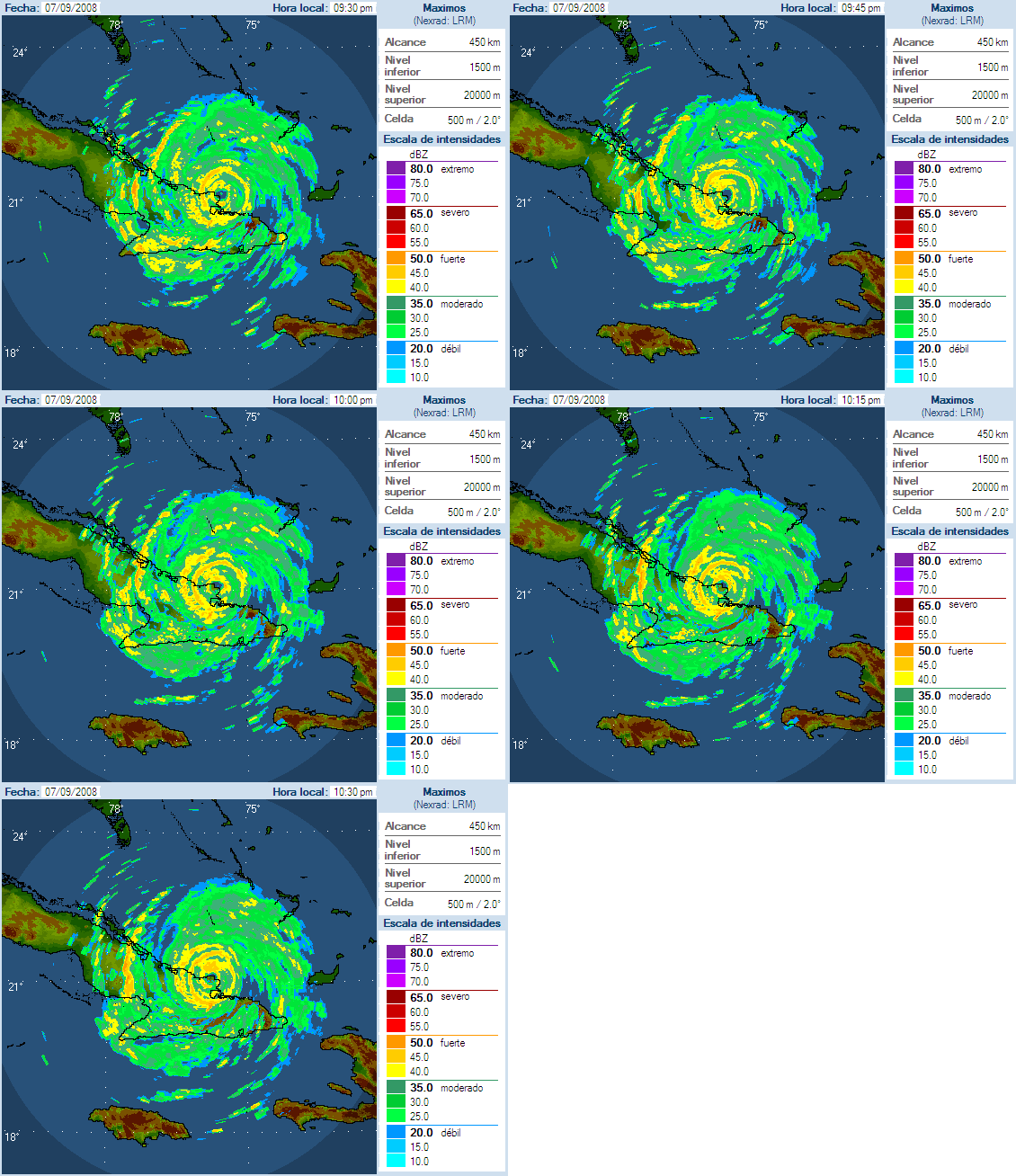
See what I meant by him not going inland yet was that his landfall is on that tiny peninsula I guess you could call it there and he's moving 275 or so in the latest frames so he will only be hugging the coast for a few hours.
0 likes
- carversteve
- Tropical Storm

- Posts: 161
- Joined: Sat Aug 18, 2007 7:40 am
- HURAKAN
- Professional-Met

- Posts: 46086
- Age: 38
- Joined: Thu May 20, 2004 4:34 pm
- Location: Key West, FL
- Contact:
Re: ATL IKE: Category 3 - Discussion
Sanibel wrote:A lengthwise track of a strong hurricane will strip Cuba of economically important crops like tobacco and sugar cane.
At the moment Cuba's strongest economic asset is not tobacco or sugar, it's tourism.
0 likes
- Texashawk
- Category 2

- Posts: 579
- Joined: Tue Aug 14, 2007 1:50 am
- Location: Missouri City, TX (Houston)
Re: ATL IKE: Category 3 - Discussion
Brent wrote:
Geez, that was a fast 11 PM forecast track post - 25 minutes early!!!
Last edited by Texashawk on Sun Sep 07, 2008 9:38 pm, edited 1 time in total.
0 likes
Re:
BigB0882 wrote:My mom was joking that last time it was Katrina for Louisiana and Rita for Texas (although, wasn't that technically a LA landfall? Oh well, she lives in Beaumont so to her it was a Texas storm) so since Louisiana had Gustav it would be Texas getting a big one soon. I hope she isn't right but Louisiana doesn't want yet another one. If this one hits around Cameron then it will be quite ironic.
Both Audrey and Rita hit Cameron, La. It may come as a shock to some, but Cameron is actually south of Orange, Texas due to the meanders of the Sabine River. Orange has seen the eye of a couple of Louisiana landfall hurricanes.
0 likes
Re: ATL IKE: Category 3 - Discussion
wxman57 wrote:
00Z plots. Pretty good consensus on Matagorda Bay to mid LA coast:
I'm right curious about the two-letter coded blocks in the GOM shown red-lined in the 00Z plot map.
I've never seen those before. What the heck do they represent??
Been bouncing back and forth between web pages and see that this question has been answered previously.
Also noticed that sinced I was last browsing here that we're now right in the bullseye in H-town. All my tanks and generators are still full from Gustav preparations. We're A.J. squared away from the last alert, and if it hits hard inland
all I've got to do is load up, lock the door and skedadel.
Last edited by randge on Sun Sep 07, 2008 9:49 pm, edited 1 time in total.
0 likes
- HouTXmetro
- Category 5

- Posts: 3949
- Joined: Sun Jun 13, 2004 6:00 pm
- Location: District of Columbia, USA
Re: ATL IKE: Category 3 - Discussion
Cameron (the town) is actually southeast of Orange, TX. Part of western Cameron Parish is south of Orange, TX. Cameron is south of Westlake and Sulphur, LA. Granted, Rita did come in at an angle and that's why you got the eye.
0 likes
-
Wx_Warrior
- Category 5

- Posts: 2718
- Joined: Thu Aug 03, 2006 3:58 pm
- Location: Beaumont, TX
- HarlequinBoy
- Category 5

- Posts: 1400
- Age: 35
- Joined: Wed Nov 29, 2006 1:57 am
- Location: Memphis
Re:
HURAKAN wrote:I think if Ike remains 36 hours over land it will likely be a TS or TD when it enter the GOM.
If it takes the forecast track from the NHC I just can't see it remaining a hurricane.
0 likes
-
BigB0882
- S2K Supporter

- Posts: 2287
- Joined: Thu Jul 03, 2003 12:08 am
- Location: Baton Rouge, LA
- Contact:
Will another LSU football game be postponed? Sheesh. I know Baton Rouge isn't nextdoor to Galveston but if the storm is big and makes landfall Saturday afternoon or evening then Baton Rouge could certainly have sloppy weather. We had a ton of rain with Rita and had gusts of around 40 mph. That is enough to cancel a game. My parents were supposed to come in for it. 
One thing worrying me is that I think if the track shifts at all, it will probably shift East because of the trough. This is going to be another very long week.
One thing worrying me is that I think if the track shifts at all, it will probably shift East because of the trough. This is going to be another very long week.
0 likes
Who is online
Users browsing this forum: No registered users and 11 guests


