ATL: Tropical Depression Fay

Moderator: S2k Moderators

Message
Author
User avatar
srainhoutx
S2K Supporter
S2K Supporter
Posts: 6919
Age: 68
Joined: Sun Jan 14, 2007 11:34 am
Location: Haywood County, NC
Contact:

Re: ATL: Tropical Storm Fay

#5221 Postby srainhoutx » Sat Aug 16, 2008 11:39 am

deltadog03 wrote:This is why I think there could be just Due WEST movement for today.. The ridge is still pretty strong to the north. Remember she is barely a TS right now. Winds are probably only 40mph or so.

http://cimss.ssec.wisc.edu/tropic2/real ... zoom=&time


Still thinking a northerly component will not happen until S of The Isle of Youth, and will be a gradual turn IMHO.
0 likes   

User avatar
senorpepr
Military Met/Moderator
Posts: 12542
Age: 43
Joined: Fri Aug 22, 2003 9:22 pm
Location: Mackenbach, Germany
Contact:

#5222 Postby senorpepr » Sat Aug 16, 2008 11:40 am

Update:

I've dropped the zoomed chart w/ radar since we're out of San Juan's range. Unfortunately, I can't get Cuban radar to automatically ingest into my script or I'd utilize that.

I've also added the NHC track for Fay.

Once Fay begins to approach Florida, I'll add a whole new suite of zoomed products, locked on Florida.
0 likes   

xironman
S2K Supporter
S2K Supporter
Posts: 2535
Joined: Sun Jun 10, 2007 4:53 pm
Location: NoVA

Re: ATL: Tropical Storm Fay

#5223 Postby xironman » Sat Aug 16, 2008 11:41 am

I am looking at a possible LLC just on the SW tip of haiti.
That is what I see, am not sure about being headed directly for Cuba's mountains. As far as being decoupled, that is the steady state of this storm.
0 likes   

User avatar
tailgater
S2K Supporter
S2K Supporter
Posts: 3339
Joined: Sun Jul 11, 2004 9:13 pm
Location: St. Amant La.

Re:

#5224 Postby tailgater » Sat Aug 16, 2008 11:41 am

Derek Ortt wrote:if it has decoupled and is moving toward the mountains of E Cuba, then it is probably a weakening depression.

However, that feature may be transient


Yeah I wouldn't be surprised if they didn't find a LLC again
0 likes   

User avatar
artist
Category 5
Category 5
Posts: 9792
Joined: Mon Jun 06, 2005 3:26 pm
Location: West Palm

#5225 Postby artist » Sat Aug 16, 2008 11:41 am

thanks senor!
0 likes   

Aric Dunn
Category 5
Category 5
Posts: 21238
Age: 43
Joined: Sun Sep 19, 2004 9:58 pm
Location: Ready for the Chase.
Contact:

#5226 Postby Aric Dunn » Sat Aug 16, 2008 11:42 am

well hello .... i had a nice rest ..... and im sure you all are have been having nice disscusions and im sure there has been no bashing or other things... :)
0 likes   

User avatar
fci
S2K Supporter
S2K Supporter
Posts: 3324
Joined: Tue Sep 14, 2004 10:29 am
Location: Lake Worth, FL

Re: Re:

#5227 Postby fci » Sat Aug 16, 2008 11:42 am

ConvergenceZone wrote:
Stephanie wrote:[quote="ConvergenceZone

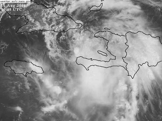
HEHE, I agree....I'm feeling MUCH better this morning than I was last night....Last night was a bit scary, thinking what horrible intensity this could have become had it got into the warm bath waters of the gulf...... Of course, let's cross our fingers that the models don't switch back again...


We then will have to worry about the Bahamas and the East Coast. She'll still be over warm water...


I just don't think the conditions will be near as good for development if it goes east of Florida. As they say, it takes more than just warm water to support a hurricane...I do think it can be a tropical storm though (just my own opinion).... ---- off to watch the olympics ----...will be interested to see tomorrow how this storm is evolved...[/quote]


I have to admit that I am confused.
A track east of here is the best for all (except maybe the Bahamas) but where did all these people come to the conclusion that fay will go east of Florida?
I don't see any models indicating it.
No Pro Mets saying that it is going to happen.

Maybe I missed something but I see no evidence that Fay will go east of the peninisula unless we are relying on Thursday's model runs.

And, BTW; I WANT it to go east of Florida and miss out state completely.
0 likes   

User avatar
cycloneye
Admin
Admin
Posts: 148494
Age: 69
Joined: Thu Oct 10, 2002 10:54 am
Location: San Juan, Puerto Rico

Re: ATL: Tropical Storm Fay

#5228 Postby cycloneye » Sat Aug 16, 2008 11:43 am

Pic at 12:32 PM EDT:

Image
0 likes   

cpdaman
Category 5
Category 5
Posts: 3131
Joined: Sat Jun 10, 2006 11:44 am
Location: SPB county (gulf stream)

Re: Re:

#5229 Postby cpdaman » Sat Aug 16, 2008 11:43 am

ConvergenceZone wrote:I just don't think the conditions will be near as good for development if it goes east of Florida. As they say, it takes more than just warm water to support a hurricane...I do think it can be a tropical storm though (just my own opinion).... ---- off to watch the olympics ----...will be interested to see tomorrow how this storm is evolved...


come on convergence zone, we all know you will be back to the site, peeking within 90 minutes to see "how she is evolving"
0 likes   

Dean4Storms
S2K Supporter
S2K Supporter
Posts: 6358
Age: 62
Joined: Sun Aug 31, 2003 1:01 pm
Location: Miramar Bch. FL

Re: ATL: Tropical Storm Fay

#5230 Postby Dean4Storms » Sat Aug 16, 2008 11:44 am

deltadog03 wrote:This is why I think there could be just Due WEST movement for today.. The ridge is still pretty strong to the north. Remember she is barely a TS right now. Winds are probably only 40mph or so.

http://cimss.ssec.wisc.edu/tropic2/real ... zoom=&time


I suppose one would have to wonder if she would stay in the E-W flow and miss turning into the weakness if she remains this shallow.
0 likes   

xironman
S2K Supporter
S2K Supporter
Posts: 2535
Joined: Sun Jun 10, 2007 4:53 pm
Location: NoVA

Re: ATL: Tropical Storm Fay

#5231 Postby xironman » Sat Aug 16, 2008 11:47 am

If you look at this pic
Pic at 12:32 PM EDT:
. The circulation I see is very close to that bursting thunderstorm just north of the southwest tip of Haiti.
0 likes   

User avatar
funster
Category 3
Category 3
Posts: 818
Joined: Sat Dec 29, 2007 4:27 pm
Location: North Dallas

#5232 Postby funster » Sat Aug 16, 2008 11:48 am

How did the center jump to 19.5? I though the NHC had it at 19 with the last update. Or maybe no one really knows where it is because it is gone now.
0 likes   

User avatar
vbhoutex
Storm2k Executive
Storm2k Executive
Posts: 29133
Age: 74
Joined: Wed Oct 09, 2002 11:31 pm
Location: Cypress, TX
Contact:

Re: ATL: Tropical Storm Fay

#5233 Postby vbhoutex » Sat Aug 16, 2008 11:49 am

Looking at some sat loops and radar posted here and looking at another sat loop I see a partially exposed LLCC just above the SW tip of the peninsula. With plenty of convection firing just to the S of it I will not be surprised to see some consolidation and restacking of the MLC(Definitley SE of the LLC)now that Fay is back over water. The mountains did disrupt this storm much more than I think many thought it would(per yesterdays discussions), with the circ centers back over water I do expect a slow consolidation and stregnthening trend to start pretty soon. Basic track still appears to be almost due West. JMHO.
0 likes   

User avatar
Blown Away
S2K Supporter
S2K Supporter
Posts: 10252
Joined: Wed May 26, 2004 6:17 am

Re:

#5234 Postby Blown Away » Sat Aug 16, 2008 11:49 am

Dean4Storms wrote:Does anyone else see the LLC near 19.5 74.5?

It shows up well on the Ramsdis floater........

http://www.cira.colostate.edu/cira/RAMM ... pical.html


Yep, pretty clear to me moving WNW, exposed center.
http://www.ssd.noaa.gov/goes/flt/t1/loop-vis.html
0 likes   

User avatar
Blown Away
S2K Supporter
S2K Supporter
Posts: 10252
Joined: Wed May 26, 2004 6:17 am

Re: ATL: Tropical Storm Fay

#5235 Postby Blown Away » Sat Aug 16, 2008 11:51 am

xironman wrote:If you look at this pic
Pic at 12:32 PM EDT:
. The circulation I see is very close to that bursting thunderstorm just north of the southwest tip of Haiti.


I don't agree, it's exposed near 19.5N/74.5W.
0 likes   

jaxfladude
Category 5
Category 5
Posts: 1249
Joined: Wed Aug 24, 2005 9:36 pm
Location: Jacksonville, Fla

#5236 Postby jaxfladude » Sat Aug 16, 2008 11:55 am

Last edited by jaxfladude on Sat Aug 16, 2008 11:59 am, edited 1 time in total.
0 likes   

User avatar
canetracker
S2K Supporter
S2K Supporter
Posts: 751
Age: 62
Joined: Wed Jul 27, 2005 8:49 pm
Location: Suburbia New Orleans...Harahan, LA

Re: ATL: Tropical Storm Fay

#5237 Postby canetracker » Sat Aug 16, 2008 11:57 am

Image
Latest Steering Layers
0 likes   

User avatar
Vortex
S2K Supporter
S2K Supporter
Posts: 4644
Age: 53
Joined: Fri Aug 01, 2003 9:34 pm
Location: Hilton Head, SC

#5238 Postby Vortex » Sat Aug 16, 2008 11:58 am

the center is not exposed
0 likes   

User avatar
HURAKAN
Professional-Met
Professional-Met
Posts: 46086
Age: 38
Joined: Thu May 20, 2004 4:34 pm
Location: Key West, FL
Contact:

#5239 Postby HURAKAN » Sat Aug 16, 2008 11:58 am

Image

The center is exactly under that burst of convection north of the tip of that peninsula in Haiti.
0 likes   

User avatar
vbhoutex
Storm2k Executive
Storm2k Executive
Posts: 29133
Age: 74
Joined: Wed Oct 09, 2002 11:31 pm
Location: Cypress, TX
Contact:

Re: Re:

#5240 Postby vbhoutex » Sat Aug 16, 2008 12:00 pm

Blown_away wrote:
Dean4Storms wrote:Does anyone else see the LLC near 19.5 74.5?

It shows up well on the Ramsdis floater........

http://www.cira.colostate.edu/cira/RAMM ... pical.html


Yep, pretty clear to me moving WNW, exposed center.
http://www.ssd.noaa.gov/goes/flt/t1/loop-vis.html


Based on that loop I see 19.4N, 79.8W or very close to that. Once the consolidation begins I wouldn't be surprised if it actually "moves" a little SW of where it appears now. Honestly after three different visibles it is not easy to pinpoint it. When the plane gets in we will know more(DUH!!! :oops: :oops: ).
0 likes   


Return to “2008”

Who is online

Users browsing this forum: No registered users and 31 guests