better hurry and rush to your final preparations before we get smacked by the RFQ. I am putting the final boards up right now.
ATL: INVEST 95L - DISCUSSION
Moderator: S2k Moderators
-
CYCLONE MIKE
- Category 5

- Posts: 2183
- Joined: Tue Aug 31, 2004 6:04 pm
- Location: Gonzales, LA
Re: ATL: INVEST 95L - DISCUSSION
tailgator,
better hurry and rush to your final preparations before we get smacked by the RFQ. I am putting the final boards up right now. Looks to be only a couple of hours away before we get into some the the heavier rain that should last all night. Do have to agree with most others saying this was at least a depression before making landfall. Even our 6 o'clock weatherman said the NHC left him scratching his head over what transpired earlier this afternoon. Also believed it should of been declared a depression upon making landfall and another few hours of water and it would have been Bonnie.
better hurry and rush to your final preparations before we get smacked by the RFQ. I am putting the final boards up right now.
0 likes
Oh that crazy NHC. 
I have no proof, I'm just throwing this out there. I wonder if politics were involved. If they take a single thunderstorm TC and call it Bonnie right near the oil spill, there is massive media over reaction and headaches all around. I could easily be wrong. Just throwing it out there.
I have no proof, I'm just throwing this out there. I wonder if politics were involved. If they take a single thunderstorm TC and call it Bonnie right near the oil spill, there is massive media over reaction and headaches all around. I could easily be wrong. Just throwing it out there.
0 likes

Re: ATL: INVEST 95L - DISCUSSION
Nice catch Cycloneye, this one has been a little strange and if there is proof of a LLC, which it certainly looked like on the visible loops, then i think they will classify it. Plus it still looks like on radar as if isn't on shore yet and has a somewhat better appearance. It's just a little baby. 
0 likes
The following post is NOT an official forecast and should not be used as such. It is just the opinion of the poster and may or may not be backed by sound meteorological data. It is NOT endorsed by any professional institution including storm2k.org For Official Information please refer to the NHC and NWS products.
-
wxman57

- Moderator-Pro Met

- Posts: 23175
- Age: 68
- Joined: Sat Jun 21, 2003 8:06 pm
- Location: Houston, TX (southwest)
Re: ATL: INVEST 95L - DISCUSSION
Surface obs still don't confirm an LLC. They do show a trof axis. Could be the circulation was mid-level.
0 likes
-
MGC

- S2K Supporter

- Posts: 5940
- Joined: Sun Mar 23, 2003 9:05 pm
- Location: Pass Christian MS, or what is left.
Re: ATL: INVEST 95L - DISCUSSION
Oh well, on to the next system......personally, I think 95L was a tiny TD. But, since I don't run the NHC......MGC
0 likes
Re: ATL: INVEST 95L - DISCUSSION
wxman57 wrote:Surface obs still don't confirm an LLC. They do show a trof axis. Could be the circulation was mid-level.
My thoughts also MLC, that's why it went n then nw and now west.
0 likes
The following post is NOT an official forecast and should not be used as such. It is just the opinion of the poster and may or may not be backed by sound meteorological data. It is NOT endorsed by any professional institution including storm2k.org For Official Information please refer to the NHC and NWS products.
-
redfish1
- Tropical Storm

- Posts: 125
- Age: 45
- Joined: Thu Jun 17, 2010 9:24 pm
- Location: Port Arthur, Tx
Re: ATL: INVEST 95L - DISCUSSION
Ivanhater wrote:
so is the center of circulation still over water and is it moving west now??
0 likes
-
vbhoutex

- Storm2k Executive

- Posts: 29149
- Age: 74
- Joined: Wed Oct 09, 2002 11:31 pm
- Location: Cypress, TX
- Contact:
Re:
RL3AO wrote:Oh that crazy NHC.
I have no proof, I'm just throwing this out there. I wonder if politics were involved. If they take a single thunderstorm TC and call it Bonnie right near the oil spill, there is massive media over reaction and headaches all around. I could easily be wrong. Just throwing it out there.
I have to disagree with this. I have already seen huge overreaction, imo, to this system. NBC news tonight stated, and I am quoting as best I can remember, "a very strong storm is moving onshore in Southern LA...". I'm sorry, but a low end TS, if indeed it is one, is not a very strong storm no matter how you paint it. We have tstorms stronger than this quite often all across the South. As far as whether NHC should have named this system, I have to defer to their knowledge and available information, which is much more than anything we have available, except for maybe our pro-mets. My biggest concern now is the fact that this system is shown by most models to be headed WNW to NW in our general direction and this area of TX does not need any more heavy rains any time soon. Whether it is named won't change any of that. JMHO.
0 likes
Skywarn, C.E.R.T.
Please click below to donate to STORM2K to help with the expenses of keeping the site going:

Please click below to donate to STORM2K to help with the expenses of keeping the site going:
-
ozonepete
- Professional-Met

- Posts: 4743
- Joined: Mon Sep 07, 2009 3:23 pm
- Location: From Ozone Park, NYC / Now in Brooklyn, NY
Re: ATL: INVEST 95L - DISCUSSION
The radar and satellite seem to indicate the center is still over water.
0 likes
Re: ATL: INVEST 95L - DISCUSSION
so is the center of circulation still over water and is it moving west now??
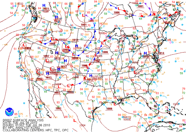
I was referring to what I think was a MLC moving west. but I'm just a gawker with too much time on his hands right now.
This is about 7 hours old so don't jump me about what it shows.

I was referring to what I think was a MLC moving west. but I'm just a gawker with too much time on his hands right now.
This is about 7 hours old so don't jump me about what it shows.
0 likes
The following post is NOT an official forecast and should not be used as such. It is just the opinion of the poster and may or may not be backed by sound meteorological data. It is NOT endorsed by any professional institution including storm2k.org For Official Information please refer to the NHC and NWS products.
-
KFDM Meteorologist

- Professional-Met
- Posts: 1314
- Joined: Tue May 16, 2006 9:52 pm
- Location: Upper Texas Coast/Orange County

-
Tireman4

- S2K Supporter
- Posts: 5903
- Age: 60
- Joined: Fri Jun 30, 2006 1:08 pm
- Location: Humble, Texas
- Contact:
Re: ATL: INVEST 95L - DISCUSSION
Ok, I have to say this. In my unprofessional opinion ( I am just a lowly community college historian...almost PhD...in 1.5 years...LOL) this system is weird. I am just at a loss for words to say.
The posts in this forum are NOT official forecast and should not be used as such. They are just the opinion of the poster and may or may not be backed by sound meteorological data. They are NOT endorsed by any professional institution or storm2k.org. For official information, please refer to the NHC and NWS products.
The posts in this forum are NOT official forecast and should not be used as such. They are just the opinion of the poster and may or may not be backed by sound meteorological data. They are NOT endorsed by any professional institution or storm2k.org. For official information, please refer to the NHC and NWS products.
0 likes
-
KFDM Meteorologist
- Professional-Met
- Posts: 1314
- Joined: Tue May 16, 2006 9:52 pm
- Location: Upper Texas Coast/Orange County
ROPICAL WEATHER OUTLOOK
NWS TPC/NATIONAL HURRICANE CENTER MIAMI FL
800 PM EDT MON JUL 5 2010
FOR THE NORTH ATLANTIC...CARIBBEAN SEA AND THE GULF OF MEXICO...
A SMALL LOW PRESSURE SYSTEM HAS MOVED INLAND OVER SOUTH-CENTRAL
LOUISIANA ABOUT 25 MILES SOUTHEAST OF MORGAN CITY. NOW THAT THE
SYSTEM IS OVER LAND AND WILL MOVE FARTHER INLAND TONIGHT...TROPICAL
CYCLONE DEVELOPMENT IS NO LONGER EXPECTED.
0 likes
-
Ivanhater

- Storm2k Moderator

- Posts: 11221
- Age: 39
- Joined: Fri Jul 01, 2005 8:25 am
- Location: Pensacola
Re: ATL: INVEST 95L - DISCUSSION
JimCantore
Invest 95L HASN'T come COMPLETELY onshore yet. It's trying to slowly organize south of Morgan City, LA. Could be interesting.....
Invest 95L HASN'T come COMPLETELY onshore yet. It's trying to slowly organize south of Morgan City, LA. Could be interesting.....
0 likes
Michael

Who is online
Users browsing this forum: No registered users and 34 guests