Disturbance In Eastern Caribbean.

This is the general tropical discussion area. Anyone can take their shot at predicting a storms path.

Moderator: S2k Moderators

Forum rules

The posts in this forum are NOT official forecasts and should not be used as such. They are just the opinion of the poster and may or may not be backed by sound meteorological data. They are NOT endorsed by any professional institution or STORM2K. For official information, please refer to products from the National Hurricane Center and National Weather Service.

Help Support Storm2K
Message
Author
Ed Mahmoud

Re: Central Atlantic Disturbance

#61 Postby Ed Mahmoud » Fri Aug 07, 2009 8:27 am

It is the Canadian...


Puerto Rico Tropical Depression Downpours!

Image
0 likes   

User avatar
Blown Away
S2K Supporter
S2K Supporter
Posts: 10140
Joined: Wed May 26, 2004 6:17 am

Re: Central Atlantic Disturbance

#62 Postby Blown Away » Fri Aug 07, 2009 8:41 am

1. Convection building today.
2. Model support (Canadian).
3. Shear not to bad on Canadian track.
4. SST's good.
5. TAFB tagged a low w/ this area.
6. Long shot, I always like the persistent underdog!
0 likes   

User avatar
HURAKAN
Professional-Met
Professional-Met
Posts: 46086
Age: 38
Joined: Thu May 20, 2004 4:34 pm
Location: Key West, FL
Contact:

#63 Postby HURAKAN » Fri Aug 07, 2009 8:44 am

Image

You know things are really bad when this is the best shot for development in the near future. :lol:
0 likes   

User avatar
wxman57
Moderator-Pro Met
Moderator-Pro Met
Posts: 22951
Age: 67
Joined: Sat Jun 21, 2003 8:06 pm
Location: Houston, TX (southwest)

Re: Central Atlantic Disturbance

#64 Postby wxman57 » Fri Aug 07, 2009 8:50 am

Here's a morning analysis of the disturbance. As you can see, there is no closed low, regardless of what some agency might put on its map. It's just a low-latitude tropical wave. Pressures are relatively high in the region. The Canadian model, by the way, isn't forecasting THIS disturbance to develop, it's focusing on the wave behind it near 9N/48W.

Image

There are several walls of shear in its path. The first is the shear associated with the upper trof across the eastern Caribbean. It'll hit that shear later today.

http://cimss.ssec.wisc.edu/tropic/real- ... g8shr.html

The second wall of death it'll face is tremendous 850mb winds across much of the Caribbean Sea forecast for this weekend:
Image

Bottom line is that chances of tropical development over the next 5 days is extremely low, maybe 1-2%. I'm afraid I'll have to push back my August 8th date of Ana to closer to the 16-20 of August.
0 likes   

User avatar
Blown Away
S2K Supporter
S2K Supporter
Posts: 10140
Joined: Wed May 26, 2004 6:17 am

Re: Central Atlantic Disturbance

#65 Postby Blown Away » Fri Aug 07, 2009 8:57 am

I was referring to the convection blob near 9N/48W, I've been watching that like a crazy fool for the past few days. :double: If this area follows the Canadian track the shear is at least not sure death as it is in the Caribbean. The unamed agency tagged the low on Wed, removed it on Thurs, and put it back on today. Thanks Wxmann!! :D
0 likes   

Ed Mahmoud

Re: Central Atlantic Disturbance

#66 Postby Ed Mahmoud » Fri Aug 07, 2009 9:02 am

WxMan57

It depends which part of the long line of storms you call the wave.

I'm talking the back end at 45º

Canadian time- about right now...

Image

About 7 am, but close enough for govt. work...
0 likes   

floridasun78
Category 5
Category 5
Posts: 3755
Joined: Sun May 17, 2009 10:16 pm
Location: miami fl

#67 Postby floridasun78 » Fri Aug 07, 2009 9:04 am

wxman57 is bad news bear for system i bet you donot see any system to form. i see you but all wave down no change untill now untill day you forcast you going see ana form
0 likes   

User avatar
Blown Away
S2K Supporter
S2K Supporter
Posts: 10140
Joined: Wed May 26, 2004 6:17 am

Re: Central Atlantic Disturbance

#68 Postby Blown Away » Fri Aug 07, 2009 9:14 am

I agree w/ you Ed, if there is any kind of circulation/vortex it's on the E side of the convection which puts it near 45W.
0 likes   

Ed Mahmoud

Re: LOW NEAR 11N / 33W

#69 Postby Ed Mahmoud » Fri Aug 07, 2009 9:21 am

Ed Mahmoud wrote:
Blown_away wrote:Image
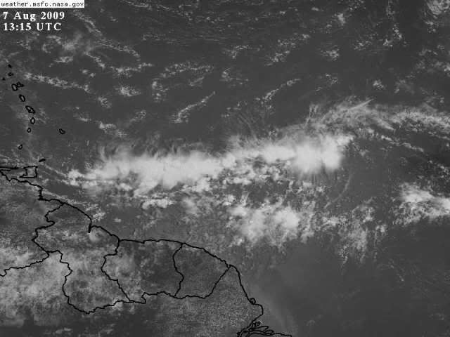
Little pop of convection to the S of the main blob, let's see if it persists.


Just wanted to move the satellite loop to the new page.
0 likes   

User avatar
Blown Away
S2K Supporter
S2K Supporter
Posts: 10140
Joined: Wed May 26, 2004 6:17 am

Re: Central Atlantic Disturbance

#70 Postby Blown Away » Fri Aug 07, 2009 9:26 am

Little WNW movement in the last few frames.
0 likes   

Sanibel
Category 5
Category 5
Posts: 10375
Joined: Mon Aug 30, 2004 11:06 pm
Location: Offshore SW Florida

Re: Central Atlantic Disturbance

#71 Postby Sanibel » Fri Aug 07, 2009 9:41 am

I think the wave is linear because the unfavorable Atlantic airmass is pushing it down against the ITCZ. It's interesting because even in this hopeless atmosphere the wave is showing signs of energy as the season starts to ramp up in climatology. Whether that weak center can pull that arm of convection off to its west into itself is the question. So far the chances are against it.

The waves over Africa and exiting the coast are badly dried out.
0 likes   

User avatar
Gustywind
Category 5
Category 5
Posts: 12334
Joined: Mon Sep 03, 2007 7:29 am
Location: Baie-Mahault, GUADELOUPE

#72 Postby Gustywind » Fri Aug 07, 2009 9:50 am

Image
0 likes   

Stormcenter
S2K Supporter
S2K Supporter
Posts: 6677
Joined: Wed Sep 03, 2003 11:27 am
Location: Houston, TX

Re: Central Atlantic Disturbance

#73 Postby Stormcenter » Fri Aug 07, 2009 10:11 am

Right now this nothing more then a disorganized mess of storms that is being suppressed southward. Move along nothing here to see at the moment. :)
0 likes   

User avatar
wxman57
Moderator-Pro Met
Moderator-Pro Met
Posts: 22951
Age: 67
Joined: Sat Jun 21, 2003 8:06 pm
Location: Houston, TX (southwest)

Re: Central Atlantic Disturbance

#74 Postby wxman57 » Fri Aug 07, 2009 11:15 am

A modified version of that 850mb wind chart. The Caribbean eagerly awaits this disturbance:

Image
0 likes   

Ed Mahmoud

Re: Central Atlantic Disturbance

#75 Postby Ed Mahmoud » Fri Aug 07, 2009 11:23 am

wxman57 wrote:A modified version of that 850mb wind chart. The Caribbean eagerly awaits this disturbance:

Image


Holy Zenyatta Mondata!


(Not the actual thing I was thinking of, but close enough)
0 likes   

Sanibel
Category 5
Category 5
Posts: 10375
Joined: Mon Aug 30, 2004 11:06 pm
Location: Offshore SW Florida

Re: Central Atlantic Disturbance

#76 Postby Sanibel » Fri Aug 07, 2009 1:19 pm

There's a very weak surface spiral near 13-47 but it looks like it is quitting:


http://www.ssd.noaa.gov/goes/east/catl/loop-vis.html
0 likes   

User avatar
wxman57
Moderator-Pro Met
Moderator-Pro Met
Posts: 22951
Age: 67
Joined: Sat Jun 21, 2003 8:06 pm
Location: Houston, TX (southwest)

Re: Central Atlantic Disturbance

#77 Postby wxman57 » Fri Aug 07, 2009 1:30 pm

Here's an 18Z analysis with surface plots. Pressure relatively high in the region. Wave axis around 47.5W now. I can't see any evidence of rotation on visible imagery. MIMIC shows a tiny bit of rotation aloft. Surface obs suggest wave.

Image
0 likes   

Sanibel
Category 5
Category 5
Posts: 10375
Joined: Mon Aug 30, 2004 11:06 pm
Location: Offshore SW Florida

Re: Central Atlantic Disturbance

#78 Postby Sanibel » Fri Aug 07, 2009 3:26 pm

Kirk, I'm detecting activity on my monitor:


Image
0 likes   

Sanibel
Category 5
Category 5
Posts: 10375
Joined: Mon Aug 30, 2004 11:06 pm
Location: Offshore SW Florida

Re: Central Atlantic Disturbance

#79 Postby Sanibel » Fri Aug 07, 2009 3:34 pm

Center burst over spiral?


Image
0 likes   

User avatar
Blown Away
S2K Supporter
S2K Supporter
Posts: 10140
Joined: Wed May 26, 2004 6:17 am

Re: Central Atlantic Disturbance

#80 Postby Blown Away » Fri Aug 07, 2009 3:39 pm

IMO, if there is any circulation it is near that ball of convection near 13N 47W.
0 likes   


Return to “Talkin' Tropics”

Who is online

Users browsing this forum: cycloneye and 194 guests