Yeah I agree Dexter, I'm not expecting anything until the latter stages of May given the MJO forecasts and extended model outlook. However if we hit mild El Nino conditions then our season will likely extend well into December. Given the Wpac is in a prolonged period of suppressed activity a near average season sounds like a smart forecast in terms of total numbers.
In the last 18 years only 2 season have had above average numbers of storms (26 is average) 1997 with 28 and 2004 with 29. I like the sound the 2009 too Dexter, after the last two utterly bizarre seasons a return to "normality" will be quite interesting!
2012 WPAC season
Moderator: S2k Moderators
Forum rules

The posts in this forum are NOT official forecasts and should not be used as such. They are just the opinion of the poster and may or may not be backed by sound meteorological data. They are NOT endorsed by any professional institution or STORM2K. For official information, please refer to products from the National Hurricane Center and National Weather Service.
-
Typhoon Hunter
- WesternPacificWeather.com

- Posts: 1222
- Joined: Wed Oct 11, 2006 11:37 am
- Location: Tokyo
- Contact:
Re: 2012 WPAC season
0 likes
-
euro6208
Re: 2012 WPAC season
Typhoon Hunter wrote:Yeah I agree Dexter, I'm not expecting anything until the latter stages of May given the MJO forecasts and extended model outlook. However if we hit mild El Nino conditions then our season will likely extend well into December. Given the Wpac is in a prolonged period of suppressed activity a near average season sounds like a smart forecast in terms of total numbers.
In the last 18 years only 2 season have had above average numbers of storms (26 is average) 1997 with 28 and 2004 with 29. I like the sound the 2009 too Dexter, after the last two utterly bizarre seasons a return to "normality" will be quite interesting!

another invest succumbs to unfavorable conditions. oh well, let's wait for the mjo to return and kickstart the wpac.
0 likes
-
dexterlabio
- Category 5

- Posts: 3499
- Joined: Sat Oct 24, 2009 11:50 pm
Re: 2012 WPAC season
Typhoon Hunter wrote:Yeah I agree Dexter, I'm not expecting anything until the latter stages of May given the MJO forecasts and extended model outlook. However if we hit mild El Nino conditions then our season will likely extend well into December. Given the Wpac is in a prolonged period of suppressed activity a near average season sounds like a smart forecast in terms of total numbers.
In the last 18 years only 2 season have had above average numbers of storms (26 is average) 1997 with 28 and 2004 with 29. I like the sound the 2009 too Dexter, after the last two utterly bizarre seasons a return to "normality" will be quite interesting!
Agree. 2009 is quite an interesting season for me, but at the same time a dreadful one. But for the last 5 years, I must admit 2009 for me is the most interesting one. If the ENSO prediction for 2012 pans out, this would be similar to 2009...and maybe 2006 for a neutral-El Nino year.
The past 2 years were not the WPAC season I used to know...It would be nice to have a year with more interesting storms to track...but nicer if there will be no troubles caused.
0 likes
Personal Forecast Disclaimer:
The posts in this forum are NOT official forecast and should not be used as such. They are just the opinion of the poster and may or may not be backed by sound meteorological data. They are NOT endorsed by any professional institution or storm2k.org. For official information, please refer to the NHC and NWS products.
The posts in this forum are NOT official forecast and should not be used as such. They are just the opinion of the poster and may or may not be backed by sound meteorological data. They are NOT endorsed by any professional institution or storm2k.org. For official information, please refer to the NHC and NWS products.
-
Typhoon Hunter
- WesternPacificWeather.com
- Posts: 1222
- Joined: Wed Oct 11, 2006 11:37 am
- Location: Tokyo
- Contact:
Re: 2012 WPAC season
Yeah 2009 and 2006 were both brutal years for the Philippines with multiple devastating landfalls! Really hope 2012 isn't the same in that respect!
0 likes
-
cycloneye

- Admin

- Posts: 148730
- Age: 69
- Joined: Thu Oct 10, 2002 10:54 am
- Location: San Juan, Puerto Rico
Re: 2012 WPAC season
It has been very quiet in this basin since Typhoon PAKHAR was around on early April. And it looks like it will continue that way for now,as the models dont have anything in their runs.
0 likes
Visit the Caribbean-Central America Weather Thread where you can find at first post web cams,radars
and observations from Caribbean basin members Click Here
and observations from Caribbean basin members Click Here
-
Typhoon Hunter
- WesternPacificWeather.com
- Posts: 1222
- Joined: Wed Oct 11, 2006 11:37 am
- Location: Tokyo
- Contact:
Re: 2012 WPAC season
Average number of Wpac storms by 10th May is two, so we're one behind at the moment. Once MJO gets on the move I expect that could help trigger tropical storm Sanvu.
0 likes
-
euro6208
Re: 2012 WPAC season
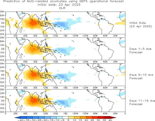
everything is favorable for a tropical cyclone to develop but it seems like the wpac wants to wait for the mjo lol which won't come until the last week of may probrably.
0 likes
-
dexterlabio
- Category 5
- Posts: 3499
- Joined: Sat Oct 24, 2009 11:50 pm
Re: 2012 WPAC season
if you check GFS latest runs it hints some development over next week. not sure if that will verify. but i saw some models also starting to hint TC development or activity. personally i rely mostly on euro and sadly i am not good at analyzing theforecast charts...something like this:
i don't know if that's 2 closed low pressure system with TC characteristics or what. i still need to learn more about these kinds of stuff.
i don't know if that's 2 closed low pressure system with TC characteristics or what.
0 likes
Personal Forecast Disclaimer:
The posts in this forum are NOT official forecast and should not be used as such. They are just the opinion of the poster and may or may not be backed by sound meteorological data. They are NOT endorsed by any professional institution or storm2k.org. For official information, please refer to the NHC and NWS products.
The posts in this forum are NOT official forecast and should not be used as such. They are just the opinion of the poster and may or may not be backed by sound meteorological data. They are NOT endorsed by any professional institution or storm2k.org. For official information, please refer to the NHC and NWS products.
-
dexterlabio
- Category 5
- Posts: 3499
- Joined: Sat Oct 24, 2009 11:50 pm
Re: 2012 WPAC season
other models (including GFS).

though IMO it's hard to think of any TC formation with the suppressed phase of the MJO, and no uptick is expected according to the latest forecast within the next 2 weeks. may i be corrected if im wrong but i see the prolonged suppressed phase of MJO to the current delay of the transition to El Nino. SOI values are still rising , could mean any chance of El Nino developing within the soonest time is low.
though IMO it's hard to think of any TC formation with the suppressed phase of the MJO, and no uptick is expected according to the latest forecast within the next 2 weeks. may i be corrected if im wrong but i see the prolonged suppressed phase of MJO to the current delay of the transition to El Nino. SOI values are still rising , could mean any chance of El Nino developing within the soonest time is low.
0 likes
Personal Forecast Disclaimer:
The posts in this forum are NOT official forecast and should not be used as such. They are just the opinion of the poster and may or may not be backed by sound meteorological data. They are NOT endorsed by any professional institution or storm2k.org. For official information, please refer to the NHC and NWS products.
The posts in this forum are NOT official forecast and should not be used as such. They are just the opinion of the poster and may or may not be backed by sound meteorological data. They are NOT endorsed by any professional institution or storm2k.org. For official information, please refer to the NHC and NWS products.

-
Typhoon Hunter
- WesternPacificWeather.com
- Posts: 1222
- Joined: Wed Oct 11, 2006 11:37 am
- Location: Tokyo
- Contact:
Re: 2012 WPAC season
Dexter I think those ECMWF charts you post depict a reverse oriented monsoon trough. The average number of storms in May is only about 1 and given the MJO being so weak we may have to wait another 10 days or so before things get interesting.
However once the storms do get going they're going to be able to tap into an obscene amount of energy. Check out ocean heat content in mid May 2011 compared to what we have today!


I think we are going to have some monsters this season!
However once the storms do get going they're going to be able to tap into an obscene amount of energy. Check out ocean heat content in mid May 2011 compared to what we have today!
I think we are going to have some monsters this season!
0 likes
-
cycloneye
- Admin
- Posts: 148730
- Age: 69
- Joined: Thu Oct 10, 2002 10:54 am
- Location: San Juan, Puerto Rico
Re: 2012 WPAC season
Typhoon Hunter wrote:Dexter I think those ECMWF charts you post depict a reverse oriented monsoon trough. The average number of storms in May is only about 1 and given the MJO being so weak we may have to wait another 10 days or so before things get interesting.
However once the storms do get going they're going to be able to tap into an obscene amount of energy. Check out ocean heat content in mid May 2011 compared to what we have today!
http://www.aoml.noaa.gov/phod/dataphod1 ... 1135np.jpg
http://www.aoml.noaa.gov/phod/dataphod1 ... 2135np.jpg
I think we are going to have some monsters this season!
TH,to think those waters will warm much more as the Summer kicks in with that hot sun angle. And also,I can see you on chase mode a few times.
0 likes
Visit the Caribbean-Central America Weather Thread where you can find at first post web cams,radars
and observations from Caribbean basin members Click Here
and observations from Caribbean basin members Click Here
-
Typhoon Hunter
- WesternPacificWeather.com
- Posts: 1222
- Joined: Wed Oct 11, 2006 11:37 am
- Location: Tokyo
- Contact:
-
dexterlabio
- Category 5
- Posts: 3499
- Joined: Sat Oct 24, 2009 11:50 pm
Re: 2012 WPAC season
i think so TH, those could be a monsoon trough...or maybe a monsoon gyre (?)
that could also mean the moist southwest monsoon beginning to kick in during the last week of May, which may also help to jumpstart the typhoon season..and yes, that high OHC is very conducive for any storms coming in.... i just don't know about MJO, i know models can only show predictions within a "foreseeable" time frame and it's hard to expect anything...but if MJO strengthens in June, along with the said factors, we could see pretty interesting and intense TC's to chase.
all in all the wet and stormy season for PI is approaching.
0 likes
Personal Forecast Disclaimer:
The posts in this forum are NOT official forecast and should not be used as such. They are just the opinion of the poster and may or may not be backed by sound meteorological data. They are NOT endorsed by any professional institution or storm2k.org. For official information, please refer to the NHC and NWS products.
The posts in this forum are NOT official forecast and should not be used as such. They are just the opinion of the poster and may or may not be backed by sound meteorological data. They are NOT endorsed by any professional institution or storm2k.org. For official information, please refer to the NHC and NWS products.
-
Typhoon Hunter
- WesternPacificWeather.com
- Posts: 1222
- Joined: Wed Oct 11, 2006 11:37 am
- Location: Tokyo
- Contact:
Re: 2012 WPAC season
This excellent map from Dr. Ryan Maue puts the current ocean heat content levels into perspective!

Uploaded with ImageShack.us

Uploaded with ImageShack.us
0 likes
-
euro6208
Re: 2012 WPAC season
Typhoon Hunter wrote:Dexter I think those ECMWF charts you post depict a reverse oriented monsoon trough. The average number of storms in May is only about 1 and given the MJO being so weak we may have to wait another 10 days or so before things get interesting.
However once the storms do get going they're going to be able to tap into an obscene amount of energy. Check out ocean heat content in mid May 2011 compared to what we have today!
I think we are going to have some monsters this season!

it's amazing that both (26.C and Heat Potential) are really concentrated in such a large area of the western pacific. the most abundant in the world.
0 likes
-
cycloneye
- Admin
- Posts: 148730
- Age: 69
- Joined: Thu Oct 10, 2002 10:54 am
- Location: San Juan, Puerto Rico
Re: 2012 WPAC season
For those who may not made a visit to our forum for invests,there are two new invests 93W and 94W. Maybe the WPAC begins to wake up?
viewforum.php?f=59
viewforum.php?f=59
0 likes
Visit the Caribbean-Central America Weather Thread where you can find at first post web cams,radars
and observations from Caribbean basin members Click Here
and observations from Caribbean basin members Click Here
-
Typhoon Hunter
- WesternPacificWeather.com
- Posts: 1222
- Joined: Wed Oct 11, 2006 11:37 am
- Location: Tokyo
- Contact:
Re: 2012 WPAC season
ECMWF spawning first tropical storm since Pakhar in the extended time frame of the run, been there for last two runs now. Worth watching to see if a trend emerges! Formation occurs off the NE coast of Luzon.
0 likes
-
dexterlabio
- Category 5
- Posts: 3499
- Joined: Sat Oct 24, 2009 11:50 pm
Re: 2012 WPAC season
so euro (which i admit is the only one i rely among other models) has been showing a possible TC developing by the end of May, and their latest run confirms to me at least that they are hinting a real TC on the 30th. Let's see if this pans out...but we all know how euro works, and hey, euro did a nice job in the Atlantic when it forecast Alberto to form this week.


That seems to be a harmless recurving system.
That seems to be a harmless recurving system.
Last edited by dexterlabio on Sun May 20, 2012 5:48 am, edited 1 time in total.
0 likes
Personal Forecast Disclaimer:
The posts in this forum are NOT official forecast and should not be used as such. They are just the opinion of the poster and may or may not be backed by sound meteorological data. They are NOT endorsed by any professional institution or storm2k.org. For official information, please refer to the NHC and NWS products.
The posts in this forum are NOT official forecast and should not be used as such. They are just the opinion of the poster and may or may not be backed by sound meteorological data. They are NOT endorsed by any professional institution or storm2k.org. For official information, please refer to the NHC and NWS products.
-
dexterlabio
- Category 5
- Posts: 3499
- Joined: Sat Oct 24, 2009 11:50 pm
Re: 2012 WPAC season
Typhoon Hunter wrote:ECMWF spawning first tropical storm since Pakhar in the extended time frame of the run, been there for last two runs now. Worth watching to see if a trend emerges! Formation occurs off the NE coast of Luzon.
haha i was just about to post about it.
0 likes
Personal Forecast Disclaimer:
The posts in this forum are NOT official forecast and should not be used as such. They are just the opinion of the poster and may or may not be backed by sound meteorological data. They are NOT endorsed by any professional institution or storm2k.org. For official information, please refer to the NHC and NWS products.
The posts in this forum are NOT official forecast and should not be used as such. They are just the opinion of the poster and may or may not be backed by sound meteorological data. They are NOT endorsed by any professional institution or storm2k.org. For official information, please refer to the NHC and NWS products.
Who is online
Users browsing this forum: JoshwaDone and 62 guests