


Coral Sea: Tropical Cyclone GUBA 02P
Moderator: S2k Moderators
-
Squarethecircle
- Category 5

- Posts: 2165
- Joined: Fri Oct 19, 2007 4:00 pm
- Location: Fairfax, VA


-
Squarethecircle
- Category 5
- Posts: 2165
- Joined: Fri Oct 19, 2007 4:00 pm
- Location: Fairfax, VA


-
Squarethecircle
- Category 5
- Posts: 2165
- Joined: Fri Oct 19, 2007 4:00 pm
- Location: Fairfax, VA
Re: Australian region/SWPac: Tropical Cyclone Guba (02P)
There is hardly any shear at all around the storm. It looks really, really good.
0 likes
-
HURAKAN

- Professional-Met

- Posts: 46084
- Age: 39
- Joined: Thu May 20, 2004 4:34 pm
- Location: Key West, FL
- Contact:
Re: Australian region/SWPac: Tropical Cyclone Guba (02P)
Australian Government Bureau of Meteorology
Queensland
Tropical Cyclone Warning Centre
TROPICAL CYCLONE INFORMATION BULLETIN
For 11am EST on Friday the 16th of November 2007
At 10 am EST Friday, Tropical Cyclone Guba [Category 2] with central pressure
980 hPa was located over the Coral Sea near latitude 11.2 south, longitude 146.7
east, which is about 400 km east northeast of Lockhart River and 500 km north
northeast of Cooktown.
The cyclone has recently moved SE but is expected to drift southward for the
next day or two while intensifying. It is not expected to cause gales on the
Queensland coast within the next 48 hours.
The next bulletin will be issued by 5 pm EST Friday.
0 likes
-
WindRunner

- Category 5
- Posts: 5803
- Age: 35
- Joined: Fri Jul 29, 2005 8:07 pm
- Location: Warrenton, VA, but Albany, NY for school
- Contact:

-
HurricaneBill
- Category 5
- Posts: 3419
- Joined: Sun Apr 11, 2004 5:51 pm
- Location: East Longmeadow, MA, USA
Re: Coral Sea: Tropical Cyclone Guba (02P) = Eye develops
3 dead in Papua New Guinea due to flooding from Guba.
http://www.rnzi.com/pages/news.php?op=read&id=36470
BTW, if you're curious how to pronounce Guba, it rhymes with Cuba.
http://www.rnzi.com/pages/news.php?op=read&id=36470
BTW, if you're curious how to pronounce Guba, it rhymes with Cuba.
0 likes

-
WindRunner
- Category 5
- Posts: 5803
- Age: 35
- Joined: Fri Jul 29, 2005 8:07 pm
- Location: Warrenton, VA, but Albany, NY for school
- Contact:
Re: Australian region/SWPac: Tropical Cyclone Guba (02P)
HURAKAN wrote:EYE = HURRICANE WINDS
Not necessarily . . . eyes/eye features can start forming well before sustained winds reach SS-Cat 1 strength, as is probably the case here. Of course, it is generally a good sign that strengthening to hurricane-force winds is imminent, but not necessarily that they exist the moment an eye pops out.
0 likes

TROPICAL CYCLONE TECHNICAL SUMMARY: AUSTRALIA - EASTERN REGION
Issued by BRISBANE TROPICAL CYCLONE WARNING CENTRE
at: 0630 UTC 16/11/2007
Tropical Cyclone: Guba
Data At: 0600 UTC
Latitude: 11.4S
Longitude: 146.7E
Location Accuracy: within 30 nm (55 km)
Movement Towards: south southeast (154 deg)
Speed of Movement: 3 knots (5 km/h)
Maximum 10-Minute Wind: 65 knots (120 km/h)
Maximum 3-Second Wind Gust: 90 knots (170 km/h)
Central Pressure: 970 hPa
Radius of 34-knot winds NE quadrant: 90 nm (165 km)
Radius of 34-knot winds SE quadrant: 90 nm (165 km)
Radius of 34-knot winds SW quadrant: 90 nm (165 km)
Radius of 34-knot winds NW quadrant: 90 nm (165 km)
Radius of 48-knot winds NE quadrant: 40 nm (75 km)
Radius of 48-knot winds SE quadrant: 40 nm (75 km)
Radius of 48-knot winds SW quadrant: 40 nm (75 km)
Radius of 48-knot winds NW quadrant: 40 nm (75 km)
Radius of 64-knot winds: 20 nm (37 km)
Radius of Maximum Winds: 20 nm (37 km)
Dvorak Intensity Code: T4.5/4.5/D1.5/24HRS
Pressure of outermost isobar: 1002 hPa
Radius of outermost closed isobar: 80 nm (150 km)
Storm Depth: Deep
FORECAST DATA
Date/Time : Location : Loc. Accuracy: Max Wind : Central Pressure
(UTC) : degrees : nm (km): knots(km/h): hPa
+12: 16/1800: 11.5S 146.7E: 035 (065): 070 (130): 965
+24: 17/0600: 11.9S 146.6E: 045 (085): 070 (130): 965
+36: 17/1800: 12.1S 146.2E: 055 (100): 070 (130): 965
+48: 18/0600: 12.3S 145.8E: 065 (120): 070 (130): 965
REMARKS:
System has continued to intensify during the past 6 hours and is now featuring a well defined eye feature with additional tight banding. Remains a small though intense system.
Notes:
This product is issued every six hours; the Cyclone Advices (Watches and Warnings) are
usually issued more frequently and contain more useful information for coastal communities.
Time Conversion from UTC to local:
WST add 8 hrs (Add another hour for daylight saving)
CST add 9 hrs 30 min
EST add 10 hrs (Add another hour for daylight saving)
==
The next bulletin for this system will be issued by: 16/1300 UTC by Brisbane TCWC.
0 likes
Cat 3 on Aussie scale means Guba is now a Severe Tropical Cyclone.
Australian Government Bureau of Meteorology
Queensland
Tropical Cyclone Warning Centre
TROPICAL CYCLONE INFORMATION BULLETIN
For 1600 AEST on Friday the 16th of November 2007
At 4 pm EST Friday, Severe Tropical Cyclone Guba [Category 3] with central
pressure 970 hPa was located over the Coral Sea near latitude 11.4 south,
longitude 146.7 east, which is about 390 km east northeast of Lockhart River and
480 km north northeast of Cooktown.
The cyclone is currently near stationary but is expected to drift southward for
the next day or two while slowly intensifying. It is not expected to cause gales
on the Queensland coast within the next 48 hours.
The next bulletin will be issued by 11 pm EST Friday.
Last edited by Chacor on Fri Nov 16, 2007 6:08 am, edited 1 time in total.
0 likes
-
HURAKAN
- Professional-Met
- Posts: 46084
- Age: 39
- Joined: Thu May 20, 2004 4:34 pm
- Location: Key West, FL
- Contact:
Re: Coral Sea: Tropical Cyclone Guba (02P) = Eye develops


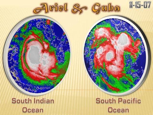
16/0830 UTC 11.4S 147.0E T4.5/4.5 GUBA -- South Pacific Ocean
0 likes
-
Squarethecircle
- Category 5
- Posts: 2165
- Joined: Fri Oct 19, 2007 4:00 pm
- Location: Fairfax, VA
Who is online
Users browsing this forum: No registered users and 65 guests