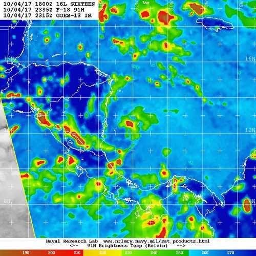
Long range radar out of Key West to the ESE is looking interesting this evening.
https://radar.weather.gov/ridge/radar.php?product=N0Z&rid=BYX&loop=yes
ATL: NATE - Post Tropical - Discussion
Moderator: S2k Moderators
-
Dean4Storms
- S2K Supporter

- Posts: 6358
- Age: 62
- Joined: Sun Aug 31, 2003 1:01 pm
- Location: Miramar Bch. FL
Re: ATL: SIXTEEN - Models
1 likes
-
Aric Dunn
- Category 5

- Posts: 21238
- Age: 43
- Joined: Sun Sep 19, 2004 9:58 pm
- Location: Ready for the Chase.
- Contact:
Re: ATL: SIXTEEN - Models
Dean4Storms wrote:Long range radar out of Key West to the ESE is looking interesting this evening.
https://radar.weather.gov/ridge/radar.php?product=N0Z&rid=BYX&loop=yes
following in talkin tropics thread...
0 likes
Note: If I make a post that is brief. Please refer back to previous posts for the analysis or reasoning. I do not re-write/qoute what my initial post said each time.
If there is nothing before... then just ask
Space & Atmospheric Physicist, Embry-Riddle Aeronautical University,
I believe the sky is falling...
If there is nothing before... then just ask
Space & Atmospheric Physicist, Embry-Riddle Aeronautical University,
I believe the sky is falling...
-
Big Easy Breeze
- Tropical Depression

- Posts: 76
- Joined: Mon Aug 28, 2017 7:52 am
Re: ATL: SIXTEEN - Models
tolakram wrote:Embarrassing. I have to say, anyone thinking the GFS solution will be close has not been following it very closely this year. This should not happen in 2017.
[im g]https://i.imgur.com/5I1hnBT.gif[/img]
What are you insinuating? You lost me.
0 likes
-
Dean4Storms
- S2K Supporter
- Posts: 6358
- Age: 62
- Joined: Sun Aug 31, 2003 1:01 pm
- Location: Miramar Bch. FL
Re: ATL: SIXTEEN - Models
Aric Dunn wrote:Dean4Storms wrote:Long range radar out of Key West to the ESE is looking interesting this evening.
https://radar.weather.gov/ridge/radar.php?product=N0Z&rid=BYX&loop=yes
following in talkin tropics thread...
OK wasn't aware. Was just pointing out here where this vort is suppose to close off near Key West tomorrow morning according to the GFS in relation to the future track of TD16 vs the ECM which shows not that much organization with it.
0 likes
-
Aric Dunn
- Category 5
- Posts: 21238
- Age: 43
- Joined: Sun Sep 19, 2004 9:58 pm
- Location: Ready for the Chase.
- Contact:
Re: ATL: SIXTEEN - Models
Dean4Storms wrote:Aric Dunn wrote:Dean4Storms wrote:Long range radar out of Key West to the ESE is looking interesting this evening.
https://radar.weather.gov/ridge/radar.php?product=N0Z&rid=BYX&loop=yes
following in talkin tropics thread...
OK wasn't aware. Was just pointing out here where this vort is suppose to close off near Key West tomorrow morning according to the GFS in relation to the future track of TD16 vs the ECM which shows not that much organization with it.
exactly... though it appears to have a weak closed circ already that started developing few hours ago.. it is very important. the pressure have fallen quite a bit with the system which could affect "Nate"
0 likes
Note: If I make a post that is brief. Please refer back to previous posts for the analysis or reasoning. I do not re-write/qoute what my initial post said each time.
If there is nothing before... then just ask
Space & Atmospheric Physicist, Embry-Riddle Aeronautical University,
I believe the sky is falling...
If there is nothing before... then just ask
Space & Atmospheric Physicist, Embry-Riddle Aeronautical University,
I believe the sky is falling...

Re: ATL: SIXTEEN - Tropical Depression - Discussion
johngaltfla wrote:NDG wrote:One thing that the subtropical looking disturbance approaching FL will do is moisten up the atmosphere quite nice as it moves westward across the GOM ahead of TD 16.
Yeah. Yee-haw. We can go from 22 inches over for the year to 30. I can't wait for SWFWMD to tell us that we can only use the sprinklers once a week in January. Boy do I have a reply planned for them.

Is sad how all this rain water just gets drained out to sea and there's no way we can preserve it for dry spells.
1 likes
-
Shell Mound
- Category 5
- Posts: 2432
- Age: 33
- Joined: Thu Sep 07, 2017 3:39 pm
- Location: St. Petersburg, FL → Scandinavia
Re: ATL: SIXTEEN - Tropical Depression - Discussion
A weaker, slower system in the short term might actually be "bad news" over time. Currently, low-level flow is from the southeast and south-southeast, while the mid- to upper-level flow is from the east and northeast. The influence of the mid-level trough to the north is imparting some southwesterly net shear over the low, hence the separation and elongation of low-level and mid-level circulations. However, as the prevailing low-level flow suggests, a weaker, slower system would be more likely to avoid significant land interaction with Central America, tracking instead over extreme eastern Nicaragua and Honduras. Such a track would only briefly make landfall over Cabo Gracias a Dios before moving offshore, while proceeding north-northwestward. In fact, shortwave satellite imagery suggests that the low-level circulation may be reforming closer to the inner band of convection that has recently developed. Recent imagery hints at a slow, north-northwestward turn over the past several hours. So long as the trough over the Straits of Florida remains weak as well, and does not develop a pronounced signature, then Sixteen is likely to make only brief contact with Central America, increasing its opportunity to deepen significantly over the western Caribbean and southern Gulf of Mexico (Loop Current). Shear currently appears too prohibitive for the trough axis to deepen much, if at all, over the Straits of Florida, thereby leaving more room for Sixteen to deepen. Once shear decreases over Sixteen, which should begin within the next twenty-four hours, then expect substantial deepening to happen, given signs of a smaller, inner core attempting to develop. Unfortunately, Sixteen, prospective Nate, may well exceed current expectations, and a major hurricane at some point is a very distinct possibility, should Sixteen avoid significant land interaction, as seems plausible.
Last edited by Shell Mound on Wed Oct 04, 2017 9:07 pm, edited 1 time in total.
1 likes
CVW / MiamiensisWx / Shell Mound
The posts in this forum are NOT official forecasts and should not be used as such. They are just the opinion of the poster and may or may not be backed by sound meteorological data. They are NOT endorsed by any professional institution or STORM2K. For official information, please refer to products from the NHC and NWS.
-
Sciencerocks
- Category 5
- Posts: 10180
- Age: 39
- Joined: Thu Jul 06, 2017 1:51 am
Re: ATL: SIXTEEN - Tropical Depression - Discussion
CrazyC83 wrote:It appears the center is a bit south and east of the advisory position (around 12.4N 82.4W). There is significant tilt between the LLC and MLC.
About where the blow up of convection is...Seems to be slowly moving northward(350 degrees?) these past 6 hours.
0 likes
-
Big Easy Breeze
- Tropical Depression
- Posts: 76
- Joined: Mon Aug 28, 2017 7:52 am
Re: ATL: SIXTEEN - Tropical Depression - Discussion
It is safe to say, accoding to the way the models are currently projecting, along with the current weather patterns, this system will landfall somewhere between the central La. gulf coast, all the way over to Destin Fl. i am doubting any landfall outside of that window. Things are lining up for that window. Now it is just a matter of where, within that window. By tomorrow evening, a much smaller window will evolve.
0 likes
-
tolakram
- Admin

- Posts: 20170
- Age: 62
- Joined: Sun Aug 27, 2006 8:23 pm
- Location: Florence, KY (name is Mark)
Re: ATL: SIXTEEN - Models
Big Easy Breeze wrote:tolakram wrote:Embarrassing. I have to say, anyone thinking the GFS solution will be close has not been following it very closely this year. This should not happen in 2017.
[i mg]https://i.imgur.com/5I1hnBT.gif[/img]
What are you insinuating? You lost me.
Horrible convective feedback which places multiple vortices all over the map. This pretty much dooms the entire run and makes trusting the model very difficult, especially if it can't get the first 48 hours correct. It's not just with sixteen either, it had the same issue with the disturbance near Florida. Something is terribly wrong.
2 likes
M a r k
- - - - -
Join us in chat: Storm2K Chatroom Invite. Android and IOS apps also available.
The posts in this forum are NOT official forecasts and should not be used as such. Posts are NOT endorsed by any professional institution or STORM2K.org. For official information and forecasts, please refer to NHC and NWS products.
Re: ATL: SIXTEEN - Models
kevin mathis wrote:https://youtu.be/UiJ0KfgQxAA
Just in case you haven't seen this from Levi. Great breakdown of why GFS and Euro see things so differently
Interesting what Levi says will make a big difference in the track of TD 16, if a piece of energy from the area of disturbed wx east of FL stays east of central FL will cause the building ridge just east of FL to say weaker thus a final track towards FL versus LA like the GFS has.
Tomorrow morning we will know which model is correct.
0 likes
-
Aric Dunn
- Category 5
- Posts: 21238
- Age: 43
- Joined: Sun Sep 19, 2004 9:58 pm
- Location: Ready for the Chase.
- Contact:
Re: ATL: SIXTEEN - Models
NDG wrote:kevin mathis wrote:https://youtu.be/UiJ0KfgQxAA
Just in case you haven't seen this from Levi. Great breakdown of why GFS and Euro see things so differently
Interesting what Levi says will make a big difference in the track of TD 16, if a piece of energy from the area of disturbed wx east of FL stays east of central FL will cause the building ridge just east of FL to say weaker thus a final track towards FL versus LA like the GFS has.
Tomorrow morning we will know which model is correct.
we will know ( though pretty clear already) in the next several hours as it will be approaching closer to the radar sites and wont have to debate if it is mid level or not..
1 likes
Note: If I make a post that is brief. Please refer back to previous posts for the analysis or reasoning. I do not re-write/qoute what my initial post said each time.
If there is nothing before... then just ask
Space & Atmospheric Physicist, Embry-Riddle Aeronautical University,
I believe the sky is falling...
If there is nothing before... then just ask
Space & Atmospheric Physicist, Embry-Riddle Aeronautical University,
I believe the sky is falling...
Re: ATL: SIXTEEN - Models
Aric Dunn wrote:NDG wrote:kevin mathis wrote:https://youtu.be/UiJ0KfgQxAA
Just in case you haven't seen this from Levi. Great breakdown of why GFS and Euro see things so differently
Interesting what Levi says will make a big difference in the track of TD 16, if a piece of energy from the area of disturbed wx east of FL stays east of central FL will cause the building ridge just east of FL to say weaker thus a final track towards FL versus LA like the GFS has.
Tomorrow morning we will know which model is correct.
we will know ( though pretty clear already) in the next several hours as it will be approaching closer to the radar sites and wont have to debate if it is mid level or not..
Oh boy, you are just not giving up on the mid level vorticity
0 likes
-
Aric Dunn
- Category 5
- Posts: 21238
- Age: 43
- Joined: Sun Sep 19, 2004 9:58 pm
- Location: Ready for the Chase.
- Contact:
Re: ATL: SIXTEEN - Models
NDG wrote:Aric Dunn wrote:NDG wrote:
Interesting what Levi says will make a big difference in the track of TD 16, if a piece of energy from the area of disturbed wx east of FL stays east of central FL will cause the building ridge just east of FL to say weaker thus a final track towards FL versus LA like the GFS has.
Tomorrow morning we will know which model is correct.
we will know ( though pretty clear already) in the next several hours as it will be approaching closer to the radar sites and wont have to debate if it is mid level or not..
Oh boy, you are just not giving up on the mid level vorticity
lol we all know its not just in the mid levels..hehe
0 likes
Note: If I make a post that is brief. Please refer back to previous posts for the analysis or reasoning. I do not re-write/qoute what my initial post said each time.
If there is nothing before... then just ask
Space & Atmospheric Physicist, Embry-Riddle Aeronautical University,
I believe the sky is falling...
If there is nothing before... then just ask
Space & Atmospheric Physicist, Embry-Riddle Aeronautical University,
I believe the sky is falling...
Re: ATL: SIXTEEN - Tropical Depression - Discussion
Big Easy Breeze wrote:It is safe to say, accoding to the way the models are currently projecting, along with the current weather patterns, this system will landfall somewhere between the central La. gulf coast, all the way over to Destin Fl. i am doubting any landfall outside of that window. Things are lining up for that window. Now it is just a matter of where, within that window. By tomorrow evening, a much smaller window will evolve.
I would say that anybody from LA to as far east as the FL big bend area still need to watch the system, hopefully by tomorrow night there should be a better consensus between the models as we get into the 3-4 day range from landfall and models do much better by then especially since tomorrow they will have data collected from the NOAA G-IV recon.
0 likes
-
AJC3

- Admin
- Posts: 4152
- Age: 62
- Joined: Tue Aug 31, 2004 7:04 pm
- Location: Ballston Spa, New York
- Contact:
Re: ATL: SIXTEEN - Tropical Depression - Discussion
Big Easy Breeze wrote:It is safe to say, according to the way the models are currently projecting, along with the current weather patterns, this system will landfall somewhere between the central La. gulf coast, all the way over to Destin Fl. i am doubting any landfall outside of that window. Things are lining up for that window. Now it is just a matter of where, within that window. By tomorrow evening, a much smaller window will evolve.
And of course, as I and many others continue to point out..."according to the way the models are currently projecting" is a pretty huge caveat 4 days out, especially given the time of year, lack of strong consensus (i.e. the global/hurricane model and ensemble spread), and some lack of continuity.
This is why any met who has any sort of experience with forecasting in the tropics will avoid using phrase like "will" (all by itself), "definitely", "extremely likely" when it comes to forecasts beyond a couple of days, and instead, use more uncertain terms that express degrees of confidence.
7 likes
Re: ATL: SIXTEEN - Tropical Depression - Discussion
the TCD tonight seemed very modelologyish. No discussion at all as to the glaring weakness of the GFS and how it affected the consensus
2 likes
-
CrazyC83
- Professional-Met

- Posts: 34310
- Joined: Tue Mar 07, 2006 11:57 pm
- Location: Deep South, for the first time!
Re: ATL: SIXTEEN - Tropical Depression - Discussion
What are the chances that the circulation could actually dissipate over Honduras or Nicaragua if it goes over it? Of course it could (and likely will) regenerate later, but that could change things dramatically in the longer term.
0 likes

Re: ATL: SIXTEEN - Models
tolakram wrote:Big Easy Breeze wrote:tolakram wrote:Embarrassing. I have to say, anyone thinking the GFS solution will be close has not been following it very closely this year. This should not happen in 2017.
[i mg]https://i.imgur.com/5I1hnBT.gif[/img]
What are you insinuating? You lost me.
Horrible convective feedback which places multiple vortices all over the map. This pretty much dooms the entire run and makes trusting the model very difficult, especially if it can't get the first 48 hours correct. It's not just with sixteen either, it had the same issue with the disturbance near Florida. Something is terribly wrong.
"Terribly wrong"
I think the issue goes back to model initialization... gotta remember the majority of equations solved within these models are differential equations which are very very sensitive to slight changed in their initial conditions!
My thought is we really won't have a clear picture until after 12z runs tommorow or maybe even later? As the truth is, before worrying about t>48 interaction with other, we don't know yet how much land interaction which of course is gonna tell story! Currently it's just a td and in theory our potential range of scenarios is from
it staying a td & losing structure due to lots of land interaction tommorow & entering gulf as a big mess
to
it becoming a strong ts ( maybe even cane ) & keeping good structure due to lesser land interaction & then entering gulf as a big problem big concern RI
IMHO just gonna have wait and c... and I think nhc kinda same mindset?
Last edited by smithtim on Wed Oct 04, 2017 10:11 pm, edited 1 time in total.
0 likes
Disclaimer: while I am PhD who does research I'm rambling here so this post should be taken only for entertainment...use nhc.noaa.gov for official forecasts!
FLoridian living round here for a while: 2016 Matthew & 1998 Earl lived barrier island landfall. Also lived nearby/inland for: 2017 Irma & 2004 Frances,Jeanne & 1992 Andrew
FLoridian living round here for a while: 2016 Matthew & 1998 Earl lived barrier island landfall. Also lived nearby/inland for: 2017 Irma & 2004 Frances,Jeanne & 1992 Andrew

Re: ATL: SIXTEEN - Models
NAM 00Z moves close to the Mouth of the Mississippi then has a hit toward Jackson/Mobile Counties 980s on 12km. Then it moves ENE across Escambia County, FL where the run ends 84 hours or 7pm Sunday local time. This looks like a reasonable solution to me and is similar to the CMC and NAVGEM runs this morning.
https://www.tropicaltidbits.com/analysi ... 0&ypos=190
https://www.tropicaltidbits.com/analysi ... 0&ypos=190
4 likes
Who is online
Users browsing this forum: No registered users and 93 guests