
Iceresistance wrote:Well, we're in for an extremely long month
https://s13.gifyu.com/images/bq9ZR.gif
https://s13.gifyu.com/images/bq9ZR.gif
What does this mean?
Moderator: S2k Moderators

Iceresistance wrote:Well, we're in for an extremely long month
https://s13.gifyu.com/images/bq9ZR.gif
https://s13.gifyu.com/images/bq9ZR.gif

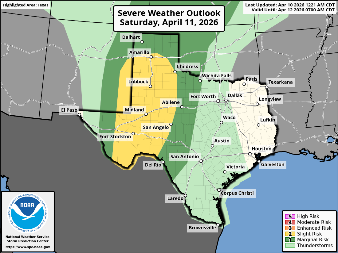
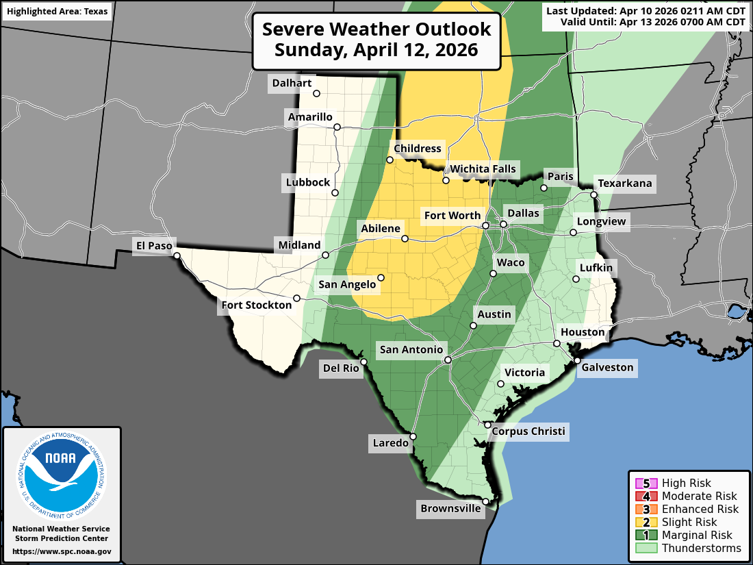
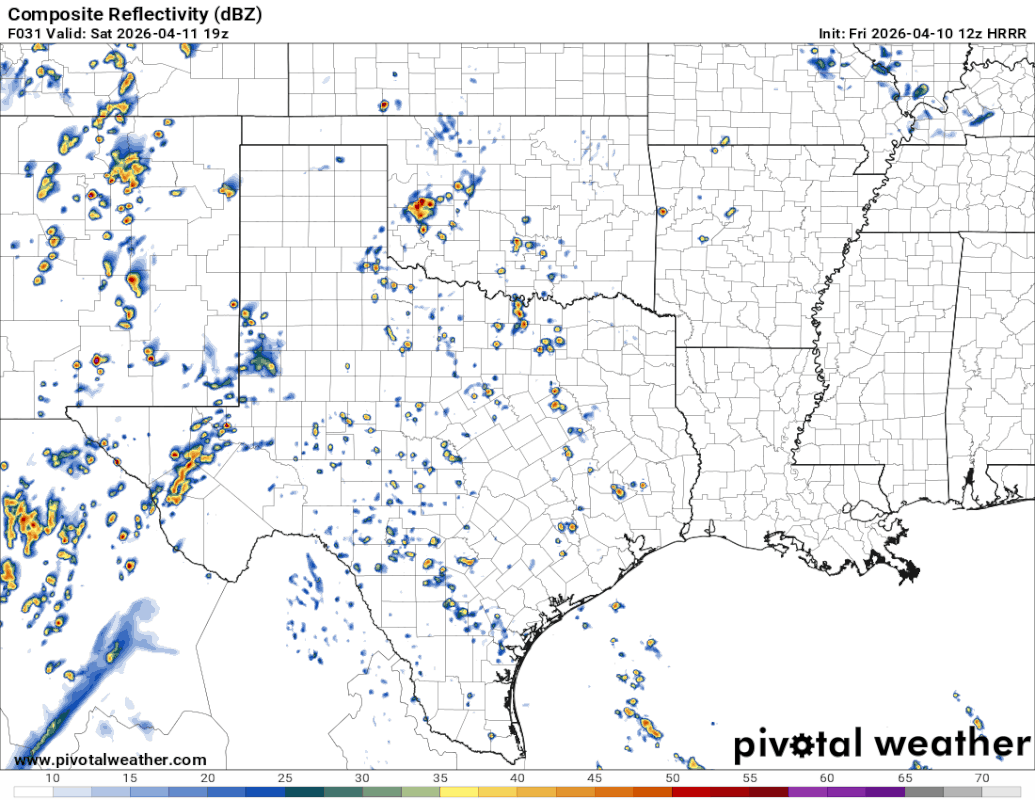
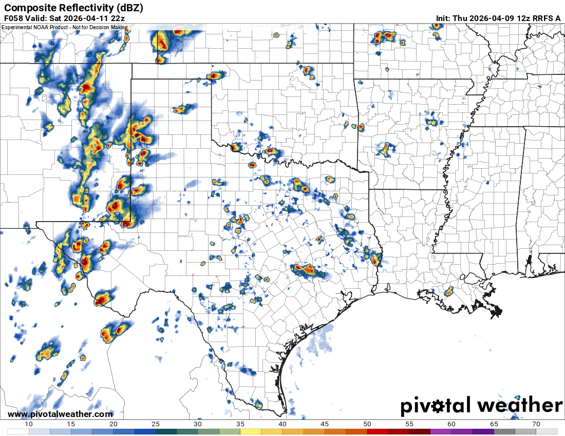
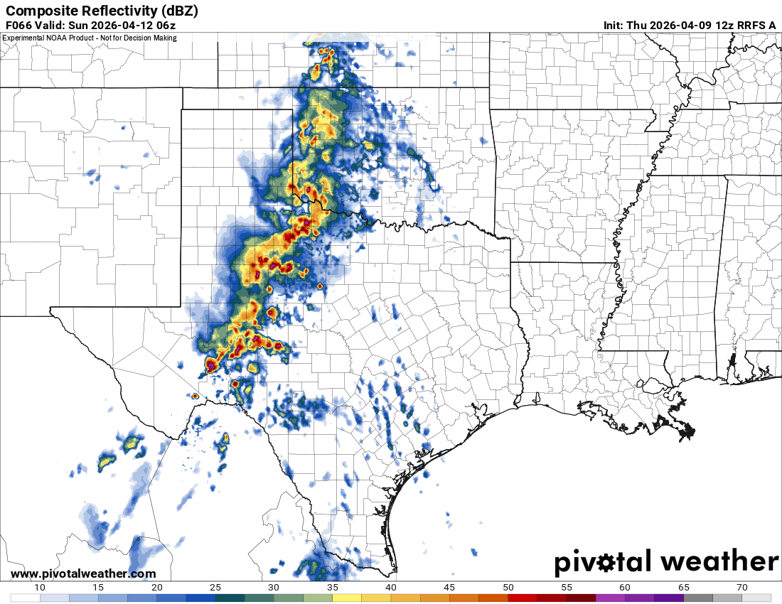
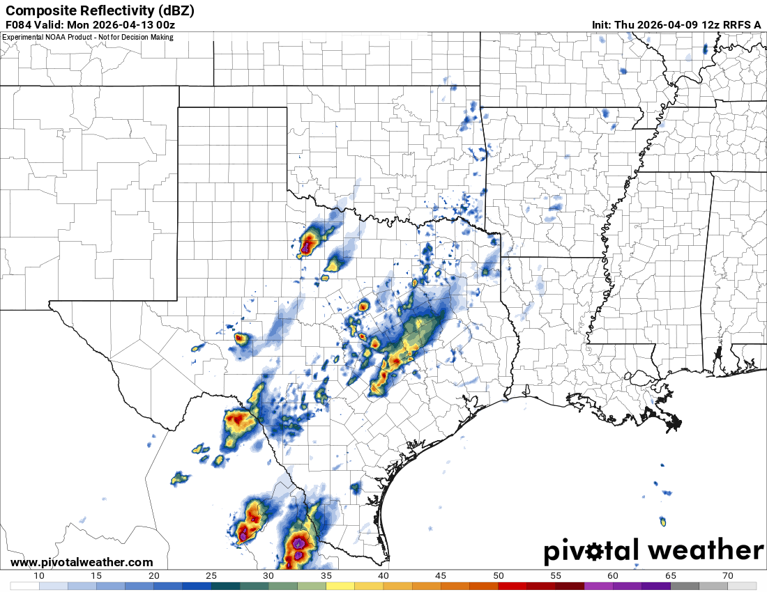
wxman22 wrote:Saturday is getting into range of the CAM’s The RRFS shows supercells developing along the dryline in west Texas and congealing into a MCS overnight. Storms move out fast enough for the atmosphere to recover by Sunday evening. And supercells start to develop again at the end of the run Sunday.
https://i.postimg.cc/rwT0GGc2/IMG_0748.png
https://i.postimg.cc/MK6Xv6YJ/IMG-0750.png
https://i.postimg.cc/g0T3KwNH/IMG-0749.png


HockeyTx82 wrote:wxman22 wrote:Saturday is getting into range of the CAM’s The RRFS shows supercells developing along the dryline in west Texas and congealing into a MCS overnight. Storms move out fast enough for the atmosphere to recover by Sunday evening. And supercells start to develop again at the end of the run Sunday.
https://i.postimg.cc/rwT0GGc2/IMG_0748.png
https://i.postimg.cc/MK6Xv6YJ/IMG-0750.png
https://i.postimg.cc/g0T3KwNH/IMG-0749.png
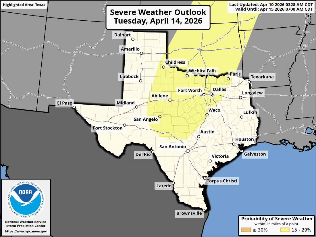
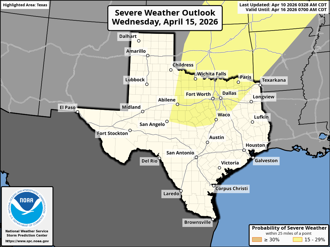
Overall how does this sound from a safety standpoint.
I've got some camping plans around Bridgeport Friday-Sunday early morning. Think we will be okay? I don't mind the rain, just want to avoid the bad stuff.

Kirby68 wrote:Iceresistance wrote:Well, we're in for an extremely long month
https://s13.gifyu.com/images/bq9ZR.gif
https://s13.gifyu.com/images/bq9ZR.gif
What does this mean?

Iceresistance wrote:Kirby68 wrote:Iceresistance wrote:Well, we're in for an extremely long month
https://s13.gifyu.com/images/bq9ZR.gif
https://s13.gifyu.com/images/bq9ZR.gif
What does this mean?
Prolonged -PNA pattern showing Eastern Ridge, extended severe
sequence possible
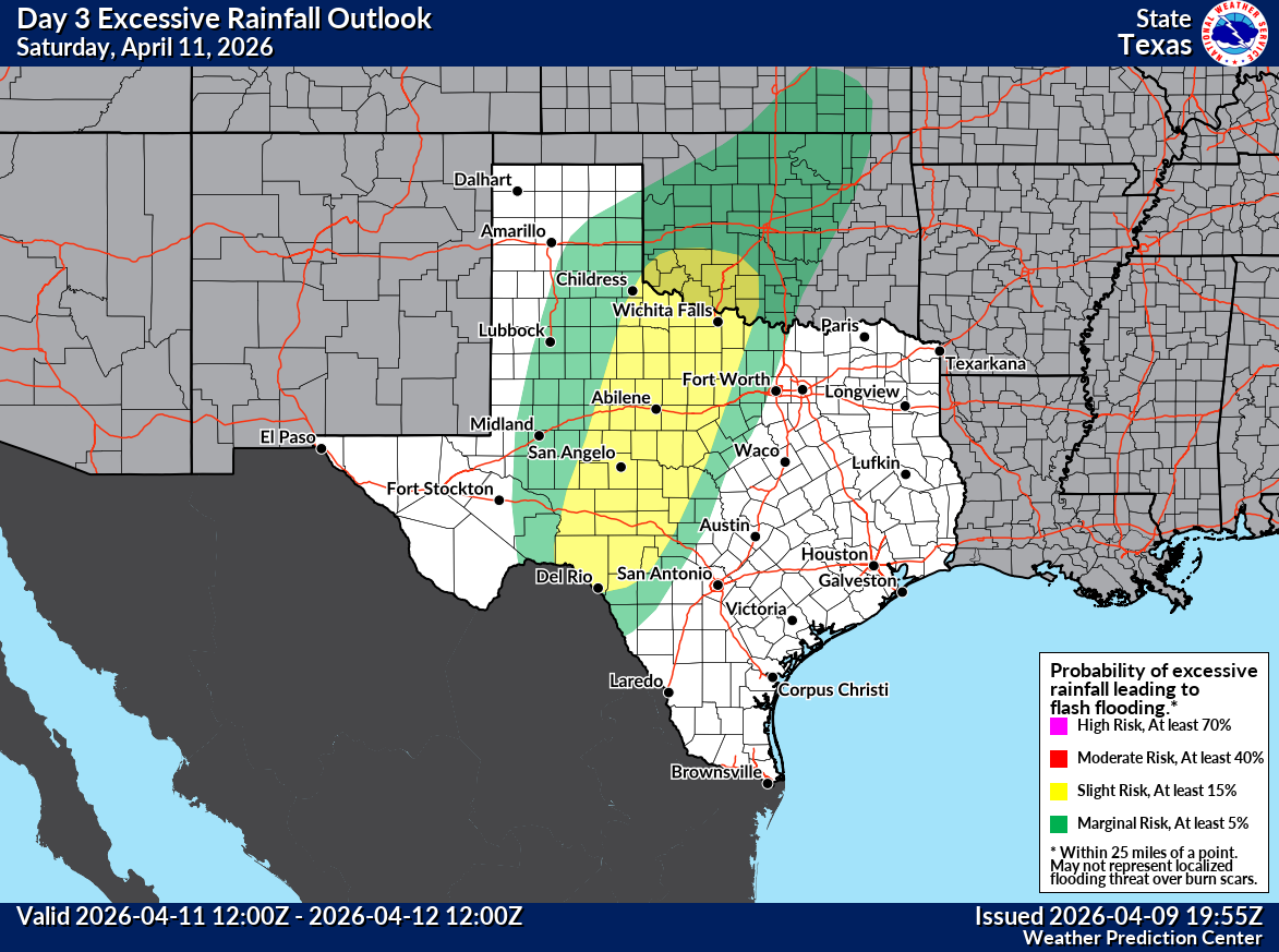
Excessive Rainfall Discussion
NWS Weather Prediction Center College Park MD
838 PM EDT Thu Apr 9 2026
Day 3
Valid 12Z Sat Apr 11 2026 - 12Z Sun Apr 12 2026
...THERE IS A SLIGHT RISK OF EXCESSIVE RAINFALL ACROSS PORTIONS OF
THE SOUTHERN PLAINS...
20z Update: Upgraded to a Slight Risk across West Texas into the
Red River Valley.
An axis of above average PWATS is expected to move across the
Southern and Central Plains on Saturday. Upper dynamics will
support ascent ahead of a longwave trough entering the West Coast,
as well as a shortwave trough traversing the High Plains. As
ridging builds in across the east, this will also promote strong
southerly flow and a low level jet over the Southern Plains and
Texas to advect moisture and instability in the area. At the
surface, a dry line across West Texas will help serve as an
initiating mechanism for convection. The QPF footprint in the
afternoon cycle has a signal for 2-4 inches possible from the
Concho Valley in West Texas to the Red River Valley in southern
Oklahoma. Rainfall rates could also be as high as an inch or two
per hour with organized convection likely as noted with SPC's
Slight Risk across the region. A Slight Risk for Excessive Rainfall
was introduced from West Texas to the Red River Valley on Saturday
for the potential of scattered flash flooding.
Wilder/Oravec
Brent wrote:If I see one more person bring up 2011 I'm gonna snap
TomballEd wrote:Nothing organzed but 3 km NAM and HRRR at 12Z see scattered showers and storms in whatever we call near and S of I-10 between San Antonio and Houston. Very scattered but some lucky people will get two inches or more on both models. Most won't.
I'm not sure what the area W of El Campo and around Shiner is called. Pretty sure there is no SE Central Texas. I could be wrong.

Return to “USA & Caribbean Weather”
Users browsing this forum: Google [Bot], HockeyTx82, rwfromkansas, wxman22 and 160 guests


