ATL: Tropical Depression Fay
Moderator: S2k Moderators
-
Stratusxpeye

- Category 2

- Posts: 686
- Joined: Tue Jun 07, 2005 10:40 am
- Location: Tampa, Florida
- Contact:

cpdaman, in theory it could slow right down and still have displaced convection because the problem is not foward speed its the fact its getting sheared by the ULL to its west, besides the simple fact is the LC is still partly exposed and until that gets resolved I doubt this is going to strengthen much if at all.
0 likes
Re: ATL: Tropical Storm Fay South of Cuba
A small core will be easier to rev up over the GOM.
0 likes
-
ConvergenceZone
.gif)
- Category 5

- Posts: 5241
- Joined: Fri Jul 29, 2005 1:40 am
- Location: Northern California
Re: ATL: Tropical Storm Fay South of Cuba
It's been about 24 hours since I've checked on Fay, not much change as I expected...However, since we are getting closer to landfall, I would reallly pay attention the models now as the margin for error is diminishing. I'm taking this "west" movement more seriously then I would if it happened yesterday or beyond...They will probably adjust the track on the next update....As Gator said, this can be much stronger if it lands further up the coast....
0 likes
-
DESTRUCTION5

- Category 5
- Posts: 4430
- Age: 44
- Joined: Wed Sep 03, 2003 11:25 am
- Location: Stuart, FL
Re: Re:
cpdaman wrote:KWT wrote:Doubt this strengthens much in the enxt 24hrs to be honest, shear thats is present doesn't ease off and if anything may increase a touch if it goes further west towards the ULL. EVentually though a westerly track is a good thing for Fay as it may well get over much better set-up again...
I think thats why some models really strengthen Fay past 36hrs as long as its still over water.
See nothing to suggest this will be a hurricane before Cuba, its going to have to form an inner core now for that to happen and shear won't allow it to happen.
well i see a blow up of convection very close to the center, and to the SE, her forward motion needs to slow a bit, and then we could see some RI imo
KWT have you looked at the ramdis loop it shows the blow up quite nicely?
http://hadar.cira.colostate.edu/ramsdis ... ive_0.html
however it may be possible that the LLC we are watching is a big eddy and that she may reform further SE? i don't know but i have to take a test now so , thankfully i can get away from the site for a few hours, and come back and stop guessing and have some facts.
Looks like the W motion was an illusion like Wxman said..Looks WNW..
0 likes
-
Shockwave
- Tropical Storm

- Posts: 167
- Joined: Fri Jul 25, 2008 7:33 am
- Location: Lafayette, TN
- Contact:
Re: Re:
cpdaman wrote:KWT wrote:Doubt this strengthens much in the enxt 24hrs to be honest, shear thats is present doesn't ease off and if anything may increase a touch if it goes further west towards the ULL. EVentually though a westerly track is a good thing for Fay as it may well get over much better set-up again...
I think thats why some models really strengthen Fay past 36hrs as long as its still over water.
See nothing to suggest this will be a hurricane before Cuba, its going to have to form an inner core now for that to happen and shear won't allow it to happen.
well i see a blow up of convection very close to the center, and to the SE, her forward motion needs to slow a bit, and then we could see some RI imo
KWT have you looked at the ramdis loop it shows the blow up quite nicely?
http://hadar.cira.colostate.edu/ramsdis ... ive_0.html
however it may be possible that the LLC we are watching is a big eddy and that she may reform further SE? i don't know but i have to take a test now so , thankfully i can get away from the site for a few hours, and come back and stop guessing and have some facts.
I hope we have some facts. This system is giving me a headache. Good luck on the test. If that test doesn't give you a test...Fay will be here waiting on your return!
0 likes
Re: ATL: Tropical Storm Fay South of Cuba
Looks like the W motion was an illusion like Wxman said..Looks WNW..
Center looks south of trop points on satellite.
0 likes

Well right now its moving just north of west, we've had recon confirm that from the last advisory estimate to the recon pass close to the center though I do think in the last hour its gone back to a more WNW again. Seems like its wobbling WNW, southern side of WNW mind you.
Convection still looks nicely sheared at the moment.
Convection still looks nicely sheared at the moment.
0 likes

Re: ATL: Tropical Storm Fay South of Cuba
Some outer bands are going to effect florida soon it looks like. Check the radar.
0 likes
-
Jason_B
Re: ATL: Tropical Storm Fay South of Cuba
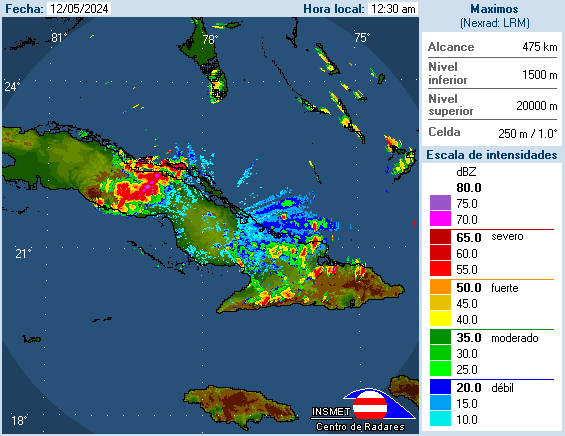
EDIT: here's the Camaguey radar.
Last edited by Jason_B on Sun Aug 17, 2008 1:41 pm, edited 1 time in total.
0 likes
-
canetracker

- S2K Supporter

- Posts: 751
- Age: 63
- Joined: Wed Jul 27, 2005 8:49 pm
- Location: Suburbia New Orleans...Harahan, LA
Re: ATL: Tropical Storm Fay South of Cuba
Sanibel wrote:Looks like the W motion was an illusion like Wxman said..Looks WNW..
Center looks south of trop points on satellite.
Basing the center fix on last VDM, I noticed that too Sanibel.
0 likes
Re: ATL: Tropical Storm Fay South of Cuba
You can see the lower half of a yin yang "S" in the SE quadrant convection which is a ULL right into the system on the west. That is fatal as far as intensification and development.
Tomorrow is when Fay gets interesting when that ULL pulls off and it heads N.
Tomorrow is when Fay gets interesting when that ULL pulls off and it heads N.
Last edited by Sanibel on Sun Aug 17, 2008 1:39 pm, edited 1 time in total.
0 likes
Re: ATL: Tropical Storm Fay South of Cuba
Jason_B wrote:
unfortunately that radar site has not been updating for 90 min, go to the radar SE of there, and you can see the center turning, also the squalls are much closer to key's now
perhaps the center is still back at 79.7 per Camaguey radar
0 likes
-
cycloneye

- Admin

- Posts: 149412
- Age: 69
- Joined: Thu Oct 10, 2002 10:54 am
- Location: San Juan, Puerto Rico
Re: ATL: Tropical Storm Fay South of Cuba
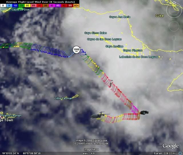
The 18:00 UTC best track:
Still at 45 kts:
AL, 06, 2008081718, , BEST, 0, 208N, 798W, 45, 1006, TS, 34, NEQ, 90, 90, 0, 0,
Still at 45 kts:
AL, 06, 2008081718, , BEST, 0, 208N, 798W, 45, 1006, TS, 34, NEQ, 90, 90, 0, 0,
0 likes
-
HURAKAN

- Professional-Met

- Posts: 46084
- Age: 39
- Joined: Thu May 20, 2004 4:34 pm
- Location: Key West, FL
- Contact:
Re:
KWT wrote:Well 43kts at least supports 35kts anyway so we do know that Fay is still a TS despite a pretty unimpressive presentation at the moment.
And the ob. was not inside the deep convection. Therefore, 45 knots wind is possible.
0 likes
-
gatorcane

- S2K Supporter
- Posts: 23708
- Age: 48
- Joined: Sun Mar 13, 2005 3:54 pm
- Location: Boca Raton, FL
deep convection finally appears to be on the increase...just east of the center and trying to wrap around it...
could it be the first sign of intensification (the long-waited)?
I think it could be.

could it be the first sign of intensification (the long-waited)?
I think it could be.
Last edited by gatorcane on Sun Aug 17, 2008 1:43 pm, edited 2 times in total.
0 likes
-
MusicCityMan

- Category 1

- Posts: 483
- Joined: Sat Feb 17, 2007 10:57 pm
- Location: Somewhere in Central Florida
-
Blown Away

- S2K Supporter
- Posts: 10253
- Joined: Wed May 26, 2004 6:17 am
Re: ATL: Tropical Storm Fay South of Cuba
Fay is moving WNW right along the NHC forecast points, I don't see any additional W deviation yet.
http://www.ssd.noaa.gov/goes/flt/t1/loop-vis.html
http://www.ssd.noaa.gov/goes/flt/t1/loop-vis.html
0 likes
Who is online
Users browsing this forum: No registered users and 10 guests