Texas Winter 2013-2014

Winter Weather Discussion

Moderator: S2k Moderators

Forum rules

The posts in this forum are NOT official forecast and should not be used as such. They are just the opinion of the poster and may or may not be backed by sound meteorological data. They are NOT endorsed by any professional institution or STORM2K.

Help Support Storm2K
Message
Author
katheria
Category 1
Category 1
Posts: 338
Joined: Mon Dec 28, 2009 10:51 pm
Location: Garland TX

Re: Texas Winter 2013-2014

#6561 Postby katheria » Sat Feb 01, 2014 1:06 pm

at this point what happens just happens for tomorrow...

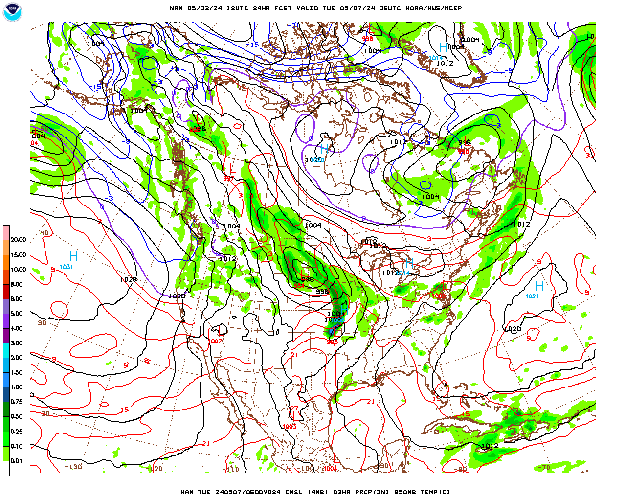
we have been surprised before :D

im sure everyone remembers this:

HAZARDOUS WEATHER OUTLOOK
NATIONAL WEATHER SERVICE FORT WORTH TX
337 PM CST WED FEB 10 2010

DAY ONE...TONIGHT.
A WINTER WEATHER ADVISORY IS IN EFFECT STARTING LATE TONIGHT
ALONG AND NORTH OF A LAMPASAS TO WACO TO PALESTINE LINE. A
MIXTURE OF RAIN AND SNOW IS EXPECTED TO DEVELOP OVERNIGHT. MOST
LOCATIONS WILL BE ABOVE FREEZING...BUT SOME SLUSHY OR ICY SPOTS
MAY DEVELOP BEFORE SUNRISE...ESPECIALLY NORTHWEST OF A
GOLDTHWAITE...DALLAS... PARIS LINE.

.DAYS TWO THROUGH SEVEN...THURSDAY THROUGH TUESDAY. NO
AS AN UPPER LEVEL STORM APPROACHES...WE WILL SEE RAIN AND SNOW
EXPAND ACROSS NORTH TEXAS THURSDAY. SNOW ACCUMULATIONS OF 1 TO
3 INCHES ARE EXPECTED ALONG AND NORTH OF A LAMPASAS...WACO...
PALESTINE LINE. WITH TEMPERATURES NEAR TO SEVERAL DEGREES ABOVE
FREEZING...THE GREATEST SNOW ACCUMULATIONS WILL BE ON GRASSY
SURFACES. SOME SLICK SPOTS ARE EXPECTED TO DEVELOP FRIDAY...
ESPECIALLY ON BRIDGES...OVERPASSES AND OTHER ELEVATED SURFACES.

.SPOTTER INFORMATION STATEMENT...
SPOTTER ACTIVATION IS NOT EXPECTED AT THIS TIME.

:lol:

i wound up with 16.5" at my house....


surprises with the weather happen all the time, even with our wonderful forecast models.

time to watch the outside world :D
0 likes   
just a guess.......take everything i say with a grain of salt.......check your local NWS for forecast information

User avatar
TheProfessor
Professional-Met
Professional-Met
Posts: 3506
Age: 29
Joined: Tue Dec 03, 2013 10:56 am
Location: Wichita, Kansas

#6562 Postby TheProfessor » Sat Feb 01, 2014 2:17 pm

Any news on the 12z Euro?

Edit: I wonder why the forum is so slow today?
0 likes   
An alumnus of The Ohio State University.

Your local National Weather Service office is your best source for weather information.

User avatar
SouthernMet
Category 3
Category 3
Posts: 857
Joined: Sun Aug 29, 2010 8:23 pm
Location: fort worth, tx

Re: Texas Winter 2013-2014

#6563 Postby SouthernMet » Sat Feb 01, 2014 2:52 pm

nws norman upgrades to Winter Storm Warning for southern oklahoma & nw tx..
NATIONAL WEATHER SERVICE NORMAN OK
126 PM CST SAT FEB 1 2014

OKZ032-036>048-050>052-TXZ083>090-020330-
/O.UPG.KOUN.WS.A.0001.140202T0000Z-140203T0000Z/
/O.NEW.KOUN.WS.W.0001.140202T0300Z-140203T0000Z/
HUGHES-JACKSON-TILLMAN-COMANCHE-STEPHENS-GARVIN-MURRAY-PONTOTOC-
COAL-COTTON-JEFFERSON-CARTER-JOHNSTON-ATOKA-LOVE-MARSHALL-BRYAN-
HARDEMAN-FOARD-WILBARGER-WICHITA-KNOX-BAYLOR-ARCHER-CLAY-
INCLUDING THE CITIES OF...HOLDENVILLE...ALTUS...FREDERICK...
LAWTON...DUNCAN...PAULS VALLEY...SULPHUR...ADA...COALGATE...
WALTERS...WAURIKA...ARDMORE...TISHOMINGO...ATOKA...MARIETTA...
MADILL...DURANT...QUANAH...CHILLICOTHE...CROWELL...VERNON...
WICHITA FALLS...MUNDAY...KNOX CITY...SEYMOUR...ARCHER CITY...
HOLLIDAY...LAKESIDE CITY...HENRIETTA
126 PM CST SAT FEB 1 2014

...WINTER STORM WARNING IN EFFECT FROM 9 PM THIS EVENING TO 6 PM
CST SUNDAY...

THE WINTER STORM WATCH IS NO LONGER IN EFFECT.

* TIMING: TONIGHT AND SUNDAY...WITH THE HEAVIEST PRECIPITATION
BETWEEN 3 AM AND 3 PM.

* MAIN IMPACT: A MIX OF SNOW...SLEET...FREEZING RAIN...AND RAIN
WILL DEVELOP TONIGHT...THEN SWITCH OVER TO SNOW WEST TO EAST.
PRECIPITATION WILL END WEST TO EAST ON SUNDAY. TOTAL SNOW AND
SLEET ACCUMULATIONS OF 2 TO 5 INCHES WITH LOCALLY HEAVIER
AMOUNTS ARE LIKELY. TOTAL ICE ACCUMULATIONS UP TO 0.25 INCH ARE
ALSO LIKELY MAINLY SOUTHEAST OF A WICHITA FALLS TO ADA LINE. ICE
ACCUMULATIONS AROUND DURANT AND ATOKA MAY EXCEED 0.25 INCH
SUNDAY AND NECESSITATE A FURTHER WARNING.


* OTHER IMPACTS: SNOW...SLEET...AND ICE ACCUMULATIONS WILL MAKE
TRAVEL SLICK AND HAZARDOUS TONIGHT INTO SUNDAY. MOTORISTS
SHOULD USE EXTRA CAUTION.

PRECAUTIONARY/PREPAREDNESS ACTIONS...

KEEP UP WITH THE LATEST WEATHER INFORMATION...ESPECIALLY IF YOU
PLAN TO TRAVEL.
0 likes   
Nothing that SouthernMet posts, is an official forecast,nor does it reflect views of STORM2K.. SouthernMet is just adding to the great discussions on STORM2K.. Refer to NWS for official forecasts.

User avatar
TheProfessor
Professional-Met
Professional-Met
Posts: 3506
Age: 29
Joined: Tue Dec 03, 2013 10:56 am
Location: Wichita, Kansas

#6564 Postby TheProfessor » Sat Feb 01, 2014 2:53 pm

SREF continues to increase are qpf. it's mean is now at .4 inches. over a 1/3 of the ensembles have us receiving at least .5 inches.
0 likes   
An alumnus of The Ohio State University.

Your local National Weather Service office is your best source for weather information.

User avatar
SouthernMet
Category 3
Category 3
Posts: 857
Joined: Sun Aug 29, 2010 8:23 pm
Location: fort worth, tx

Re:

#6565 Postby SouthernMet » Sat Feb 01, 2014 2:55 pm

TheProfessor wrote: I wonder why the forum is so slow today?


Wondering the same thing.. Alot to talk about, wish Orangeblood would chime in.
0 likes   
Nothing that SouthernMet posts, is an official forecast,nor does it reflect views of STORM2K.. SouthernMet is just adding to the great discussions on STORM2K.. Refer to NWS for official forecasts.

BrokenGlassRepublicn
Category 1
Category 1
Posts: 483
Joined: Sun Nov 20, 2011 8:07 pm
Location: Richardson, Texas

Re: Texas Winter 2013-2014

#6566 Postby BrokenGlassRepublicn » Sat Feb 01, 2014 3:05 pm

I am in New Orleans for the day and the weather is absolutely perfect. Not looking forward to the drive back to DFW tomorrow.
0 likes   

User avatar
SouthernMet
Category 3
Category 3
Posts: 857
Joined: Sun Aug 29, 2010 8:23 pm
Location: fort worth, tx

Re: Texas Winter 2013-2014

#6567 Postby SouthernMet » Sat Feb 01, 2014 3:14 pm

North Texans need to pay really close attention to the HRRR, much wetter & further south. 15 hours out has very heavy precip out in west texas but MUCH further south than expected. Surprise surprise..(as someone pointed out sref ensembles also wetter) Plot thickens.
0 likes   
Nothing that SouthernMet posts, is an official forecast,nor does it reflect views of STORM2K.. SouthernMet is just adding to the great discussions on STORM2K.. Refer to NWS for official forecasts.

User avatar
gboudx
S2K Supporter
S2K Supporter
Posts: 4080
Joined: Thu Sep 04, 2003 1:39 pm
Location: Rockwall, Tx but from Harvey, La

#6568 Postby gboudx » Sat Feb 01, 2014 3:21 pm

It's probably slow because it's the weekend and people have things to do. I just got a WWA txt for Rockwall county with WSW further west.
0 likes   

User avatar
SouthernMet
Category 3
Category 3
Posts: 857
Joined: Sun Aug 29, 2010 8:23 pm
Location: fort worth, tx

Re: Texas Winter 2013-2014

#6569 Postby SouthernMet » Sat Feb 01, 2014 3:31 pm

nws fort worth adds - Jack, Montague, Cooke, Young & Stephens counties to the Winter Storm Warning for 2-4" of snow on top of a glazing of ice.

edit : dfw also now under a wwa
0 likes   
Nothing that SouthernMet posts, is an official forecast,nor does it reflect views of STORM2K.. SouthernMet is just adding to the great discussions on STORM2K.. Refer to NWS for official forecasts.

User avatar
SouthernMet
Category 3
Category 3
Posts: 857
Joined: Sun Aug 29, 2010 8:23 pm
Location: fort worth, tx

Re: Texas Winter 2013-2014

#6570 Postby SouthernMet » Sat Feb 01, 2014 3:35 pm

westplexers & red river counties need to really watch this imo
0 likes   
Nothing that SouthernMet posts, is an official forecast,nor does it reflect views of STORM2K.. SouthernMet is just adding to the great discussions on STORM2K.. Refer to NWS for official forecasts.

gpsnowman
S2K Supporter
S2K Supporter
Posts: 3214
Joined: Fri Jan 07, 2011 10:35 am
Location: Grand Prairie Tx

#6571 Postby gpsnowman » Sat Feb 01, 2014 3:43 pm

If winter does pay us a visit, this board will light up regardless of the Super Bowl. I know me, if it is snowing the Neilson ratings for the snow will be higher than the game.
It is going to be very cool smoking ribs tomorrow in the sleet/snow. Not cool if a cold rain.
0 likes   

User avatar
TheProfessor
Professional-Met
Professional-Met
Posts: 3506
Age: 29
Joined: Tue Dec 03, 2013 10:56 am
Location: Wichita, Kansas

#6572 Postby TheProfessor » Sat Feb 01, 2014 3:49 pm

I'm thinking if the models trend colder and the short term models continue to trend wetter than FWD might need to extend that WSR to Wise, Denton, and Collin counties.
0 likes   
An alumnus of The Ohio State University.

Your local National Weather Service office is your best source for weather information.

weatherdude1108
Category 5
Category 5
Posts: 4228
Joined: Tue Dec 13, 2011 1:04 pm
Location: Northwest Austin/Cedar Park, TX

Re: Texas Winter 2013-2014

#6573 Postby weatherdude1108 » Sat Feb 01, 2014 3:55 pm

wxman57 wrote:
TheProfessor wrote:
wxman57 wrote:12Z GFS has just a little freezing rain in the Dallas-Ft. Worth area with sleet to the NW and snow up along the Red River northward into OK. This airmass is not that cold compared to earlier this week. I don't think you'll get any snow in the D-FW area this weekend.


Why must you always ruin the fun? :crying:


Sorry. I think you'll get a foot or two of snow in north Texas tomorrow.


:hehe:
0 likes   

User avatar
TrekkerCC
S2K Supporter
S2K Supporter
Posts: 263
Joined: Sat Sep 06, 2003 10:19 pm
Location: North Central Texas (Dallas Area)

Re: Texas Winter 2013-2014

#6574 Postby TrekkerCC » Sat Feb 01, 2014 4:06 pm

NWS FWD office has also posted a Winter Storm Warning and a Winter Weather Advisory for numerous counties (basically metroplex and NW) in their CWA.

Snippets of the Winter Storm Warning and Winter Weather Advisory below

NWS Ft Worth Office wrote:Winter Storm Warning
URGENT - WINTER WEATHER MESSAGE
NATIONAL WEATHER SERVICE FORT WORTH TX
218 PM CST SAT FEB 1 2014

TXZ091-092-100-101-115-020600-
/O.NEW.KFWD.WS.W.0001.140202T1200Z-140203T0300Z/
MONTAGUE-COOKE-YOUNG-JACK-STEPHENS-
INCLUDING THE CITIES OF...BOWIE...NOCONA...GAINESVILLE...GRAHAM...
OLNEY...JACKSBORO...BRECKENRIDGE
218 PM CST SAT FEB 1 2014

...WINTER STORM WARNING IN EFFECT FROM 6 AM TO 9 PM CST SUNDAY...

THE NATIONAL WEATHER SERVICE IN FORT WORTH HAS ISSUED A WINTER
STORM WARNING FOR SNOW...SLEET...AND SOME ICE ACCUMULATION...WHICH IS
IN EFFECT FROM 6 AM TO 9 PM CST SUNDAY.

* TIMING...LIGHT FREEZING RAIN WILL BEGIN EARLY SUNDAY MORNING AND
GRADUALLY INCREASE IN INTENSITY THROUGH LATE MORNING. A
TRANSITION TO SLEET AND SNOW IS EXPECTED BY AFTERNOON WITH
PRECIPITATION COMING TO AN END DURING THE EVENING.


and

NWS Ft Worth Office wrote:URGENT - WINTER WEATHER MESSAGE
NATIONAL WEATHER SERVICE FORT WORTH TX
218 PM CST SAT FEB 1 2014

TXZ093-094-102>104-116>120-129>131-141-020600-
/O.NEW.KFWD.WW.Y.0003.140202T1200Z-140203T0300Z/
GRAYSON-FANNIN-WISE-DENTON-COLLIN-PALO PINTO-PARKER-TARRANT-
DALLAS-ROCKWALL-EASTLAND-ERATH-HOOD-COMANCHE-
INCLUDING THE CITIES OF...SHERMAN...DENISON...BONHAM...DECATUR...
BRIDGEPORT...DENTON...LEWISVILLE...FLOWER MOUND...THE COLONY...
PLANO...MINERAL WELLS...WEATHERFORD...BRIAR...FORT WORTH...
ARLINGTON...DALLAS...ROCKWALL...CISCO...EASTLAND...RANGER...
GORMAN...STEPHENVILLE...DUBLIN...GRANBURY...OAK TRAIL SHORES...
COMANCHE...DE LEON
218 PM CST SAT FEB 1 2014

...WINTER WEATHER ADVISORY IN EFFECT FROM 6 AM TO 9 PM CST
SUNDAY...

THE NATIONAL WEATHER SERVICE IN FORT WORTH HAS ISSUED A WINTER
WEATHER ADVISORY FOR LIGHT ICE ACCUMULATIONS...WHICH IS IN EFFECT
FROM 6 AM TO 9 PM CST SUNDAY.

* TIMING...LIGHT FREEZING RAIN WILL DEVELOP ACROSS THE ADVISORY
AREA EARLY SUNDAY MORNING AND INCREASE IN INTENSITY THROUGH
AFTERNOON. SOME SLEET OR SNOW MAY MIX IN THROUGH THE LATE
AFTERNOON HOURS.


So it begins....
0 likes   
Storm2K Forecast Disclaimer:

This post is NOT AN OFFICIAL FORECAST and should not be used as such. It is just the opinion of the poster and may or may not be backed by sound meteorological data. It is NOT endorsed by any professional institution including storm2k.org. For Official Information please refer to the NHC and NWS products.

User avatar
iorange55
Category 5
Category 5
Posts: 2388
Joined: Thu Nov 13, 2008 9:47 pm
Location: Big D

Re: Texas Winter 2013-2014

#6575 Postby iorange55 » Sat Feb 01, 2014 4:09 pm

Gotta love the NAM...

Image
0 likes   

User avatar
dhweather
S2K Supporter
S2K Supporter
Posts: 6199
Joined: Sat Aug 14, 2004 9:29 pm
Location: Heath, TX
Contact:

Re: Texas Winter 2013-2014

#6576 Postby dhweather » Sat Feb 01, 2014 4:12 pm

Image
0 likes   
The above post and any post by dhweather is NOT an official forecast and should not be used as such. It is just the opinion of the poster and may or may not be backed by sound meteorological data. It is NOT endorsed by any professional institution including storm2k.org. For official information, please refer to NWS products.

User avatar
SouthernMet
Category 3
Category 3
Posts: 857
Joined: Sun Aug 29, 2010 8:23 pm
Location: fort worth, tx

Re: Texas Winter 2013-2014

#6577 Postby SouthernMet » Sat Feb 01, 2014 4:24 pm

nws san angelo on board.. issues Winter Storm Warning for Throckmorton, Fisher, Haskell, Jones & Shackelford counties (along & north of i-20) and wwa for Big Spring, Brownwood, & San Angelo.

edit : for those that follow steve mccauley he has the hardest hit areas between w falls & denton into far southern ok this goes for snow & ice.(similar to christmas eve 09)
Last edited by SouthernMet on Sat Feb 01, 2014 4:33 pm, edited 1 time in total.
0 likes   
Nothing that SouthernMet posts, is an official forecast,nor does it reflect views of STORM2K.. SouthernMet is just adding to the great discussions on STORM2K.. Refer to NWS for official forecasts.

User avatar
iorange55
Category 5
Category 5
Posts: 2388
Joined: Thu Nov 13, 2008 9:47 pm
Location: Big D

Re: Texas Winter 2013-2014

#6578 Postby iorange55 » Sat Feb 01, 2014 4:26 pm

DFW NWS Discussion...

THE WINTRY MIX WILL
GEAR UP OUT WEST OVERNIGHT AND SPREAD INTO THE NORTHWEST COUNTIES
EARLY SUNDAY MORNING...THEN OVER THE REST OF THE CWA THROUGH
SUNSET SUNDAY. WE STILL FEEL THAT A WARM NOSE ALOFT WILL RESULT IN
LIQUID PRECIP INITIALLY...THEN TRANSITION TO MOST FREEZING RAIN AS
SURFACE TEMPS FALL TO OR BELOW FREEZING. AS THE WARM NOSE ERODES
EARLY SUNDAY MORNING...THE PRECIP WILL TRANSITION TO SLEET AND
SNOW. DUE TO THE STRONG FRONTOGENETIC SIGNATURE...THE TRANSITION
GRADIENT WILL BE TIGHT BUT SLOW MOVING WHICH SHOULD ALLOW FOR SOME
SLEET AND SNOW TO ACCUMULATE. SNOWFALL SHOULD BE 2 TO 4 INCHES IN
THE WARNING AREA AND GENERALLY A DUSTING TO NEAR 2 INCHES IN THE
ADVISORY AREA. TO ADD TO THIS EQUATION IS THE POTENTIAL FOR
SLANT-WISE CONDITIONAL INSTABILITY WHICH WOULD PRODUCE ENHANCED
PRODUCTION OF SLEET/SNOW...RESULTING IN BANDS OF HIGHER
ACCUMULATION THAT WOULD COVER ROADS MORE QUICKLY. THE
PRECIPITATION SHOULD BEGIN TO WIND DOWN WEST TO EAST BY LATE SUNDAY
AFTERNOON...BUT SOME LIGHT SNOW MAY LINGER INTO THE EVENING HOURS.


It'll be interesting to see who wins the battle. Steve McCauley's map looks a lot different went it comes to snow totals...

Image
0 likes   

User avatar
TheProfessor
Professional-Met
Professional-Met
Posts: 3506
Age: 29
Joined: Tue Dec 03, 2013 10:56 am
Location: Wichita, Kansas

#6579 Postby TheProfessor » Sat Feb 01, 2014 4:45 pm

I know we don't like to trust accuweather. But they have .33 inches of ice with 1.46inches of snow for my area.
0 likes   
An alumnus of The Ohio State University.

Your local National Weather Service office is your best source for weather information.

User avatar
Tammie
S2K Supporter
S2K Supporter
Posts: 327
Joined: Thu Dec 05, 2013 7:49 am
Location: Sherman, TX

#6580 Postby Tammie » Sat Feb 01, 2014 4:52 pm

:uarrow: Accuweather also has our temps a few degrees colder as well. That freeze line on the maps has me concerned.
0 likes   
Tammie - Sherman TX


Return to “Winter Weather”

Who is online

Users browsing this forum: No registered users and 44 guests