ATL: TROPICAL DEPRESSION ALEX - DISCUSSION
Moderator: S2k Moderators

-
HouTXmetro

- Category 5

- Posts: 3949
- Joined: Sun Jun 13, 2004 6:00 pm
- Location: District of Columbia, USA
Re: ATL: INVEST 93L - DISCUSSION
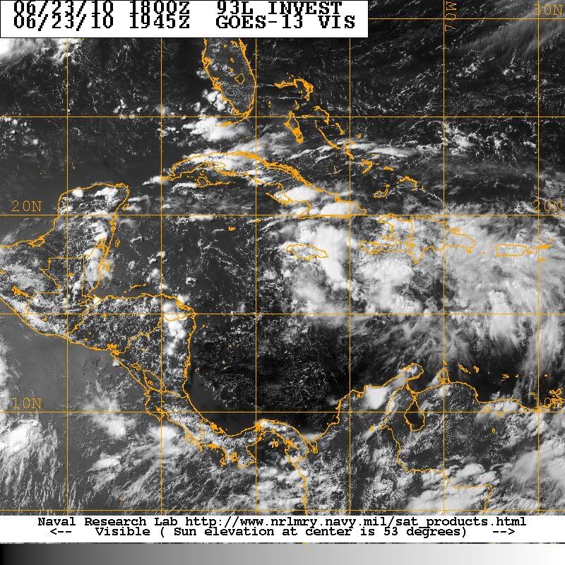
BigA wrote:I don't want to read too much into an orange circle, but it looks like the NHC thinks that if an LLCC forms, it will be within that curving band of thunderstorms from the northeast to southeast of Jamaica.
Im going to say perhaps I see something around 75W 16N....maybe?
0 likes
[Disclaimer: My Amateur Opinion, please defer to your local authorities or the NHC for Guidance.]
-
Florida1118
Re: ATL: INVEST 93L - DISCUSSION
The NHC actually said conditions still appear conductive for development. So, yes conditions now should be favorable but will get even more when in the west Caribbean
0 likes
-
Aquawind

- Category 5
- Posts: 6714
- Age: 62
- Joined: Mon Jun 16, 2003 10:41 pm
- Location: Salisbury, NC
- Contact:
Re: ATL: INVEST 93L - DISCUSSION
Ivanhater wrote:tolakram wrote:Personal Forecast Disclaimer:
The posts in this forum are NOT official forecast and should not be used as such. They are just the opinion of the poster and may or may not be backed by sound meteorological data. They are NOT endorsed by any professional institution or storm2k.org. For official information, please refer to the NHC and NWS products.
I'm going to disagree with 'looks like crap'.I believe the new center is / will form SW of Jamaica where things seem to be coming together and MIMIC-TPW shows the most turning. There's a lot of spin there, just not obvious yet on the surface. Storms currently developing over what I think will be the NE side of a new surface low. I'm wrong 95.8% of the time so ....
Lol, maybe I was a little harshGood observations though...
Exactly Ivan..I agree entirely Mark! Although your % is way better than that..lol Clear LL rotation moving off the screen imo and it could reform NE but, I like(means nothing) the LL spin more to the west.
http://www.ssd.noaa.gov/goes/flt/t1/loop-vis.html
0 likes
-
tolakram
- Admin

- Posts: 20186
- Age: 62
- Joined: Sun Aug 27, 2006 8:23 pm
- Location: Florence, KY (name is Mark)
Re: ATL: INVEST 93L - DISCUSSION
Well someone else also likes the Jamaica idea. Here's the floater from the Real Time Tropical Cyclone site: http://rammb.cira.colostate.edu/product ... r=AL932010
1K floater: http://rammb.cira.colostate.edu/product ... 211315.GIF
I think it's important to note, though, that this convection seems to be waning and the MLC area is picking up again.
1K floater: http://rammb.cira.colostate.edu/product ... 211315.GIF
I think it's important to note, though, that this convection seems to be waning and the MLC area is picking up again.
0 likes
M a r k
- - - - -
Join us in chat: Storm2K Chatroom Invite. Android and IOS apps also available.
The posts in this forum are NOT official forecasts and should not be used as such. Posts are NOT endorsed by any professional institution or STORM2K.org. For official information and forecasts, please refer to NHC and NWS products.


-
cycloneye

- Admin
- Posts: 149596
- Age: 69
- Joined: Thu Oct 10, 2002 10:54 am
- Location: San Juan, Puerto Rico
Re: ATL: INVEST 93L - DISCUSSION
Breaking News=18z position of Best Track is more north and west.
AL, 93, 2010062318, , BEST, 0, 166N, 786W, 25, 1010, WV
ftp://ftp.tpc.ncep.noaa.gov/atcf/tcweb/ ... 010.invest
AL, 93, 2010062318, , BEST, 0, 166N, 786W, 25, 1010, WV
ftp://ftp.tpc.ncep.noaa.gov/atcf/tcweb/ ... 010.invest
0 likes
Visit the Caribbean-Central America Weather Thread where you can find at first post web cams,radars
and observations from Caribbean basin members Click Here
and observations from Caribbean basin members Click Here
-
wx247

- S2K Supporter

- Posts: 14279
- Age: 42
- Joined: Wed Feb 05, 2003 10:35 pm
- Location: Monett, Missouri
- Contact:
 I see the center of circulation... oh wait, that is the MLC... Wait no, there it is...
 This has been crazy frustrating to follow.
0 likes
Personal Forecast Disclaimer:
The posts in this forum are NOT official forecast and should not be used as such. They are just the opinion of the poster and may or may not be backed by sound meteorological data. They are NOT endorsed by any professional institution or storm2k.org. For official information, please refer to the NHC and NWS products.
The posts in this forum are NOT official forecast and should not be used as such. They are just the opinion of the poster and may or may not be backed by sound meteorological data. They are NOT endorsed by any professional institution or storm2k.org. For official information, please refer to the NHC and NWS products.
-
tolakram
- Admin
- Posts: 20186
- Age: 62
- Joined: Sun Aug 27, 2006 8:23 pm
- Location: Florence, KY (name is Mark)
Re: ATL: INVEST 93L - DISCUSSION
So that is it ... at least for now.
http://wwwghcc.msfc.nasa.gov/cgi-bin/ge ... mframes=12
... and while all this has been going on shear is on the increase.

http://wwwghcc.msfc.nasa.gov/cgi-bin/ge ... mframes=12
... and while all this has been going on shear is on the increase.
0 likes
M a r k
- - - - -
Join us in chat: Storm2K Chatroom Invite. Android and IOS apps also available.
The posts in this forum are NOT official forecasts and should not be used as such. Posts are NOT endorsed by any professional institution or STORM2K.org. For official information and forecasts, please refer to NHC and NWS products.
- - - - -
Join us in chat: Storm2K Chatroom Invite. Android and IOS apps also available.
The posts in this forum are NOT official forecasts and should not be used as such. Posts are NOT endorsed by any professional institution or STORM2K.org. For official information and forecasts, please refer to NHC and NWS products.

I definitely see some swirling low clouds to the SW of Jamaica. It looks to be getting a little better defined through the loop. If it can pop some convection near/over it, maybe it will take off.
Then again, I also see convection rebuilding over the old MLC south of Haiti, so I'm just confused.
Then again, I also see convection rebuilding over the old MLC south of Haiti, so I'm just confused.
0 likes
-
CourierPR

- Category 5
- Posts: 1336
- Age: 72
- Joined: Tue Aug 31, 2004 7:53 pm
- Location: Pompano Beach, Florida
Re:
Bastardi posted today that two lows in the Caribbean will spawn the one cyclone ala typhoon formation in the Pacific.BigA wrote:I definitely see some swirling low clouds to the SW of Jamaica. It looks to be getting a little better defined through the loop. If it can pop some convection near/over it, maybe it will take off.
Then again, I also see convection rebuilding over the old MLC south of Haiti, so I'm just confused.
0 likes
-
Stormcenter
- S2K Supporter
- Posts: 6689
- Joined: Wed Sep 03, 2003 11:27 am
- Location: Houston, TX
Re:
At this time I'm not so sure this will even make it into the Central GOM. IMO
CrazyC83 wrote:With that shear map, I cannot see development happening with this until the central Gulf.
0 likes
-
Florida1118
Re: ATL: INVEST 93L - DISCUSSION
Just another waiting game. It might not even go to the GOM...We just dont know. New computer models show a hurricane in 72 hours. Then crossing the Yucatan then in the GOM and then rapid weakening. They are starting to come closer together also. Still a wide uncertainty, but less loops and sharp random turns.
0 likes
-
Stormcenter
- S2K Supporter
- Posts: 6689
- Joined: Wed Sep 03, 2003 11:27 am
- Location: Houston, TX
Below is the afternoon discussion from the NWS in New Orleans, LA. They mention a trough digging deep south with a ton of dry air and 93L.
LONG TERM...
MODEL SOLUTIONS BEGIN TO DIVERGE BEYOND THE WEEKEND. THEY ALL
AGREE THAT HIGH PRESSURE WILL BEGIN TO SHIFT EASTWARD BY MONDAY AS
AN UPPER TROUGH MOVES INTO THE GREAT LAKES REGION. THE MAIN
DIFFERENCES CONCERN THE STRENGTH OF THIS TROUGH AND HOW FAR SOUTH
IT WILL DIG AS IT APPROACHES THE EAST COAST.
MOST MODELS...INCLUDING BOTH THE GFS AND ECMWF...CURRENTLY
SUGGEST THAT THE EAST COAST TROUGH WILL DIG FAR ENOUGH SOUTH TO
PUSH A FRONT INTO THE GULF OF MEXICO TOWARD THE MIDDLE OF NEXT
WEEK. IF THIS PANS OUT...EXPECT AFTERNOON HIGHS TO REMAIN THE SAME
OR RISE A FEW DEGREES DUE TO A LACK OF CLOUD COVER. THE MAIN
DIFFERENCE WILL BE AN INFLUX OF MUCH DRIER AIR.
CONCERNING THE TROPICAL WAVE LOCATED IN THE CARIBBEAN. PER THE
LATEST TROPICAL WEATHER OUTLOOK FROM NHC...THE WAVE IS CURRENTLY
VERY DISORGANIZED AND THERE IS ONLY A 30 PERCENT CHANCE OF THE
SYSTEM BECOMING A TROPICAL DEPRESSION WITHIN THE NEXT 48 HOURS.
MODEL GUIDANCE HAS BEEN EXTREMELY INCONSISTENT IN THE HANDLING OF
THIS SYSTEM...BOTH BETWEEN THE DIFFERENT MODELS AND WITHIN EACH
MODEL/S RUN-TO-RUN SOLUTIONS. PRESENTLY...MODEL GUIDANCE IS
SHOWING A WESTWARD TREND WITH A WEAK TC MOVING ACROSS OR JUST
NORTH OF THE YUCATAN PENINSULA...THROUGH THE BAY OF CAMPECHE AND
INTO SOUTHERN TEXAS OR MEXICO LATE NEXT WEEK.
0 likes
-
srainhoutx

- S2K Supporter
- Posts: 6919
- Age: 68
- Joined: Sun Jan 14, 2007 11:34 am
- Location: Haywood County, NC
- Contact:
Re: ATL: INVEST 93L - DISCUSSION
0 likes
Carla/Alicia/Jerry(In The Eye)/Michelle/Charley/Ivan/Dennis/Katrina/Rita/Wilma/Ike/Harvey
Member: National Weather Association
Wx Infinity Forums
http://wxinfinity.com/index.php
Facebook.com/WeatherInfinity
Twitter @WeatherInfinity
Member: National Weather Association
Wx Infinity Forums
http://wxinfinity.com/index.php
Facebook.com/WeatherInfinity
Twitter @WeatherInfinity
-
StarmanHDB

- Tropical Storm

- Posts: 202
- Age: 61
- Joined: Wed Sep 02, 2009 7:59 pm
- Location: West Palm Beach, Florida
Who is online
Users browsing this forum: No registered users and 59 guests