ekal wrote:Aric Dunn wrote:cpdaman wrote:nice pic Aric
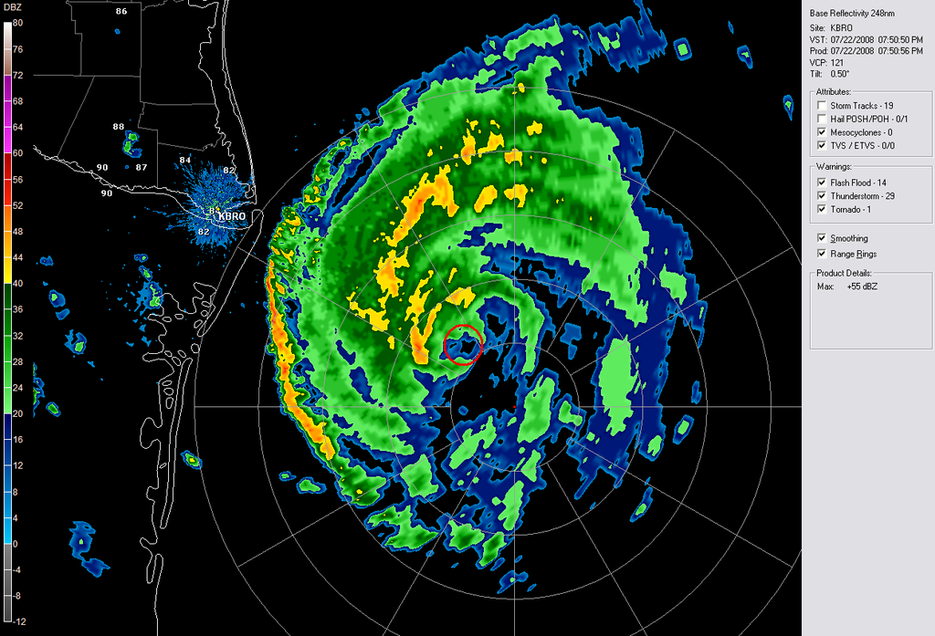
also us poor folk's radar is also seeing that dry spot on the east side of the center filling in with developing bands ..... crikey!
http://radar.weather.gov/ridge/radar.ph ... o&loop=yes
latest trend for the last half hours is interesting as the that dry slot is filling in and the core or small eye is much more defined ... with a small ring of convection beginning to take shape
That "dry slot" may actually be filled with heavy precipitation that is too far from the radar to be detected. In fact, I think those bands you see "developing" now were always present --just out of range.
its possible to a point.. but it has not moved that much on my loop so that does not hold. its barely moving over the past hour or so .. but the convection is filling ..