I'm not sure yet, but I am thinking probably not. I will most likely just let Ike come to me here in Oklahoma as a weaker storm instead of heading to the TX coast and getting stuck in that chaotic mess of evacuations and panic they are likely going to be experiencing down there in and around Houston, Galveston and the surrounding communities as the week progresses. I could always change my mind at the last minute, but at the moment there is definitely a much higher chance that I will not be chasing this one.cycloneye wrote:Extremeweatherguy wrote:If the 11pm track is correct, then this will be a very bad storm from the Texas coast all the way up through Dallas and even into Oklahoma and beyond! We could be looking at a big wind event for cities such as Houston and Victoria, followed by an extreme rainfall and possible tornado threat for Austin, Dallas and Oklahoma City. Nasty! Nasty! Nasty!
http://www.nhc.noaa.gov/storm_graphics/ ... 15W_sm.gif
This could very well be one of the worst tropical systems to affect all of the above mentioned areas in many, many years..
Are you going to chase Ike?
ATL: IKE Discussion
Moderator: S2k Moderators
-
Extremeweatherguy

- Category 5

- Posts: 11095
- Joined: Mon Oct 10, 2005 8:13 pm
- Location: Florida
Re: Re:
0 likes
-
cycloneye

- Admin

- Posts: 149320
- Age: 69
- Joined: Thu Oct 10, 2002 10:54 am
- Location: San Juan, Puerto Rico
Re: ATL IKE: Category 1 - Discussion
Attention to all:
There is a server problem,but already the administrators are on top of it trying to resolve it as soon as possible so lets be patient.Lets not post graphics while the problem is on to not make things worse.Thanks to all for your cooperation.
There is a server problem,but already the administrators are on top of it trying to resolve it as soon as possible so lets be patient.Lets not post graphics while the problem is on to not make things worse.Thanks to all for your cooperation.
0 likes

-
AZRainman

- Tropical Storm

- Posts: 146
- Joined: Fri Sep 23, 2005 12:48 pm
- Location: Sonoran Desert
- Contact:
Re: ATL IKE: Category 1 - Discussion
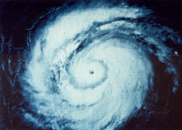
Sanibel wrote: I believe if you analyzed your September 4th shot more closely you would see that it isn't a small eye but is rather a larger surface eye partly occluded by the upper cloud tops.
I picked that example for a reason, and I presume you don't really know who I am though, so fair enough
Yes, it was a small eye in that Sept. 4th image e.g. went from 65knts to 125knts less than 12 hours.
15NM eye as of now = look at the T-index plummet.
Last edited by AZRainman on Tue Sep 09, 2008 10:42 pm, edited 3 times in total.
0 likes
-
texascanetracker

- Tropical Wave

- Posts: 8
- Age: 62
- Joined: Thu Jul 10, 2008 10:22 pm
- Location: Webster/Clear Lake, Texas
I have been following Hurricanes for many years now and have seen these fronts in September many times before and cannot believe one of them wont pull IKE nothward before he gets too far west. We are still looking at 3 days away and error is 150 miles. The fact that he is slowing down worries me.
0 likes
-
Texas Snowman

- Storm2k Moderator

- Posts: 6197
- Joined: Fri Jan 25, 2008 11:29 am
- Location: Denison, Texas
Re: ATL IKE: Category 1 - Discussion
Another thing that is setting portions of Texas up for a bad weekend - the moisture and remnants of Lowell in EPAC are going to move towards Texas it appears.
I would think that will only enhance the inland flooding threat from Ike.
I remember back in the 1980s when the remains of three EPAC storms in a row made their way into N. Texas to interact with strong frontal passages. Official rainfall in Sherman was in the order of 31 inches for the month of October that year and there was some really bad flooding.
We need rain in Texas, but Ike (and Lowell) may bring too much of a good thing.
0 likes
Re: ATL IKE: Category 1 - Discussion
Now it's going to do it again.
Interesting. I often get clobbered for suggesting hurricane personalities. Strange traits that seem to define and accompany a storm. What you are talking about is an example. One small eye RI followed by another because the hurricane shows that as a trait. I won't argue your prediction because the west track will probably allow Ike to buffer any dry air with tropical air taken up from the south and carpeted before it. The archives also show high end systems under a ridge on this track. The loop current won't hurt either.
0 likes
-
MHurricanes

- Tropical Storm
- Posts: 102
- Age: 74
- Joined: Thu Aug 14, 2008 2:05 pm
- Location: Altamonte Springs, FL
- Contact:
Re: ATL IKE: Category 1 - Discussion
Ike appears to have kicked into overdrive. Reds exploding everywhere.
- MHurricanes
- MHurricanes
0 likes
-
Stormcenter
- S2K Supporter

- Posts: 6689
- Joined: Wed Sep 03, 2003 11:27 am
- Location: Houston, TX
Re:
texascanetracker wrote:I have been following Hurricanes for many years now and have seen these fronts in September many times before and cannot believe one of them wont pull IKE nothward before he gets too far west. We are still looking at 3 days away and error is 150 miles. The fact that he is slowing down worries me.
Well it didn't happen with Rita and that was in late September.
0 likes

Re: ATL IKE: Category 1 - Discussion
MHurricanes wrote:Ike appears to have kicked into overdrive. Reds exploding everywhere.
- MHurricanes
Overdrive with Reds but snailing it speed wise.
0 likes
-
HurricaneRobert
- Category 3

- Posts: 812
- Joined: Fri May 18, 2007 9:31 pm
-
HouTXmetro

- Category 5
- Posts: 3949
- Joined: Sun Jun 13, 2004 6:00 pm
- Location: District of Columbia, USA
-
Category 5

- Category 5
- Posts: 10074
- Age: 36
- Joined: Sun Feb 11, 2007 10:00 pm
- Location: New Brunswick, NJ
- Contact:
Re: ATL IKE: Category 1 - Discussion
SoupBone wrote:MHurricanes wrote:Ike appears to have kicked into overdrive. Reds exploding everywhere.
- MHurricanes
Overdrive with Reds but snailing it speed wise.
Again, 9mph is NOT a snails pace. It's not fast, but it's not a snails pace.
0 likes
-
Weatherfreak000

-
HurricaneRobert
- Category 3
- Posts: 812
- Joined: Fri May 18, 2007 9:31 pm
Re:
HouTXmetro wrote:Per the moderators previous request, the board is expiriencing problems... PLEASE STOP POSTING GRAPHICS until the problem is fixed.
Images are not hosted on the site, so what does it matter?
0 likes

-
attallaman
Re: ATL IKE: Category 1 - Discussion
I heard Cantore tonight on TWC say that Ike could possibly end up being a larger sized storm than Katrina, not a stronger storm but a larger storm, possibly 500 miles across.
0 likes

Who is online
Users browsing this forum: No registered users and 19 guests