Florida Weather
Moderator: S2k Moderators
Forum rules

The posts in this forum are NOT official forecast and should not be used as such. They are just the opinion of the poster and may or may not be backed by sound meteorological data. They are NOT endorsed by any professional institution or STORM2K.

We didnt get any rains, forget appreciable. It rained for 4 minutes last MOnday, the only "rain" in 20+ days. That is not rain! I hope you are right, because I am going to have to deep water the palms now they are showing stress. The fronds are wilting downwards. The storms just stayed inland from me. I am appx 1 mile from the GOM in New Port Richey. It usually is dry here in May, then when the rainy season begins we get drenched with too much at once. This year I will take it! 
0 likes
Re:
I looked at long range and I am not seeing any huge drenching. Where are you guys seeing this? Website? Info? Thanks...it will give me some hope.
gsytch wrote:We didnt get any rains, forget appreciable. It rained for 4 minutes last MOnday, the only "rain" in 20+ days. That is not rain! I hope you are right, because I am going to have to deep water the palms now they are showing stress. The fronds are wilting downwards. The storms just stayed inland from me. I am appx 1 mile from the GOM in New Port Richey. It usually is dry here in May, then when the rainy season begins we get drenched with too much at once. This year I will take it!
0 likes
-
northjaxpro

- S2K Supporter

- Posts: 8900
- Joined: Mon Sep 27, 2010 11:21 am
- Location: Jacksonville, FL
Hope you all are having a great holiday weekend so far! The weather has been near perfect here this weekend, with sunny, dry and cooler conditions. Currently 57.3 degrees at my locale. Feels absolutely great in late May. max temp today only in the low 80s. We need this dry period to dry thimgs out around here after a very wet month.
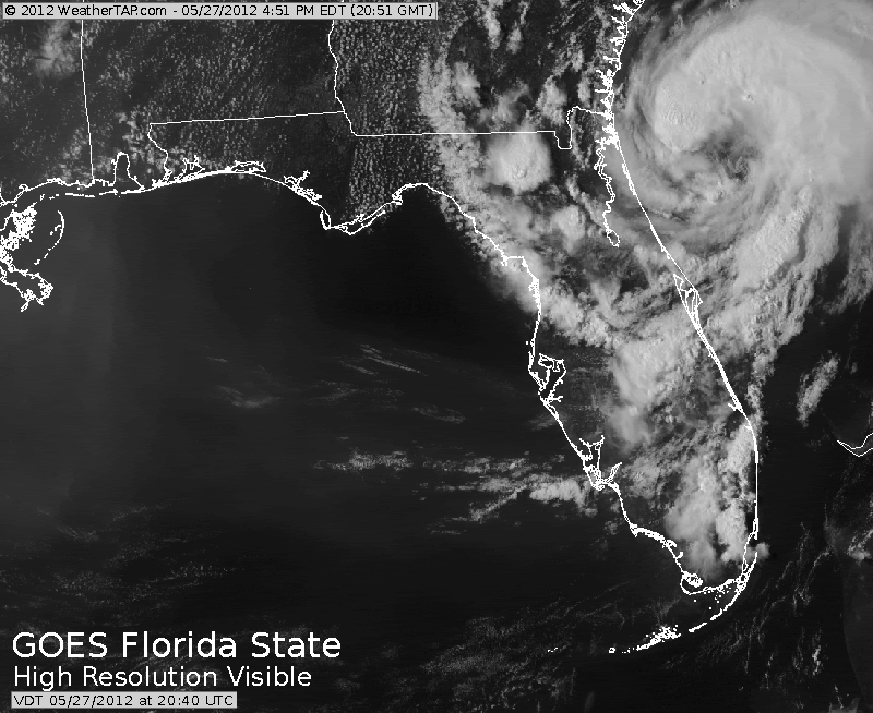
Hang in there gsytch. The dry weather will continue into about mid-week, but the models are hinting at deep tropical moisture surging north toward the peninsula by Friday. Some of the reliable models keep hinting at possible tropical cyclone activity within the next week to ten days, but I am cautiously monitoring that scenario.
The rainy season will kick into gear gsytch for you over there in New Port Richey very shortly hopefully.
0 likes
NEVER, EVER SAY NEVER in the tropics and weather in general, and most importantly, with life itself!!
________________________________________________________________________________________
Fay 2008 Beryl 2012 Debby 2012 Colin 2016 Hermine 2016 Julia 2016 Matthew 2016 Irma 2017 Dorian 2019
________________________________________________________________________________________
Fay 2008 Beryl 2012 Debby 2012 Colin 2016 Hermine 2016 Julia 2016 Matthew 2016 Irma 2017 Dorian 2019
-
vbhoutex

- Storm2k Executive

- Posts: 29150
- Age: 74
- Joined: Wed Oct 09, 2002 11:31 pm
- Location: Cypress, TX
- Contact:
Re:
northjaxpro wrote:Hope you all are having a great holiday weekend so far! The weather has been near perfect here this weekend, with sunny, dry and cooler conditions. Currently 57.3 degrees at my locale. Feels absolutely great in late May. max temp today only in the low 80s. We need this dry period to dry thimgs out around here after a very wet month.
Hang in there gsytch. The dry weather will continue into about mid-week, but the models are hinting at deep tropical moisture surging north toward the peninsula by Friday. Some of the reliable models keep hinting at possible tropical cyclone activity within the next week to ten days, but I am cautiously monitoring that scenario.
The rainy season will kick into gear gsytch for you over there in New Port Richey very shortly hopefully.
57.3 degrees on May 26??
0 likes
Skywarn, C.E.R.T.
Please click below to donate to STORM2K to help with the expenses of keeping the site going:

Please click below to donate to STORM2K to help with the expenses of keeping the site going:
-
northjaxpro
- S2K Supporter
- Posts: 8900
- Joined: Mon Sep 27, 2010 11:21 am
- Location: Jacksonville, FL
Re: Re:
vbhoutex wrote:northjaxpro wrote:Hope you all are having a great holiday weekend so far! The weather has been near perfect here this weekend, with sunny, dry and cooler conditions. Currently 57.3 degrees at my locale. Feels absolutely great in late May. max temp today only in the low 80s. We need this dry period to dry thimgs out around here after a very wet month.
Hang in there gsytch. The dry weather will continue into about mid-week, but the models are hinting at deep tropical moisture surging north toward the peninsula by Friday. Some of the reliable models keep hinting at possible tropical cyclone activity within the next week to ten days, but I am cautiously monitoring that scenario.
The rainy season will kick into gear gsytch for you over there in New Port Richey very shortly hopefully.
57.3 degrees on May 26??Did you move to NE? We only went down to 74 degrees for our low this morning.
We had a cool front bring in a drier and cooler air mass early Saturday morning. It really felt great earlier today that's for sure.
0 likes
NEVER, EVER SAY NEVER in the tropics and weather in general, and most importantly, with life itself!!
________________________________________________________________________________________
Fay 2008 Beryl 2012 Debby 2012 Colin 2016 Hermine 2016 Julia 2016 Matthew 2016 Irma 2017 Dorian 2019
________________________________________________________________________________________
Fay 2008 Beryl 2012 Debby 2012 Colin 2016 Hermine 2016 Julia 2016 Matthew 2016 Irma 2017 Dorian 2019
-
cycloneye

- Admin
- Posts: 149710
- Age: 69
- Joined: Thu Oct 10, 2002 10:54 am
- Location: San Juan, Puerto Rico
Re: Florida Weather
northjaxpro, you remember this.
0 likes
Visit the Caribbean-Central America Weather Thread where you can find at first post web cams,radars
and observations from Caribbean basin members Click Here
and observations from Caribbean basin members Click Here
-
northjaxpro
- S2K Supporter
- Posts: 8900
- Joined: Mon Sep 27, 2010 11:21 am
- Location: Jacksonville, FL
Re: Florida Weather
cycloneye
Oh yeah cycloneye will never forget it of course. It was exactly one year ago that Beryl came roaring through my locale. I have a friend who lives out Blount Island, which is about 15 minutes from where I live and he did receive a reading of a gust to 76 mph at the time of landfall. I measured a peak gust to 67 mph at my locale, but Beryl was a pretty strong tropical storm nonetheless. I had power lines and some trees felled by the storm and lost power for nearly three days. Thank goodness that the cyclone moved through at a 8-10 mph pace when she made landfall or else we would have had much more than the 8 inch rain total I received from the system.
Beryl nearly became a minimal hurricane and if it had another 4 to 6 hours over the Gulf Stream before making landfall, it would have made that status IMO. But, the impact from a strong tropical storm and /or minimal hurricane is virtually the same, so Beryl was bad enough for sure. It was also a historic storm for the Jax area. Beryl was the first tropical cyclone to directly make landfall on Jax from the due east since Hurricane Dora in 1964.
northjaxpro, you remember this.
Oh yeah cycloneye will never forget it of course. It was exactly one year ago that Beryl came roaring through my locale. I have a friend who lives out Blount Island, which is about 15 minutes from where I live and he did receive a reading of a gust to 76 mph at the time of landfall. I measured a peak gust to 67 mph at my locale, but Beryl was a pretty strong tropical storm nonetheless. I had power lines and some trees felled by the storm and lost power for nearly three days. Thank goodness that the cyclone moved through at a 8-10 mph pace when she made landfall or else we would have had much more than the 8 inch rain total I received from the system.
Beryl nearly became a minimal hurricane and if it had another 4 to 6 hours over the Gulf Stream before making landfall, it would have made that status IMO. But, the impact from a strong tropical storm and /or minimal hurricane is virtually the same, so Beryl was bad enough for sure. It was also a historic storm for the Jax area. Beryl was the first tropical cyclone to directly make landfall on Jax from the due east since Hurricane Dora in 1964.
0 likes
NEVER, EVER SAY NEVER in the tropics and weather in general, and most importantly, with life itself!!
________________________________________________________________________________________
Fay 2008 Beryl 2012 Debby 2012 Colin 2016 Hermine 2016 Julia 2016 Matthew 2016 Irma 2017 Dorian 2019
________________________________________________________________________________________
Fay 2008 Beryl 2012 Debby 2012 Colin 2016 Hermine 2016 Julia 2016 Matthew 2016 Irma 2017 Dorian 2019


-
JonathanBelles
- Professional-Met

- Posts: 11430
- Age: 35
- Joined: Sat Dec 24, 2005 9:00 pm
- Location: School: Florida State University (Tallahassee, FL) Home: St. Petersburg, Florida
- Contact:
-
Bocadude85

- Category 5

- Posts: 2991
- Age: 39
- Joined: Mon Apr 18, 2005 2:20 pm
- Location: Honolulu,Hi
Re: Florida Weather
FLASH FLOOD WARNING
FLC099-291500-
/O.NEW.KMFL.FF.W.0007.130529T1215Z-130529T1500Z/
/00000.0.ER.000000T0000Z.000000T0000Z.000000T0000Z.OO/
BULLETIN - EAS ACTIVATION REQUESTED
FLASH FLOOD WARNING
NATIONAL WEATHER SERVICE MIAMI FL
815 AM EDT WED MAY 29 2013
THE NATIONAL WEATHER SERVICE IN MIAMI HAS ISSUED A
* FLASH FLOOD WARNING FOR...
EAST CENTRAL PALM BEACH COUNTY IN SOUTHEAST FLORIDA...
* UNTIL 1100 AM EDT
* AT 811 AM EDT...DOPPLER RADAR INDICATED SHOWERS WITH VERY HEAVY
RAINFALL ACROSS MUCH OF EASTERN PALM BEACH COUNTY. RADAR ESTIMATES
AND RAIN GAGES INDICATED BETWEEN 3 AND 5 INCHES OF RAIN HAS FALLEN
FROM BOYNTON BEACH TO THE ACREAGE. BROADCAST MEDIA REPORTED
FLOODING IN HOMES IN THE ACREAGE...AND OTHER REPORTS OF FLOODING
HAVE BEEN RECEIVED FROM BOYNTON BEACH.
* RUNOFF FROM THIS EXCESSIVE RAINFALL WILL CAUSE FLASH FLOODING TO
OCCUR. SOME LOCATIONS THAT WILL EXPERIENCE FLOODING INCLUDE...
BOYNTON BEACH...DELRAY BEACH...LAKE WORTH...WEST PALM BEACH...
GOLDEN LAKES...GREENACRES CITY...HAVERHILL...LION COUNTRY SAFARI...
OCEAN RIDGE...PALM BEACH...ROYAL PALM BEACH...VILLAGE OF GOLF AND
WELLINGTON.
0 likes
-
SouthFloridian92
- Tropical Storm

- Posts: 120
- Age: 33
- Joined: Tue Dec 11, 2012 4:50 pm
- Location: Sebring, Florida
Re:
I even have big Crepe Myrtles wilted and a Camellia bush that was limp before watering! Just sunny, dry and windy. Very windy. Send it my way!!!!!!!! 
gsytch wrote:Dry, dry here. It rained at the school I teach at - 5 mins away - but the house yard is so dry, much wilting is occurring. Hose out yet again. Sun shining strongly, winds gusting easily 25-30mph....dry dry. 26 days and counting without rainfall. Will I reach an even month? hmmmm
0 likes
-
AdamFirst

- S2K Supporter
- Posts: 2490
- Age: 36
- Joined: Thu Aug 14, 2008 10:54 am
- Location: Port Saint Lucie, FL
Re: Florida Weather

0 likes
Dolphins Marlins Canes Golden Panthers HEAT
Andrew 1992 - Irene 1999 - Frances 2004 - Jeanne 2004 - Wilma 2005 - Fay 2008 - Isaac 2012 - Matthew 2016 - Irma 2017 - Dorian 2019 - Ian 2022 - Nicole 2022 - Milton 2024
Andrew 1992 - Irene 1999 - Frances 2004 - Jeanne 2004 - Wilma 2005 - Fay 2008 - Isaac 2012 - Matthew 2016 - Irma 2017 - Dorian 2019 - Ian 2022 - Nicole 2022 - Milton 2024
-
northjaxpro
- S2K Supporter
- Posts: 8900
- Joined: Mon Sep 27, 2010 11:21 am
- Location: Jacksonville, FL
Re:
gsytch wrote:It finally rained! It wasn't all that great, but yes, it rained. 3/10" officially. These showers are just moving too fast to acucmulate much but a seabreeze may helpa bit on Friday. Let the rainy season begin...please!
gsytch, I am happy to see that you finally got some rain down there. Hopefully, your area will begin to catch up now with the rainy season beginning to really kick into gear.
0 likes
NEVER, EVER SAY NEVER in the tropics and weather in general, and most importantly, with life itself!!
________________________________________________________________________________________
Fay 2008 Beryl 2012 Debby 2012 Colin 2016 Hermine 2016 Julia 2016 Matthew 2016 Irma 2017 Dorian 2019
________________________________________________________________________________________
Fay 2008 Beryl 2012 Debby 2012 Colin 2016 Hermine 2016 Julia 2016 Matthew 2016 Irma 2017 Dorian 2019

well someone needs to turn off the faucet in our area. We don't have much room left before the flooding hits our house. And we now have 60% chance today, as well as -
HYDROLOGIC OUTLOOK
NATIONAL WEATHER SERVICE MIAMI FL
600 AM EDT SAT JUN 1 2013
...VERY HEAVY RAINFALL POSSIBLE NEXT WEEK...
AN AREA OF LOW PRESSURE IS FORECAST TO DEVELOP ACROSS THE YUCATAN
AND SOUTHERN GULF OF MEXICO EARLY NEXT WEEK. THIS AREA OF LOW
PRESSURE IS FORECAST TO TRACK SLOWLY TO THE NORTHEAST TOWARDS
SOUTHWEST OR CENTRAL FLORIDA TUESDAY THROUGH THURSDAY. SOUTHERLY
FLOW IS EXPECTED TO DEVELOP...BRINGING IN DEEP TROPICAL MOISTURE
TO SOUTH FLORIDA. THIS WILL INCREASE THE THREAT OF VERY HEAVY
RAINFALL AND FLOODING...WITH THE HEAVIEST RAINS LIKELY FALLING IN
THE TUESDAY THROUGH THURSDAY PERIOD. HOWEVER...THE THREAT OF
INCREASINGLY WET CONDITIONS COULD START EARLIER. AREA-WIDE
RAINFALL ACCUMULATIONS OF 5 TO 10 INCHES ARE POSSIBLE OVER THE
NEXT 5 TO 7 DAYS...AND ISOLATED LOCATIONS COULD SEE EVEN HIGHER
AMOUNTS. FLOOD WATCHES MAY BECOME NECESSARY DURING THE COURSE OF
NEXT WEEK...SO INTERESTS ARE ENCOURAGED TO MONITOR THE LATEST
FORECASTS AS THIS SITUATION UNFOLDS.
0 likes
Return to “USA & Caribbean Weather”
Who is online
Users browsing this forum: Brent and 122 guests