TC Bertha
Moderator: S2k Moderators
-
Tampa_God

- Category 1

- Posts: 333
- Age: 36
- Joined: Wed May 31, 2006 7:27 pm
- Location: New Port Richey/Trinity, FL
Re: Tropical Storm Bertha in East Atlantic
I don't know guys, I see the trough off the eastern coast falling apart before Bertha gets there. Ofcourse, you have the weakening Bermuda High that I can see happening, but the curve that everyone is forecasting looks less likely to me. We'll just wait and see I guess.
0 likes

The trough coming off the USA is only a back-up if the storm remains weak tampa-god, the main driver of the models northward movement is the weakness and upper low as mentioned in the snippet cycloneye posted up. Still will the weakness be enough thats the main question, if it gets stronger then it will get the job done but if it stays or weakens then who knows!
0 likes
-
Tampa_God
- Category 1
- Posts: 333
- Age: 36
- Joined: Wed May 31, 2006 7:27 pm
- Location: New Port Richey/Trinity, FL
Re:
KWT wrote:The trough coming off the USA is only a back-up if the storm remains weak tampa-god, the main driver of the models northward movement is the weakness and upper low as mentioned in the snippet cycloneye posted up. Still will the weakness be enough thats the main question, if it gets stronger then it will get the job done but if it stays or weakens then who knows!
Okay I see that, but I forgot to add in that I don't really see Bertha gaining much strength. It will most likely get to 50 mph and than weaken after it hits the cold waters this weekend, and than stay around 50 mph until it reaches 70 W.
0 likes
Who knows Tampa-god, the models are trending further west which doesn't surprise me too much given they do tend to have a poleward bias from my past experience of these systems.
In terms of SST's, interestingly they are already a good deal below 26C (SHIPS started with SST's of 25.5C at 06z guidence) and so aren't going to get much lower then what they are now, esp if it stays on its current track, though the little drop that will occur will probably enough to stall any further development past 12-24hrs.
I think right now its a little better organised though the NHC are going to hold at 35kts for now which makes sense I suppose.
0 likes
-
Derek Ortt
Re: Re:
Tampa_God wrote:KWT wrote:The trough coming off the USA is only a back-up if the storm remains weak tampa-god, the main driver of the models northward movement is the weakness and upper low as mentioned in the snippet cycloneye posted up. Still will the weakness be enough thats the main question, if it gets stronger then it will get the job done but if it stays or weakens then who knows!
Okay I see that, but I forgot to add in that I don't really see Bertha gaining much strength. It will most likely get to 50 mph and than weaken after it hits the cold waters this weekend, and than stay around 50 mph until it reaches 70 W.
Bertha is already over sub 26C waters according to SHIPS
0 likes
-
Gustywind

- Category 5

- Posts: 12334
- Joined: Mon Sep 03, 2007 7:29 am
- Location: Baie-Mahault, GUADELOUPE
Re: Re:
Cryomaniac wrote:fci wrote:I completely agree that the one line statements are useless and border on "trolling".
A one line statement in itself isn't trolling. It's not a good post, but it's not really trolling. Saying that you want a storm to hit a major population centre as a Cat 5 would be trolling.
The following is the opinion of Cryomaniac, and is not based on any evidence, meteorological, economic or otherwise. As such it should not be used for any purpose
As for Bertha, I stand by my earlier post that it could become a marginal hurricane, of course anything can happen.
Cycloneye, let's take it easy, please
0 likes

-
CrazyC83
- Professional-Met

- Posts: 34315
- Joined: Tue Mar 07, 2006 11:57 pm
- Location: Deep South, for the first time!
Current Intensity Analysis
UW - CIMSS
ADVANCED DVORAK TECHNIQUE
ADT-Version 7.2.3
Tropical Cyclone Intensity Algorithm
----- Current Analysis -----
Date : 03 JUL 2008 Time : 184500 UTC
Lat : 13:31:35 N Lon : 25:26:31 W
CI# /Pressure/ Vmax
3.0 /1000.0mb/ 45.0kt
Final T# Adj T# Raw T#
(3hr avg)
3.0 3.2 3.4
Latitude bias adjustment to MSLP : +0.0mb
Center Temp : -39.4C Cloud Region Temp : -40.6C
Scene Type : SHEAR (0.04^ TO DG)
Positioning Method : FORECAST INTERPOLATION
Ocean Basin : ATLANTIC
Dvorak CI > MSLP Conversion Used : ATLANTIC
Tno/CI Rules : Constraint Limits : 0.5T/hour
Weakening Flag : OFF
Rapid Dissipation Flag : OFF
0 likes
-
cycloneye

- Admin

- Posts: 149578
- Age: 69
- Joined: Thu Oct 10, 2002 10:54 am
- Location: San Juan, Puerto Rico
Re: Tropical Storm Bertha in East Atlantic
03/1745 UTC 13.3N 24.9W T2.5/2.5 BERTHA -- Atlantic Ocean
http://www.ssd.noaa.gov/PS/TROP/positions.html
http://www.ssd.noaa.gov/PS/TROP/positions.html
0 likes
-
Aric Dunn
- Category 5
- Posts: 21238
- Age: 43
- Joined: Sun Sep 19, 2004 9:58 pm
- Location: Ready for the Chase.
- Contact:
Re: Tropical Storm Bertha in East Atlantic
another good pass .. convection a little deeper .. but great stucture.. and the center at about 13.5n 26.5w

0 likes

-
wxman57

- Moderator-Pro Met

- Posts: 23175
- Age: 68
- Joined: Sat Jun 21, 2003 8:06 pm
- Location: Houston, TX (southwest)
Re: Re:
hial2 wrote:wxmann_91 wrote:brunota2003 wrote:Either way, Bertha is pretty much doomed from the start.
It turns into the weakness, shear and cold waters quickly kill it off. It misses the weakness and runs head on into Mr. TUTT, need I say more?
Spot on. Can't believe this storm will make it past 60W. I don't know why we're having the fish definition argument.
Interesting...yesterday the concensus was for Bertha to turn @ 45W..
I think you're confusing the start of a turn with a farthest west the storm may get. The turn begins between 30-35W. TCs don't make sharp right-hand turns, they're gradual turns. No one said this system would track westward to 45W then take a sharp right turn, not passing 45W.
0 likes
To be fair though wxman57 some the models did have the furtherest point around 45W, the GFS and the GFDL being the main culprits but the ECM also did have a run or two where about 45W was the furtherest west it got. The models are now keeping the WNW track alot longer and indeed within 120hrs on alot of the models there isn't really a hint of the NW track that was so dominant at one point on the models at 45W.
0 likes
-
dixiebreeze
- S2K Supporter

- Posts: 5140
- Joined: Wed Sep 03, 2003 5:07 pm
- Location: crystal river, fla.
Re: Tropical Storm Bertha in East Atlantic
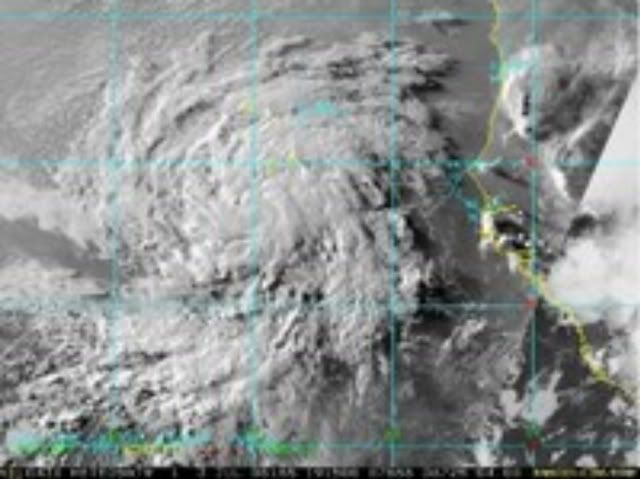
Very convective wave right behind Bertha:
http://www.ssd.noaa.gov/eumet/eatl/rb-l.jpg
(sorry if this was already posted)
http://www.ssd.noaa.gov/eumet/eatl/rb-l.jpg
(sorry if this was already posted)
0 likes
Who is online
Users browsing this forum: No registered users and 29 guests