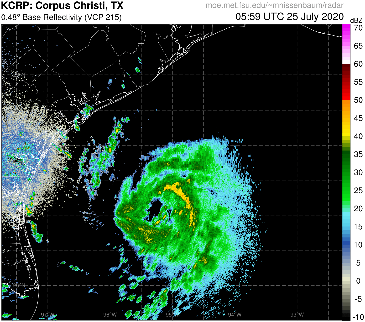
#884 Postby HurricaneAndre2008 » Fri Jul 24, 2020 9:30 am
Logo
Menu
Jul. 24, 2020
14:29 Z
Map: Google Earth Logo Cesium Logo
07/24 13:06 | 11 | 1001mb | 34kts (43kts) | 48kts (48kts)
Raw?
Note: "In. Flt" is max inbound flight level wind. "In. Sfc" is max inbound surface wind, estimated by SFMR or visually. If outbound wind is reported, then highest wind, inbound or outbound from center, is in parenthesis. Winds usually averaged over 10s period. Extrap. MSLPs have (e) next to them. Add missed obs.
Product: NOAA Vortex Message (URNT12 KWBC)
Transmitted: 24th day of the month at 14:25Z
Agency: National Oceanic and Atmospheric Administration (NOAA)
Aircraft: Lockheed WP-3D Orion (Reg. Num. N43RF)
Storm Number & Year: 08 in 2020
Storm Name: Hanna (flight in the North Atlantic basin)
Mission Number: 4
Observation Number: 11
A. Time of Center Fix: 24th day of the month at 13:06:37Z
B. Center Fix Coordinates: 27.16N 92.98W
B. Center Fix Location: 212 statute miles (341 km) to the S (176°) from Lake Charles, LA, USA.
C. Minimum Height at Standard Level: 1,439m (4,721ft) at 850mb
D. Minimum Sea Level Pressure: 1001mb (29.56 inHg)
E. Dropsonde Surface Wind at Center: From 250° at 15kts (From the WSW at 17mph)
F. Eye Character: Not Available
G. Eye Shape: Not Available
H. Estimated (by SFMR or visually) Maximum Surface Wind Inbound: 48kts (55.2mph)
I. Location & Time of the Estimated Maximum Surface Wind Inbound: 53 nautical miles (61 statute miles) to the S (180°) of center fix at 12:52:20Z
J. Maximum Flight Level Wind Inbound: From 260° at 34kts (From the W at 39.1mph)
K. Location & Time of the Maximum Flight Level Wind Inbound: 58 nautical miles (67 statute miles) to the S (179°) of center fix at 12:50:55Z
L. Estimated (by SFMR or visually) Maximum Surface Wind Outbound: 33kts (38.0mph)
M. Location & Time of the Estimated Maximum Surface Wind Outbound: 12 nautical miles (14 statute miles) to the NNW/N (349°) of center fix at 13:10:02Z
N. Maximum Flight Level Wind Outbound: From 100° at 43kts (From the E at 49.5mph)
O. Location & Time of the Maximum Flight Level Wind Outbound: 33 nautical miles (38 statute miles) to the N (355°) of center fix at 13:15:21Z
P. Maximum Flight Level Temp & Pressure Altitude Outside Eye: 19°C (66°F) at a pressure alt. of 1,552m (5,092ft)
Q. Maximum Flight Level Temp & Pressure Altitude Inside Eye: 21°C (70°F) at a pressure alt. of 1,554m (5,098ft)
R. Dewpoint Temp (collected at same location as temp inside eye): 18°C (64°F)
R. Sea Surface Temp (collected at same location as temp inside eye): Not Available
S. Fix Determined By: Penetration, Radar, Wind, Pressure and Temperature
S. Fix Level: 850mb
T. Navigational Fix Accuracy: 0.01 nautical miles
T. Meteorological Accuracy: 2 nautical miles
Remarks Section:
Maximum Flight Level Wind: 43kts (~ 49.5mph) which was observed 33 nautical miles (38 statute miles) to the N (355°) from the flight level center at 13:15:21Z
Maximum Flight Level Temp: 22°C (72°F) which was observed 8 nautical miles to the NNW (343°) from the flight level center
0 likes
Cindy(2005), Katrina(2005), Rita(2005), Erin(2007), Isaac(2012)


