
2023 Global Model Runs Discussion (Out thru day 16)
Moderator: S2k Moderators
Forum rules

The posts in this forum are NOT official forecasts and should not be used as such. They are just the opinion of the poster and may or may not be backed by sound meteorological data. They are NOT endorsed by any professional institution or STORM2K. For official information, please refer to products from the National Hurricane Center and National Weather Service.
-
lsuhurricane
- Category 1

- Posts: 270
- Joined: Tue Aug 15, 2017 2:53 pm
Re: 2023 Global Model Runs Discussion (Out thru day 16)
18z EPS is very aggressive on its last frame. Looks like that first wave may have future after all.
1 likes
-
Blown Away

- S2K Supporter

- Posts: 10253
- Joined: Wed May 26, 2004 6:17 am
Re: 2023 Global Model Runs Discussion (Out thru day 16)
blp wrote:Looks Ukmet joins the party similar to the Euro with that first wave.
https://uploads.disquscdn.com/images/6295bddb7d1795982306cb50e092541eb3c44aa355a9337031a311ab5980685e.png
Nearly all the models now move a strong TW near Caribbean. Biases are in place Euro more W, GFS more E, and CMC way out there. This system might be real and if these model runs miss GA’s to the N this TW may blow up after 70W.
0 likes
Hurricane Eye Experience: David 79, Irene 99, Frances 04, Jeanne 04, Wilma 05… Hurricane Brush Experience: Andrew 92, Erin 95, Floyd 99, Matthew 16, Irma 17, Ian 22, Nicole 22…

-
IsabelaWeather
- Category 1
- Posts: 316
- Age: 36
- Joined: Tue Jul 07, 2020 7:29 am
- Location: Isabela, Puerto Rico
Re: 2023 Global Model Runs Discussion (Out thru day 16)
blp wrote:Looks Ukmet joins the party similar to the Euro with that first wave.
https://uploads.disquscdn.com/images/6295bddb7d1795982306cb50e092541eb3c44aa355a9337031a311ab5980685e.png
I dont think I have access to the Ukmet, is that heading W or NW?
0 likes
Re: 2023 Global Model Runs Discussion (Out thru day 16)
lsuhurricane wrote:18z EPS is very aggressive on its last frame. Looks like that first wave may have future after all.
https://i.ibb.co/xj00nqh/IMG-0922.png
If this takes time to form and sneaks into the carribean could this be a charley type set up with the trof? Thing would easily explode cat4 or above with 92 degree waters out in the gulf.
0 likes
-
Category5Kaiju

- Category 5

- Posts: 4345
- Joined: Thu Dec 24, 2020 12:45 pm
- Location: Seattle during the summer, Phoenix during the winter
Re: 2023 Global Model Runs Discussion (Out thru day 16)
If that first wave is a legit TC signal and ends up north of the Caribbean.....oh snap
0 likes
Unless explicitly stated, all information in my posts is based on my own opinions and observations. Tropical storms and hurricanes can be extremely dangerous. Refer to an accredited weather research agency or meteorologist if you need to make serious decisions regarding an approaching storm.
-
lsuhurricane
- Category 1
- Posts: 270
- Joined: Tue Aug 15, 2017 2:53 pm
Re: 2023 Global Model Runs Discussion (Out thru day 16)
This GFS run already looks different. TS south of Cuba headed WNW. Looks like trouble if shear is low
0 likes
Re: 2023 Global Model Runs Discussion (Out thru day 16)
lsuhurricane wrote:This GFS run already looks different. TS south of Cuba headed WNW. Looks like trouble if shear is low
Yea, catching up to the ensembles intensity wise. Not good track for swfl.
0 likes
-
Stratton23
- Category 5
- Posts: 3575
- Joined: Fri Jul 21, 2023 10:59 pm
- Location: Katy, Tx
Re: 2023 Global Model Runs Discussion (Out thru day 16)
Oh boy thats a very ugly run by the 00z GFS, Deepening hurricane as it just kind of meanders around due to a strong ridge to its north
0 likes


Re: 2023 Global Model Runs Discussion (Out thru day 16)
Stratton23 wrote:Oh boy thats a very ugly run by the 00z GFS, Deepening hurricane as it just kind of meanders around due to a strong ridge to its north
In that model, does is show it entering the GOM? Or is it a Florida storm at this point in the model?
0 likes
-
Stratton23
- Category 5
- Posts: 3575
- Joined: Fri Jul 21, 2023 10:59 pm
- Location: Katy, Tx
Re: 2023 Global Model Runs Discussion (Out thru day 16)
Sambucol GFS has a cat 5 in the central gulf, 936 mb….
0 likes
Re: 2023 Global Model Runs Discussion (Out thru day 16)
Stratton23 wrote:Sambucol GFS has a cat 5 in the central gulf, 936 mb….
Omg. How many days down the road is it showing that?
0 likes
-
Stratton23
- Category 5
- Posts: 3575
- Joined: Fri Jul 21, 2023 10:59 pm
- Location: Katy, Tx
Re: 2023 Global Model Runs Discussion (Out thru day 16)
Beyond 10 days so just fantasy land, but that is one of the most disturbing tropical runs ive ever seen from the GFS, sub 930 MB cat 5 heading WNW
1 likes
Re: 2023 Global Model Runs Discussion (Out thru day 16)
Stratton23 wrote:Beyond 10 days so just fantasy land, but that is one of the most disturbing tropical runs ive ever seen from the GFS, sub 930 MB cat 5 heading WNW
Agree. At WNW, from that point, would that make landfall in Texas?
0 likes
-
Stratton23
- Category 5
- Posts: 3575
- Joined: Fri Jul 21, 2023 10:59 pm
- Location: Katy, Tx
Re: 2023 Global Model Runs Discussion (Out thru day 16)
The run stops their, but if it kept that general motion, then texas would be in play, thankfully i have better odds of getting struck by lightning than this run will verify lol
1 likes
-
Category5Kaiju
- Category 5
- Posts: 4345
- Joined: Thu Dec 24, 2020 12:45 pm
- Location: Seattle during the summer, Phoenix during the winter
Re: 2023 Global Model Runs Discussion (Out thru day 16)
If that last GFS verified, then Emily is almost certainly going to be nixed from the Atlantic naming list 
2 likes
Unless explicitly stated, all information in my posts is based on my own opinions and observations. Tropical storms and hurricanes can be extremely dangerous. Refer to an accredited weather research agency or meteorologist if you need to make serious decisions regarding an approaching storm.


Re: 2023 Global Model Runs Discussion (Out thru day 16)
The 0Z GFS has a H in the GOM 8/26-8 moving slowly W. That makes 6 GFS runs out of 53 (11%) since 7/31 with a H on the run:
-7/31 12Z: hit SC 8/16
-8/3 6Z: hit MX/TX border 8/16
-8/6 0Z: MDR 8/18-21
-8/9 18Z: just off SC 8/25
-8/11 0Z: just off LA 8/26
-8/13 0Z: GOM 8/26-8
The last three on this list are all from the AEW now in the E Atlantic, the same one the EPS has been harping on since August 4th.
-7/31 12Z: hit SC 8/16
-8/3 6Z: hit MX/TX border 8/16
-8/6 0Z: MDR 8/18-21
-8/9 18Z: just off SC 8/25
-8/11 0Z: just off LA 8/26
-8/13 0Z: GOM 8/26-8
The last three on this list are all from the AEW now in the E Atlantic, the same one the EPS has been harping on since August 4th.
1 likes
Personal Forecast Disclaimer:
The posts in this forum are NOT official forecasts and should not be used as such. They are just the opinion of the poster and may or may not be backed by sound meteorological data. They are NOT endorsed by any professional institution or storm2k.org. For official information, please refer to the NHC and NWS products.
The posts in this forum are NOT official forecasts and should not be used as such. They are just the opinion of the poster and may or may not be backed by sound meteorological data. They are NOT endorsed by any professional institution or storm2k.org. For official information, please refer to the NHC and NWS products.

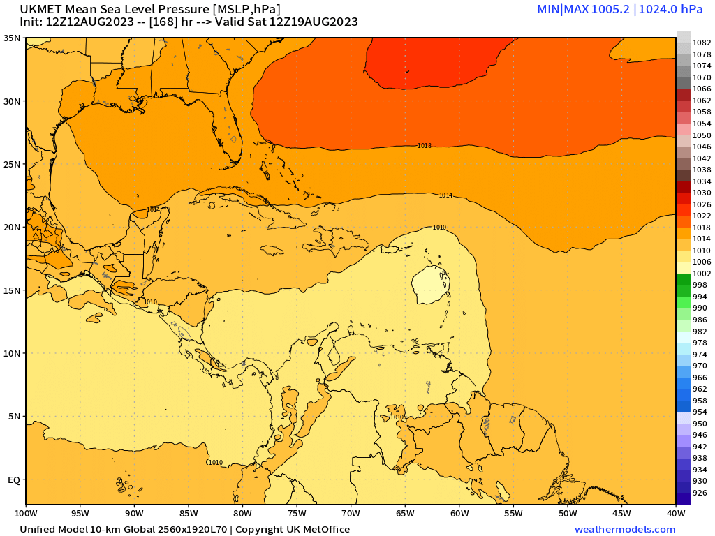
Re: 2023 Global Model Runs Discussion (Out thru day 16)
0z Euro has a weak vort hitting Texas:
This appears to be ahead of the Caribbean wave (the one currently offshore Africa that GFS just blew up). The distinction is seen most clearly on 0z CMC, which shows all 4 potential systems:
0z GFS doesn't have it.
This appears to be ahead of the Caribbean wave (the one currently offshore Africa that GFS just blew up). The distinction is seen most clearly on 0z CMC, which shows all 4 potential systems:
0z GFS doesn't have it.
0 likes
TC naming lists: retirements and intensity
Most aggressive Advisory #1's in North Atlantic (cr. kevin for starting the list)
Most aggressive Advisory #1's in North Atlantic (cr. kevin for starting the list)
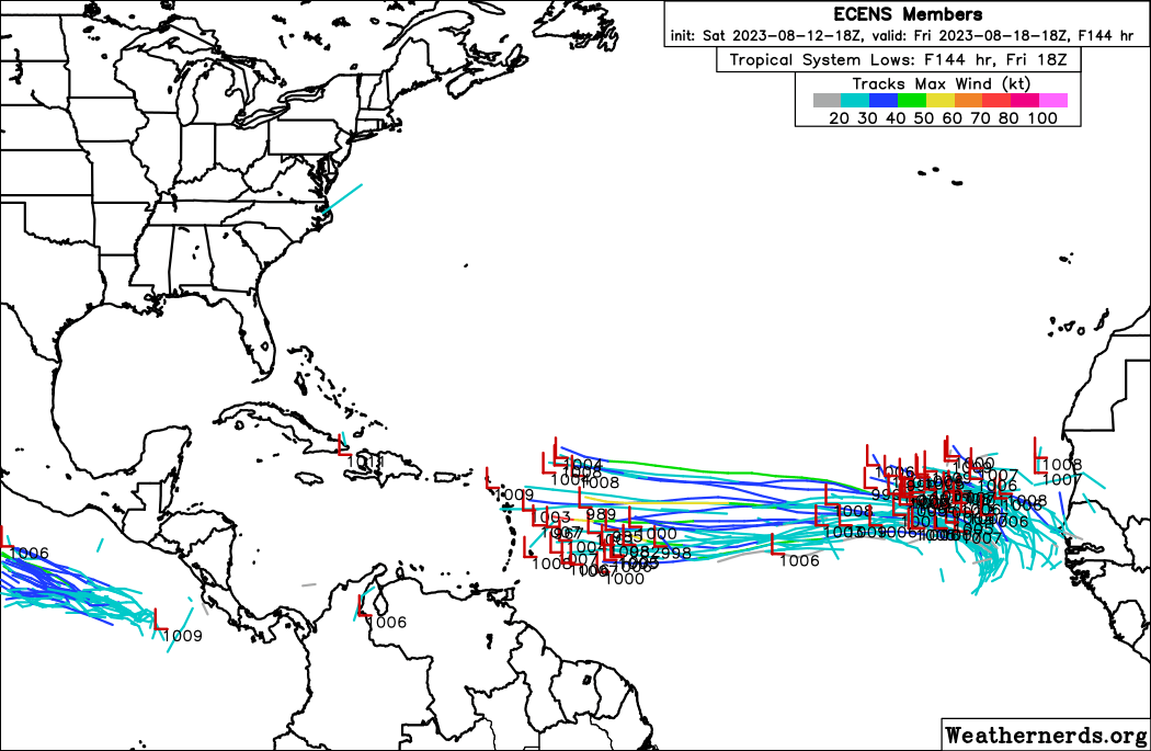
Re: 2023 Global Model Runs Discussion (Out thru day 16)
0z EPS is significantly weaker for the first wave within MDR:
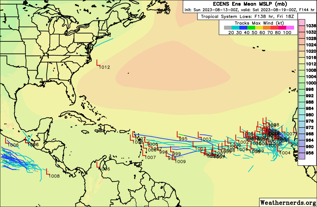
Of course, this doesn't preclude development further west, and future runs can always bring it back.
1 likes
TC naming lists: retirements and intensity
Most aggressive Advisory #1's in North Atlantic (cr. kevin for starting the list)
Most aggressive Advisory #1's in North Atlantic (cr. kevin for starting the list)
Who is online
Users browsing this forum: AnnularCane, USTropics and 215 guests