The posts in this forum are NOT official forecast and should not be used as such. They are just the opinion of the poster and may or may not be backed by sound meteorological data. They are NOT endorsed by any professional institution or


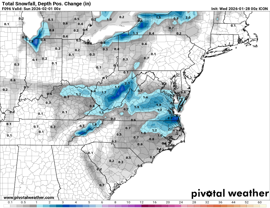
Kingarabian wrote:Seeing some hints on the models for snow this weekend in eastern NC. Some models show it in relation to the gulf system while some others dont.
12Z Euro has a 963 mb low in the same area as that GFS 18Z run with the 959 mb super storm but the track is further offshore not over Long Island this run. So it wasn't a pure GFS fantasy. The Polar vortex has a passing lobe that could kink the jet stream a little more than we are projecting 6 days out. I just hope we don't get ghosted in the last 36 hours with a major shift that surprises everyone in emergency planning. For example we've got cold air at the surface from the first frontal passage and ice takes out power fast and you can't plow it.