Cyclones MEDITERRANEAN
A RARE PHENOMENON AND LITTLE KNOWN
edited by Stefano Nava
Introduction
Among the convective weather that can affect the Mediterranean to different spatial and temporal scales (cold fronts, mesocicloni, isolated cells) there are also phenomena called "Mediterranean cyclone" or Like Tropical cyclones (TLC). "Cyclones Mediterranean", in the broadest sense Are often called the most intense depression (minimum ground below 1000 hPa), characterized by the presence of an eye, devoid of clouds, well-defined and twenty particularly intense.
In the weather was often called "meteorological bomb" as defined by T. Bergeron: "a very rapid deepening of the cyclone extratropicale, where the pressure drop on the surface corresponds to 1 hPa every hour or more for at least 24 hours." Some meteorologists also called the "Mediterranean Bombs", according to studies latest seems that these phenomena are in fact the "hybrid storms." Arise as of mid-latitudes depression with hot and cold face and then evolve taking similar characteristics to those of tropical cyclones.
Morphology of the Mediterranean cyclone
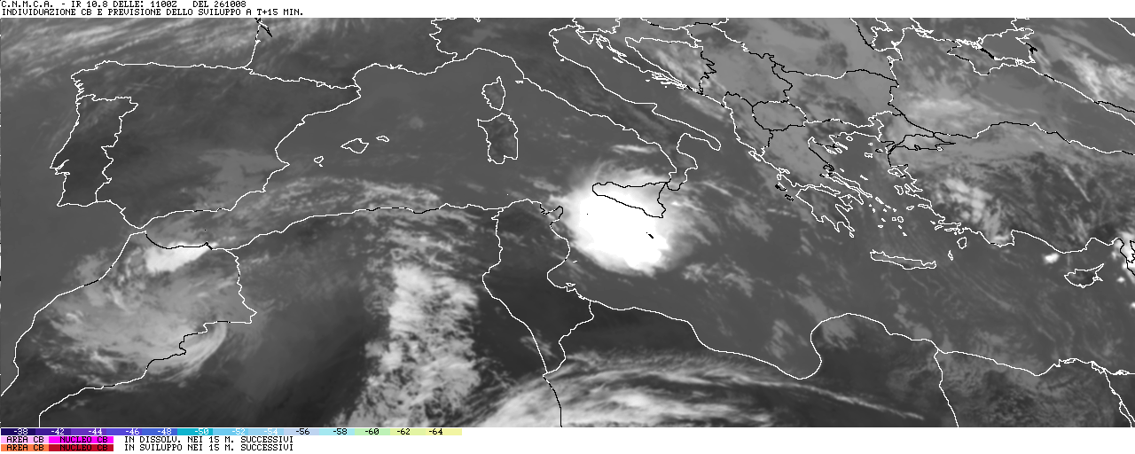
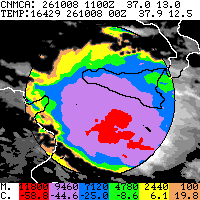
The true ciclones Mediterranean, also known as TLC (Tropical Cyclones Like cyclones or tropical-type) are fully comparable to those of the tropics. We characterize morphologically to a spiral of clouds with well-defined eye and persistent Surrounded by a wall of towering clouds and motions of warm air descending inside.
The wind exceeds, at least near this wall, the 135 km / h and are violent, persistent and heavy rain to mainly sunny and reverse (maximum of 500 mm / h).The maximum diameter of the Mediterranean cyclone is 200-400 km. The time duration is very variable but generally is limited to 1 or 2 days (most often these phenomena lasting only a few hours, Reale and Atlas 2001). In the only case in which it was possible to measure the pressure near the minimum (as of 16 January 1995) thanks to a German weather ship, the Meteor, which was near the storm was 975 hPa.
Genesis of the Mediterranean cyclone
Their origin as that of tropical hurricanes, is to be found in the excess of thermal energy stored above the sea (in this case the Mediterranean Sea). This energy is rapidly converted into kinetic energy, or in an intensive whirling motion of , With minimal dispersion in translational motion as an almost isolated.
The time of year when you may have is that where the surface temperature of the Mediterranean Sea is higher (around 26 ° C), which normally occurs between August and September on the Ionian Sea, the Tyrrhenian low, the channel Sicily, on Libyan sea, in central Sardinia and the Adriatic, but may still between July and January if other conditions are favorable.
Necessary condition for their birth is the presence of very warm air close to saturation in the lower layers above the surface of the sea.
But to trigger the release of excess is necessary to form an area of convergence in the lower layers that lead to the birth of motion and then climb a small depression on the ground. This situation may present for the following reasons:
a) presence of a vortex in isolated share (cut off)
b) passage of a branch of the polar jet at high altitudes
c) presence of a strong vertical thermal gradient superadiabatico close to the ground or in layers next to it (decrease in temperature exceeding 1 ° C per 100 meters up to a share of about 1000 meters)
d) presence of a nearly stationary frontal discontinuity sea level
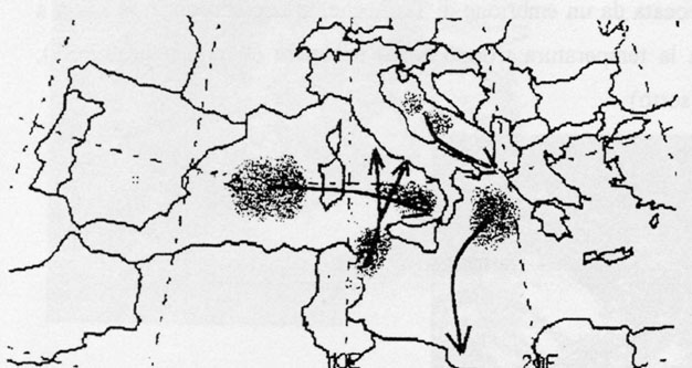 Figure 1 - top spots genesis of the Mediterranean cyclones and prevailing trajectories; dark areas indicate the place of origin, arrows trajectories (Art by S. Nava)
The rise of the air, if not hampered by high pressure with dynamic motion descendants, causing the cooling adiabatic expansion and then condensation of water vapor content in it, but the condensation free the latent heat of evaporation which is the heat that the water had previously absorbed to evaporate, taking solar energy, this heat is added to the heat already in the air and warm air rise further determines that continues until it reaches the level of freezing, where free additional latent heat of fusion and so the mechanism is self.
All this if the supply of steam continues (persistence of the sea) and persist if the conditions for the rise because of the formation of a vortex well known thanks to the Coriolis force (force deviant): At this point the vortex works as a suction pump that continues to suck steam and heat from the sea; increasingly intensifies, the pressure falls to very low (hardly measurable) and the wind reaches the maximum intensity.
Now describe the various stages of development of a cyclone Mediterranean following the simulation conducted by some researchers (Kuo, Guo & Reed 2001) on a case actually happened (the TLC, 23 January 1982). The simulation took into consideration the scope of the winds and heat to share Air pressure of 925 hPa (about 1100 meters high).
Here are the main stages of development of a Mediterranean cyclone:
1)Its create heat wave, with a well-defined hot located in the area southeast of depression on the ground, the winds are weak
2) once the convective process begins, the warm and moist air is sucked up until the previous sector remains hot little tracks, the winds begin to increase around the minimum ground pressure
3)as soon as the cyclone began to develop and grow to create a "heart" (core) with hot air and drier than its surroundings; winds reach their maximum intensity
4) after about 37 hours of training the eye of the soil "heart" has temperatures of 6-8 ° C higher than the surrounding cold air that usually located in north-west of TLC.
List of major TLC on the Mediterranean from 1947 to 2005 and effects
edited by Stefano Nava with the collaboration of Daniel Bianchini
1) 23 September 1947: Libyan Sea - no damage
2) September 24 1969: Libyan Sea - no damage
3) 19 August 1976: TLC center in the Adriatic moving towards south / southeast - rainfall on the Abruzzo coast-Romagna with tornado (Figure 4)
4) Jan 23 1982: Libyan Sea - no damage
5) 27 September 1983: Canale di Sicilia - strong wind on Sicily and the Aeolian Islands (Figure 8 and 9)
6) 14 Dec 1985: Ionian Sea - strong wind on the eastern Sicily (90 km / h) (Figure 13)
7) 23/24 November 1991: Mar Tirreno - reached minimum pressure: 994 hPa, strong winds (up to 140 km / h) and heavy rain.
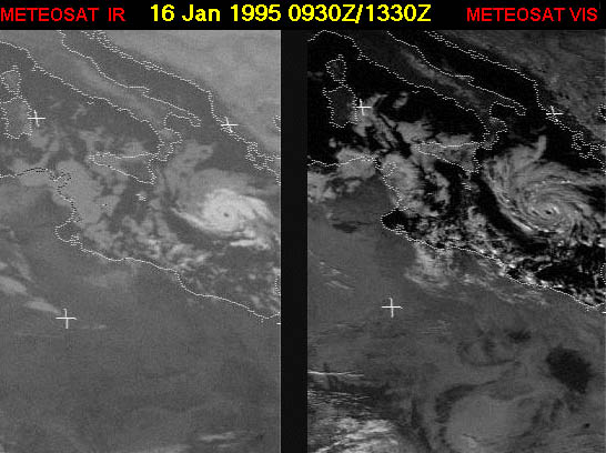
8) 16 Jan 1995: Ionian Sea - no damage. Minimum pressure reached 975 hPa (Figure 7a, 7b, 7c and 7d)
9) 3-14 October 1996: Mar Tirreno - 2 cyclones Mediterranean. During the first storm in the Polso accumulated 480 mm of rain in a few hours. In Crotone on June 14 will fall 144 mm in 12 hours, violent thunderstorms and strong wind on the Aeolian islands (140 km / h) (Figures 10, 11 and 12)
10) 7 August 2001 - A NW Morocco formation of a little TLC which was quickly exhausted, no damage
11) 18 February 2002 - A NW Morocco formation of a TLC lasting a few hours, no damage
12) 6 Jul 2002: Tunisia - Strong thunderstorms, but no damage (Figure 5)
13) February 4 2003 - TLC embryo of the Gulf of Genoa, duration: 1 hour. Minimum registered 983 hPa (Figure 6)
14) 15-18 September 2003 - Tunisia / South Sicily; no damage, only lightning storms and rains, a Syracuse fell in 48 hours 514 mm of rainfall (Figure 19, 20 and 21)
15)22-23 October 2005 - Flood in Puglia: fallen more 'than 200 mm in 24 hours.
16) 26-27 October 2005 - Ionian Sea: strong sea storms and gusts of wind storm (Figure 25)
17) 17) 13-15 December 2005 - Sicily / Aegean Sea between the provinces of Siracusa, Catania and Ragusa fallen in 24 hours 236 mm of rain. Venti forti in tutta l'isola (intorno a 70 km/h, ma con raffiche superiori). Strong winds across the island (around 70 km / h, but with higher gusts). In the Aegean Sea south of Crete storm force 8 on the eastern Libya strong sand storm (Figure 23)
Figure 7a - The Mediterranean cyclone of 16 January 1995 between 9.30 am and 11.30 UTC on the Ionian Sea canal in the visible and infrared (source: Dr. J. Welcome website)
Sorry i translated this whit Google
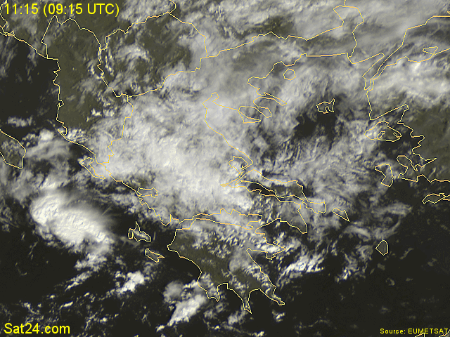
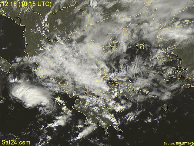
Here you can see the sat pictures from these cyclones
http://www.fenomenitemporaleschi.it/ciclone.htm