December 18-20, 2008 Storm: Quick Thoughts

Winter Weather Discussion

Moderator: S2k Moderators

Forum rules

The posts in this forum are NOT official forecast and should not be used as such. They are just the opinion of the poster and may or may not be backed by sound meteorological data. They are NOT endorsed by any professional institution or STORM2K.

Help Support Storm2K
Message
Author
donsutherland1
S2K Analyst
S2K Analyst
Posts: 2718
Joined: Mon Sep 15, 2003 8:49 pm
Location: New York

December 18-20, 2008 Storm: Quick Thoughts

#1 Postby donsutherland1 » Wed Dec 17, 2008 10:47 am

At this time, I am increasingly confident that a complex storm system where a strong low tracks across Michigan and another reforms along the Mid-Atlantic Coast will bring parts of southern Ontario, New York State, and New England their biggest snowfall of the winter so far. Farther south, the Mid-Atlantic region's old nemesis (which shows up quite well on the 500 mb GFS ensemble mean anomalies) will likely ruin things.

Image

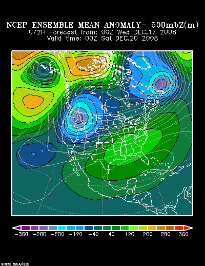
Given the overrunning signature and the expected evolution of the systems, my guess is that the boundary from little or now snow to a significant accumulation will be quite narrow. Hence, a small difference in the track--50 miles or so--could make the difference for some cities between little snow to a sizable accumulation. My guess is that while NYC could see several inches of snow before a changeover to sleet and rain, the proverbial equal chances of much less or much more applies there.

For now, my early thinking is as follows:

High Risk: 6" or More (10" or more is possible in many of those cities):
Albany, Boston, Concord, Hartford, Portland, Providence, Poughkeepsie, Toronto, Westfield (MA), Worcester

High Risk: 4" or More; Moderate Risk: 6" or More:
Binghamton, Burlington, Ottawa, White Plains

Some Chance: 4" or More:
Montreal, New York City
0 likes   

User avatar
tropicana
Category 5
Category 5
Posts: 8056
Joined: Sat Sep 27, 2003 6:48 pm
Location: Niagara Falls, Ontario, Canada
Contact:

Re: December 18-20, 2008 Storm: Quick Thoughts

#2 Postby tropicana » Wed Dec 17, 2008 11:33 am

yay! im glad you posted , i really love your predictions. Environment Canada has latched on to this storm system and it certainly appears Southern Ontario is in for a duzzy of a snowstorm for Friday, they used the term "snow-mageddon" in their special weather statement. It wasn't meant to alarm anyone, but taken into account we just had a significant snowfall last night that dropped up to 11cm of snow ( near 6 inches) in spots, and with this major new storm on the way that could produce up to 20cm of snow ( 10 inches) , along with severe blowing and drifting snow, creating whiteouts and low visibility, and even another snowstorm of similar consequences on Sunday into Monday.

Additionally, they are taking into account how heavily populated this area of Ontario is, particularly areas like Toronto, and the time of the year. This is one of the busiest shopping weekends of the year coming up, and this Friday is supposedly one of the busiest "visa" shopping days of the year when the most transactions are recorded. Furthermore, the week before christmas is one of biggest travel times of the year, whether by plane, train or automobile. All of these methods of transportation will be severely hampered on Friday, and long delays or cancellations are likely at Pearson Airport in Toronto.

-justin-
0 likes   

User avatar
Stephanie
S2K Supporter
S2K Supporter
Posts: 23843
Age: 62
Joined: Thu Feb 06, 2003 9:53 am
Location: Glassboro, NJ

Re: December 18-20, 2008 Storm: Quick Thoughts

#3 Postby Stephanie » Wed Dec 17, 2008 8:04 pm

It's great to see your forecast, Don. :D
0 likes   

donsutherland1
S2K Analyst
S2K Analyst
Posts: 2718
Joined: Mon Sep 15, 2003 8:49 pm
Location: New York

Re: December 18-20, 2008 Storm: Quick Thoughts

#4 Postby donsutherland1 » Thu Dec 18, 2008 1:02 pm

Thanks Stephanie and Tropicana.
0 likes   

donsutherland1
S2K Analyst
S2K Analyst
Posts: 2718
Joined: Mon Sep 15, 2003 8:49 pm
Location: New York

Re: December 18-20, 2008 Storm: Quick Thoughts

#5 Postby donsutherland1 » Thu Dec 18, 2008 1:02 pm

After considering some of the trends in the GFS guidance, I suspect that locations that could see just a little snowfall or a lot of snowfall will include Greenwich, Newark, New York, and White Plains. A small shift in the track and/or the timing of the changeover will make a significant difference as to how much snow falls at those locations. Considering the latest information, along with a degree of winter storm climatology for December, my initial snowfall estimates are as follows:

Albany: 5"-10"
Allentown: 2"-4"
Boston: 6"-12"
Concord: 5"-10"
Danbury: 6"-12"
Detroit: 5"-10"
Hartford: 6"-12"
New York City: 2"-4"
Newark: 2"-4"
Providence: 6"-12"
Scranton: 5"-10"
Toronto: 4"-8" (10.2 cm-20.3 cm)
Westfield: 6"-12"
White Plains: 4"-8"
Worcester: 6"-12"

Whether the 12z Euro agrees with the 12z NAM or 12z GFS could add further insight into whether the colder NAM or warmer GFS solution is more likely to verify. There remain some sizable differences between the two models.

Given the model differences and the large difference a small shift in the track can make, I will likely offer a revised estimate at some point tonight.
0 likes   

User avatar
Category 5
Category 5
Category 5
Posts: 10074
Age: 35
Joined: Sun Feb 11, 2007 10:00 pm
Location: New Brunswick, NJ
Contact:

Re: December 18-20, 2008 Storm: Quick Thoughts

#6 Postby Category 5 » Thu Dec 18, 2008 3:14 pm

Great work as always Don.
0 likes   

User avatar
Stephanie
S2K Supporter
S2K Supporter
Posts: 23843
Age: 62
Joined: Thu Feb 06, 2003 9:53 am
Location: Glassboro, NJ

Re: December 18-20, 2008 Storm: Quick Thoughts

#7 Postby Stephanie » Thu Dec 18, 2008 8:08 pm

Looking forward to the update.
0 likes   

User avatar
srainhoutx
S2K Supporter
S2K Supporter
Posts: 6919
Age: 67
Joined: Sun Jan 14, 2007 11:34 am
Location: Haywood County, NC
Contact:

Re: December 18-20, 2008 Storm: Quick Thoughts

#8 Postby srainhoutx » Thu Dec 18, 2008 9:03 pm

Looking forward to your 00Z's update. I have always have enjoyed your analysis Don. NE friends with travel plans are getting concerned.
0 likes   

donsutherland1
S2K Analyst
S2K Analyst
Posts: 2718
Joined: Mon Sep 15, 2003 8:49 pm
Location: New York

Re: December 18-20, 2008 Storm: Quick Thoughts

#9 Postby donsutherland1 » Thu Dec 18, 2008 10:36 pm

With the latest NAM trending ever so slightly cooler and the northward trend seeming to have stopped on the 18z GFS, I have greater confidence in the storm's track. I believe that New York City could see quite a spread in accumulations from around 2" in Queens to near 6" in the north Bronx.

My final estimates are as follows:

Albany: 6"-12"
Allentown: 3"-6"
Binghamton: 7"-14"
Boston: 6"-12"
Concord: 5"-10"
Danbury: 6"-12"
Detroit: 5"-10"
Hamilton, Ontario: 5"-10" (12.7 cm-25.4 cm)
Hartford: 6"-12"
New York City: 3"-6"
Newark: 2"-4"
Portland: 3"-6"
Providence: 7"-14"
Scranton: 5"-10"
Toronto: 4"-8" (10.2 cm-20.3 cm)
Westfield, MA: 6"-12"
White Plains: 6"-12"
Worcester: 6"-12"
0 likes   

donsutherland1
S2K Analyst
S2K Analyst
Posts: 2718
Joined: Mon Sep 15, 2003 8:49 pm
Location: New York

Re: December 18-20, 2008 Storm: Quick Thoughts

#10 Postby donsutherland1 » Thu Dec 18, 2008 10:36 pm

Thanks Srainhoutx.
0 likes   

Ed Mahmoud

Re: December 18-20, 2008 Storm: Quick Thoughts

#11 Postby Ed Mahmoud » Thu Dec 18, 2008 10:55 pm

If the 0Z NAM is right, I think BOS is closer to 10 to 15 inches. About an inch of liquid equivalent, and 850 mb temps around -10ºC High relative humidities. I think better than the normal 10:1 fluff ratio.

Not sure about the immediate coast with an onshore wind for a time, but the general NYC area looks like it may have some sleet, as there is a spread between the 1000-500 mb, 1000-700 mb thicknesses and the 850 mb freezing line between about lunch and dinner.

East Coast NAM loop from PSU e-Wall.
0 likes   

User avatar
Stephanie
S2K Supporter
S2K Supporter
Posts: 23843
Age: 62
Joined: Thu Feb 06, 2003 9:53 am
Location: Glassboro, NJ

Re: December 18-20, 2008 Storm: Quick Thoughts

#12 Postby Stephanie » Fri Dec 19, 2008 9:39 pm

Quite an active pattern for the northern tier of the US through next week. Those poor people in New England can't catch a break. All of that ice and now all of the snow that you've forecasted.

The ski resorts are loving it, I'll bet!

We're still on the warm side and will probably be for tomorrow night's and maybe Christmas Eve. I hope we get a little snow for Christmas (no ice, thank you).
0 likes   

User avatar
Nimbus
Category 5
Category 5
Posts: 5300
Joined: Mon Jul 19, 2004 10:54 am

#13 Postby Nimbus » Fri Dec 19, 2008 9:45 pm

00 GFS 24 hour precipitation charts look interesting heaviest NE accumulation looks to be near the coast.

http://www.nco.ncep.noaa.gov/pmb/nwprod ... 4_066m.gif

http://www.nco.ncep.noaa.gov/pmb/nwprod ... 4_072m.gif
0 likes   

jinftl
Category 5
Category 5
Posts: 4312
Joined: Tue Aug 31, 2004 4:47 pm
Location: fort lauderdale, fl

Re: December 18-20, 2008 Storm: Quick Thoughts

#14 Postby jinftl » Sat Dec 20, 2008 2:54 pm

Image

Boston may see some melting of the snowpack by mid-week but with even more snow possible sunday night, a white christmas looks likely.

Image
0 likes   

User avatar
Nimbus
Category 5
Category 5
Posts: 5300
Joined: Mon Jul 19, 2004 10:54 am

#15 Postby Nimbus » Sun Dec 21, 2008 8:28 am

The models continue trending colder so areas like Portland and Augusta Maine should see a foot or more of snow. Don't know where the rain snow line will occur in Boston but areas like Needham west of 128 could see over a foot as well.
0 likes   

User avatar
Stephanie
S2K Supporter
S2K Supporter
Posts: 23843
Age: 62
Joined: Thu Feb 06, 2003 9:53 am
Location: Glassboro, NJ

Re: December 18-20, 2008 Storm: Quick Thoughts

#16 Postby Stephanie » Sun Dec 21, 2008 10:25 am

Freezing rain right now in Southwestern New Jersey. We're under a Winter Weather advisory until 11:00 am. We've been stuck between 31 or 32 degrees. It's supposed to go over freezing today, but I'm afraid of the re-freeze we'll have overnight. The highs tomorrow are only going to be in the upper 20's with 20 - 30 mph winds. :eek:
0 likes   

donsutherland1
S2K Analyst
S2K Analyst
Posts: 2718
Joined: Mon Sep 15, 2003 8:49 pm
Location: New York

#17 Postby donsutherland1 » Tue Dec 23, 2008 11:20 am

Verification:

From 12/18/2008 12:58 pm:
Albany: 5"-10"; Actual: 11.3"; Error: 1.3"
Allentown: 2"-4"; Actual: 2.8"; Within range
Boston: 6"-12"; Actual: 12.5"; Error: 0.5"
Concord: 5"-10"; Actual: 8.3"; Within range
Danbury: 6"-12"; Actual: 8.5"; Within range
Detroit: 5"-10"; Actual: 7.9"; Within range
Hartford: 6"-12"; Actual: 9.4"; Within range
New York City: 2"-4"; Actual: 4.5"; Error: 0.5"
Newark: 2"-4"; Actual: 5.4"; Error: 1.4"
Providence: 6"-12"; Actual: 9.8"; Within range
Scranton: 5"-10"; Actual: 7.4"; Within range
Toronto: 4"-8" (10.2 cm-20.3 cm); Actual: 6.1" (15.4 cm); Within range
Westfield, MA: 6"-12"; Actual: 12.0"; Within range
White Plains: 4"-8"; Actual: 6.0"; Within range
Worcester: 6"-12"; Actual: 14.1"; Error: 2.1"

From 12/18/2008 10:34 pm:
Albany: 6"-12"; Actual: 11.3"; Within range
Allentown: 3"-6"; Actual: 2.8"; Error: 0.2"
Binghamton: 7"-14"; Actual: 6.4"; Error: 0.6"
Boston: 6"-12"; Actual: 12.5"; Error: 0.5"
Concord: 5"-10"; Actual: 8.3"; Within range
Danbury: 6"-12"; Actual: 8.5"; Within range
Detroit: 5"-10"; Actual: 7.9"; Within range
Hamilton, Ontario: 5"-10" (12.7 cm-25.4 cm); Actual: 6.2" (15.8 cm)
Hartford: 6"-12"; Actual: 9.4"; Within range
New York City: 3"-6"; Actual: 4.5"; Within range
Newark: 2"-4"; Actual: 5.4"; Error: 1.4"
Portland: 3"-6"; Actual: 6.5"; Error: 0.5"
Providence: 7"-14"; Actual: 9.8"; Within range
Scranton: 5"-10"; Actual: 7.4"; Within range
Toronto: 4"-8" (10.2 cm-20.3 cm); Actual: 6.1" (15.4 cm)
Westfield, MA: 6"-12"; Actual: 12.0"; Within range
White Plains: 6"-12"; Actual: 6.0"; Within range
Worcester: 6"-12"; Actual: 14.1"; Error: 2.1"
0 likes   

User avatar
vbhoutex
Storm2k Executive
Storm2k Executive
Posts: 29112
Age: 73
Joined: Wed Oct 09, 2002 11:31 pm
Location: Cypress, TX
Contact:

Re: December 18-20, 2008 Storm: Quick Thoughts

#18 Postby vbhoutex » Tue Dec 23, 2008 3:50 pm

Good job as usual Don!! Wish you had to do those for our area!!! Well, I probably really don't, but one fantasy snowfall would be good. I am already surprised at our winter here in Texas. We have now had two december winter precip events in SE TX, which I don't remember happening in the 37 years I've been in Houston. If the -NAO comes to fruition we may see more.
0 likes   

User avatar
Stephanie
S2K Supporter
S2K Supporter
Posts: 23843
Age: 62
Joined: Thu Feb 06, 2003 9:53 am
Location: Glassboro, NJ

Re: December 18-20, 2008 Storm: Quick Thoughts

#19 Postby Stephanie » Tue Dec 23, 2008 8:52 pm

You just want the snow David, NOT the ice!

Don's estimates for snow depth are usually spot on. :wink:
0 likes   

User avatar
vbhoutex
Storm2k Executive
Storm2k Executive
Posts: 29112
Age: 73
Joined: Wed Oct 09, 2002 11:31 pm
Location: Cypress, TX
Contact:

Re: December 18-20, 2008 Storm: Quick Thoughts

#20 Postby vbhoutex » Tue Dec 23, 2008 11:12 pm

Stephanie wrote:You just want the snow David, NOT the ice!

Don's estimates for snow depth are usually spot on. :wink:


Exactly!!!We hate ice down here as much as anyone else does. Texans or for tha tmatter Southerners have enough trouble driving well on dry roads, much less ice covered roads!! :roll: :roll:
0 likes   


Return to “Winter Weather”

Who is online

Users browsing this forum: No registered users and 8 guests