The following post is NOT an official forecast and should not be used as such. It is just the opinion of the poster and may or may not be backed by sound meteorological data. It is NOT endorsed by any professional institution or storm2k.org. For official information, please refer to the NHC and NWS products.
Well, the hurricane season starts this week, and I’ve come back to give another season’s worth of weekly predictions! I’m sure I’ll have some good weeks along the way, but as I learned last year, I am very prone to a bad week. Still, I’ll take what I’ve learned from last year and see if I can improve upon the mistakes from then to give the best weekly predictions possible. So here goes the first week, which looks like a toughie on the surface!
Current situation and models
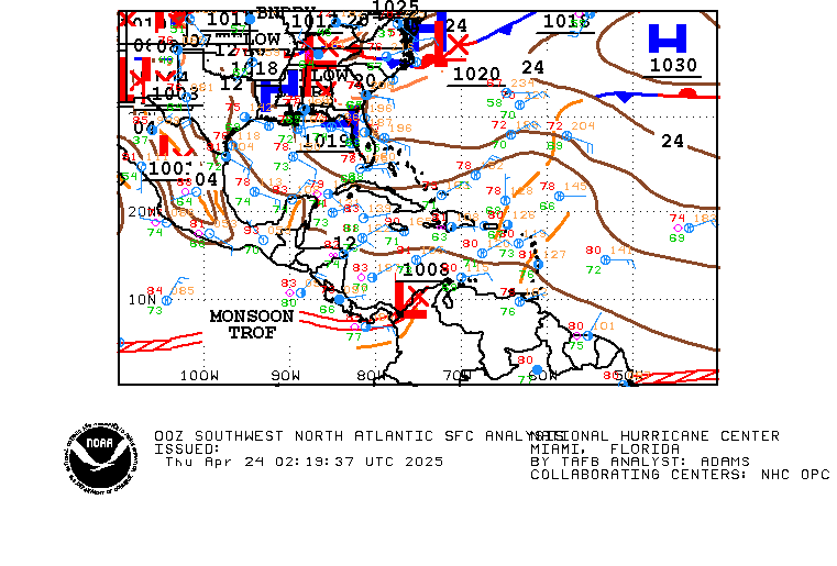
A monsoonal trough in the western Caribbean appears to be a possible threat to develop sometime in the near future. Several of the models, such as GFS, NOGAPS, Euro, and the Canadian all have some type of early June development. Forecasters such as Joe Bastardi and Jeff Masters are also high on something happening, though the latter thinks it may be slow to occur. That’s because there is still some shear in the Caribbean and it doesn’t have an African tropical wave to help get it spinning. However, the shear is forecast to retreat northward later this week towards the Gulf of Mexico, and a tropical wave may at the same time approach the area. One other enhancing feature is that a favorable MJO appears poised to possibly give a better chance for some type of tropical development. This is definitely something to look at to start the 2011 Atlantic hurricane season. As for track, most models seem to indicate something of a motion towards the Gulf of Mexico, but it may be slow and not occur during this upcoming week.
For now, this is the only real threat on paper to develop during the first few days of this new hurricane season.
Recent history
This week will run until June 5; between now and then, the following storms have developed since 1960:
Alma in 1966
Abby in 1968
Alberto in 1982
Allison in 1995
A subtropical storm in 1997
Allison in 2001
Barry in 2007
Arthur in 2008
Only two of these eight did not develop from the Caribbean: the 1997 subtropical storm and Allison in 2001. Also, surprisingly, four of these eight have become hurricanes! That said, three of them only barely made the threshold at 74 mph: Abby, Alberto, and Allison 1995. I think Allison may have been a hurricane, but I suspect at least one of the others may not have been, and that HURDAT just has to get to the seasons of 1968 and 1982. Alma was unquestionably a hurricane, though it reached that intensity a bit beyond June 5. Also, all of these storms from the Caribbean moved on northward paths for the most part, except Alberto which moved more east-northeast and Arthur which developed next to Belize and ran into it.
Also, as they got further north and approached landfall on the Gulf Coast, they weakened as they did so, including even Alma. Alma had been a C3, and weakened to a high-level C1 at landfall. Abby and Allison 1995 were tropical storms at landfall, and Alberto pretty much fizzled before any kind of landfall. Allison in 2001 briefly had 60-mph winds, but they leveled off just before landfall (though it didn’t have much time to begin with in that arena given that it developed about 100 miles offshore).
I also can’t help but think of Tropical Storm Arlene in 2005, even though it did develop a couple days after June 5. Several members on a couple of threads have brought up that storm as a potential analog, and with good reason. It too developed in the western Caribbean, headed north through the Gulf of Mexico, and landfalled on the Florida Panhandle. It was also almost a hurricane, but weakened a bit before landfall. Almost all, if not all, of these parameters are potentially being suggested by models.
So what does this all tell us?
The western Caribbean is indeed a potential hotspot for development this early in the season. Also, the somewhat northward track towards the Gulf of Mexico hinted by models is consistent with what recent history would suggest. Anything that develops could become a decent storm, but probably will peak before making a final landfall and then start to weaken. Whether all this happens this upcoming week remains to be seen, but if the whole thing being suggested takes place, it is likely to spill over a bit into the next weekly prediction.
The Prediction
Yes, I’ve decided to change this from “Back to looking ahead” to “The Prediction,” as this summary always really looks ahead to the upcoming week. It’s going to be a tricky one indeed! I remember one issue I had was timing of development of tropical systems, so hopefully I can say I have that more fine-tuned this year. However, there is too much not to go with something later this week, with there already being some disturbed weather in the Caribbean, an African wave that may reach the area, shear forecast to retreat north of there, warm waters, and possibly a favorable MJO setting up late in the week or maybe slightly after. This seems to add up to slow development at about the end of the week, so here is my prediction: I predict the formation of a tropical depression on Saturday in the western Caribbean a short ways northeast of the coast of Honduras. This depression will initially take some time to strengthen as I think it will be somewhat disorganized, but I think it will become Tropical Storm Arlene with 40-45 mph winds by Sunday night. It will also be moving slowly northwest to north-northwest towards Cuba and the Yucatan Channel during this stage. Confidence is 60%.
Elsewhere, I predict no tropical cyclone development or activity. Confidence is near 100%.
-Andrew9
Upcoming week - May 29-June 5 (first of 2011!)
Moderator: S2k Moderators
Forum rules
The posts in this forum are NOT official forecasts and should not be used as such. They are just the opinion of the poster and may or may not be backed by sound meteorological data. They are NOT endorsed by any professional institution or STORM2K. For official information, please refer to products from the National Hurricane Center and National Weather Service.
- cycloneye
- Admin

- Posts: 148733
- Age: 69
- Joined: Thu Oct 10, 2002 10:54 am
- Location: San Juan, Puerto Rico
Re: Upcoming week - May 29-June 5 (first of 2011!)
Last year you did very well doing this. Lets see if you do even better this season.To let you know that there are a couple of tropical waves on the surface charts that may be important down the road.


0 likes
Visit the Caribbean-Central America Weather Thread where you can find at first post web cams,radars
and observations from Caribbean basin members Click Here
and observations from Caribbean basin members Click Here
- Andrew92
- S2K Supporter

- Posts: 3247
- Age: 41
- Joined: Mon Jun 16, 2003 12:35 am
- Location: Phoenix, Arizona
Well, this was a bit of a mixed bag. I was right in calling for no development away from the Caribbean, and that happened despite a surprise Invest 93L going from east of Florida to the western Gulf of Mexico. I also said there would be no development in the Caribbean until Saturday due to environmental conditions not being yet entirely favorable. By this, I meant still a shearing environment, along with a broad low pressure without an African tropical wave to enhance development. But I did predict a tropical depression that day, and a weak tropical storm on Sunday; neither of this happened. The location would have been very close: I predicted a little northeast of the coast of Honduras, and it would have been a bit further east that that, closer to Jamaica. All in all, I was on the right track with the Caribbean idea, and had many parameters right, but unfortunately called for a development that hasn’t happened yet. Granted, it still could happen this week, but all things considered, my grade for the first week of 2011 is a C.
Rough start, but it was very prone with thoughts of an early development. Another even tougher prediction coming up in just a few minutes.
-Andrew92
Rough start, but it was very prone with thoughts of an early development. Another even tougher prediction coming up in just a few minutes.
-Andrew92
0 likes
-
DavidPerez
- Tropical Wave

- Posts: 5
- Joined: Sat Jun 11, 2011 1:44 am
Who is online
Users browsing this forum: NotAHurricane and 75 guests
