Satellite presentation of super typhoons vs Atlantic Cat 5s

This is the general tropical discussion area. Anyone can take their shot at predicting a storms path.

Moderator: S2k Moderators

Forum rules

The posts in this forum are NOT official forecasts and should not be used as such. They are just the opinion of the poster and may or may not be backed by sound meteorological data. They are NOT endorsed by any professional institution or STORM2K. For official information, please refer to products from the National Hurricane Center and National Weather Service.

Help Support Storm2K
Message
Author
User avatar
HurricaneEdouard
Tropical Storm
Tropical Storm
Posts: 140
Joined: Sun May 03, 2015 11:09 am

Satellite presentation of super typhoons vs Atlantic Cat 5s

#1 Postby HurricaneEdouard » Wed May 06, 2015 4:31 pm

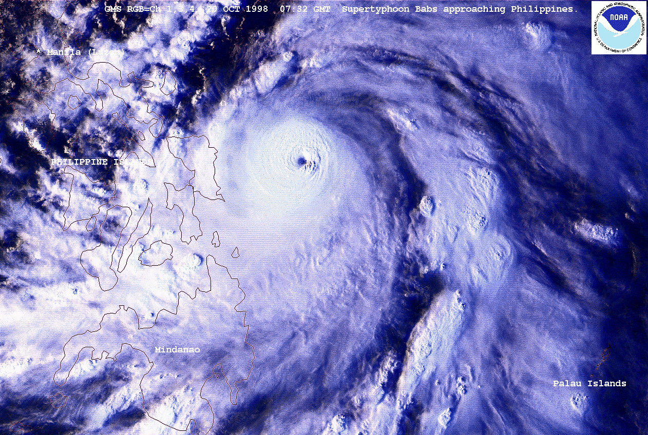
So, here's one thing I've noticed and was very curious for an opinion on re. reasons why. It seems to me that Category 5 super typhoons often share a distinctive shape, with intense banding to the west and south, yet not so much to the north and east. The CDO is symmetrical, but the entire cloud coverage seems elongated north-south.

A few examples below:

Image

Image

Image

Image

Image

Most Category 5 hurricanes in the Atlantic do not share this appearance. The only one I could plausibly mistake for being a WPac Category 5 would be Gilbert. Otherwise, they tend to have a very different 'look,' although it's hard to pin down what's different in general simply due to the amount of variety in Cat 5 satellite presentation compared to super typhoons.

Image

Image

But all I can say is that, if I were showed satellite images of the above without knowing them to be Atlantic storms, I would tend to identify them as Atlantic (or east Pacific) hurricanes, not super typhoons. Is there actually some truth to this observation? And if so, does anyone know why super typhoons often gravitate towards a certain 'shape,' an appearance markedly lacking in Atlantic and east Pacific systems of similar intensity?
0 likes   
You know you're a hurricane nut, when your main source of adrenaline is reading old hurricane advisories...

euro6208

Re: Satellite presentation of super typhoons vs Atlantic Cat 5s

#2 Postby euro6208 » Sun May 24, 2015 5:08 am

Really interesting topic but no response?

I would love to learn more...
0 likes   

tatertawt24
Category 1
Category 1
Posts: 309
Joined: Wed Oct 24, 2012 12:57 pm

#3 Postby tatertawt24 » Tue May 26, 2015 1:52 am

There's definitely a look that classic WPAC typhoons have. But, in addition to Gilbert, I always thought Rita resembled that look a little:

Image

Large in size, a small but not pinhole eye, and strong bands on the south side. Dean looked pretty solid too. Maybe it has something to do with the direction they're moving in?
0 likes   
Personal Forecast Disclaimer:
The posts in this forum are NOT official forecast and should not be used as such. They are just the opinion of the poster and may or may not be backed by sound meteorological data. They are NOT endorsed by any professional institution or storm2k.org. For official information, please refer to the NHC and NWS products.

MiamiensisWx

Re: Satellite presentation of super typhoons vs Atlantic Cat 5s

#4 Postby MiamiensisWx » Wed May 27, 2015 1:50 pm

You're largely asking questions of geography. Because the Pacific Ocean is so much larger than the Atlantic, there is a larger area of higher heat content offering more potential for release of latent heat, leading to lower environmental pressures and hence storms with larger circulations than are usually observed in the Atlantic. Western Pacific typhoons often form within a broad monsoonal trough with larger areas of instability, so even when typhoons develop a tight inner core, their circulation can be quite large, and after eyewall replacement cycles, their pressures can be much deeper than in the Atlantic due to surrounding low environmental pressures. Due to higher instability, Western Pacific typhoons typically develop larger central dense overcasts (CDOs) with a broader area of extremely cold cloud tops than are often observed in Atlantic storms. Therefore, Western Pacific typhoons have a higher ceiling under which to become more intense than even the most intense Atlantic hurricanes (at least in terms of minimum central pressure). However, there is a decent likelihood that Atlantic hurricanes and Pacific typhoons are equally capable of attaining extreme maximum sustained wind speeds, for higher environmental pressures in the Atlantic compensate for lower instability and often produce small but very powerful hurricanes, e.g., the 1932 Puerto Rican and Texas hurricanes, the 1935 Labor Day hurricane, Janet 1955, Carol 1953, Andrew 1992, Charley 2004, etc. Although Gilbert 1988 was an exception in that it had a large, typhoon-like circulation, its inner core was quite small, as was Wilma's, hence each storm's peak winds of 160 kt/185 mph.
0 likes   

euro6208

Re: Satellite presentation of super typhoons vs Atlantic Cat 5s

#5 Postby euro6208 » Tue Sep 01, 2015 8:12 am

WPAC storms have a larger area to work with with small islands in their path with a huge area of hot sst's...
0 likes   


Return to “Talkin' Tropics”

Who is online

Users browsing this forum: dl20415, sphelps8681 and 38 guests