AL, 95, 2021103012, , BEST, 0, 92N, 238W, 25, 1008, DB, 34, NEQ, 0, 0, 0, 0, 1011, 90, 30, 0, 0, L, 0, , 0, 0, INVEST, S, 0, , 0, 0, 0, 0, genesis-num, 051, SPAWNINVEST, al762021 to al952021
ATL: INVEST 95L - Discussion
Moderator: S2k Moderators
-
cycloneye

- Admin

- Posts: 149505
- Age: 69
- Joined: Thu Oct 10, 2002 10:54 am
- Location: San Juan, Puerto Rico
ATL: INVEST 95L - Discussion
https://ftp.nhc.noaa.gov/atcf/btk/
0 likes
Visit the Caribbean-Central America Weather Thread where you can find at first post web cams,radars
and observations from Caribbean basin members Click Here
and observations from Caribbean basin members Click Here
-
MHC Tracking
- Tropical Storm

- Posts: 203
- Joined: Mon Mar 15, 2021 10:05 am


Re: ATL: INVEST 95L - Discussion

3 likes
Kendall -> SLO -> PBC
Memorable Storms: Katrina (for its Florida landfall...) Wilma Matthew Irma
Memorable Storms: Katrina (for its Florida landfall...) Wilma Matthew Irma
-
MHC Tracking
- Tropical Storm
- Posts: 203
- Joined: Mon Mar 15, 2021 10:05 am
Re: ATL: INVEST 95L - Discussion
Mid-level-center looks to be drilling down in the latest ASCAT pass. I wouldn't be surprised if this becomes a TC tomorrow. 
0 likes
-
TheDreamTraveler

- Category 2

- Posts: 645
- Joined: Sun Aug 22, 2010 3:10 am
- Location: PA
Re: ATL: INVEST 95L - Discussion
Woah what that's impressive seeing this in this part of the basin when it's almost november
0 likes
Re: ATL: INVEST 95L - Discussion
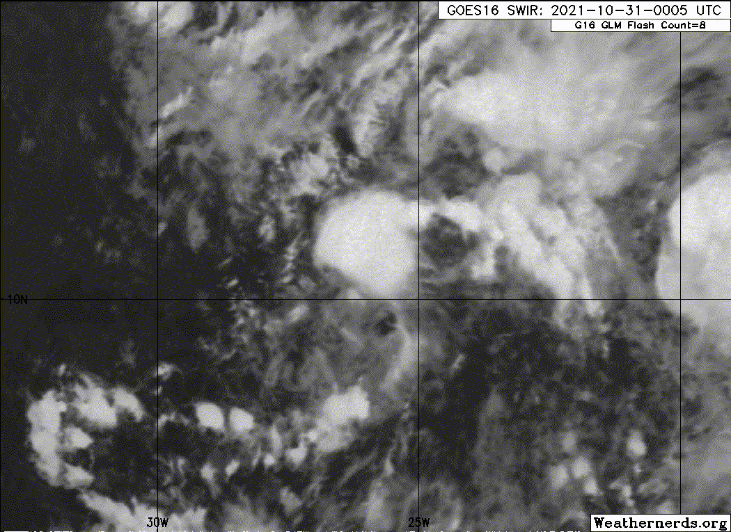
Was just about to post on the cape verde thread. It is definitely a tropical cyclonic system.
Metrosat-11 Day Cloud Phase loop - https://col.st/3H3Bp
Metrosat-11 Day Cloud Phase loop - https://col.st/3H3Bp
0 likes
-
CrazyC83
- Professional-Met

- Posts: 34315
- Joined: Tue Mar 07, 2006 11:57 pm
- Location: Deep South, for the first time!
Re: ATL: INVEST 95L - Discussion
This would be a record for the latest developing storm in the Cabo Verde region if it indeed develops?
0 likes

Re: ATL: INVEST 95L - Discussion
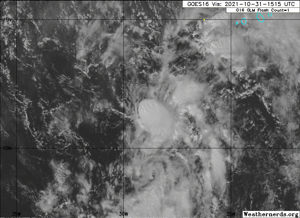
A broad area of low pressure over the eastern tropical Atlantic is
located several hundred miles south of the Cabo Verde Islands. The
associated shower and thunderstorm activity is showing signs of
organization, and environmental conditions could support some
development of this system during the next couple of days while it
moves generally northwestward at 10 to 15 mph. Upper-level winds
are forecast to become increasingly unfavorable for further
development by the middle of next week.
* Formation chance through 48 hours...low...30 percent.
* Formation chance through 5 days...low...30 percent.
0 likes
-
cycloneye
- Admin
- Posts: 149505
- Age: 69
- Joined: Thu Oct 10, 2002 10:54 am
- Location: San Juan, Puerto Rico
Re: ATL: INVEST 95L - Discussion
AL, 95, 2021103018, , BEST, 0, 97N, 246W, 25, 1008, DB
0 likes
Visit the Caribbean-Central America Weather Thread where you can find at first post web cams,radars
and observations from Caribbean basin members Click Here
and observations from Caribbean basin members Click Here
-
InfernoFlameCat

- Category 5

- Posts: 2127
- Age: 22
- Joined: Mon Dec 14, 2020 10:52 am
- Location: Buford, GA
Re: ATL: INVEST 95L - Discussion
I was looking at this two days ago and was like, why is this not an AOI? Then I remembered it was near November. Now it is looking like it will develop.
1 likes
I am by no means a professional. DO NOT look at my forecasts for official information or make decisions based on what I post.
Goal: to become a registered expert over tropical and subtropical cyclones.
Goal: to become a registered expert over tropical and subtropical cyclones.
-
cycloneye
- Admin
- Posts: 149505
- Age: 69
- Joined: Thu Oct 10, 2002 10:54 am
- Location: San Juan, Puerto Rico
Re: ATL: INVEST 95L - Discussion
A broad area of low pressure located over the tropical eastern
Atlantic a few hundred miles south of the Cabo Verde Islands is
producing a large area of disorganized showers and thunderstorms.
Slow development of this system is possible during the next couple
of days before it moves into a region of strong upper-level winds
early next week. This system is expected to move west-northwestward
to northwestward at 10 to 15 mph during the next few days.
* Formation chance through 48 hours...low...30 percent.
* Formation chance through 5 days...low...30 percent.
0 likes
Visit the Caribbean-Central America Weather Thread where you can find at first post web cams,radars
and observations from Caribbean basin members Click Here
and observations from Caribbean basin members Click Here
-
Sciencerocks
- Category 5
- Posts: 10186
- Age: 40
- Joined: Thu Jul 06, 2017 1:51 am
-
cycloneye
- Admin
- Posts: 149505
- Age: 69
- Joined: Thu Oct 10, 2002 10:54 am
- Location: San Juan, Puerto Rico
Re: ATL: INVEST 95L - Discussion
Tropical Weather Outlook
NWS National Hurricane Center Miami FL
800 AM EDT Sun Oct 31 2021
For the North Atlantic...Caribbean Sea and the Gulf of Mexico:
The National Hurricane Center is issuing advisories on Subtropical
Storm Wanda, located a little over 900 miles west of the Azores.
A broad area of low pressure located over the tropical eastern
Atlantic a few hundred miles southwest of the Cabo Verde Islands
continues to produce a large area of disorganized showers and
thunderstorms. Slow development of this system is possible during
the next couple of days before it moves into a region of strong
upper-level winds. This system is expected to move
west-northwestward to northwestward at 10 to 15 mph during the next
few days.
* Formation chance through 48 hours...low...30 percent.
* Formation chance through 5 days...low...30 percent.
Forecaster Latto
0 likes
Visit the Caribbean-Central America Weather Thread where you can find at first post web cams,radars
and observations from Caribbean basin members Click Here
and observations from Caribbean basin members Click Here
-
Sciencerocks
- Category 5
- Posts: 10186
- Age: 40
- Joined: Thu Jul 06, 2017 1:51 am
Who is online
Users browsing this forum: No registered users and 61 guests