Tropical Weather Outlook
NWS National Hurricane Center Miami FL
100 PM EST Sun Nov 3 2024
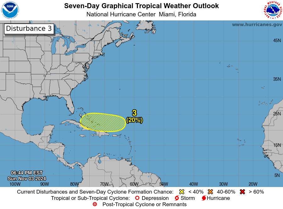
Southwestern Atlantic:
An area of disturbed weather is expected to develop near the
northern Leeward Islands around the middle of the week. Some slow
development of this system is possible after that time as it moves
generally westward over the southwestern Atlantic.
* Formation chance through 48 hours...low...near 0 percent.
* Formation chance through 7 days...low...20 percent.
\NWS National Hurricane Center Miami FL
100 PM EST Sun Nov 3 2024
Southwestern Atlantic:
An area of disturbed weather is expected to develop near the
northern Leeward Islands around the middle of the week. Some slow
development of this system is possible after that time as it moves
generally westward over the southwestern Atlantic.
* Formation chance through 48 hours...low...near 0 percent.
* Formation chance through 7 days...low...20 percent.