Vigorous low-level vorticity for a tropical wave (near 50W/10N)

Moderator: S2k Moderators


Ubuntwo wrote:This is the wave the GFS and CMC have been developing in the Caribbean:
https://i.imgur.com/qe5WXks.gif
...


Ubuntwo wrote:This is the wave the GFS and CMC have been developing in the Caribbean:
https://i.imgur.com/qe5WXks.gif
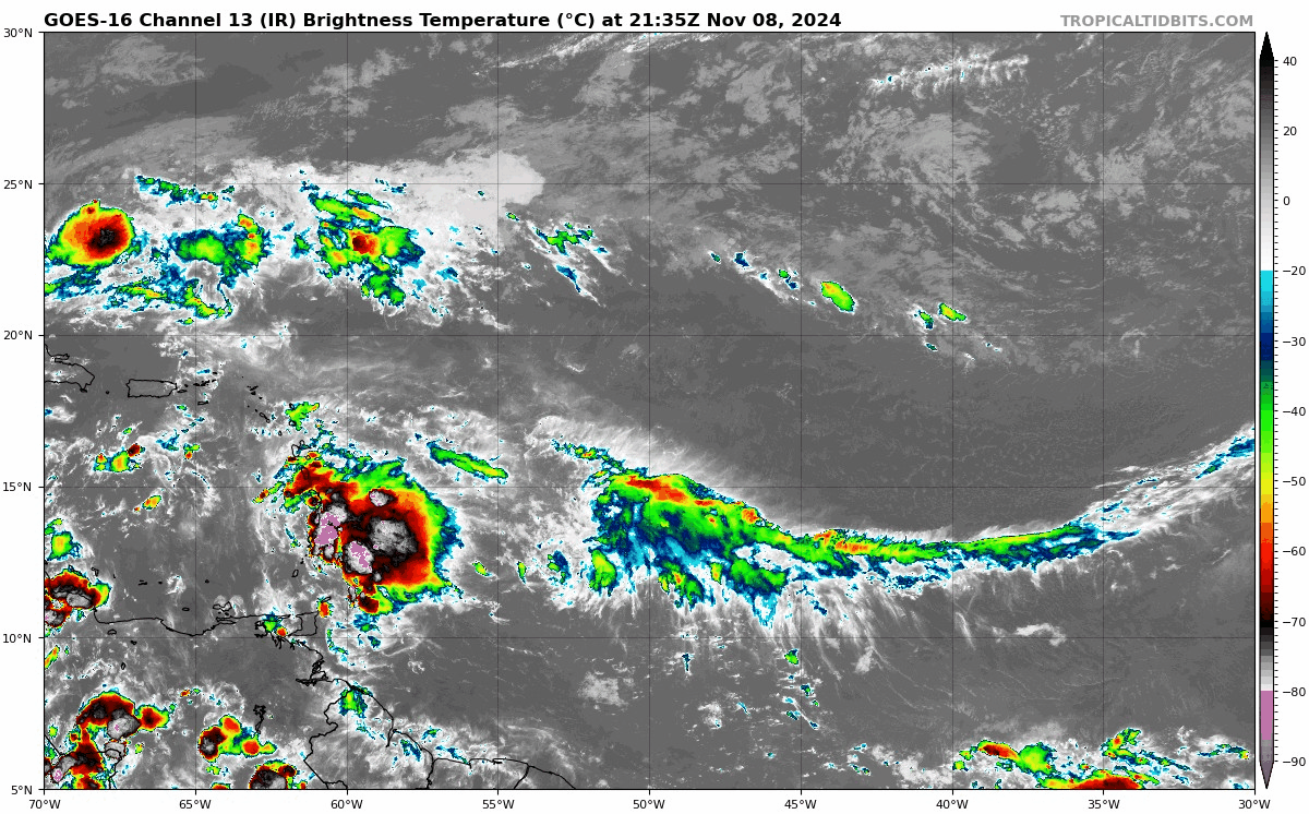
Vigorous low-level vorticity for a tropical wave (near 50W/10N)
https://i.imgur.com/jl3SoOE.png


cycloneye wrote:https://i.imgur.com/cuyAaQx.gif


AJC3 wrote:Looking at visible satellite from this morning, I think an argument can be
made that the wave axis is actually near 61W, beginning to move through
the Windward/southern Leeward islands, and the convection farther west
from 63-66W is simply along a weak marine boundary being ventilated by
strong divergence from the large central Caribbean upper level low.
Users browsing this forum: No registered users and 171 guests