The posts in this forum are NOT official forecast and should not be used as such. They are just the opinion of the poster and may or may not be backed by sound meteorological data. They are NOT endorsed by any professional institution or

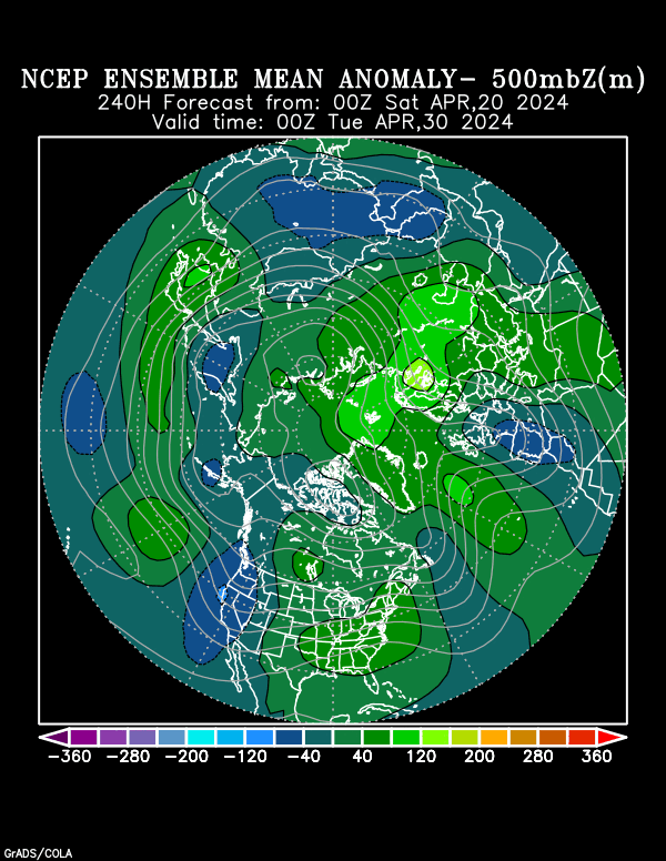
The bad news:
The new 00z run of the GFS (not so good with this range) has some screwy maps:


We have the MRF/GFS colorized here

Note the aleutean low developing a nice ridge into the west meaning according to this model a surge of arctic air into the east is next.
I'm looking for model guidence to this.
Plenty more ensemble runs can be found at http://www.cdc.noaa.gov/map/images/ens/ens.html#nh
Artic air is on the way
/004.gif)