http://www.stormsfury1.com
(Toolbar to Current Tropical Weather Information) and click on the My 2004 Tropical Prediction link)
SF
Final release on my tropical outlook numbers for 2004...
Moderator: S2k Moderators
Forum rules
The posts in this forum are NOT official forecasts and should not be used as such. They are just the opinion of the poster and may or may not be backed by sound meteorological data. They are NOT endorsed by any professional institution or STORM2K. For official information, please refer to products from the National Hurricane Center and National Weather Service.
- Stormsfury
- Category 5

- Posts: 10549
- Age: 53
- Joined: Wed Feb 05, 2003 6:27 pm
- Location: Summerville, SC
- FWBHurricane
- Category 1

- Posts: 495
- Joined: Fri Apr 02, 2004 10:57 pm
- Location: Midlothian/Ovilla, Texas
- Contact:
Good stuff. Maybe conservative as you say. Got a feeling that Florida is gonna take a big hit somewhere. SSTs are starting to come up quite nicely (compared to last years freezing beach temps, again unprecedented), strong easterlies slacking off (no surface westerly flow like last year), and a mid-Atlantic ridge getting established. The jury is still out on ENSO. If it remains neutral or pulls a slight LaNina it could really raise the level of activity to that of '95. A LaNina is not expected, so that will be unlikely. But it wouldn't take much to tip the scale. But a solid forecast SF. These past few years have been difficult to read. When we're in a neutral state, it seems as if its a crap shoot.
0 likes
- Stormsfury
- Category 5

- Posts: 10549
- Age: 53
- Joined: Wed Feb 05, 2003 6:27 pm
- Location: Summerville, SC
Thanks for the input, everyone ...
The numbers I'm putting up for the final (13/8/3) are on the high end of analog years with years that have featured 16 or more systems in the Atlantic Season ... (1995-1996, 19 and 13 respectively, which up to this point is the highest number of storms following a season with 16 or more storms. 2000-2001 featured 15 storms in each year) ... other years, including what was going to be my main analog year, 1887 (which was the only other year that featured two developed December storms, only had 9, in 1888.), but the atmospheric signals tell us otherwise ...
Another thing of interest is the fact that although the overall ENSO is neutral, the pattern is very stagnant ... and I'm seeing patterns that remind me of both La Niña and El Niño across the U.S. alone ...
Since 1995 ...
_____________
|1995|19|11|04|
|1996|13|09|06|
|1997|08|03|01|
|1998|14|10|03|
|1999|12|08|05|
|2000|15|08|03|
|2001|15|09|04|
|2002|12|04|02|
|2003|16|07|03|
______________
Totals = Last 9 years
Tropical Storms: 124 (13.8 storms/year)
Hurricanes: 69 (7.7 hurricanes/year)
Major Hurricanes: 31 (3.4 majors/year)
Other sideworthy tidbits:
6 consecutive years of 10 or more storms in a season: new record
8 of 9 years with 10 or more storms, ever since the ATL thermaline circulation became stronger than normal.
43 storms in 3 years: most active by no. of storms-3 year period
58 storms in 4 years: most active by no. of storms-4 year period
70 storms in 5 years: most active by no. of storms-5 year period
SF
Steve H. wrote:Good stuff. Maybe conservative as you say. Got a feeling that Florida is gonna take a big hit somewhere. SSTs are starting to come up quite nicely (compared to last years freezing beach temps, again unprecedented), strong easterlies slacking off (no surface westerly flow like last year), and a mid-Atlantic ridge getting established. The jury is still out on ENSO. If it remains neutral or pulls a slight LaNina it could really raise the level of activity to that of '95. A LaNina is not expected, so that will be unlikely. But it wouldn't take much to tip the scale. But a solid forecast SF. These past few years have been difficult to read. When we're in a neutral state, it seems as if its a crap shoot.
The numbers I'm putting up for the final (13/8/3) are on the high end of analog years with years that have featured 16 or more systems in the Atlantic Season ... (1995-1996, 19 and 13 respectively, which up to this point is the highest number of storms following a season with 16 or more storms. 2000-2001 featured 15 storms in each year) ... other years, including what was going to be my main analog year, 1887 (which was the only other year that featured two developed December storms, only had 9, in 1888.), but the atmospheric signals tell us otherwise ...
Another thing of interest is the fact that although the overall ENSO is neutral, the pattern is very stagnant ... and I'm seeing patterns that remind me of both La Niña and El Niño across the U.S. alone ...
Since 1995 ...
_____________
|1995|19|11|04|
|1996|13|09|06|
|1997|08|03|01|
|1998|14|10|03|
|1999|12|08|05|
|2000|15|08|03|
|2001|15|09|04|
|2002|12|04|02|
|2003|16|07|03|
______________
Totals = Last 9 years
Tropical Storms: 124 (13.8 storms/year)
Hurricanes: 69 (7.7 hurricanes/year)
Major Hurricanes: 31 (3.4 majors/year)
Other sideworthy tidbits:
6 consecutive years of 10 or more storms in a season: new record
8 of 9 years with 10 or more storms, ever since the ATL thermaline circulation became stronger than normal.
43 storms in 3 years: most active by no. of storms-3 year period
58 storms in 4 years: most active by no. of storms-4 year period
70 storms in 5 years: most active by no. of storms-5 year period
SF
0 likes
The cold pool in the EPAC NINO regions does appear to be weakening somewhat.....
https://www.fnmoc.navy.mil/products/OTI ... nomaly.gif
and NOT as strong or prevalent as it was just a few weeks ago
https://www.fnmoc.navy.mil/products/OTI ... nomaly.gif
https://www.fnmoc.navy.mil/products/OTI ... nomaly.gif
Now, while the ENSO should remain neutral through at least AUG and probably MOST of SEP, some of the data continues to suggest the onset of weak warm ENSO conditions by OCT
\

Model | SEP 04 | DEC 04 ---->
Bureau of Met (BMRC) Warm Neutral
CSIRO Not Available Not Avaiable
CPC Neutral Neutral
ECMWF Neutral Not Available
LDEO (4) Warm Warm
NCEP Neutral Warm
NOAA LINEAR INVERSE Neutral Neutral
SCRIPPS/MPI Neutral Warm
NSIPP/NASA Neutral Neutral
JMA Warm Not Available
CLIPER Neutral Neutral
What is MOST noteworthy though IMO is that NONE of the data is suggesting LA NINA conditions, during any period....at this time.
Basically through SEP it is likely that we will remain with an SSTA configuration close to the curent with only minor warming/cooling across the EPAC.
After that is when questions will arise, however by then, MOST of the hurricane season will already be behind us, and any POSSIBLE developing WEAK EL NINO would have relatively little effect on the remainder of the season.
BOTTOM LINE....in the absence of any STRONG warm or cold episode, the ENSO will allow other factors to have a more profound influence on the tropical season.
https://www.fnmoc.navy.mil/products/OTI ... nomaly.gif
and NOT as strong or prevalent as it was just a few weeks ago
https://www.fnmoc.navy.mil/products/OTI ... nomaly.gif
https://www.fnmoc.navy.mil/products/OTI ... nomaly.gif
Now, while the ENSO should remain neutral through at least AUG and probably MOST of SEP, some of the data continues to suggest the onset of weak warm ENSO conditions by OCT
\

Model | SEP 04 | DEC 04 ---->
Bureau of Met (BMRC) Warm Neutral
CSIRO Not Available Not Avaiable
CPC Neutral Neutral
ECMWF Neutral Not Available
LDEO (4) Warm Warm
NCEP Neutral Warm
NOAA LINEAR INVERSE Neutral Neutral
SCRIPPS/MPI Neutral Warm
NSIPP/NASA Neutral Neutral
JMA Warm Not Available
CLIPER Neutral Neutral
What is MOST noteworthy though IMO is that NONE of the data is suggesting LA NINA conditions, during any period....at this time.
Basically through SEP it is likely that we will remain with an SSTA configuration close to the curent with only minor warming/cooling across the EPAC.
After that is when questions will arise, however by then, MOST of the hurricane season will already be behind us, and any POSSIBLE developing WEAK EL NINO would have relatively little effect on the remainder of the season.
BOTTOM LINE....in the absence of any STRONG warm or cold episode, the ENSO will allow other factors to have a more profound influence on the tropical season.
0 likes
Stormsfury wrote:www.stormsfury1.com
(Toolbar to Current Tropical Weather Information) and click on the My 2004 Tropical Prediction link)
SF
A solid forecast and EXCELLENT discussion as always, SF.
Steve H. wrote:Good stuff. Maybe conservative as you say. Got a feeling that Florida is gonna take a big hit somewhere. SSTs are starting to come up quite nicely (compared to last years freezing beach temps, again unprecedented), strong easterlies slacking off (no surface westerly flow like last year), and a mid-Atlantic ridge getting established. The jury is still out on ENSO. If it remains neutral or pulls a slight LaNina it could really raise the level of activity to that of '95. A LaNina is not expected, so that will be unlikely. But it wouldn't take much to tip the scale. But a solid forecast SF. These past few years have been difficult to read. When we're in a neutral state, it seems as if its a crap shoot.
As far as his numbers are concerned, I happen to think they look rather good.
0 likes
- Stormsfury
- Category 5

- Posts: 10549
- Age: 53
- Joined: Wed Feb 05, 2003 6:27 pm
- Location: Summerville, SC
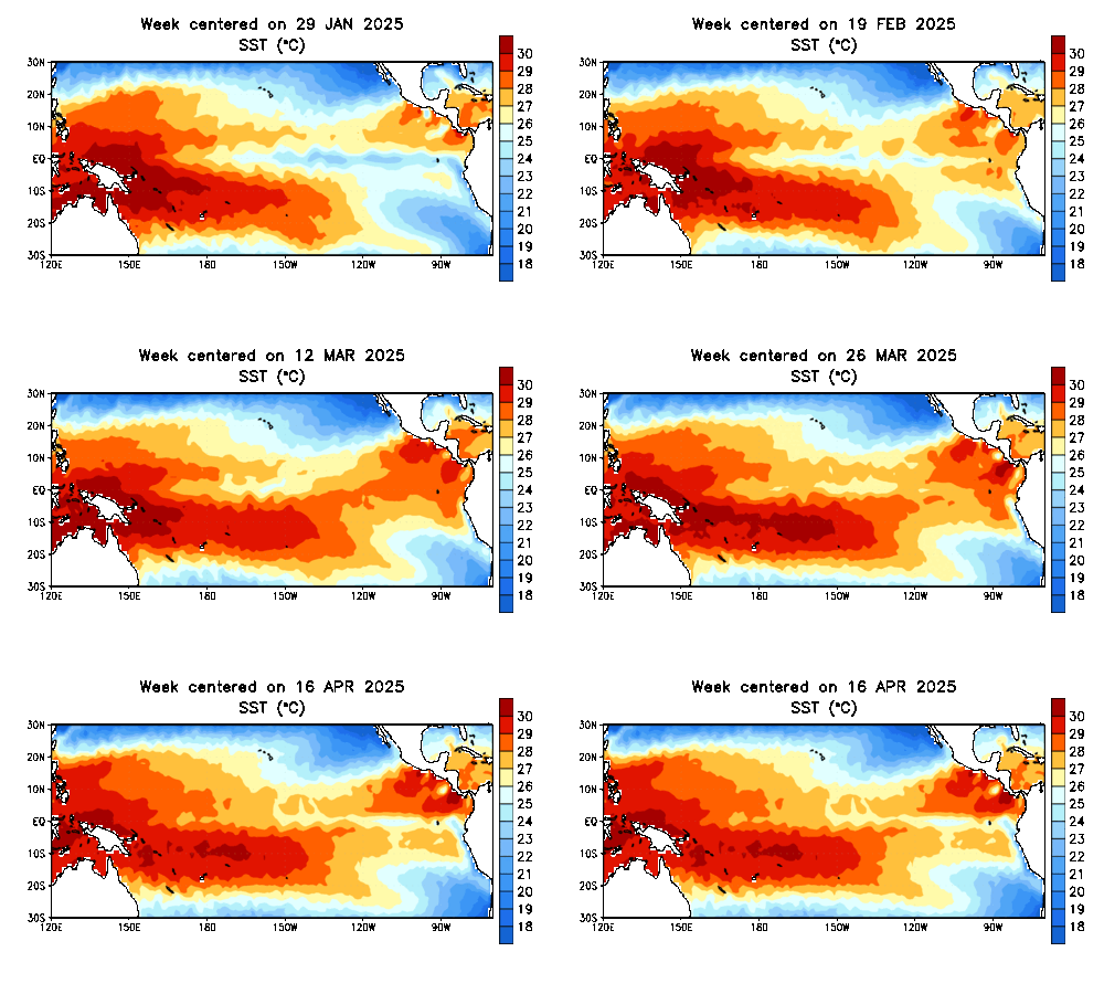
On this view, the cold pool off of South America is spreading out somewhat but also warming ever so slightly ... also note, some warm pockets are appearing west of the IDL ...

Unfortunately, the site that I use for Equatorial Depths temperatures (CPC) hasn't updated since early March so I don't have a look at what's going on underneath ...

Unfortunately, the site that I use for Equatorial Depths temperatures (CPC) hasn't updated since early March so I don't have a look at what's going on underneath ...
Last edited by Stormsfury on Wed May 26, 2004 8:48 pm, edited 1 time in total.
0 likes
Who is online
Users browsing this forum: HurricaneRyan and 31 guests


