

Track Frocast error:
http://www.nhc.noaa.gov/1992andrew.html#TABLE4
Probability Charts:
http://www.nhc.noaa.gov/1992andrew.html#TABLE7
Forcast Critique
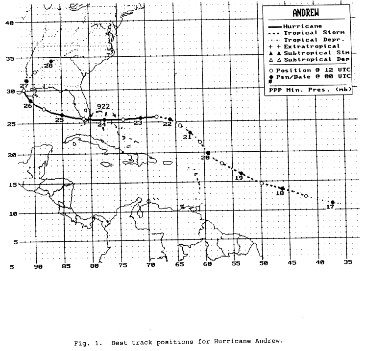
Track forecast errors by the NHC and by the suite of track prediction models are given in Table 4. On average, the NHC errors were about 30% smaller than the current 10-year average. The most significant changes in Andrew's track and intensity (see Fig. 1, Table 1) were generally well anticipated (noted in NHC's Tropical Cyclone Discussions) and the forecast tracks generally lie close to the best track. However, the rate of Andrew's westward acceleration over the southwestern Atlantic was greater than initially forecast. In addition, the NHC forecast a rate of strengthening that was less than what occurred during Andrew's period of rapid deepening.
Several of the dynamic track models had stellar performances during this hurricane. The Aviation Model and a tracking routine that follows a simulated hurricane vortex (AVNO) performed especially well. However, this was the first storm for which AVNO output was available to NHC forecasters. Hence, its operational reliability was not established. The GFDL and QLM models also had small errors. It should be pointed out, however, that the NHC works on a six-hourly forecast cycle and that the models mentioned above are run just once per 12 hours. Moreover, the output from these models becomes available to forecasters no earlier than the following six-hour forecast cycle.
Hope that helps some... if i come across more resources i'll post them here.
-Eric